Results by title
111 books match the query 'Historical geography' and 11 start with a
A Big History of North America
From Montezuma to MonroeKevin Jon Fernlund
University of Missouri Press, 2023
Nevertheless, the three-century journey to get to this point had been anything but predictable. The United States’ rise as a regional power was very much conditioned by constantly shifting transcontinental, transpacific, and above all transatlantic factors, all of which influenced North America’s three interactive cultural spheres: the Indigenous, the Hispano, and the Anglo. And while the United States profoundly shaped the history of Canada and Mexico, so, too, did these two transcontinental countries likewise shape the course of U.S. history.
In this ground-breaking work, Kevin Fernlund shows us that any society’s social development is directly related to its own social power and, just as crucially, to the protective extension or destructive intrusion of the social power of other societies.

A Favored Place
San Juan River Wetlands, Central Veracruz, A.D. 500 to the PresentBy Alfred H. Siemens
University of Texas Press, 1998
The wetlands of the San Juan Basin in Central Veracruz, Mexico, have been a favored place since the fifth century A.D., when Prehispanic people built an extensive network of canals and raised fields that allowed for almost year-round agriculture. Alfred Siemens' discovery of the remains of this network in the 1970s led him to uncover fifteen centuries of land-use history in the region. This book contains a full record of his findings.
Siemens organizes his history of the San Juan Basin around the question: What relationships exist between Prehispanic agriculture and the production systems of the tropical lowlands in our own time? This focus allows him to chart the changes in human perceptions and uses of the landscape, from the Prehispanic wetland agricultural system to the drained pastures of today's cattle ranches.
Amplified with air oblique photography, maps, and tables, and enriched with data from archaeology and colonial archives, this is an authoritative historical geography of a wetland landscape. Or, in the author's more modest words, "It seems to me that what I have here is a biography of a swamp."
A Geography of New Jersey
The City in the GardenStansfield, Charles A.
Rutgers University Press, 1998

A Historical Atlas of Tibet
Karl E. Ryavec
University of Chicago Press, 2015
Cradled among the world’s highest mountains—and sheltering one of its most devout religious communities—Tibet is, for many of us, an ultimate destination, a place that touches the heavens, a place only barely in our world, at its very end. In recent decades Western fascination with Tibet has soared, from the rise of Tibetan studies in academia to the rock concerts aimed at supporting its independence to the simple fact that most of us—far from any base camp—know exactly what a sherpa is. And yet any sustained look into Tibet as a place, any attempt to find one’s way around its high plateaus and through its deep history, will yield this surprising fact: we have barely mapped it. With this atlas, Karl E. Ryavec rights that wrong, sweeping aside the image of Tibet as Shangri-La and putting in its place a comprehensive vision of the region as it really is, a civilization in its own right. And the results are absolutely stunning.
The product of twelve years of research and eight more of mapmaking, A Historical Atlas of Tibet documents cultural and religious sites across the Tibetan Plateau and its bordering regions from the Paleolithic and Neolithic times all the way up to today. It ranges through the five main periods in Tibetan history, offering introductory maps of each followed by details of western, central, and eastern regions. It beautifully visualizes the history of Tibetan Buddhism, tracing its spread throughout Asia, with thousands of temples mapped, both within Tibet and across North China and Mongolia, all the way to Beijing. There are maps of major polities and their territorial administrations, as well as of the kingdoms of Guge and Purang in western Tibet, and of Derge and Nangchen in Kham. There are town plans of Lhasa and maps that focus on history and language, on population, natural resources, and contemporary politics.
Extraordinarily comprehensive and absolutely gorgeous, this overdue volume will be a cornerstone in cartography, Asian studies, Buddhist studies, and in the libraries or on the coffee tables of anyone who has ever felt the draw of the landscapes, people, and cultures of the highest place on Earth.
A History of America in 100 Maps
Susan Schulten
University of Chicago Press, 2018
In this book Susan Schulten uses maps to explore five centuries of American history, from the voyages of European discovery to the digital age. With stunning visual clarity, A History of America in 100 Maps showcases the power of cartography to illuminate and complicate our understanding of the past.
Gathered primarily from the British Library’s incomparable archives and compiled into nine chronological chapters, these one hundred full-color maps range from the iconic to the unfamiliar. Each is discussed in terms of its specific features as well as its larger historical significance in a way that conveys a fresh perspective on the past. Some of these maps were made by established cartographers, while others were made by unknown individuals such as Cherokee tribal leaders, soldiers on the front, and the first generation of girls to be formally educated. Some were tools of statecraft and diplomacy, and others were instruments of social reform or even advertising and entertainment. But when considered together, they demonstrate the many ways that maps both reflect and influence historical change.
Audacious in scope and charming in execution, this collection of one hundred full-color maps offers an imaginative and visually engaging tour of American history that will show readers a new way of navigating their own worlds.

A Scholar's Guide to Geographical Writing on the American and Canadian Past
Edited by Michael P. Conzen, Thomas A. Rumney, and Graeme Wynn
University of Chicago Press, 1993
American Capitals
A Historical GeographyChristian Montès
University of Chicago Press, 2014
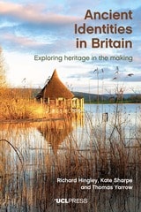
Ancient Identities in Britain
Exploring Heritage in the MakingRichard Hingley, Kate Sharpe, and Tom Yarrow
University College London, 2025
Ancient Identities in Britain explores the relevance of Iron Age and Roman heritage in modern-day Britain. Shedding new light on the continued social significance of these ancient histories, it discusses how they are presented in the form of ancient monuments, museums, reenactments, living history exhibits, community projects, and other heritage venues across England, Scotland, and Wales. The book is not only interested in the continued resonance of ancient myths and material culture, but also the very actions, ideas, and material conditions through which antiquity becomes heritage in the present—and how present values shape the way antiquity is displayed and consumed.
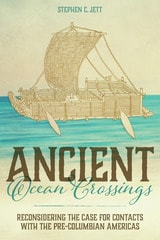
Ancient Ocean Crossings
Reconsidering the Case for Contacts with the Pre-Columbian AmericasStephen C. Jett
University of Alabama Press, 2017
In Ancient Ocean Crossings: Reconsidering the Case for Contacts with the Pre-Columbian Americas, Stephen Jett encourages readers to reevaluate the common belief that there was no significant interchange between the chiefdoms and civilizations of Eurasia and Africa and peoples who occupied the alleged terra incognita beyond the great oceans.
More than a hundred centuries separate the time that Ice Age hunters are conventionally thought to have crossed a land bridge from Asia into North America and the arrival of Columbus in the Bahamas in 1492. Traditional belief has long held that earth’s two hemispheres were essentially cut off from one another as a result of the post-Pleistocene meltwater-fed rising oceans that covered that bridge. The oceans, along with arctic climates and daunting terrestrial distances, formed impermeable barriers to interhemispheric communication. This viewpoint implies that the cultures of the Old World and those of the Americas developed independently.
Drawing on abundant and concrete evidence to support his theory for significant pre-Columbian contacts, Jett suggests that many ancient peoples had both the seafaring capabilities and the motives to cross the oceans and, in fact, did so repeatedly and with great impact. His deep and broad work synthesizes information and ideas from archaeology, geography, linguistics, climatology, oceanography, ethnobotany, genetics, medicine, and the history of navigation and seafaring, making an innovative and persuasive multidisciplinary case for a new understanding of human societies and their diffuse but interconnected development.
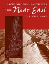
Archaeological Landscapes of the Near East
T. J. Wilkinson
University of Arizona Press, 2003
Many fundamental studies of the origins of states have built upon landscape data, but an overall study of the Near Eastern landscape itself has never been attempted. Spanning thousands of years of history, the ancient Near East presents a bewildering range of landscapes, the understanding of which can greatly enhance our ability to infer past political and social systems.
Tony Wilkinson now shows that throughout the Holocene humans altered the Near Eastern environment so thoroughly that the land has become a human artifact, albeit one that retains the power to shape human societies. In this trailblazing book—the first to describe and explain the development of the Near Eastern landscape using archaeological data—Wilkinson identifies specific landscape signatures for various regions and periods, from the early stages of complex societies in the fifth to sixth millennium B.C. to the close of the Early Islamic period around the tenth century A.D.
From Bronze Age city-states to colonized steppes, these signature landscapes of irrigation systems, tells, and other features changed through time along with changes in social, economic, political, and environmental conditions. By weaving together the record of the human landscape with evidence of settlement, the environment, and social and economic conditions, Wilkinson provides a holistic view of the ancient Near East that complements archaeological excavations, cuneiform texts, and other conventional sources.
Through this overview, culled from thirty years' research, Wilkinson establishes a new framework for understanding the economic and physical infrastructure of the region. By describing the basic attributes of the ancient cultural landscape and placing their development within the context of a dynamic environment, he breaks new ground in landscape archaeology and offers a new context for understanding the ancient Near East.
Armenia
A Historical AtlasRobert H. Hewsen
University of Chicago Press, 2001
Hewsen has divided the maps into five sections, each of which begins with a chronology of important dates and a historical introduction to the period. Specialized maps include Ptolemy's second-century map of Armenia, as well as maps of Roman, Cilician, Ottoman, tsarist, and Soviet Armenia. Other maps show the Persian khanate of Erevan, the Caucasian campaigns of World War I, the Armenian Genocide, the Armenian monuments in Turkey and Transcaucasia, the worldwide diaspora, ground plans of selected cities, and plans of the great monastery of Echmiadzin in 1660, 1890, and 1990. The atlas concludes with maps portraying the Karabagh war and the new Armenian Republic, and an extensive bibliography compiles references to the vast historical, ethnological, and travel literature on the region.
The first comprehensive and authoritative atlas of any of the former Soviet republics, this book does not treat Armenia in isolation, but instead sets it within the context of Caucasia as a whole, providing detailed information on neighboring regions such as Georgia and Azerbaijan. Armenia: A Historical Atlas will be an essential reference and an important teaching tool for generations to come.