Results by title
122 books match the query 'Maps' and 17 start with a

A Historical Atlas of Tibet
Karl E. Ryavec
University of Chicago Press, 2015
Cradled among the world’s highest mountains—and sheltering one of its most devout religious communities—Tibet is, for many of us, an ultimate destination, a place that touches the heavens, a place only barely in our world, at its very end. In recent decades Western fascination with Tibet has soared, from the rise of Tibetan studies in academia to the rock concerts aimed at supporting its independence to the simple fact that most of us—far from any base camp—know exactly what a sherpa is. And yet any sustained look into Tibet as a place, any attempt to find one’s way around its high plateaus and through its deep history, will yield this surprising fact: we have barely mapped it. With this atlas, Karl E. Ryavec rights that wrong, sweeping aside the image of Tibet as Shangri-La and putting in its place a comprehensive vision of the region as it really is, a civilization in its own right. And the results are absolutely stunning.
The product of twelve years of research and eight more of mapmaking, A Historical Atlas of Tibet documents cultural and religious sites across the Tibetan Plateau and its bordering regions from the Paleolithic and Neolithic times all the way up to today. It ranges through the five main periods in Tibetan history, offering introductory maps of each followed by details of western, central, and eastern regions. It beautifully visualizes the history of Tibetan Buddhism, tracing its spread throughout Asia, with thousands of temples mapped, both within Tibet and across North China and Mongolia, all the way to Beijing. There are maps of major polities and their territorial administrations, as well as of the kingdoms of Guge and Purang in western Tibet, and of Derge and Nangchen in Kham. There are town plans of Lhasa and maps that focus on history and language, on population, natural resources, and contemporary politics.
Extraordinarily comprehensive and absolutely gorgeous, this overdue volume will be a cornerstone in cartography, Asian studies, Buddhist studies, and in the libraries or on the coffee tables of anyone who has ever felt the draw of the landscapes, people, and cultures of the highest place on Earth.
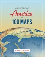
A History of America in 100 Maps
Susan Schulten
University of Chicago Press, 2018
In this book Susan Schulten uses maps to explore five centuries of American history, from the voyages of European discovery to the digital age. With stunning visual clarity, A History of America in 100 Maps showcases the power of cartography to illuminate and complicate our understanding of the past.
Gathered primarily from the British Library’s incomparable archives and compiled into nine chronological chapters, these one hundred full-color maps range from the iconic to the unfamiliar. Each is discussed in terms of its specific features as well as its larger historical significance in a way that conveys a fresh perspective on the past. Some of these maps were made by established cartographers, while others were made by unknown individuals such as Cherokee tribal leaders, soldiers on the front, and the first generation of girls to be formally educated. Some were tools of statecraft and diplomacy, and others were instruments of social reform or even advertising and entertainment. But when considered together, they demonstrate the many ways that maps both reflect and influence historical change.
Audacious in scope and charming in execution, this collection of one hundred full-color maps offers an imaginative and visually engaging tour of American history that will show readers a new way of navigating their own worlds.
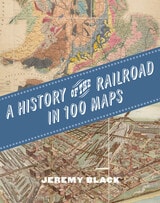
A History of the Railroad in 100 Maps
Jeremy Black
University of Chicago Press, 2024
The first international history of railroads and railroad infrastructure told through stunningly reproduced maps.
Since their origins in eighteenth-century England, railroads have spread across the globe, changing everything in their path, from where and how people grew and made things to where and how they lived and moved. Railroads rewrote not only world geography but also the history of maps and mapping. Today, the needs of train companies and their users continue to shape the maps we consume and consult.
Featuring full-color maps primarily from the British Library's distinguished collection—many of them never before published—A History of the Railroad in 100 Maps is the first international history of railroads and railroad infrastructure told through maps. Jeremy Black includes examples from six continents, spanning a variety of uses from railroad planning and operations to guides for passengers, shippers, and tourists.
Arranged chronologically, the maps are accompanied by explanatory text that sheds light on the political, military, and urban development histories associated with the spread of railroads. A final chapter considers railroad maps from games, books, and other cultural artifacts. For anyone interested in the history of railroads or maps, A History of the Railroad in 100 Maps will offer new and unexpected insights into their intertwined global history.
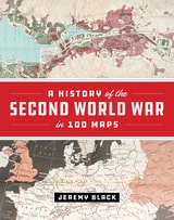
A History of the Second World War in 100 Maps
Jeremy Black
University of Chicago Press, 2020
The First World War was marked by an exceptional expansion in the use and production of military cartography. But World War II took things even further, employing maps, charts, reconnaissance, and the systematic recording and processing of geographical and topographical information on an unprecedented scale. As Jeremy Black—one of the world’s leading military and cartographic historians—convincingly shows in this lavish full-color book, it is impossible to understand the events and outcomes of the Second World War without deep reference to mapping at all levels. In World War II, maps themselves became the weapons.
A History of the Second World War in 100 Maps traces how military cartography developed from simply recording and reflecting history to having a decisive impact on events of a global scale. Drawing on one hundred key maps from the unparalleled collections of the British Library and other sources—many of which have never been published in book form before--Jeremy Black takes us from the prewar mapping programs undertaken by both Germany and the United Kingdom in the mid-1930s through the conflict’s end a decade later. Black shows how the development of maps led directly to the planning of the complex and fluid maneuvers that defined the European theater in World War II: for example, aerial reconnaissance photography allowed for the charting of beach gradients and ocean depths in the runup to the D-Day landings, and the subsequent troop movements at Normandy would have been impossible without the help of situation maps and photos. In the course of the conflict, both in Europe and the Pacific, the realities of climate, terrain, and logistics—recorded on maps—overcame the Axis powers. Maps also became propaganda tools as the pages of Time outlined the directions of the campaigns and the Allies dropped maps from their aircraft.
In this thrilling and unique book, Jeremy Black blends his singular cartographic and military expertise into a captivating overview of World War II from the air, sea, and sky, making clear how fundamental maps were to every aspect of this unforgettable global conflict.
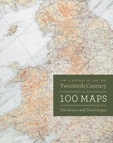
A History of the Twentieth Century in 100 Maps
Tim Bryars and Tom Harper
University of Chicago Press, 2014
As Bryars and Harper reveal, maps make ideal narrators, and the maps in this book tell the story of the 1900s—which saw two world wars, the Great Depression, the Swinging Sixties, the Cold War, feminism, leisure, and the Internet. Several of the maps have already gained recognition for their historical significance—for example, Harry Beck’s iconic London Underground map—but the majority of maps on these pages have rarely, if ever, been seen in print since they first appeared. There are maps that were printed on handkerchiefs and on the endpapers of books; maps that were used in advertising or propaganda; maps that were strictly official and those that were entirely commercial; maps that were printed by the thousand, and highly specialist maps issued in editions of just a few dozen; maps that were envisaged as permanent keepsakes of major events, and maps that were relevant for a matter of hours or days.
As much a pleasure to view as it is to read, A History of the Twentieth Century in 100 Maps celebrates the visual variety of twentieth century maps and the hilarious, shocking, or poignant narratives of the individuals and institutions caught up in their production and use.
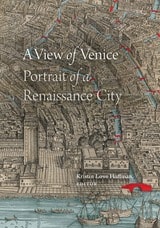
A View of Venice
Portrait of a Renaissance CityKristin Love Huffman, editor
Duke University Press, 2024
Contributors. Karen-edis Barzman, Andrea Bellieni, Patricia Fortini Brown, Valeria Cafà, Stanley Chojnacki, Tracy E. Cooper, Giada Damen, Julia A. DeLancey, Piero Falchetta, Ludovica Galeazzo, Maartje van Gelder, Jonathan Glixon, Richard Goy, Anna Christine Swartwood House, Kristin Love Huffman, Holly Hurlburt, Claire Judde de Larivière, Blake de Maria, Martina Massaro, Cosimo Monteleone, Monique O’Connell, Mary Pardo, Giorgio Tagliaferro, Saundra Weddle, Bronwen Wilson, Rangsook Yoon
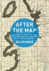
After the Map
Cartography, Navigation, and the Transformation of Territory in the Twentieth CenturyWilliam Rankin
University of Chicago Press, 2016
In After the Map, William Rankin argues that although this shift did not render traditional maps obsolete, it did radically change our experience of geographic knowledge, from the God’s-eye view of the map to the embedded subjectivity of GPS. Likewise, older concerns with geographic truth and objectivity have been upstaged by a new emphasis on simplicity, reliability, and convenience. After the Map shows how this change in geographic perspective is ultimately a transformation of the nature of territory, both social and political.

An Atlas of Illinois Fishes
150 Years of ChangeBrian A. Metzke, Brooks M. Burr, Leon C. Hinz Jr., Lawrence M. Page, and Christopher A. Taylor
University of Illinois Press, 2022
Scientifically up-to-date and illustrated with over 240 color photos, An Atlas of Illinois Fishes is a benchmark in the study of Illinois’s ever-changing fish communities and the habitats that support them.
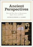
Ancient Perspectives
Maps and Their Place in Mesopotamia, Egypt, Greece, and RomeEdited by Richard J. A. Talbert
University of Chicago Press, 2012
Ancient Perspectives encompasses a vast arc of space and time—Western Asia to North Africa and Europe from the third millennium BCE to the fifth century CE—to explore mapmaking and worldviews in the ancient civilizations of Mesopotamia, Egypt, Greece, and Rome. In each society, maps served as critical economic, political, and personal tools, but there was little consistency in how and why they were made. Much like today, maps in antiquity meant very different things to different people.
Archaeological Settlement Pattern Data from the Chalco, Xochimilco, Ixtapalapa, Texcoco and Zumpango Regions, Mexico
Jeffrey R. Parsons, Keith W. Kintigh, and Susan A. Gregg
University of Michigan Press, 1983

Armenia
A Historical AtlasRobert H. Hewsen
University of Chicago Press, 2001
Hewsen has divided the maps into five sections, each of which begins with a chronology of important dates and a historical introduction to the period. Specialized maps include Ptolemy's second-century map of Armenia, as well as maps of Roman, Cilician, Ottoman, tsarist, and Soviet Armenia. Other maps show the Persian khanate of Erevan, the Caucasian campaigns of World War I, the Armenian Genocide, the Armenian monuments in Turkey and Transcaucasia, the worldwide diaspora, ground plans of selected cities, and plans of the great monastery of Echmiadzin in 1660, 1890, and 1990. The atlas concludes with maps portraying the Karabagh war and the new Armenian Republic, and an extensive bibliography compiles references to the vast historical, ethnological, and travel literature on the region.
The first comprehensive and authoritative atlas of any of the former Soviet republics, this book does not treat Armenia in isolation, but instead sets it within the context of Caucasia as a whole, providing detailed information on neighboring regions such as Georgia and Azerbaijan. Armenia: A Historical Atlas will be an essential reference and an important teaching tool for generations to come.
Art and Cartography
Six Historical EssaysEdited by David Woodward
University of Chicago Press, 1987
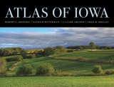
Atlas of Iowa
Robert C. Shepard
University of Iowa Press, 2024

Atlas of Oregon Wildlife
Blair Csuti
Oregon State University Press, 1997
Atlas of Oregon Wildlife, 2nd Ed
Distribution, Habitat, and Natural HistoryBlair Csuti
Oregon State University Press, 2001
Atlas of the Pacific Northwest
Philip Jackson
Oregon State University Press, 1993
Atlas of the Pacific Northwest, 9th Ed
Philip Jackson
Oregon State University Press, 2003