Results by title
28 books match the query 'Navigation'
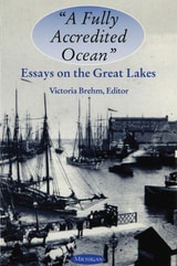
"A Fully Accredited Ocean"
Essays on the Great LakesVictoria Brehm, Editor
University of Michigan Press, 1998
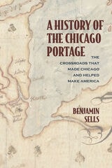
A History of the Chicago Portage
The Crossroads That Made Chicago and Helped Make AmericaBenjamin Sells
Northwestern University Press, 2021
This fascinating account explores the significance of the Chicago Portage, one of the most important—and neglected—sites in early US history. A seven-mile-long strip of marsh connecting the Chicago and Des Plaines Rivers, the portage was inhabited by the earliest indigenous people in the Midwest and served as a major trade route for Native American tribes. A link between the Mississippi River and the Atlantic Ocean, the Chicago Portage was a geopolitically significant resource that the French, British, and US governments jockeyed to control. Later, it became a template for some of the most significant waterways created in the nineteenth and twentieth centuries. The portage gave Chicago its name and spurred the city’s success—and is the reason why the metropolis is located in Illinois, not Wisconsin.
A History of the Chicago Portage: The Crossroads That Made Chicago and Helped Make America is the definitive story of a national landmark.
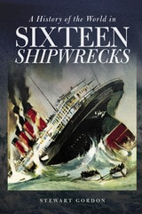
A History of the World in Sixteen Shipwrecks
Stewart Gordon
University Press of New England, 2017
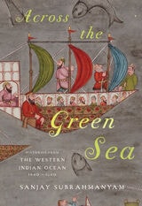
Across the Green Sea
Histories from the Western Indian Ocean, 1440-1640Sanjay Subrahmanyam
University of Texas Press, 2024
A history of two centuries of interactions among the areas bordering the western Indian Ocean, including India, Iran, and Africa.
Beginning in the mid-fifteenth century, the regions bordering the western Indian Ocean—“the green sea,” as it was known to Arabic speakers—had increasing contact through commerce, including a slave trade, and underwent cultural exchange and transformation. Using a variety of texts and documents in multiple Asian and European languages, Across the Green Sea looks at the history of the ocean from a variety of shifting viewpoints: western India; the Red Sea and Mecca; the Persian Gulf; East Africa; and Kerala.
Sanjay Subrahmanyam sets the scene for this region starting with the withdrawal of China's Ming Dynasty and explores how the western Indian Ocean was transformed by the growth and increasing prominence of the Ottoman Empire and the continued spread of Islam into East Africa. He examines how several cities, including Mecca and the vital Indian port of Surat, grew and changed during these centuries, when various powers interacted until famines and other disturbances upended the region in the seventeenth century. Rather than proposing an artificial model of a dominant center and its dominated peripheries, Across the Green Sea demonstrates the complexity of a truly dynamic and polycentric system through the use of connected histories, a method pioneered by Subrahmanyam himself.
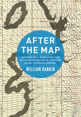
After the Map
Cartography, Navigation, and the Transformation of Territory in the Twentieth CenturyWilliam Rankin
University of Chicago Press, 2016
In After the Map, William Rankin argues that although this shift did not render traditional maps obsolete, it did radically change our experience of geographic knowledge, from the God’s-eye view of the map to the embedded subjectivity of GPS. Likewise, older concerns with geographic truth and objectivity have been upstaged by a new emphasis on simplicity, reliability, and convenience. After the Map shows how this change in geographic perspective is ultimately a transformation of the nature of territory, both social and political.
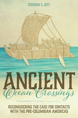
Ancient Ocean Crossings
Reconsidering the Case for Contacts with the Pre-Columbian AmericasStephen C. Jett
University of Alabama Press, 2017
In Ancient Ocean Crossings: Reconsidering the Case for Contacts with the Pre-Columbian Americas, Stephen Jett encourages readers to reevaluate the common belief that there was no significant interchange between the chiefdoms and civilizations of Eurasia and Africa and peoples who occupied the alleged terra incognita beyond the great oceans.
More than a hundred centuries separate the time that Ice Age hunters are conventionally thought to have crossed a land bridge from Asia into North America and the arrival of Columbus in the Bahamas in 1492. Traditional belief has long held that earth’s two hemispheres were essentially cut off from one another as a result of the post-Pleistocene meltwater-fed rising oceans that covered that bridge. The oceans, along with arctic climates and daunting terrestrial distances, formed impermeable barriers to interhemispheric communication. This viewpoint implies that the cultures of the Old World and those of the Americas developed independently.
Drawing on abundant and concrete evidence to support his theory for significant pre-Columbian contacts, Jett suggests that many ancient peoples had both the seafaring capabilities and the motives to cross the oceans and, in fact, did so repeatedly and with great impact. His deep and broad work synthesizes information and ideas from archaeology, geography, linguistics, climatology, oceanography, ethnobotany, genetics, medicine, and the history of navigation and seafaring, making an innovative and persuasive multidisciplinary case for a new understanding of human societies and their diffuse but interconnected development.
Captain W. W. Withenbury's 1838-1842 "Red River Reminiscences"
Jacques D. Bagur
University of North Texas Press, 2014
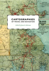
Cartographies of Travel and Navigation
Edited by James R. Akerman
University of Chicago Press, 2006
Finding one’s way with a map is a relatively recent phenomenon. In premodern times, maps were used, if at all, mainly for planning journeys in advance, not for guiding travelers on the road. With the exception of navigational sea charts, the use of maps by travelers only became common in the modern era; indeed, in the last two hundred years, maps have become the most ubiquitous and familiar genre of modern cartography.
Examining the historical relationship between travelers, navigation, and maps, Cartographies of Travel and Navigation considers the cartographic response to the new modalities of modern travel brought about by technological and institutional developments in the twentieth century. Highlighting the ways in which the travelers, operators, and planners of modern transportation systems value maps as both navigation tools and as representatives of a radical new mobility, this collection brings the cartography of travel—by road, sea, rail, and air—to the forefront, placing maps at the center of the history of travel and movement.
Richly and colorfully illustrated, Cartographies of Travel and Navigation ably fills the void in historical literature on transportation mapping.

Edgar Allan Poe - American Writers 89
University of Minnesota Pamphlets on American WritersRoger Asselineau
University of Minnesota Press, 1970
Edgar Allan Poe - American Writers 89 was first published in 1970. Minnesota Archive Editions uses digital technology to make long-unavailable books once again accessible, and are published unaltered from the original University of Minnesota Press editions.
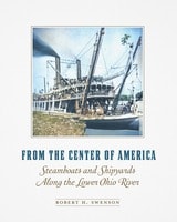
From the Center of America
Steamboats and Shipyards Along the Lower Ohio RiverRobert H. Swenson
Southern Illinois University Press, 2026
Charting the legacy of mid-America's shipyards and iconic steamboats
Before the railroad stitched together the American landscape, the dominant mode of transportation in the United States was by steamboat. These grand vessels, their iconic paddlewheels churning the country’s rivers, have long captured the national imagination as symbols of innovation and adventure.
In the heart of America, four major rivers converge—the Cumberland and Tennessee with the Ohio; then the Ohio with the Mississippi. These three confluences, which author Robert Swenson christens the Four Rivers Reach, played a unique role in the development of the steamboats that dominated American continental transport for almost 100 years. Between 1825 and 1936, the river towns of Smithland, Paducah, Metropolis, Mound City, and Cairo launched 295 wood-hulled, steam-powered vessels. Drawing from a wealth of archival sources, Swenson presents detailed histories of these steamboats over a span of 110 years, accompanied by nearly one hundred illustrations and photographs.
The book focuses on distinct events in steamboat history, tracing the impact of these shipyards on the economies and communities of the river towns where they were built. It reveals how the availability of steamboats along this sixty-mile Reach affected migration, politics, and the US economy of the nineteenth century. Steamboats built at the Four Rivers Reach played pivotal roles in the forced relocation of Native Americans from southern Appalachia to Oklahoma, the outcome of the Civil War, and the Montana gold rush. From the Center of America demonstrates how steamboat building shaped the culture, people, and economy of this region—and how, in turn, the area and its steamships influenced the growth of the young United States.
Globes
400 Years of Exploration, Navigation, and PowerSylvia Sumira
University of Chicago Press, 2014
Showcasing the impressive collection of globes held by the British Library, Sumira traces the inception and progression of globes during the period in which they were most widely used—from the late fifteenth century to the late nineteenth century—shedding light on their purpose, function, influence, and manufacture, as well as the cartographers, printers, and instrument makers who created them. She takes readers on a chronological journey around the world to examine a wide variety of globes, from those of the Renaissance that demonstrated a renewed interest in classical thinkers; to those of James Wilson, the first successful commercial globe maker in America; to those mass-produced in Boston and New York beginning in the 1800s. Along the way, Sumira not only details the historical significance of each globe, but also pays special attention to their materials and methods of manufacture and how these evolved over the centuries.
A stunning and accessible guide to one of the great tools of human exploration, Globes will appeal to historians, collectors, and anyone who has ever examined this classroom accessory and wondered when, why, and how they came to be made.
Great Ships on the Great Lakes
A Maritime HistoryBobbie Malone
Wisconsin Historical Society Press, 2013
In this highly accessible history of ships and shipping on the Great Lakes, upper elementary readers are taken on a rip-roaring journey through the waterways of the upper Midwest.
Great Ships on the Great Lakes explores the history of the region’s rivers, lakes, and inland seas—and the people and ships who navigated them. Read along as the first peoples paddle tributaries in birch bark canoes. Follow as European voyageurs pilot rivers and lakes to get beaver pelts back to the eastern market. Watch as settlers build towns and eventually cities on the shores of the Great Lakes. Listen to the stories of sailors, lighthouse keepers, and shipping agents whose livelihoods depended on the dangerous waters of Lake Michigan, Superior, Huron, Erie, and Ontario. Give an ear to their stories of unexpected tragedy and miraculous rescue, and heed their tales of risk and reward on the low seas.
Great Ships also tells the story of sea battles and gunships, of the first vessels to travel beyond the Niagara, and of the treacherous storms and cold weather that caused thousands of ships to sink in the Great Lakes. Watch as underwater archaeologists solve the mysteries of Great Lakes shipwrecks today. And learn how the shift from sail to steam forever changed the history of shipping, as schooners made way for steamships and bulk freighters, and sailing became a recreation, not a hazardous way of life.
Designed for the upper elementary classroom with emphasis on Michigan and Wisconsin, Great Ships on the Great Lakes includes a timeline of events, on-page vocabulary, and a list of resources and places to visit. Over 20 maps highlight the region’s maritime history. The accompanying Teacher’s Guide includes 18 classroom activities, arranged by chapter, including lessons on exploring shipwrecks and learning how glaciers moved across the landscape.
Guardian of the Great Lakes
The U.S. Paddle Frigate MichiganBradley A. Rodgers
University of Michigan Press, 1996
Guardian of the Great Lakes is the saga of the USS Michigan, an archetype iron-hulled war steamer launched in 1843. Its mission was to patrol the ofttimes volatile Great Lakes region, quelling port town civil disturbances, while at the same time rescuing both Canadian and American ships in distress.
The Michigan found itself unavoidably attracted to calamity, leaving in its wake a collection of eyewitness accounts to these momentous yet largely forgotten occurences. Incidents such as the timber rebellion of the 1850s, which occurred in Wisconsin, Illinois, and Michigan, are documented for the first time. Other episodes such as the assassination of "king" Strang on Beaver Island and the destruction of the community there are studied under the light of newly discovered sources. Still other chapters reveal the chaos created by the Civil War on the lakes, the destructive mining strikes of Michigan's Upper Peninsula, and the tragic, bloody, Fenian invasion of Canada.
Between major calamities lay the vagaries of maritime life on the Great Lakes detailed in the records of the Michigan's crew. From their social and community life in Erie, Pennsylvania to storms, shipwrecks, and sickness, the records kept by the men and officers of the USS Michigan have helped to produce in this book an accurate and detailed narrative of naval and maritime life on the Great Lakes during this important period.
Bradley A. Rodgers is Assistant Professor, Program in Maritime History and Nautical Archaeology, East Carolina University.
Guide to Peril Strait and Wrangell Narrows, Alaska
William Morgan Hopkins
University of Alaska Press, 2020
Kanaka Hawai'i Cartography
Hula, Navigation, and OratoryRenee Pualani Louis
Oregon State University Press, 2017
An important symbolic element in Hawai'ian cartography is the storied place name, which reflects Hawai'ian spatial knowledge of the environment. Many Hawai'ian place names performed in daily rituals were a conscious act of locating genealogical connections, recreating cultural landscapes, and regenerating cultural mores. They constitute a critically important body of Hawai'ian cultural knowledge. When Hawai'ian place names were incorporated into Western cartographic maps they were transformed epistemologically. They went from representing place as a repository of cultural knowledge to representing place as an object on the landscape. Hawai'ian spatial knowledge presentation is interactive, multi-sensual, and multi‐ dimensional.
Kanaka Hawai'i Cartography interweaves methodology with personal narrative and performance presentation in a playbill format. Three of the seven chapters are presented as “Acts” in a play. The remaining four chapters serve as intermissions or interludes together with a prologue and an epilogue for setting the stage and providing closure. To help make the topic more accessible, complex terms have been minimized, making academic theory easier for the educated reader to understand. The book will fill an important gap in Indigenous and Native Studies and will be welcomed by anyone interested in traditional Hawai’ian performance cartography.

Ladies of the Lights
Michigan Women in the U.S. Lighthouse ServicePatricia Majher
University of Michigan Press, 2010
"A great read about some great ladies, Pat Majher's Ladies of the Lights pays long overdue homage to an overlooked part of Great Lakes maritime history in which a select group of stalwart women beat the odds to succeed in a field historically reserved for men."
---Terry Pepper, Executive Director of Great Lakes Lighthouse Keeper's Association
Michigan once led the country in the number of lighthouses, and they're still a central part of the mystique and colorful countryside of the state. What even the region's lighthouse enthusiasts might not know is the rich history of female lighthouse keepers in the area.
Fifty women served the sailing communities on Lakes Huron, Michigan, and Superior, as well as on the Detroit River, for more than 100 years. From Catherine Shook, who raised eight children while maintaining the Pointe Aux Barques light at the entrance to Saginaw Bay; to Eliza Truckey, who assumed responsibility for the lighthouse in Marquette while her husband fought for four years in the Civil War; to Elizabeth Whitney, whose combined service on Beaver Island and in Harbor Springs totaled forty-one years---the stories of Michigan's "ladies of the light" are inspiring.
This is no technical tome documenting the minutiae of Michigan's lighthouse specifications. Rather, it's a detailed, human portrait of the women who kept those lighthouses running, defying the gender expectations of their time.
Patricia Majher is Editor of Michigan History magazine, published by the Historical Society of Michigan. Prior, she was Assistant Director of the Michigan Women's Historical Center and Hall of Fame in Lansing, Michigan. In addition, she has been writing both advertising and editorial copy for almost thirty years and has been a frequent contributor to Michigan newspapers and magazines.
Mastering the Inland Seas
How Lighthouses, Navigational Aids, and Harbors Transformed the Great Lakes and AmericaTheodore J. Karamanski
University of Wisconsin Press, 2020
Karamanski explores both the navigational and sailing tools of First Nations peoples and the dismissive and foolhardy attitude of early European maritime sailors. He investigates the role played by commercial boats in the Underground Railroad, as well as how the federal development of crucial navigational resources exacerbated sectionalism in the antebellum United States. Ultimately Mastering the Inland Sea shows the undeniable environmental impact of technologies used by the modern commercial maritime industry. This expansive story illuminates the symbiotic relationship between infrastructure investment in the region's interconnected waterways and North America's lasting economic and political development.

Navigation and Control of Autonomous Marine Vehicles
Sanjay Sharma
The Institution of Engineering and Technology, 2019
Rafts and Other Rivercraft
in Huckleberry FinnPeter G. Beidler
University of Missouri Press, 2018
Huck and Jim’s little raft is not made of logs, as it is often depicted in illustrations, but of sawn planks, and it was originally part of a much larger raft. Beidler explains why this matters and describes the other rivercraft that appear in the book. He gives what will almost certainly be the last word on the vexed question of whether the lengthy “raft episode,” removed at the publisher’s suggestion from the novel, should be restored to its original place.
Rhumb Lines and Map Wars
A Social History of the Mercator ProjectionMark Monmonier
University of Chicago Press, 2004
Because it distorts the proportionate size of countries, the Mercator map was criticized for inflating Europe and North America in a promotion of colonialism. In 1974, German historian Arno Peters proffered his own map, on which countries were ostensibly drawn in true proportion to one another. In the ensuing "map wars" of the 1970s and 1980s, these dueling projections vied for public support—with varying degrees of success.
Widely acclaimed for his accessible, intelligent books on maps and mapping, Monmonier here examines the uses and limitations of one of cartography's most significant innovations. With informed skepticism, he offers insightful interpretations of why well-intentioned clerics and development advocates rallied around the Peters projection, which flagrantly distorted the shape of Third World nations; why journalists covering the controversy ignored alternative world maps and other key issues; and how a few postmodern writers defended the Peters worldview with a self-serving overstatement of the power of maps. Rhumb Lines and Map Wars is vintage Monmonier: historically rich, beautifully written, and fully engaged with the issues of our time.
Sail, Steam, and Diesel
Moving Cargo on the Great LakesEric Hirsimaki
Michigan State University Press, 2024
Ships and Shipwrecks
Stories from the Great LakesRichard Gebhart
Michigan State University Press, 2022
Steamboats on the Colorado River, 1852-1916
Richard E. Lingenfelter
University of Arizona Press, 1978
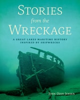
Stories from the Wreckage
A Great Lakes Maritime History Inspired by ShipwrecksJohn Odin Jensen
Wisconsin Historical Society Press, 2019
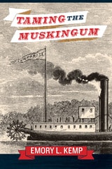
Taming the Muskingum
EMORY L. KEMP
West Virginia University Press, 2014
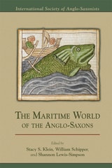
The Maritime World of the Anglo-Saxons
Stacy S. Klein
Arizona Center for Medieval and Renaissance Studies, 2014
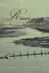
The River We Have Wrought
A History of the Upper MississippiJohn O. Anfinson
University of Minnesota Press, 2005
Wilderness Route Finder
The Classic Guide to Finding Your Way in the WildCalvin Rutstrum
University of Minnesota Press, 2000
An indispensable resource for navigating the wild.
In the days before cell phones and global positioning systems, knowing how to find your own way in the wilderness was a vitally important skill. The Wilderness Route Finder, first published in 1967, was the popular resource for anyone venturing into the woods who wanted to find their way out again. Now this essential book is available once more in a handy paperback edition.
As more and more people seek to simplify their wilderness experiences and return to traditional camping methods, Rutstrum’s simple, straightforward, and dependable methods can be appreciated anew. Rutstrum focuses on the tried-and-true techniques that have served wilderness travelers for generations: how to use a map, a compass, a sextant, and the sun and stars. He explains why we sometimes get lost and what we should do when we are. This is a valuable traveling companion for anyone wishing to hunt, fish, explore, camp, or simply walk through unfamiliar territory.