Results by title
13 books match the query 'Surveying'
American Boundaries
The Nation, the States, the Rectangular SurveyBill Hubbard Jr.
University of Chicago Press, 2009
Ancient Perspectives
Maps and Their Place in Mesopotamia, Egypt, Greece, and RomeEdited by Richard J. A. Talbert
University of Chicago Press, 2012
Ancient Perspectives encompasses a vast arc of space and time—Western Asia to North Africa and Europe from the third millennium BCE to the fifth century CE—to explore mapmaking and worldviews in the ancient civilizations of Mesopotamia, Egypt, Greece, and Rome. In each society, maps served as critical economic, political, and personal tools, but there was little consistency in how and why they were made. Much like today, maps in antiquity meant very different things to different people.
Creating New England, Defending the Northeast
Contested Algonquian and English Spatial Worlds, 1500–1700Nathan Braccio
University of Massachusetts Press, 2026
Between 1500 and 1700, Indigenous and English mapmakers across the North Atlantic depicted present-day New England in markedly distinct ways, highlighting how differently their communities understood the landscape. While English cartographers relied on new mathematics and other developing scientific knowledge from Europe, as well as an overhead perspective of the world, Algonquian mapmakers drew on deep knowledge of the landscape, derived from their communities’ long history upon it. Nathan Braccio refers to this phenomenon as “parallel landscapes.”
Creating New England, Defending the Northeast asserts that Algonquian knowledge of the landscape represented a powerful and persistent alternative to English surveying and mapmaking in the Northeast. When English colonists and explorers recognized the unsuitability of their techniques for understanding New England’s unfamiliar landscape, they attempted to appropriate Indigenous knowledge and maps. Algonquian sachems used this as an opportunity to control and benefit from their new English neighbors. Later, as the English became insecure in their dependence on Indigenous people, they began to remake and mark the landscape. Algonquians adapted, maintaining control of important spatial knowledge, even in a place no longer entirely of their making. This story complicates narratives of conquest and highlights the Indigenous spatial knowledge too often overlooked.
Gender and Agricultural Development
Surveying the FieldEdited by Helen K. Henderson
University of Arizona Press, 1995
This book is both a resource guide and a review of major issues in gender and agriculture which demonstrates that recognizing the contribution of women to agricultural production is a necessary step in development planning. It presents relevant information and research literature regarding women's roles in agriculture in a consolidated and accessible format, offering insights into how the inclusion or exclusion of appropriate information at the planning stage can have an impact during implementation. It also provides guidelines for locating information on gender-related agricultural issues and incorporating it into development planning, research, and training. The literature reviewed not only calls attention to the work women do in order to improve their access to technology and training but also challenges existing development paradigms. The issues discussed present women's experiences and local knowledge and allude to gender and class inequities that farming women face. Each chapter is intended to help the reader address major gender issues in a specific subject in order to access relevant information and thereby better design and implement appropriate agricultural planning and policies.
By synthesizing twenty years of international research, Gender and Agricultural Development provides an effective tool for development practitioners to use in training programs or surveys in order to ensure the appropriate collection of gender disaggregated data and for educators to integrate gender issues into courses dealing with social aspects of agricultural systems. Its findings are presented in such a way as to allow them to be easily incorporated into innovative planning for more sustainable and equitable agricultural policies.
La Gran Línea
Mapping the United States–Mexico Boundary, 1849–1857By Paula Rebert
University of Texas Press, 2001
The Treaty of Guadalupe Hildalgo, which officially ended the U.S.-Mexican War in 1848, cost Mexico half its territory, while the United States gained land that became California, Nevada, Utah, Texas, and parts of Colorado, Arizona, and New Mexico. Because the new United States-Mexico border ran through territory that was still incompletely mapped, the treaty also called for government commissions from both nations to locate and mark the boundary on the ground. This book documents the accomplishments of both the U.S. and the Mexican Boundary Commissions that mapped the boundary between 1849 and 1857, as well as the fifty-four pairs of maps produced by their efforts and the ongoing importance of these historical maps in current boundary administration. Paula Rebert explores how, despite the efforts of both commissions to draw neutral, scientific maps, the actual maps that resulted from their efforts reflected the differing goals and outlooks of the two countries. She also traces how the differences between the U.S. and Mexican maps have had important consequences for the history of the boundary.
Of Caves and Shell Mounds
Edited by Kenneth C. Carstens and Patty Jo Watson
University of Alabama Press, 1996
Ancient human groups in the Eastern Woodlands of North America were long viewed as homogeneous and stable hunter-gatherers, changing little until the late prehistoric period when Mesoamerican influences were thought to have stimulated important economic and social developments. The authors in this volume offer new, contrary evidence to dispute this earlier assumption, and their studies demonstrate the vigor and complexity of prehistoric peoples in the North American Midwest and Midsouth. These peoples gathered at favored places along midcontinental streams to harvest mussels and other wild foods and to inter their dead in the shell mounds that had resulted from their riverside activities. They created a highly successful, pre-maize agricultural system beginning more than 4,000 years ago, established far-flung trade networks, and explored and mined the world's longest cave—the Mammoth Cave System in Kentucky.
Contributors include:
Kenneth C. Carstens, Cheryl Ann Munson, Guy Prentice, Kenneth B. Tankersley, Philip J. DiBlasi, Mary C. Kennedy, Jan Marie Hemberger, Gail E. Wagner, Christine K. Hensley, Valerie A. Haskins, Nicholas P. Herrmann, Mary Lucas Powell, Cheryl Claassen, David H. Dye, and Patty Jo Watson
Shooting Polaris
A Personal Survey in the American WestJohn Hales
University of Missouri Press, 2005
Soldier-Artist of the Great Reconnaissance
John C. Tidball and the 35th Parallel Pacific Railroad SurveyEugene C. Tidball
University of Arizona Press, 2004
Surveying The Archaeology Of Northwest Mexico
Gilliam E Newell
University of Utah Press, 2003
Archaeology in the Southwest is increasingly directing its attention south of the international border as it becomes clear that a picture of the pre-hispanic Southwest is incomplete without taking the Mexican Northwest into account.
Surveying the Archaeology of Northwest Mexico presents an overview of recent work in Sonora and Chihuahua, comprising a sort of professional tour of the area. The chapters offer fresh insights into the formation of centers such as Paquimé, Cerro de Trincheras, and the Rio Sonora cabaceras. Contributors explore relations between these centers, individual internal organization of the various identifiable polities, and the relation of the whole northwest Mexican region to better-known adjacent ones. The volume underscores that northwest Mexico was not a dependent hinterland but was inhabited by many independent groups throughout prehistory.
Surveying The Interior
Literary Cartographers And The Sense Of PlaceRick Van Noy
University of Nevada Press, 2003
From a cartographer who wrote to a writer who mapped, the literary significance of surveying is revealed in this study of human relationships to the landscape. From the very beginning, American literature was closely intertwined with surveying. In Surveying the Interior, Rick Van Noy explores the ways that four American literary cartographers—Henry David Thoreau, Clarence King, John Wesley Powell, and Wallace Stegner—concerned themselves with what it means to map or survey a place and what it means to write about it. In the process, he helps define the ways by which space enters the human psyche as definable place, as well as the ways by which physical landscape is transmuted into a sense of place as an intimate, personal manifestation of both physical and existential realities.
Surveying in Early America
The Point of Beginning, An Illustrated HistoryDan Patterson; Clinton Terry
Ohio University Press, 2020
Published by the University of Cincinnati Press
In Surveying in Early America: The Point of Beginning, An Illustrated History, award-winning photographer Dan Patterson and American historian Clinton Terry vividly examine the profession of surveying in the eighteenth century. Retracing the steps Washington and other surveyors took to map the Ohio River Valley, readers are immersed in historically accurate details of early surveying techniques and practices. Terry's narrative describes the practice of land and survey measurement—methods that did not substantially change until the invention of GPS technology 200 years later. Over 100 full color photographs exclusively shot for the book depict authentic and historically accurate reproductions of tools along with early American reenactors to provide an interpretive look at surveying as a primary means to building the American nation. Working with the Department of the Geographer, Patterson restages actual expeditions, brilliantly displaying the techniques and instruments Washington would have employed 260 years ago. Through the lens of Patterson's camera and Terry's accompanying narrative, readers see what Washington saw as he learned his trade, explored the vast American wilderness, and occasionally laid personal claim to great expanses of land along the way.
Surveying the Landscape
Arts Integration at Research Universities: A Review of Best Practices and Challenges for Arts Integration in Higher EducationBruce M. Mackh, PhD
Michigan Publishing Services, 2015
This study presents “best practices in the integration of arts practice in U.S. research universities . . . , fulfill[ing] the need for a document that articulates models, obstacles, implementation strategies, costs, and impact on students and faculty as well as on research, practice, and teaching in other knowledge areas” (ArtsEngine). Rather than providing a detailed set of instructions, this document maps the landscape of arts integration at 30 partner institutions in the Alliance for the Arts in Research Universities (a2ru) and at 16 other institutions. It highlights aspirational models and presents an overall guide to current practices linking the arts to other learning areas.
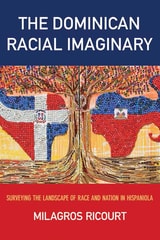
The Dominican Racial Imaginary
Surveying the Landscape of Race and Nation in HispaniolaRicourt, Milagros
Rutgers University Press, 2016
This book begins with a simple question: why do so many Dominicans deny the African components of their DNA, culture, and history?