Results by title
3 books match the query 'Wigen, Kären'
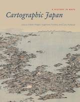
Cartographic Japan
A History in MapsEdited by Kären Wigen, Sugimoto Fumiko, and Cary Karacas
University of Chicago Press, 2016
Miles of shelf space in contemporary Japanese bookstores and libraries are devoted to travel guides, walking maps, and topical atlases. Young Japanese children are taught how to properly map their classrooms and schoolgrounds. Elderly retirees pore over old castle plans and village cadasters. Pioneering surveyors are featured in popular television shows, and avid collectors covet exquisite scrolls depicting sea and land routes. Today, Japanese people are zealous producers and consumers of cartography, and maps are an integral part of daily life.
But this was not always the case: a thousand years ago, maps were solely a privilege of the ruling elite in Japan. Only in the past four hundred years has Japanese cartography truly taken off, and between the dawn of Japan’s cartographic explosion and today, the nation’s society and landscape have undergone major transformations. At every point, maps have documented those monumental changes. Cartographic Japan offers a rich introduction to the resulting treasure trove, with close analysis of one hundred maps from the late 1500s to the present day, each one treated as a distinctive window onto Japan’s tumultuous history.
Forty-seven distinguished contributors—hailing from Japan, North America, Europe, and Australia—uncover the meanings behind a key selection of these maps, situating them in historical context and explaining how they were made, read, and used at the time. With more than one hundred gorgeous full-color illustrations, Cartographic Japan offers an enlightening tour of Japan’s magnificent cartographic archive.
But this was not always the case: a thousand years ago, maps were solely a privilege of the ruling elite in Japan. Only in the past four hundred years has Japanese cartography truly taken off, and between the dawn of Japan’s cartographic explosion and today, the nation’s society and landscape have undergone major transformations. At every point, maps have documented those monumental changes. Cartographic Japan offers a rich introduction to the resulting treasure trove, with close analysis of one hundred maps from the late 1500s to the present day, each one treated as a distinctive window onto Japan’s tumultuous history.
Forty-seven distinguished contributors—hailing from Japan, North America, Europe, and Australia—uncover the meanings behind a key selection of these maps, situating them in historical context and explaining how they were made, read, and used at the time. With more than one hundred gorgeous full-color illustrations, Cartographic Japan offers an enlightening tour of Japan’s magnificent cartographic archive.
[more]
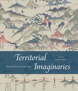
Territorial Imaginaries
Beyond the Sovereign MapEdited by Kären Wigen
University of Chicago Press, 2025
Fresh offerings on world mapping beyond Western conventions.
This strikingly colorful volume contends that modern mapping has never been sufficient to illustrate the complex reality of territory and political sovereignty, whether past or present. For Territorial Imaginaries, editor Kären Wigen has assembled an impressive slate of experts, spanning disciplines from political science to art history, to contribute perspectives and case studies covering three main themes: mapping before the nation-state, rethinking and critiquing mapping practices, and robust traditions of counter-cartography.
Each contributor proposes alternative ways to think about mapping, and the essays are supported with rich archival documentation. Among the far-reaching case studies are Barbara Mundy’s cartographic history of Indigenous dispossession in the Americas, Peter Bol’s examination of two Chinese maps created five hundred years apart, and Ali Yaycıoğlu’s exploration of tensions between top-down and bottom-up mapping of Habsburg and Ottoman border claims.
This strikingly colorful volume contends that modern mapping has never been sufficient to illustrate the complex reality of territory and political sovereignty, whether past or present. For Territorial Imaginaries, editor Kären Wigen has assembled an impressive slate of experts, spanning disciplines from political science to art history, to contribute perspectives and case studies covering three main themes: mapping before the nation-state, rethinking and critiquing mapping practices, and robust traditions of counter-cartography.
Each contributor proposes alternative ways to think about mapping, and the essays are supported with rich archival documentation. Among the far-reaching case studies are Barbara Mundy’s cartographic history of Indigenous dispossession in the Americas, Peter Bol’s examination of two Chinese maps created five hundred years apart, and Ali Yaycıoğlu’s exploration of tensions between top-down and bottom-up mapping of Habsburg and Ottoman border claims.
[more]
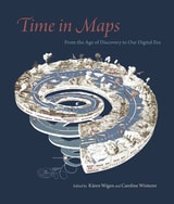
Time in Maps
From the Age of Discovery to Our Digital EraEdited by Kären Wigen and Caroline Winterer
University of Chicago Press, 2020
Maps organize us in space, but they also organize us in time. Looking around the world for the last five hundred years, Time in Maps shows that today’s digital maps are only the latest effort to insert a sense of time into the spatial medium of maps. Historians Kären Wigen and Caroline Winterer have assembled leading scholars to consider how maps from all over the world have depicted time in ingenious and provocative ways.
Focusing on maps created in Spanish America, Europe, the United States, and Asia, these essays take us from the Aztecs documenting the founding of Tenochtitlan, to early modern Japanese reconstructing nostalgic landscapes before Western encroachments, to nineteenth-century Americans grappling with the new concept of deep time. The book also features a defense of traditional paper maps by digital mapmaker William Rankin. With more than one hundred color maps and illustrations, Time in Maps will draw the attention of anyone interested in cartographic history.
Focusing on maps created in Spanish America, Europe, the United States, and Asia, these essays take us from the Aztecs documenting the founding of Tenochtitlan, to early modern Japanese reconstructing nostalgic landscapes before Western encroachments, to nineteenth-century Americans grappling with the new concept of deep time. The book also features a defense of traditional paper maps by digital mapmaker William Rankin. With more than one hundred color maps and illustrations, Time in Maps will draw the attention of anyone interested in cartographic history.
[more]