
 A SCHOLARLY BOOK REPOSITORY
14 start with P start with P
Though the essays in Place and Prosperity are in some ways personal, drawing on Fulton’s experience in learning and writing about cities, their primary purpose is to show how these two ideas – place and prosperity – lie at the heart of what a city is and, by extension, what our society is all about. Fulton shows how, over time, a successful place creates enduring economic assets that don’t go away and lay the groundwork for prosperity in the future. But for urbanism to succeed, all of us have to participate in making cities great places for everybody. Because cities, imposing though they may be as physical environments, don’t work without us.
Cities are resilient. They’ve been buffeted over the decades by White flight, decay, urban renewal, unequal investment, increasingly extreme weather events, and now the worst pandemic in a century, and they’re still going strong. Fulton shows that at their best, cities not only inspire and uplift us, but they make our daily life more convenient, more fulfilling – and more prosperous.
Building on the tenth-century geographer al-Maqdisi's writings on urban centers of the Islamic world, buttressed by extensive comparative material from roadbooks, topographies, histories, adab literatures, and gazetteers of the time, Wheatley identifies the main functions of different Islamic urban centers. Chapters on each of the thirteen centers that al-Maqdisi identified, ranging from the Atlantic to the Indus and from the Caspian to the Sudan, form the heart of this book. In each case Wheatley shows how specific agglomeration and accessibility factors combined to make every city functionally distinct as a creator of effective space. He also demonstrates that, far from revolutionizing every aspect of life in these cities, the adoption of Islam often affected the development of these cities less than previously existing local traditions.
The Places Where Men Pray Together is a monumental work that will speak to scholars and readers across a broad variety of disciplines, from historians, anthropologists, and sociologists to religious historians, archaeologists, and geographers.
The book's contributors include the most well-known experts in the planning and design fields, among them James Howard Kunstler, Alex Garvin, Andres Duany, Joel Kotkin, and Wendell Cox. These and other prominent thinkers offer passionate debates and thought-provoking commentary on the most important and controversial topics in the field of urban planning and design: gentrification, eminent domain, the philosophical divide between the Smart Growth community, libertarians and New Urbanists, regional growth patterns, urban design trends, transportation systems, and reaction to disasters such as Katrina and 9/11 that changed the way we look at cities and security.
Planetizen's Contemporary Debates in Urban Planning provides readers with a unique and accessible introduction to a broad array of ideas and perspectives. With the increasing awareness of the need for sound urban planning to ensure the economic, environmental, and social health of modern society, Planetizen's Contemporary Debates in Urban Planning gives professionals in the field and concerned citizens alike a deeper understanding of the critical, complex issues that continue to challenge urban planners, designers, and developers.
Oregon is one of the nation’s most celebrated exceptions. In the early 1970s Oregon established the nation’s first and only comprehensive statewide system of land-use planning and largely succeeded in confining residential and commercial growth to urban areas while preserving the state’s rural farmland, forests, and natural areas. Despite repeated political attacks, the state’s planning system remained essentially politically unscathed for three decades. In the early- and mid-2000s, however, the Oregon public appeared disenchanted, voting repeatedly in favor of statewide ballot initiatives that undermined the ability of the state to regulate growth. One of America’s most celebrated “success stories” in the war against sprawl appeared to crumble, inspiring property rights activists in numerous other western states to launch copycat ballot initiatives against land-use regulation.
This is the first book to tell the story of Oregon’s unique land-use planning system from its rise in the early 1970s to its near-death experience in the first decade of the 2000s. Using participant observation and extensive original interviews with key figures on both sides of the state’s land use wars past and present, this book examines the question of how and why a planning system that was once the nation’s most visible and successful example of a comprehensive regulatory approach to preventing runaway sprawl nearly collapsed.
Planning Paradise is tough love for Oregon planning. While admiring much of what the state’s planning system has accomplished, Walker and Hurley believe that scholars, professionals, activists, and citizens engaged in the battle against sprawl would be well advised to think long and deeply about the lessons that the recent struggles of one of America’s most celebrated planning systems may hold for the future of land-use planning in Oregon and beyond.
The income of blacks in most northern industrial states today is lower relative to the income of whites than in 1949.Fusfeld and Bates examine the forces that have led to this state of affairs and find that these economic relationships are the product of a complex pattern of historical development and change in which black-white economic relationships play a major part, along with patterns of industrial, agricultural, and technological change and urban development. They argue that today’s urban racial ghettos are the result of the same forces that created modern America and that one of the by-products of American affluence is a ghettoized racial underclass.
These two themes, they state, are essential for an understanding of the problem and for the formulation of policy. Poverty is not simply the result of poor education, skills, and work habits but one outcome of the structure and functioning of the economy. Solutions require more than policies that seek to change people: they await a recognition that basic economic relationships must be changed.
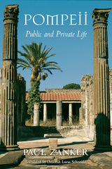
Pompeii's tragedy is our windfall: an ancient city fully preserved, its urban design and domestic styles speaking across the ages. This richly illustrated book conducts us through the captured wonders of Pompeii, evoking at every turn the life of the city as it was 2,000 years ago.
When Vesuvius erupted in 79 A.D. its lava preserved not only the Pompeii of that time but a palimpsest of the city's history, visible traces of the different societies of Pompeii's past. Paul Zanker, a noted authority on Roman art and architecture, disentangles these tantalizing traces to show us the urban images that marked Pompeii's development from country town to Roman imperial city. Exploring Pompeii's public buildings, its streets and gathering places, we witness the impact of religious changes, the renovation of theaters and expansion of athletic facilities, and the influence of elite families on the city's appearance. Through these stages, Zanker adeptly conjures a sense of the political and social meanings in urban planning and public architecture.
The private houses of Pompeii prove equally eloquent, their layout, decor, and architectural detail speaking volumes about the life, taste, and desires of their owners. At home or in public, at work or at ease, these Pompeians and their world come alive in Zanker's masterly rendering. A provocative and original reading of material culture, his work is an incomparable introduction to urban life in antiquity.
The authors also highlight key trends that will continue to transform the state: domestic migration out of the state and immigration into it; increasing diversity; slower overall population growth; contracting fertility; the household revolution and changing living arrangements; generational disruptions; and suburbanization versus re-urbanization. All of these factors help place in context the result of the 2020 decennial U.S. Census.
While the book focuses on New Jersey, the Garden State is a template of demographic, economic, social, and other forces characterizing the United States in the twenty-first century.
This form of place study calls attention to how we can see a past through a serial view of places, by the nature of repetition, and the photographing of the same place over and over again. Arreola draws our focus to townscapes, or built landscapes, of four border towns—Tijuana, Mexicali, Tecate, and Algodones—during the first half of the twentieth century. With an emphasis on the tourist’s view of these places, this book creates a vivid picture of what life was like for tourists and residents of these towns in the early and mid-twentieth century. Postcards from the Baja California Border is a rich and fascinating experience, one that takes you on a time-travel journey through border town histories and geographies while celebrating the visual intrigue of postcards.
In Postcards from the Chihuahua Border Daniel D. Arreola captures the exhilaration of places in time, taking us back to Mexico’s northern border towns of Cuidad Juárez, Ojinaga, and Palomas in the early twentieth century. Drawing on more than three decades of archival work, Arreola uses postcards and maps to unveil the history of these towns along west Texas’s and New Mexico’s southern borders.
Postcards offer a special kind of visual evidence. Arreola’s collection of imagery and commentary about them shows us singular places, enriching our understandings of history and the history of change in Chihuahua. No one postcard tells the entire story. But image after image offers a collected view and insight into changing perceptions. Arreola’s geography of place looks both inward and outward. We see what tourists see, while at the same time gaining insight about what postcard photographers and postcard publishers wanted to be seen and perceived about these border communities.
Postcards from the Chihuahua Border is a colorful and dynamic visual history. It invites the reader to time travel, to revisit another era—the first half of the last century—when these border towns were framed and made popular through picture postcards.
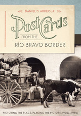
Between 1900 and the late 1950s, Mexican border towns came of age both as tourist destinations and as emerging cities. Commercial photographers produced thousands of images of their streets, plazas, historic architecture, and tourist attractions, which were reproduced as photo postcards. Daniel Arreola has amassed one of the largest collections of these border town postcards, and in this book, he uses this amazing visual archive to offer a new way of understanding how the border towns grew and transformed themselves in the first half of the twentieth century, as well as how they were pictured to attract American tourists.
Postcards from the Río Bravo Border presents nearly two hundred images of five significant towns on the lower Río Bravo—Matamoros, Reynosa, Nuevo Laredo, Piedras Negras, and Villa Acuña. Using multiple images of sites within each city, Arreola tracks changes both within the cities as places and in the ways in which the cities have been pictured for tourist consumption. He makes a strong case that visual imagery has a shaping influence on how we negotiate and think about places, creating a serial scripting or narrating of the place. Arreola also shows how postcard images, when systematically and chronologically arranged, can tell us a great deal about how Mexican border towns have been viewed over time. This innovative visual approach demonstrates that historical imagery, no less than text or maps, can be assembled to tell a compelling geographical story about place and time.
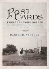
Young men ride horses on a dusty main road through town. Cars and gas stations gradually intrude on the land, and, years later, curiosity shops and cantinas change the face of Mexican border towns south of Arizona. Between 1900 and the late 1950s, Mexican border towns came of age both as centers of commerce and as tourist destinations. Postcards from the Sonora Border reveals how images—in this case the iconic postcard—shape the way we experience and think about place.
Making use of his personal collection of historic images, Daniel D. Arreola captures the evolution of Sonoran border towns, creating a sense of visual “time travel” for the reader. Supported by maps and visual imagery, the author shares the geographical and historical story of five unique border towns—Agua Prieta, Naco, Nogales, Sonoyta, and San Luis Río Colorado.
Postcards from the Sonora Border introduces us to these important towns and provides individual stories about each, using the postcards as markers. No one postcard view tells the complete story—rather, the sense of place emerges image by image as the author pulls readers through the collection as an assembled view. Arreola reveals how often the same locations and landmarks of a town were photographed as postcard images generation after generation, giving a long and dynamic view of the inhabitants through time. Arranged chronologically, Arreola’s postcards allow us to discover the changing perceptions of place in the borderlands of Sonora, Mexico.
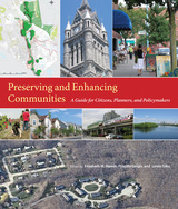
In this volume, twenty-nine experts from a variety of fields describe in very practical terms the "community preservation" approach to these issues. As opposed to the top-down regulatory mechanisms that are sometimes used to manage growth, the contributors favor a more flexible, locally based approach that has proven successful in Massachusetts and elsewhere. They show how residents can be empowered to become involved in local decision-making, building coalitions and expressing their views on a wide range of issues, such as zoning, water and land protection, transportation, historic preservation, economic diversity, affordable housing, and reuse of brown-fields. When done properly, development can enhance the sense of place and provide needed homes and jobs. Done improperly, it can generate sprawl and a multitude of problems.
Preserving and Enhancing Communities will be particularly useful to members of planning and other regulatory boards, as well as students of community planning. The book covers not just typical ways of doing things, but also the full spectrum of innovative and emerging practices. Each chapter includes illustrations and case studies, some from Massachusetts and many from other states. The volume concludes with a set of indicators that communities can use to track their progress in community preservation
and enhancement.
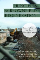
This is the first book to provide an accessible introduction to the design, policy, and technical issues related to brownfield redevelopment. After defining brownfields and advocating for their redevelopment, the book describes the steps for cleaning up a site and creating viable land for development or open space. Land use and design considerations are addressed in a separate chapter and again in each of five case studies that make up the heart of the volume: The Steel Yard, Providence, RI; Assunpink Greenway, Trenton, NJ; June Key Community Center Demonstration Project, Portland, OR; Eastern Manufacturing Facility, Brewer, ME; and The Watershed at Hillsdale, Portland, OR. Throughout, the authors draw on interviews with people involved in brownfield projects as well as on their own considerable expertise.
READERS
Browse our collection.
PUBLISHERS
See BiblioVault's publisher services.
STUDENT SERVICES
Files for college accessibility offices.
RECENTLY PUBLISHED


UChicago Accessibility Resources
home | accessibility | search | about | contact us
BiblioVault ® 2001 - 2025
The University of Chicago Press