
 A SCHOLARLY BOOK REPOSITORY
29 start with P start with P
In 1910 John Merven Carrère, a Paris-trained American architect, wrote, “Learning from Paris made Washington outstanding among American cities.” The five essays in Paris on the Potomac explore aspects of this influence on the artistic and architectural environment of Washington, D.C., which continued long after the well-known contributions of Peter Charles L’Enfant, the transplanted French military officer who designed the city’s plan.
Isabelle Gournay’s introductory essay provides an overview and examines the context and issues involved in three distinct periods of French influence: the classical and Enlightenment principles that prevailed from the 1790s through the 1820s, the Second Empire style of the 1850s through the 1870s, and the Beaux-Arts movement of the early twentieth century. William C. Allen and Thomas P. Somma present two case studies: Allen on the influence of French architecture, especially the Halle aux Blés, on Thomas Jefferson’s vision of the U.S. Capitol; and Somma on David d’Angers’s busts of George Washington and the Marquis de Lafayette. Liana Paredes offers a richly detailed examination of French-inspired interior decoration in the homes of Washington’s elite in the late nineteenth and early twentieth centuries. Cynthia R. Field concludes the volume with a consideration of the influence of Paris on city planning in Washington, D.C., including the efforts of the McMillan Commission and the later development of the Federal Triangle complex.
The essays in this collection, the latest addition to the series Perspectives on the Art and Architectural History of the United States Capitol, originated in a conference held by the U.S. Capitol Historical Society in 2002 at the French Embassy’s Maison Française.
In the last 50 years, parking management has grown from a minor aspect of local policy and regulation to a central position in the provision of transportation access. The higher densities, tight land supplies, mixed land uses, environmental and social concerns, and alternative transportation modes of Smart Growth demand a different approach—actively managed parking.
This book offers a set of tools and a method for strategic parking management so that communities can better use parking resources and avoid overbuilding parking. It explores new opportunities for making the most from every parking space in a sharing economy and taking advantage of new digital parking tools to increase user interaction and satisfaction. Examples are provided of successful approaches for parking management—from Pasadena to London. At its essence, the book provides a path forward for strategic parking management in a new era of tighter parking supplies.
Today, there are more than three parking spaces for every car in the United States. No one likes searching for a space, but in many areas, there is an oversupply, wasting valuable land, damaging the environment, and deterring development. Richard W. Willson argues that the problem stems from outdated minimum parking requirements. In this practical guide, he shows practitioners how to reform parking requirements in a way that supports planning goals and creates vibrant cities.
Local planners and policymakers, traffic engineers, developers, and community members are actively seeking this information as they institute principles of Smart Growth. But making effective changes requires more than relying on national averages or copying information from neighboring communities. Instead, Willson shows how professionals can confidently create requirements based on local parking data, an understanding of future trends affecting parking use, and clear policy choices.
After putting parking and parking requirements in context, the book offers an accessible tool kit to get started and repair outdated requirements. It looks in depth at parking requirements for multifamily developments, including income-restricted housing, workplaces, and mixed-use, transit-oriented development. Case studies for each type of parking illustrate what works, what doesn’t, and how to overcome challenges. Willson also explores the process of codifying regulations and how to work with stakeholders to avoid political conflicts.
With Parking Reform Made Easy, practitioners will learn, step-by-step, how to improve requirements. The result will be higher density, healthier, more energy-efficient, and livable communities. This book will be exceptionally useful for local and regional land use and transportation planners, transportation engineers, real estate developers, citizen activists, and students of transportation planning and urban policy.
This urban resurgence is a national phenomenon, boosting cities from Cleveland to Buffalo and Portland to Pittsburgh. Experts offer a range of theories on what is driving the return to the city—from the impact of the recent housing crisis to a desire to be socially engaged, live near work, and reduce automobile use. But there’s also more to it. Time and again, when asked why they moved to the city, people talk about the desire to live somewhere distinctive, to be some place rather than no place. Often these distinguishing urban landmarks are exciting neighborhoods—Miami boasts its Art Deco district, New Orleans the French Quarter. Sometimes, as in the case of Baltimore’s historic rowhouses, the most distinguishing feature is the urban fabric itself.
While many aspects of this urban resurgence are a cause for celebration, the changes have also brought to the forefront issues of access, affordable housing, inequality, sustainability, and how we should commemorate difficult history. This book speaks directly to all of these issues.
In The Past and Future City, Stephanie Meeks, the president of the National Trust for Historic Preservation, describes in detail, and with unique empirical research, the many ways that saving and restoring historic fabric can help a city create thriving neighborhoods, good jobs, and a vibrant economy. She explains the critical importance of preservation for all our communities, the ways the historic preservation field has evolved to embrace the challenges of the twenty-first century, and the innovative work being done in the preservation space now.
This book is for anyone who cares about cities, places, and saving America’s diverse stories, in a way that will bring us together and help us better understand our past, present, and future.
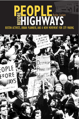
Linking archival research, ethnographic fieldwork, and oral history, Karilyn Crockett in People before Highways offers ground-level analysis of the social, political, and environmental significance of a local anti-highway protest and its lasting national implications. The story of how an unlikely multiracial coalition of urban and suburban residents, planners, and activists emerged to stop an interstate highway is one full of suspenseful twists and surprises, including for the actors themselves. And yet, the victory and its aftermath are undeniable: federally funded mass transit expansion, a linear central city park, and a highway-less urban corridor that serves as a daily reminder of the power and efficacy of citizen-led city making.
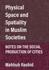
Mahbub Rashid embarks on a fascinating journey through urban space in all of its physical and social aspects, using the theories of Foucault, Bourdieu, Lefebvre, and others to explore how consumer capitalism, colonialism, and power disparity consciously shape cities. Using two Muslim cities as case studies, Algiers (Ottoman/French) and Zanzibar (Ottoman/British), Rashid shows how Western perceptions can only view Muslim cities through the lens of colonization—a lens that distorts both physical and social space. Is it possible, he asks, to find a useable urban past in a timeline broken by colonization? He concludes that political economy may be less relevant in premodern cities, that local variation is central to the understanding of power, that cities engage more actively in social reproduction than in production, that the manipulation of space is the exercise of power, that all urban space is a conscious construct and is therefore not inevitable, and that consumer capitalism is taking over everyday life. Ultimately, we reconstruct a present from a fragmented past through local struggles against the homogenizing power of abstract space.
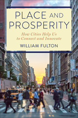
Though the essays in Place and Prosperity are in some ways personal, drawing on Fulton’s experience in learning and writing about cities, their primary purpose is to show how these two ideas – place and prosperity – lie at the heart of what a city is and, by extension, what our society is all about. Fulton shows how, over time, a successful place creates enduring economic assets that don’t go away and lay the groundwork for prosperity in the future. But for urbanism to succeed, all of us have to participate in making cities great places for everybody. Because cities, imposing though they may be as physical environments, don’t work without us.
Cities are resilient. They’ve been buffeted over the decades by White flight, decay, urban renewal, unequal investment, increasingly extreme weather events, and now the worst pandemic in a century, and they’re still going strong. Fulton shows that at their best, cities not only inspire and uplift us, but they make our daily life more convenient, more fulfilling – and more prosperous.
Arguably the most influential document in the history of urban planning, Daniel Burnham’s 1909 Plan of Chicago, coauthored by Edward Bennett and produced in collaboration with the Commercial Club of Chicago, proposed many of the city’s most distinctive features, including its lakefront parks and roadways, the Magnificent Mile, and Navy Pier. Carl Smith’s fascinating history reveals the Plan’s central role in shaping the ways people envision the cityscape and urban life itself.
Smith’s concise and accessible narrative begins with a survey of Chicago’s stunning rise from a tiny frontier settlement to the nation’s second-largest city. He then offers an illuminating exploration of the Plan’s creation and reveals how it embodies the renowned architect’s belief that cities can and must be remade for the better. The Plan defined the City Beautiful movement and was the first comprehensive attempt to reimagine a major American city. Smith points out the ways the Plan continues to influence debates, even a century after its publication, about how to create a vibrant and habitable urban environment.
Richly illustrated and incisively written, his insightful book will be indispensable to our understanding of Chicago, Daniel Burnham, and the emergence of the modern city.
The book's contributors include the most well-known experts in the planning and design fields, among them James Howard Kunstler, Alex Garvin, Andres Duany, Joel Kotkin, and Wendell Cox. These and other prominent thinkers offer passionate debates and thought-provoking commentary on the most important and controversial topics in the field of urban planning and design: gentrification, eminent domain, the philosophical divide between the Smart Growth community, libertarians and New Urbanists, regional growth patterns, urban design trends, transportation systems, and reaction to disasters such as Katrina and 9/11 that changed the way we look at cities and security.
Planetizen's Contemporary Debates in Urban Planning provides readers with a unique and accessible introduction to a broad array of ideas and perspectives. With the increasing awareness of the need for sound urban planning to ensure the economic, environmental, and social health of modern society, Planetizen's Contemporary Debates in Urban Planning gives professionals in the field and concerned citizens alike a deeper understanding of the critical, complex issues that continue to challenge urban planners, designers, and developers.
Communities can reduce their vulnerability to disaster by becoming more resilient—to not only bounce back more readily from disasters but to grow stronger, more socially cohesive, and more environmentally responsible. To be truly resilient, disaster preparation and response must consider all populations in the community. By bringing together natural hazards planning and community planning to consider vulnerabilities, more resilient and equitable communities are achievable.
In Planning for Community Resilience the authors describe an inclusive process for creating disaster-resilient communities. Based on their recovery work after Hurricane Ike in Galveston, Texas, they developed a process that relies on the Disaster Impacts Model. This handbook guides any community through the process of determining their level of hazard exposure, physical vulnerability, and social vulnerability with the goal of determining the best planning strategy.
Planning for Community Resilience will be invaluable to professionals working to protect their community from disturbance, including city planners, elected officials, floodplain managers, natural hazard managers, planning commissioners, local business leaders, and citizen organizers.
In the ambitious and provocative Planning Matter, Robert A. Beauregard sets out to offer a new materialist perspective on planning practice that reveals the many ways in which the nonhuman things of the world mediate what planners say and do. Drawing on actor-network theory and science and technology studies, Beauregard lays out a framework that acknowledges the inevitable insufficiency of our representations of reality while also engaging more holistically with the world in all of its diversity—including human and nonhuman actors alike.
In this companion volume to his 2012 book Oregon Plans: The Making of an Unquiet Land-Use Revolution, Sy Adler offers readers a deep analysis of planning Portland’s Urban Growth Boundary. Required by one of Oregon’s nineteen statewide planning goals, a boundary in the Portland metropolitan area was intended to separate urban land and land that would be urbanized from commercially productive farmland. After adopting the goals, approving the Portland growth boundary in 1979 was the most significant decision the Oregon Land Conservation and Development Commission has ever made, and, more broadly, is a significant milestone in American land-use planning.
Planning the Portland Urban Growth Boundary primarily covers the 1970s. Innovative regional planning institutions were established in response to concerns about sprawl, but planners working for those institutions had to confront the reality that various plans being developed and implemented by city and county governments in metro Portland would instead allow sprawl to continue. Regional planners labeled these as “Trend City” plans, and sought to transform them during the 1970s and thereafter.
Adler discusses the dynamics of these partially successful efforts and the conflicts that characterized the development of the Portland UGB during the 1970s—between different levels of government, and between public, private, and civic sector advocates. When the regional UGB is periodically reviewed, these conflicts continue, as debates about values and technical issues related to forecasting future amounts of population, economic activity, and the availability of land for urban development over a twenty-year period roil the boundary planning process.
Planning the Portland Urban Growth Boundary is an authoritative history and an indispensable resource for anyone actively involved in urban and regional planning—from neighborhood associations and elected officials to organizations working on land use and development issues throughout the state.
Gwendolyn Wright focuses on three French colonies—Indochina, Morocco, and Madagascar—that were the most discussed, most often photographed, and most admired showpieces of the French empire in the early twentieth century. She explores how urban policy and design fit into the French colonial policy of "association," a strategy that accepted, even encouraged, cultural differences while it promoted modern urban improvements that would foster economic development for Western investors. Wright shows how these colonial cities evolved, tracing the distinctive nature of each locale under French imperialism. She also relates these cities to the larger category of French architecture and urbanism, showing how consistently the French tried to resolve certain stylistic and policy problems they faced at home and abroad.
With the advice of architects and sociologists, art historians and geographers, colonial administrators sought to exert greater control over such matters as family life and working conditions, industrial growth and cultural memory. The issues Wright confronts—the potent implications of traditional norms, cultural continuity, modernization, and radical urban experiments—still challenge us today.
Pompeii's tragedy is our windfall: an ancient city fully preserved, its urban design and domestic styles speaking across the ages. This richly illustrated book conducts us through the captured wonders of Pompeii, evoking at every turn the life of the city as it was 2,000 years ago.
When Vesuvius erupted in 79 A.D. its lava preserved not only the Pompeii of that time but a palimpsest of the city's history, visible traces of the different societies of Pompeii's past. Paul Zanker, a noted authority on Roman art and architecture, disentangles these tantalizing traces to show us the urban images that marked Pompeii's development from country town to Roman imperial city. Exploring Pompeii's public buildings, its streets and gathering places, we witness the impact of religious changes, the renovation of theaters and expansion of athletic facilities, and the influence of elite families on the city's appearance. Through these stages, Zanker adeptly conjures a sense of the political and social meanings in urban planning and public architecture.
The private houses of Pompeii prove equally eloquent, their layout, decor, and architectural detail speaking volumes about the life, taste, and desires of their owners. At home or in public, at work or at ease, these Pompeians and their world come alive in Zanker's masterly rendering. A provocative and original reading of material culture, his work is an incomparable introduction to urban life in antiquity.
Portland, Oregon, is often cited as one of the most livable cities in the United States and a model for "smart growth." At the same time, critics deride it as a victim of heavy-handed planning and point to its skyrocketing housing costs as a clear sign of good intentions gone awry. Which side is right? Does Portland deserve the accolades it has received, or has hype overshadowed the real story?
In The Portland Edge, leading urban scholars who have lived in and studied the region present a balanced look at Portland today, explaining current conditions in the context of the people and institutions that have been instrumental in shaping it. Contributors provide empirical data as well as critical insights and analyses, clarifying the ways in which policy and planning have made a difference in the Portland metropolitan region.
Because of its iconic status and innovative approach to growth, Portland is an important case study for anyone concerned with land use and community development in the twenty-first century. The Portland Edge offers useful background and a vital overview of region, allowing others to draw lessons from its experience.
Since World War II, Houston has become a burgeoning, internationally connected metropolis—and a sprawling, car-dependent city. In 1950, it possessed only one highway, the Gulf Freeway, which ran between Houston and Galveston. Today, Houston and Harris County have more than 1,200 miles of highways, and a third major loop is under construction nearly thirty miles out from the historic core. Highways have driven every aspect of Houston’s postwar development, from the physical layout of the city to the political process that has transformed both the transportation network and the balance of power between governing elites and ordinary citizens.
Power Moves examines debates around the planning, construction, and use of highway and public transportation systems in Houston. Kyle Shelton shows how Houstonians helped shape the city’s growth by attending city council meetings, writing letters to the highway commission, and protesting the destruction of homes to make way for freeways, which happened in both affluent and low-income neighborhoods. He demonstrates that these assertions of what he terms “infrastructural citizenship” opened up the transportation decision-making process to meaningful input from the public and gave many previously marginalized citizens a more powerful voice in civic affairs. Power Moves also reveals the long-lasting results of choosing highway and auto-based infrastructure over other transit options and the resulting challenges that Houstonians currently face as they grapple with how best to move forward from the consequences and opportunities created by past choices.
Practical Ecology for Planners, Developers, and Citizens introduces and explains key ecological concepts for planners, landscape architects, developers, and others involved in planning and building human habitats. The book is tailored to meet the needs of busy land use professionals and citizens seeking a concise yet thorough overview of ecology and its applications. It offers clear guidelines and a wealth of information on how we can protect species and ecosystems while at the same creating healthy, sustainable human communities.
Throughout the book, the authors make ecological concepts accessible to readers with little or no scientific background. They present key ideas and information in simple and pragmatic terms, and provide numerous graphics to help explain important concepts. They also offer exercises for the reader to practice ecologically-based planning and design, along with a list of resources for practical information on ecology and conservation.
Practical Ecology for Planners, Developers, and Citizens will raise the level of ecological understanding among land use professionals and citizens, and is an invaluable new resource for anyone concerned with human land use and its environmental impacts.
In Practicing Utopia, Rosemary Wakeman gives us a sweeping view of the new town movement as a global phenomenon. From Tapiola in Finland to Islamabad in Pakistan, Cergy-Pontoise in France to Irvine in California, Wakeman unspools a masterly account of the golden age of new towns, exploring their utopian qualities and investigating what these towns can tell us about contemporary modernization and urban planning. She presents the new town movement as something truly global, defying a Cold War East-West dichotomy or the north-south polarization of rich and poor countries. Wherever these new towns were located, whatever their size, whether famous or forgotten, they shared a utopian lineage and conception that, in each case, reveals how residents and planners imagined their ideal urban future.
In this volume, twenty-nine experts from a variety of fields describe in very practical terms the "community preservation" approach to these issues. As opposed to the top-down regulatory mechanisms that are sometimes used to manage growth, the contributors favor a more flexible, locally based approach that has proven successful in Massachusetts and elsewhere. They show how residents can be empowered to become involved in local decision-making, building coalitions and expressing their views on a wide range of issues, such as zoning, water and land protection, transportation, historic preservation, economic diversity, affordable housing, and reuse of brown-fields. When done properly, development can enhance the sense of place and provide needed homes and jobs. Done improperly, it can generate sprawl and a multitude of problems.
Preserving and Enhancing Communities will be particularly useful to members of planning and other regulatory boards, as well as students of community planning. The book covers not just typical ways of doing things, but also the full spectrum of innovative and emerging practices. Each chapter includes illustrations and case studies, some from Massachusetts and many from other states. The volume concludes with a set of indicators that communities can use to track their progress in community preservation
and enhancement.
This is the first book to provide an accessible introduction to the design, policy, and technical issues related to brownfield redevelopment. After defining brownfields and advocating for their redevelopment, the book describes the steps for cleaning up a site and creating viable land for development or open space. Land use and design considerations are addressed in a separate chapter and again in each of five case studies that make up the heart of the volume: The Steel Yard, Providence, RI; Assunpink Greenway, Trenton, NJ; June Key Community Center Demonstration Project, Portland, OR; Eastern Manufacturing Facility, Brewer, ME; and The Watershed at Hillsdale, Portland, OR. Throughout, the authors draw on interviews with people involved in brownfield projects as well as on their own considerable expertise.
In the 1800s, urban development efforts modernized Paris and encouraged the creation of brothels, boulevards, cafés, dancehalls, and even public urinals. However, complaints also arose regarding an apparent increase in public sexual activity, and the appearance of “individuals of both sexes with depraved morals” in these spaces. Andrew Israel Ross’s illuminating study, Public City/Public Sex, chronicles the tension between the embourgeoisement and democratization of urban culture in nineteenth-century Paris and the commercialization and commodification of a public sexual culture, the emergence of new sex districts, as well as the development of gay and lesbian subcultures.
Public City/Public Sex examines how the notion that male sexual desire required suitable outlets shaped urban policing and development. Ross traces the struggle to control sex in public and argues that it was the very effort to police the city that created new opportunities for women who sold sex and men who sought sex with other men. Placing public sex at the center of urban history, Ross shows how those who used public spaces played a central role in defining the way the city was understood.
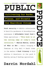
The idea that public land could be used creatively to grow fresh food for local citizens was beginning to gain traction when Public Produce was first published in 2009, but there were few concrete examples of action. Today, things are different: fruits and vegetables are thriving in parks, plazas, along our streets, and around our civic buildings.
This revised edition of Public Produce profiles the many communities and community officials that are rethinking the role of public space in cities, and shows how places as diverse as parking lots and playgrounds can sustain health and happiness through fresh produce. But these efforts produce more than food. Revitalizing urban areas, connecting residents with their neighborhoods, and promoting healthier lifestyles are just a few of the community goods we harvest from growing fruits and vegetables in our public gathering spots.
Taking readers from inspiration to implementation, Public Produce is chock full of tantalizing images and hearty lessons for bringing agriculture back into our cities.
READERS
Browse our collection.
PUBLISHERS
See BiblioVault's publisher services.
STUDENT SERVICES
Files for college accessibility offices.
RECENTLY PUBLISHED
")


UChicago Accessibility Resources
home | accessibility | search | about | contact us
BiblioVault ® 2001 - 2025
The University of Chicago Press