
 A SCHOLARLY BOOK REPOSITORY
10 start with S start with S
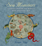
Nearly two meters wide in total, the map’s nine wood-block panels comprise the largest and first realistic portrayal of Northern Europe. But in addition to these important geographic elements, Magnus’s map goes beyond cartography to scenes both domestic and mystic. Close to shore, Magnus shows humans interacting with common sea life—boats struggling to stay afloat, merchants trading, children swimming, and fisherman pulling lines. But from the offshore deeps rise some of the most magical and terrifying sea creatures imaginable at the time or thereafter—like sea swine, whales as large as islands, and the Kraken. In this book, Nigg provides a thorough tour of the map’s cartographic details, as well as a colorful look at its unusual pictorial and imaginative elements. He draws on Magnus’s own text to further describe and illuminate the inventive scenes and to flesh out the stories of the monsters.
Sea Monsters is a stunning tour of a world that still holds many secrets for us land dwellers, who will forever be fascinated by reports of giant squid and the real-life creatures of the deep that have proven to be as bizarre and otherworldly as we have imagined for centuries. It is a gorgeous guide for enthusiasts of maps, monsters, and the mythic.
An illustrated story of the relationship between mapping and secrecy, charting the role maps played in concealing and revealing knowledge across centuries.
Is there anything more intriguing than a secret map? One that reveals clandestine information or meanings, or a map that is itself a secret? Secret Maps features over one hundred examples of these kinds of maps, connected by their varied relationships to secrecy, and ranging from the twelfth to the twenty-first centuries and across the globe. They include views into state secrecy and power—such as maps used for domestic and military purposes, imperial expansion, espionage, and surveillance as well as those with private or commercial uses, such as charts of private land, trade routes, or the flights of private jets. The maps span widely in their scope and cover issues of broad interest, from old-fashioned spying to contemporary concerns about technology and privacy.
As illuminating as it is thrilling, Secret Maps unearths the once-hidden routes, landscapes, and locations that have covertly shaped our world.
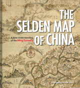
Exploring the commercial aims of the Ming Dynasty, the port city of Quanzhou and its connections with the voyages of the early traveler Zheng He, this book describes the historical background of the era in which the map was used. It also includes an analysis of the skills and techniques involved in Chinese map-making and the significance of the compass bearings, scale, and ratios found on the map, all of which combine to represent a breakthrough in cartographic techniques.
The enthralling story revealed by this extraordinary artifact sheds light on the long history of China’s relationship with the sea and with the wider world.
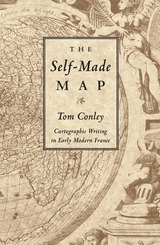
Conley traces the explosion of interest in mapmaking that occurred with the discovery of the New World, and discusses the commensurate rise of what he defines as cartographic writing-writing that "holds, penetrates, delineates, and explores space." Considering the works of such writers as Rabelais, Montaigne, and Descartes, Conley provides a "navigation" through the printed page, revealing the emerging values of Renaissance France. In his examination of the placing of words, letters, and graphic elements in books, he exposes the playful and sometimes enigmatic relation between spatial organization and text.
Conley also exposes the ideological exercise inherent in mapmaking, arguing that Renaissance cartography is inseparably bound up with the politics of the era. He undertakes close readings of maps and illustrations, discussing the necessity of viewing Renaissance maps in the context of their typographic layout, graphic reproduction, and literary and ideological import.
Richly illustrated throughout, The Self-Made Map combines studies of art, geography, history, literature, and printing to show a clear historical transformation, along the way linking geographical discoveries, printing processes, and political awareness. Conley's provocative analysis discloses how early modern printed literature and cartography worked together to crystallize broader issues engaging the then emergent status of cultural identity, nation, and individuality.
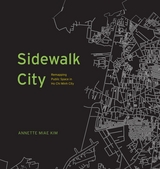
With Sidewalk City, Annette Miae Kim provides the first multidisciplinary case study of sidewalks in a distinctive geographical area. She focuses on Ho Chi Minh City, Vietnam, a rapidly growing and evolving city that throughout its history, her multicultural residents have built up alternative legitimacies and norms about how the sidewalk should be used. Based on fieldwork over 15 years, Kim developed methods of spatial ethnography to overcome habitual seeing, and recorded both the spatial patterns and the social relations of how the city’s vibrant sidewalk life is practiced.
In Sidewalk City, she transforms this data into an imaginative array of maps, progressing through a primer of critical cartography, to unveil new insights about the importance and potential of this quotidian public space. This richly illustrated and fascinating study of Ho Chi Minh City’s sidewalks shows us that it is possible to have an aesthetic sidewalk life that is inclusive of multiple publics’ aspirations and livelihoods, particularly those of migrant vendors.
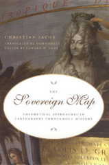
Beginning with a historical overview of maps and their creation—from those traced in the dirt by primitive hands to the monumental Dutch atlases and ornate maps on Italian palace walls—Jacob goes on to consider the visual components of cartography: the decorative periphery, geometric grid, topographical lines, dots, details of iconographic figures, and many other aspects. Considering text on maps—titles, toponyms, legends, and keys—Jacob proposes that writing can both clarify and interfere with a map's visual presentation. Finally Jacob examines the role of the viewer in decoding a map's meaning and the role of society in defining the power of maps as authoritative depictions of space.
Innovative in its philosophical motivation and its interdisciplinary approach to looking at and writing about maps, The Sovereign Map is eagerly awaited by scholars from many different fields.
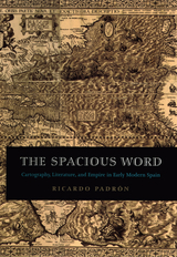
Padrón contends too that maps and geographic writings heavily influenced the Spanish imperial imagination. During the early modern period, the idea of "America" was still something being invented in the minds of Europeans. Maps of the New World, letters from explorers of indigenous civilizations, and poems dramatizing the conquest of distant lands, then, helped Spain to redefine itself both geographically and imaginatively as an Atlantic and even global empire. In turn, such literature had a profound influence on Spanish ideas of nationhood, most significantly its own.
Elegantly conceived and meticulously researched, The Spacious Word will be of enormous interest to historians of Spain, early modern literature, and cartography.
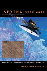
Despite our apprehension about surveillance technology, Spying with Maps is not a jeremiad, crammed with dire warnings about eyes in the sky and invasive tracking. Monmonier's approach encompasses both skepticism and the acknowledgment that geospatial technology brings with it unprecedented benefits to governments, institutions, and individuals, especially in an era of asymmetric warfare and bioterrorism. Monmonier frames his explanations of what this new technology is and how it works with the question of whether locational privacy is a fundamental right. Does the right to be left alone include not letting Big Brother (or a legion of Little Brothers) know where we are or where we've been? What sacrifices must we make for homeland security and open government?
With his usual wit and clarity, Monmonier offers readers an engaging, even-handed introduction to the dark side of the new technology that surrounds us—from traffic cameras and weather satellites to personal GPS devices and wireless communications.
This sumptuous volume begins with an introduction by Douglas Palmer that places Smith’s work in the context of earlier, concurrent, and subsequent ideas regarding the structure and natural processes of the earth, geographical mapping, and biostratigraphical theories. The book is then organized into four parts, each beginning with four sheets from Smith’s hand-colored, 1815 strata map, accompanied by related geological cross-sections and county maps, and followed by fossil illustrations by Smith contemporary James Sowerby, all organized by strata. Essays between each section explore the aims of Smith’s work and its application in the fields of mining, agriculture, cartography and hydrology. Strata concludes with reflections on Smith’s later years as an itinerant geologist and surveyor, plagiarism by a rival, receipt of the first Wollaston Medal in recognition of his achievements, and the influence of his geological mapping and biostratigraphical theories on the sciences—all of which culminated in the establishment of the modern geological timescale.
Featuring a foreword by Robert Macfarlane, Strata is a glorious testament to the lasting geological and illustrative genius of William Smith, a collection as colossal and awe-inspiring as the layers of the Earth themselves.
READERS
Browse our collection.
PUBLISHERS
See BiblioVault's publisher services.
STUDENT SERVICES
Files for college accessibility offices.
RECENTLY PUBLISHED


UChicago Accessibility Resources
home | accessibility | search | about | contact us
BiblioVault ® 2001 - 2025
The University of Chicago Press