
 A SCHOLARLY BOOK REPOSITORY
10 start with T start with T
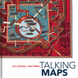
Drawing on the Bodleian Library’s outstanding map collection and covering almost a thousand years, Talking Maps takes a new approach to map-making by showing how maps and stories have always been intimately entwined. Including such rare treasures as a unique map of the Mediterranean from the eleventh-century Arabic Book of Curiosities, a twelfth-century map of the world by al-Sharīf al-Idrīsī, and C. S. Lewis’s map of Narnia, this fascinating book analyzes maps as objects that enable us to cross sea and land; as windows into alternative and imaginary worlds; as guides to reaching the afterlife; as tools to manage cities, nations, and empires; as images of environmental change; and as digitized visions of the global future.
By telling the stories behind the artifacts and those generated by them, Talking Maps reveals how each map is not just a tool for navigation but also a worldly proposal that helps us to understand who we are by describing where we are.
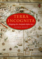
In Terra Incognita, Alfred Hiatt draws on sources both literary and visual to understand the appeal of the antipodes. Examining maps and diagrams, as well as evidence contained in geographical and historical works, poetry, travel narratives, and legal documents, he challenges long-standing characterizations of medieval spatiality as exclusively symbolic and religious. Instead, Hiatt finds, the idea of people on the other side of the Earth provided a potent and malleable symbol for political theorists, satirists, scholars, and poets—as well as for map makers. Terra Incognita is, in the end, the history of a non-place, of lands conjured by the scientific imagination, which nevertheless drove exploration, and which continued to shape the world map, even as they slowly vanished from it.
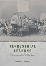
In Terrestrial Lessons, Ramaswamy provides the first in-depth analysis of the globe’s history in and impact on the Indian subcontinent during the colonial era and its aftermath. Drawing on a wide array of archival sources, she delineates its transformation from a thing of distinction possessed by elite men into that mass-produced commodity used in classrooms worldwide—the humble school globe. Traversing the length and breadth of British India, Terrestrial Lessons is an unconventional history of this master object of pedagogical modernity that will fascinate historians of cartography, science, and Asian studies.

This strikingly colorful volume contends that modern mapping has never been sufficient to illustrate the complex reality of territory and political sovereignty, whether past or present. For Territorial Imaginaries, editor Kären Wigen has assembled an impressive slate of experts, spanning disciplines from political science to art history, to contribute perspectives and case studies covering three main themes: mapping before the nation-state, rethinking and critiquing mapping practices, and robust traditions of counter-cartography.
Each contributor proposes alternative ways to think about mapping, and the essays are supported with rich archival documentation. Among the far-reaching case studies are Barbara Mundy’s cartographic history of Indigenous dispossession in the Americas, Peter Bol’s examination of two Chinese maps created five hundred years apart, and Ali Yaycıoğlu’s exploration of tensions between top-down and bottom-up mapping of Habsburg and Ottoman border claims.
A comprehensive volume on historical mapping in Texas.
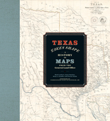
The Texas General Land Office’s map collection contains over 45,000 maps, some dating from the sixteenth century, making it one of the most important cartographic archives in Texas. As products and agents of history drawn by cartographers with motives and means as diverse as the places they document, maps provide a unique perspective on geopolitical, cultural, and economic processes. The maps of the GLO offer key insights into Texas’s sprawling history. They speak to issues of changing borders, social and political upheaval, and questions of sovereignty and power.
Texas Takes Shape offers an illuminating selection from the GLO archive: over one hundred maps that tell—and sometimes obscure—the stories of European colonization, Spanish and Mexican rule, the Republic of Texas, and the modern US state. There are maps here of every scale, from the hemispheric visions of European explorers to individual survey plats. Accompanying essays offer fascinating lessons on topics ranging from Indigenous cartography to military and railroad mapmaking and frontier surveys. Artful and informative, Texas Takes Shape examines a unique place through the eyes and imaginations of those who sought to govern it, profit from it, understand it, and call it home.
Focusing on maps created in Spanish America, Europe, the United States, and Asia, these essays take us from the Aztecs documenting the founding of Tenochtitlan, to early modern Japanese reconstructing nostalgic landscapes before Western encroachments, to nineteenth-century Americans grappling with the new concept of deep time. The book also features a defense of traditional paper maps by digital mapmaker William Rankin. With more than one hundred color maps and illustrations, Time in Maps will draw the attention of anyone interested in cartographic history.

Trail of Footprints offers an intimate glimpse into the commission, circulation, and use of indigenous maps from colonial Mexico. A collection of sixty largely unpublished maps from the late sixteenth to the eighteenth centuries and made in the southern region of Oaxaca anchors an analysis of the way ethnically diverse societies produced knowledge in colonial settings. Mapmaking, proposes Hidalgo, formed part of an epistemological shift tied to the negotiation of land and natural resources between the region’s Spanish, Indian, and mixed-race communities. The craft of making maps drew from social memory, indigenous and European conceptions of space and ritual, and Spanish legal practices designed to adjust spatial boundaries in the New World. Indigenous mapmaking brought together a distinct coalition of social actors—Indian leaders, native towns, notaries, surveyors, judges, artisans, merchants, muleteers, collectors, and painters—who participated in the critical observation of the region’s geographic features. Demand for maps reconfigured technologies associated with the making of colorants, adhesives, and paper that drew from Indian botany and experimentation, trans-Atlantic commerce, and Iberian notarial culture. The maps in this study reflect a regional perspective associated with Oaxaca’s decentralized organization, its strategic position amidst a network of important trade routes that linked central Mexico to Central America, and the ruggedness and diversity of its physical landscape.
From the sixteenth century until the early nineteenth, Europeans had envisioned New Spain (colonial Mexico) in texts, maps, and other images. In the first decades of the 1800s, ideas about Mexican, rather than Spanish, national character and identity began to cohere in written and illustrated narratives produced by foreign travelers. During the nineteenth century, technologies and processes of visual reproduction expanded to include lithography, daguerreotype, and photography. New methods of display—such as albums, museums, exhibitions, and world fairs—signaled new ideas about spectatorship. García Cubas participated in this emerging visual culture as he reconfigured geographic and cultural imagery culled from previous mapping practices and travel writing. In works such as the Atlas geográfico (1858) and the Atlas pintoresco é historico (1885), he presented independent Mexico to Mexican citizens and the world.
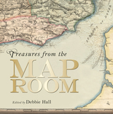
Treasures from the Map Room publishes seventy-five extraordinary examples from this collection, housed in the Map Room at the newly renovated Weston Library. The maps reproduced in Treasures range from the fourteenth to the twenty-first century. Among them are the fourteenth-century Gough Map, the earliest road map of Great Britain that achieved a remarkable level of accuracy and detail for its time; fifteenth-century portolan charts intended for maritime navigation; the Selden Map of China, the earliest Chinese map to show shipping routes; and an important early map from the medieval Islamic Book of Curiosities. The book also includes a great many recent examples, including J. R. R. Tolkien’s map of Middle Earth and C. S. Lewis’s map of Narnia. Debbie Hall takes readers back in time to uncover the fascinating story of each treasure, from a map plotting outbreaks of cholera to a jigsaw map of India from the 1850s and silk escape maps carried by pilots flying missions over occupied Europe during World War II.
With lavish full-color photography and descriptions of each map’s provenance, purpose, and creation, Treasures from the Map Room is a beautiful and informative catalog of this remarkable collection.
READERS
Browse our collection.
PUBLISHERS
See BiblioVault's publisher services.
STUDENT SERVICES
Files for college accessibility offices.
RECENTLY PUBLISHED


UChicago Accessibility Resources
home | accessibility | search | about | contact us
BiblioVault ® 2001 - 2025
The University of Chicago Press