
 A SCHOLARLY BOOK REPOSITORY
Hispanics/Latinos are the largest ethnic minority in the United States—but they are far from being a homogenous group. Mexican Americans in the Southwest have roots that extend back four centuries, while Dominicans and Salvadorans are very recent immigrants. Cuban Americans in South Florida have very different occupational achievements, employment levels, and income from immigrant Guatemalans who work in the poultry industry in Virginia. In fact, the only characteristic shared by all Hispanics/Latinos in the United States is birth or ancestry in a Spanish-speaking country.
In this book, sixteen geographers and two sociologists map the regional and cultural diversity of the Hispanic/Latino population of the United States. They report on Hispanic communities in all sections of the country, showing how factors such as people's country/culture of origin, length of time in the United States, and relations with non-Hispanic society have interacted to create a wide variety of Hispanic communities. Identifying larger trends, they also discuss the common characteristics of three types of Hispanic communities—those that have always been predominantly Hispanic, those that have become Anglo-dominated, and those in which Hispanics are just becoming a significant portion of the population.
The Mexican Border Cities draws on extensive field research to examine eighteen settlements along the 2,000-mile border, ranging from towns of less than 10,000 people to dynamic metropolises of nearly a million. The authors chronicle the cities' growth and compare their urban structure, analyzing them in terms of tourist districts, commercial landscapes, residential areas, and industrial and transportation quarters.
Arreola and Curtis contend that, despite their proximity to the United States, the border cities are fundamentally Mexican places, as distinguished by their cultural landscapes, including town plan, land-use pattern, and building fabric. Their study, richly illustrated with over 75 maps and photographs, offers a provocative and insightful interpretation of the geographic anatomy and personality of these fascinating—and rapidly changing—communities.
This form of place study calls attention to how we can see a past through a serial view of places, by the nature of repetition, and the photographing of the same place over and over again. Arreola draws our focus to townscapes, or built landscapes, of four border towns—Tijuana, Mexicali, Tecate, and Algodones—during the first half of the twentieth century. With an emphasis on the tourist’s view of these places, this book creates a vivid picture of what life was like for tourists and residents of these towns in the early and mid-twentieth century. Postcards from the Baja California Border is a rich and fascinating experience, one that takes you on a time-travel journey through border town histories and geographies while celebrating the visual intrigue of postcards.
In Postcards from the Chihuahua Border Daniel D. Arreola captures the exhilaration of places in time, taking us back to Mexico’s northern border towns of Cuidad Juárez, Ojinaga, and Palomas in the early twentieth century. Drawing on more than three decades of archival work, Arreola uses postcards and maps to unveil the history of these towns along west Texas’s and New Mexico’s southern borders.
Postcards offer a special kind of visual evidence. Arreola’s collection of imagery and commentary about them shows us singular places, enriching our understandings of history and the history of change in Chihuahua. No one postcard tells the entire story. But image after image offers a collected view and insight into changing perceptions. Arreola’s geography of place looks both inward and outward. We see what tourists see, while at the same time gaining insight about what postcard photographers and postcard publishers wanted to be seen and perceived about these border communities.
Postcards from the Chihuahua Border is a colorful and dynamic visual history. It invites the reader to time travel, to revisit another era—the first half of the last century—when these border towns were framed and made popular through picture postcards.
Between 1900 and the late 1950s, Mexican border towns came of age both as tourist destinations and as emerging cities. Commercial photographers produced thousands of images of their streets, plazas, historic architecture, and tourist attractions, which were reproduced as photo postcards. Daniel Arreola has amassed one of the largest collections of these border town postcards, and in this book, he uses this amazing visual archive to offer a new way of understanding how the border towns grew and transformed themselves in the first half of the twentieth century, as well as how they were pictured to attract American tourists.
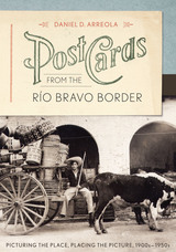
Postcards from the Río Bravo Border presents nearly two hundred images of five significant towns on the lower Río Bravo—Matamoros, Reynosa, Nuevo Laredo, Piedras Negras, and Villa Acuña. Using multiple images of sites within each city, Arreola tracks changes both within the cities as places and in the ways in which the cities have been pictured for tourist consumption. He makes a strong case that visual imagery has a shaping influence on how we negotiate and think about places, creating a serial scripting or narrating of the place. Arreola also shows how postcard images, when systematically and chronologically arranged, can tell us a great deal about how Mexican border towns have been viewed over time. This innovative visual approach demonstrates that historical imagery, no less than text or maps, can be assembled to tell a compelling geographical story about place and time.
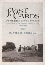
Young men ride horses on a dusty main road through town. Cars and gas stations gradually intrude on the land, and, years later, curiosity shops and cantinas change the face of Mexican border towns south of Arizona. Between 1900 and the late 1950s, Mexican border towns came of age both as centers of commerce and as tourist destinations. Postcards from the Sonora Border reveals how images—in this case the iconic postcard—shape the way we experience and think about place.
Making use of his personal collection of historic images, Daniel D. Arreola captures the evolution of Sonoran border towns, creating a sense of visual “time travel” for the reader. Supported by maps and visual imagery, the author shares the geographical and historical story of five unique border towns—Agua Prieta, Naco, Nogales, Sonoyta, and San Luis Río Colorado.
Postcards from the Sonora Border introduces us to these important towns and provides individual stories about each, using the postcards as markers. No one postcard view tells the complete story—rather, the sense of place emerges image by image as the author pulls readers through the collection as an assembled view. Arreola reveals how often the same locations and landmarks of a town were photographed as postcard images generation after generation, giving a long and dynamic view of the inhabitants through time. Arranged chronologically, Arreola’s postcards allow us to discover the changing perceptions of place in the borderlands of Sonora, Mexico.
Winner, John Brinckerhoff Jackson Prize, Association of American Geographers
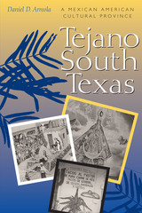
On the plains between the San Antonio River and the Rio Grande lies the heartland of what is perhaps the largest ethnic region in the United States, Tejano South Texas. In this cultural geography, Daniel Arreola charts the many ways in which Texans of Mexican ancestry have established a cultural province in this Texas-Mexico borderland that is unlike any other Mexican American region.
Arreola begins by delineating South Texas as an environmental and cultural region. He then explores who the Tejanos are, where in Mexico they originated, and how and where they settled historically in South Texas. Moving into the present, he examines many factors that make Tejano South Texas distinctive from other Mexican American regions—the physical spaces of ranchos, plazas, barrios, and colonias; the cultural life of the small towns and the cities of San Antonio and Laredo; and the foods, public celebrations, and political attitudes that characterize the region. Arreola's findings thus offer a new appreciation for the great cultural diversity that exists within the Mexican American borderlands.
READERS
Browse our collection.
PUBLISHERS
See BiblioVault's publisher services.
STUDENT SERVICES
Files for college accessibility offices.
RECENTLY PUBLISHED


UChicago Accessibility Resources
home | accessibility | search | about | contact us
BiblioVault ® 2001 - 2024
The University of Chicago Press