
 A SCHOLARLY BOOK REPOSITORY
18 start with C start with C
The Cadastral Map in the Service of the State, illustrated with 126 maps, traces the development and application of rural property mapping in Europe from the Renaissance through the nineteenth century. Beginning with a review of the roots of cadastral mapping in the Roman Empire, the authors concentrate on the use of cadastral maps in the Netherlands, France, England, the Nordic countries, the German lands, the territories of the Austrian Habsburgs, and the European colonies. During the sixteenth century government institutions began to use maps to secure economic and political bases; by the nineteenth century these maps had become tools for aggressive governmental control of land as tax bases, natural resources, and national territories. This work demonstrates how the seemingly neutral science of cartography became a political instrument for national
interests.
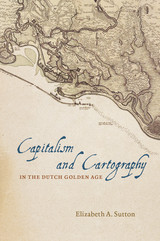
Building her exploration around the central figure of Claes Jansz Vischer, an Amsterdam-based publisher closely tied to the Dutch West India Company, Sutton shows how printed maps of Dutch Atlantic territories helped rationalize the Dutch Republic’s global expansion. Maps of land reclamation projects in the Netherlands, as well as the Dutch territories of New Netherland (now New York) and New Holland (Dutch Brazil), reveal how print media were used both to increase investment and to project a common narrative of national unity. Maps of this era showed those boundaries, commodities, and topographical details that publishers and the Dutch West India Company merchants and governing Dutch elite deemed significant to their agenda. In the process, Sutton argues, they perpetuated and promoted modern state capitalism.
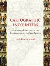
There’s no excuse for getting lost these days—satellite maps on our computers can chart our journey in detail and electronics on our car dashboards instruct us which way to turn. But there was a time when the varied landscape of North America was largely undocumented, and expeditions like that of Lewis and Clark set out to map its expanse. As John Rennie Short argues in Cartographic Encounters, that mapping of the New World was only possible due to a unique relationship between the indigenous inhabitants and the explorers.
In this vital reinterpretation of American history, Short describes how previous accounts of the mapping of the new world have largely ignored the fundamental role played by local, indigenous guides. The exchange of information that resulted from this “cartographic encounter” allowed the native Americans to draw upon their wide knowledge of the land in the hope of gaining a better position among the settlers.
This account offers a radical new understanding of Western expansion and the mapping of the land and will be essential to scholars in cartography and American history.
G. Malcolm Lewis provides accessible and detailed overviews of the history of native North American maps, mapmaking, and scholarly interest in these topics. Other contributions include a study of colonial Aztec cartography that highlights the connections among maps, space, and history; an account of the importance of native maps as archaeological evidence; and an interpretation of an early-contact-period hide painting of an actual encounter involving whites and two groups of warring natives.
Although few original native maps have survived, contemporary copies and accounts of mapmaking form a rich resource for anyone interested in the history of Native American encounters or the history of cartography and geography.
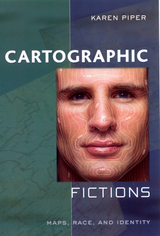
Maps are stories as much about us as about the landscape. They reveal changing perceptions of the natural world, as well as conflicts over the acquisition of territories. Cartographic Fictions looks at maps in relation to journals, correspondence, advertisements, and novels by authors such as Joseph Conrad and Michael Ondaatje. In her innovative study, Karen Piper follows the history of cartography through three stages: the establishment of the prime meridian, the development of aerial photography, and the emergence of satellite and computer mapping.
Piper follows the cartographer’s impulse to “leave the ground” as the desire to escape the racialized or gendered subject. With the distance that the aerial view provided, maps could then be produced “objectively,” that is, devoid of “problematic” native interference. Piper attempts to bring back the dialogue of the “native informant,” demonstrating how maps have historically constructed or betrayed anxieties about race. The book also attempts to bring back key areas of contact to the map between explorer/native and masculine/feminine definitions of space.
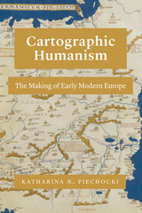
What is “Europe,” and when did it come to be? In the Renaissance, the term “Europe” circulated widely. But as Katharina N. Piechocki argues in this compelling book, the continent itself was only in the making in the fifteenth and sixteenth centuries.
Cartographic Humanism sheds new light on how humanists negotiated and defined Europe’s boundaries at a momentous shift in the continent’s formation: when a new imagining of Europe was driven by the rise of cartography. As Piechocki shows, this tool of geography, philosophy, and philology was used not only to represent but, more importantly, also to shape and promote an image of Europe quite unparalleled in previous centuries. Engaging with poets, historians, and mapmakers, Piechocki resists an easy categorization of the continent, scrutinizing Europe as an unexamined category that demands a much more careful and nuanced investigation than scholars of early modernity have hitherto undertaken. Unprecedented in its geographic scope, Cartographic Humanism is the first book to chart new itineraries across Europe as it brings France, Germany, Italy, Poland, and Portugal into a lively, interdisciplinary dialogue.
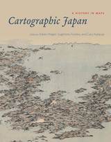
But this was not always the case: a thousand years ago, maps were solely a privilege of the ruling elite in Japan. Only in the past four hundred years has Japanese cartography truly taken off, and between the dawn of Japan’s cartographic explosion and today, the nation’s society and landscape have undergone major transformations. At every point, maps have documented those monumental changes. Cartographic Japan offers a rich introduction to the resulting treasure trove, with close analysis of one hundred maps from the late 1500s to the present day, each one treated as a distinctive window onto Japan’s tumultuous history.
Forty-seven distinguished contributors—hailing from Japan, North America, Europe, and Australia—uncover the meanings behind a key selection of these maps, situating them in historical context and explaining how they were made, read, and used at the time. With more than one hundred gorgeous full-color illustrations, Cartographic Japan offers an enlightening tour of Japan’s magnificent cartographic archive.
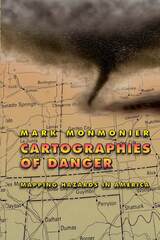
California, for example, takes earthquakes seriously, with a comprehensive program of seismic mapping, whereas Washington has been comparatively lax about earthquakes in Puget Sound. But as the Northridge earthquake in January 1994 demonstrated all too clearly to Californians, even reliable seismic-hazard maps can deceive anyone who misinterprets "known fault-lines" as the only places vulnerable to earthquakes.
Important as it is to predict and prepare for catastrophic natural hazards, more subtle and persistent phenomena such as pollution and crime also pose serious dangers that we have to cope with on a daily basis. Hazard-zone maps highlight these more insidious hazards and raise awareness about them among planners, local officials, and the public.
With the help of many maps illustrating examples from all corners of the United States, Monmonier demonstrates how hazard mapping reflects not just scientific understanding of hazards but also perceptions of risk and how risk can be reduced. Whether you live on a faultline or a coastline, near a toxic waste dump or an EMF-generating power line, you ignore this book's plain-language advice on geographic hazards and how to avoid them at your own peril.
"No one should buy a home, rent an apartment, or even drink the local water without having read this fascinating cartographic alert on the dangers that lurk in our everyday lives. . . . Who has not asked where it is safe to live? Cartographies of Danger provides the answer."—H. J. de Blij, NBC News
"Even if you're not interested in maps, you're almost certainly interested in hazards. And this book is one of the best places I've seen to learn about them in a highly entertaining and informative fashion."—John Casti, New Scientist
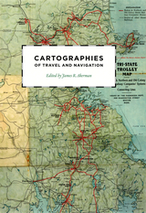
Finding one’s way with a map is a relatively recent phenomenon. In premodern times, maps were used, if at all, mainly for planning journeys in advance, not for guiding travelers on the road. With the exception of navigational sea charts, the use of maps by travelers only became common in the modern era; indeed, in the last two hundred years, maps have become the most ubiquitous and familiar genre of modern cartography.
Examining the historical relationship between travelers, navigation, and maps, Cartographies of Travel and Navigation considers the cartographic response to the new modalities of modern travel brought about by technological and institutional developments in the twentieth century. Highlighting the ways in which the travelers, operators, and planners of modern transportation systems value maps as both navigation tools and as representatives of a radical new mobility, this collection brings the cartography of travel—by road, sea, rail, and air—to the forefront, placing maps at the center of the history of travel and movement.
Richly and colorfully illustrated, Cartographies of Travel and Navigation ably fills the void in historical literature on transportation mapping.
After four decades of British rule in colonial Kenya, a previously unknown ethnic name—“Luyia”—appeared on the official census in 1948. The emergence of the Luyia represents a clear case of ethnic “invention.” At the same time, current restrictive theories privileging ethnic homogeneity fail to explain this defiantly diverse ethnic project, which now comprises the second-largest ethnic group in Kenya.
In Cartography and the Political Imagination, which encompasses social history, geography, and political science, Julie MacArthur unpacks Luyia origins. In so doing, she calls for a shift to understanding geographic imagination and mapping not only as means of enforcing imperial power and constraining colonized populations, but as tools for articulating new political communities and dissent. Through cartography, Luyia ethnic patriots crafted an identity for themselves characterized by plurality, mobility, and cosmopolitan belonging.
While other historians have focused on the official maps of imperial surveyors, MacArthur scrutinizes the ways African communities adopted and adapted mapping strategies to their own ongoing creative projects. This book marks an important reassessment of current theories of ethnogenesis, investigates the geographic imaginations of African communities, and challenges contemporary readings of community and conflict in Africa.
Concentrating on how and why new concepts and techniques of making and using maps were introduced, Josef Konvitz skillfully traces the modernization of cartography during the French Enlightenment. The story he unfolds is not merely a narrative of who did what, but an analysis of how the map itself influenced attitudes toward the land and the consequent effects on planning and the development of resources. Throughout, Konvitz demonstrates the significant relationship between cartography and political, economic, and military life. He emphasizes efforts to enlarge the practical applications of maps in government and the impact of government policy on the evolution of cartography.
In this book Edney disavows the term cartography, rejecting the notion that maps represent an undifferentiated category of objects for study. Rather than treating maps as a single, unified group, he argues, scholars need to take a processual approach that examines specific types of maps—sea charts versus thematic maps, for example—in the context of the unique circumstances of their production, circulation, and consumption. To illuminate this bold argument, Edney chronicles precisely how the ideal of cartography that has developed in the West since 1800 has gone astray. By exposing the flaws in this ideal, his book challenges everyone who studies maps and mapping practices to reexamine their approach to the topic. The study of cartography will never be the same.
Turning to a previously undiscovered archive of popular maps, Cartophilia reveals Alsace-Lorraine’s lively world of citizen mapmakers that included linguists, ethnographers, schoolteachers, hikers, and priests. Together, this fresh group of mapmakers invented new genres of maps that framed French and German territory in original ways through experimental surveying techniques, orientations, scales, colors, and iconography. In focusing on the power of “bottom-up” maps to transform modern European identities, Cartophilia argues that the history of cartography must expand beyond the study of elite maps and shift its emphasis to the democratization of cartography in the modern world.
Fifteen years in the making, this catalogue will be an essential reference for bibliographers and archivists dealing with rare books and maps of the period, for map collectors, map librarians, and scholars and librarians working with early printed items and manuscripts.
Whether for sailing charts or property maps, Monmonier shows, coastlines challenge mapmakers to capture on paper a highly irregular land-water boundary perturbed by tides and storms and complicated by rocks, wrecks, and shoals. Coast Lines is peppered with captivating anecdotes about the frustrating effort to expunge fictitious islands from nautical charts, the tricky measurement of a coastline’s length, and the contentious notions of beachfront property and public access.
Combing maritime history and the history of technology, Coast Lines charts the historical progression from offshore sketches to satellite images and explores the societal impact of coastal cartography on everything from global warming to homeland security. Returning to the form of his celebrated Air Apparent, Monmonier ably renders the topic of coastal cartography accessible to both general readers and historians of science, technology, and maritime studies. In the post-Katrina era, when the map of entire regions can be redrawn by a single natural event, the issues he raises are more important than ever.
Conceptualizing the relationship between economics and cartography, Pedley traces the process of mapmaking from compilation, production, and marketing to consumption, reception, and criticism. In detailing the rise of commercial cartography, Pedley explores qualitative issues of mapmaking as well. Why, for instance, did eighteenth-century ideals of aesthetics override the modern values of accuracy and detail? And what, to an eighteenth-century mind and eye, qualified as a good map?
A thorough and engaging study of the business of cartography during the Enlightenment, The Commerce of Cartography charts a new cartographic landscape and will prove invaluable to scholars of economic history, historical geography, and the history of publishing.
Over the centuries, maps have served many varied purposes; far from mere guides for reaching a destination, they are unique artistic forms, aides in planning commercial routes, literary devices for illuminating a story. Accuracy—or inaccuracy—of maps has been the make-or-break factor in countless military battles throughout history. They have graced the walls of homes, bringing prestige and elegance to their owners. They track the mountains, oceans, and stars of our existence. Maps help us make sense of our worlds both real and imaginary—they bring order to the seeming chaos of our surroundings.
With The Curious Map Book, Ashley Baynton-Williams gathers an amazing, chronologically ordered variety of cartographic gems, mainly from the vast collection of the British Library. He has unearthed a wide array of the whimsical and fantastic, from maps of board games to political ones, maps of the Holy Land to maps of the human soul. In his illuminating introduction, Baynton-Williams also identifies and expounds upon key themes of map production, peculiar styles, and the commerce and collection of unique maps. This incredible volume offers a wealth of gorgeous illustrations for anyone who is cartographically curious.
READERS
Browse our collection.
PUBLISHERS
See BiblioVault's publisher services.
STUDENT SERVICES
Files for college accessibility offices.
RECENTLY PUBLISHED


UChicago Accessibility Resources
home | accessibility | search | about | contact us
BiblioVault ® 2001 - 2024
The University of Chicago Press