
 A SCHOLARLY BOOK REPOSITORY
150 books about Cartography and 5
start with W
150 books about Cartography and 5
150 books about Cartography
5 start with W start with W
5 start with W start with W
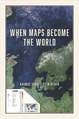
When Maps Become the World
Rasmus Grønfeldt Winther
University of Chicago Press, 2020
Map making and, ultimately, map thinking is ubiquitous across literature, cosmology, mathematics, psychology, and genetics. We partition, summarize, organize, and clarify our world via spatialized representations. Our maps and, more generally, our representations seduce and persuade; they build and destroy. They are the ultimate record of empires and of our evolving comprehension of our world.
This book is about the promises and perils of map thinking. Maps are purpose-driven abstractions, discarding detail to highlight only particular features of a territory. By preserving certain features at the expense of others, they can be used to reinforce a privileged position.
When Maps Become the World shows us how the scientific theories, models, and concepts we use to intervene in the world function as maps, and explores the consequences of this, both good and bad. We increasingly understand the world around us in terms of models, to the extent that we often take the models for reality. Winther explains how in time, our historical representations in science, in cartography, and in our stories about ourselves replace individual memories and become dominant social narratives—they become reality, and they can remake the world.
[more]
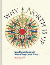
Why North Is Up
Map Conventions and Where They Came From
Mick Ashworth
Bodleian Library Publishing, 2019
Many people have a love of maps. But what lies behind the process of map-making? How have cartographers through the centuries developed their craft and established a language of maps which helps them to better represent our world and help users to understand it?
This book tells the story of how widely accepted mapping conventions originated and evolved—from map orientation, projections, typography, and scale, to the use of color, symbols, ways of representing relief, and the treatment of boundaries and place names. It charts the fascinating story of how conventions have changed in response to new technologies and ever-changing mapping requirements, how symbols can be a matter of life or death, why universal acceptance of conventions can be difficult to achieve, and how new mapping conventions are developing to meet the needs of modern cartography. Why North is Up offers an accessible and enlightening guide to the sometimes hidden techniques of map-making through the centuries.
This book tells the story of how widely accepted mapping conventions originated and evolved—from map orientation, projections, typography, and scale, to the use of color, symbols, ways of representing relief, and the treatment of boundaries and place names. It charts the fascinating story of how conventions have changed in response to new technologies and ever-changing mapping requirements, how symbols can be a matter of life or death, why universal acceptance of conventions can be difficult to achieve, and how new mapping conventions are developing to meet the needs of modern cartography. Why North is Up offers an accessible and enlightening guide to the sometimes hidden techniques of map-making through the centuries.
[more]
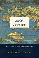
Worldly Consumers
The Demand for Maps in Renaissance Italy
Genevieve Carlton
University of Chicago Press, 2015
Though the practical value of maps during the sixteenth century is well documented, their personal and cultural importance has been relatively underexamined. In Worldly Consumers, Genevieve Carlton explores the growing availability of maps to private consumers during the Italian Renaissance and shows how map acquisition and display became central tools for constructing personal identity and impressing one’s peers.
Drawing on a variety of sixteenth-century sources, including household inventories, epigrams, dedications, catalogs, travel books, and advice manuals, Worldly Consumers studies how individuals displayed different maps in their homes as deliberate acts of self-fashioning. One citizen decorated with maps of Bruges, Holland, Flanders, and Amsterdam to remind visitors of his military prowess, for example, while another hung maps of cities where his ancestors fought or governed, in homage to his auspicious family history. Renaissance Italians turned domestic spaces into a microcosm of larger geographical places to craft cosmopolitan, erudite identities for themselves, creating a new class of consumers who drew cultural capital from maps of the time.
Drawing on a variety of sixteenth-century sources, including household inventories, epigrams, dedications, catalogs, travel books, and advice manuals, Worldly Consumers studies how individuals displayed different maps in their homes as deliberate acts of self-fashioning. One citizen decorated with maps of Bruges, Holland, Flanders, and Amsterdam to remind visitors of his military prowess, for example, while another hung maps of cities where his ancestors fought or governed, in homage to his auspicious family history. Renaissance Italians turned domestic spaces into a microcosm of larger geographical places to craft cosmopolitan, erudite identities for themselves, creating a new class of consumers who drew cultural capital from maps of the time.
[more]
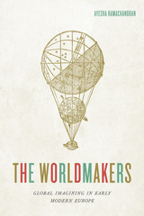
The Worldmakers
Global Imagining in Early Modern Europe
Ayesha Ramachandran
University of Chicago Press, 2015
In this beautifully conceived book, Ayesha Ramachandran reconstructs the imaginative struggles of early modern artists, philosophers, and writers to make sense of something that we take for granted: the world, imagined as a whole. Once a new, exciting, and frightening concept, “the world” was transformed in the sixteenth and seventeenth centuries. But how could one envision something that no one had ever seen in its totality?
The Worldmakers moves beyond histories of globalization to explore how “the world” itself—variously understood as an object of inquiry, a comprehensive category, and a system of order—was self-consciously shaped by human agents. Gathering an international cast of characters, from Dutch cartographers and French philosophers to Portuguese and English poets, Ramachandran describes a history of firsts: the first world atlas, the first global epic, the first modern attempt to develop a systematic natural philosophy—all part of an effort by early modern thinkers to capture “the world” on the page.
The Worldmakers moves beyond histories of globalization to explore how “the world” itself—variously understood as an object of inquiry, a comprehensive category, and a system of order—was self-consciously shaped by human agents. Gathering an international cast of characters, from Dutch cartographers and French philosophers to Portuguese and English poets, Ramachandran describes a history of firsts: the first world atlas, the first global epic, the first modern attempt to develop a systematic natural philosophy—all part of an effort by early modern thinkers to capture “the world” on the page.
[more]
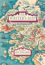
The Writer's Map
An Atlas of Imaginary Lands
Edited by Huw Lewis-Jones
University of Chicago Press, 2018
It’s one of the first things we discover as children, reading and drawing: Maps have a unique power to transport us to distant lands on wondrous travels. Put a map at the start of a book, and we know an adventure is going to follow. Displaying this truth with beautiful full-color illustrations, The Writer’s Map is an atlas of the journeys that our most creative storytellers have made throughout their lives. This magnificent collection encompasses not only the maps that appear in their books but also the many maps that have inspired them, the sketches that they used while writing, and others that simply sparked their curiosity.
Philip Pullman recounts the experience of drawing a map as he set out on one of his early novels, The Tin Princess. Miraphora Mina recalls the creative challenge of drawing up ”The Marauder’s Map” for the Harry Potter films. David Mitchell leads us to the Mappa Mundi by way of Cloud Atlas and his own sketch maps. Robert Macfarlane reflects on the cartophilia that has informed his evocative nature writing, which was set off by Robert Louis Stevenson and his map of Treasure Island. Joanne Harris tells of her fascination with Norse maps of the universe. Reif Larsen writes about our dependence on GPS and the impulse to map our experience. Daniel Reeve describes drawing maps and charts for The Hobbit film trilogy. This exquisitely crafted and illustrated atlas explores these and so many more of the maps writers create and are inspired by—some real, some imagined—in both words and images.
Amid a cornucopia of 167 full-color images, we find here maps of the world as envisaged in medieval times, as well as maps of adventure, sci-fi and fantasy, nursery rhymes, literary classics, and collectible comics. An enchanting visual and verbal journey, The Writer’s Map will be irresistible for lovers of maps, literature, and memories—and anyone prone to flights of the imagination.
[more]
READERS
Browse our collection.
PUBLISHERS
See BiblioVault's publisher services.
STUDENT SERVICES
Files for college accessibility offices.
RECENTLY PUBLISHED


UChicago Accessibility Resources
home | accessibility | search | about | contact us
BiblioVault ® 2001 - 2024
The University of Chicago Press