
 A SCHOLARLY BOOK REPOSITORY
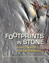
Where ancient creatures walked—science uncovers their lasting impressions.
The Steven C. Minkin (Union Chapel) Paleozoic Footprint Site ranks among the most important fossil sites in the world today, and Footprints in Stone recounts the accidental revelation of its existence and detailed findings about its fossil record.
Currently 2,500 miles from the equator and more than 250 miles north of the Gulf of Mexico, the Minkin site was a swampy tropical forest adjacent to a tidal flat during the Coal Age or Carboniferous Period more than 300 million years ago. That fecund strand of sand and mud at the ocean’s edge teemed with the earth’s earliest reptiles as well as amphibians, fish, horseshoe crabs, spiders, jumping insects, and other fascinating organisms. Unlike dinosaurs and other large animals whose sturdy bodies left hard fossil records, most of these small, soft-bodied creatures left no concrete remains. But they did leave something else. Preserved in the site’s coal beds along with insect wings and beautifully textured patterns of primeval plants are their footprints, fossilized animal tracks from which modern paleontologists can glean many valuable insights about their physical anatomies and behaviors.
The paleontological examination of fossil tracks is now the cutting-edge of contemporary scholarship, and the Minkin site is the first and largest site of its kind in eastern North America. Discovered by a local high school science teacher, the site provides both professional and amateur paleontologists around the world with a wealth of fossil track samples along with an inspirational story for amateur explorers and collectors.
Authoritative and extensively illustrated, Footprints in Stone brings together the contributions of many geologists and paleontologists who photographed, documented, and analyzed the Minkin site’s fossil trackways. An engrossing tale of its serendipitous discovery and a detailed study of its fossil records, Footprints in Stone is a landmark publication in the history of paleontology.
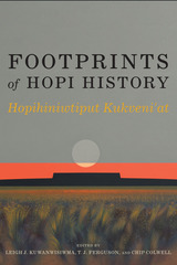
The fourteen chapters in Footprints of Hopi History: Hopihiniwtiput Kukveni’at focus on these Hopi footprints as they are understood through a variety of research techniques, including archaeology, ethnography, documentary history, plant genetics, and educational outreach. The editors and contributors offer fresh and innovative perspectives on Hopi archaeology and history, and demonstrate how one tribe has significantly advanced knowledge about its past through collaboration with archaeologists and cultural anthropologists.
The book features managerial uses of research, cultural landscape theory, use of GIS in research, archaeological interpretations of social identity and immigration, analysis of corn genetics, heritage education of youth, and research of oral traditions and documentary history. Footprints of Hopi History highlights the Hopi tribe’s leadership in sustained efforts to create bridges between tribal goals and anthropology, forging a path for others to follow.
Contributors
E. Charles Adams
Wesley Bernardini
Joëlle Clark
Chip Colwell
T. J. Ferguson
Dennis Gilpin
Kelley Hays-Gilpin
George Gumerman IV
Saul L. Hedquist
Maren P. Hopkins
Stewart B. Koyiyumptewa
Leigh J. Kuwanwisiwma
Lee Wayne Lomayestewa
Patrick D. Lyons
Shirley Powell
Gregson Schachner
Thomas E. Sheridan
Mark D. Varien
Laurie D. Webster
Peter M. Whiteley
Michael Yeatts


Trail of Footprints offers an intimate glimpse into the commission, circulation, and use of indigenous maps from colonial Mexico. A collection of sixty largely unpublished maps from the late sixteenth to the eighteenth centuries and made in the southern region of Oaxaca anchors an analysis of the way ethnically diverse societies produced knowledge in colonial settings. Mapmaking, proposes Hidalgo, formed part of an epistemological shift tied to the negotiation of land and natural resources between the region’s Spanish, Indian, and mixed-race communities. The craft of making maps drew from social memory, indigenous and European conceptions of space and ritual, and Spanish legal practices designed to adjust spatial boundaries in the New World. Indigenous mapmaking brought together a distinct coalition of social actors—Indian leaders, native towns, notaries, surveyors, judges, artisans, merchants, muleteers, collectors, and painters—who participated in the critical observation of the region’s geographic features. Demand for maps reconfigured technologies associated with the making of colorants, adhesives, and paper that drew from Indian botany and experimentation, trans-Atlantic commerce, and Iberian notarial culture. The maps in this study reflect a regional perspective associated with Oaxaca’s decentralized organization, its strategic position amidst a network of important trade routes that linked central Mexico to Central America, and the ruggedness and diversity of its physical landscape.
READERS
Browse our collection.
PUBLISHERS
See BiblioVault's publisher services.
STUDENT SERVICES
Files for college accessibility offices.
RECENTLY PUBLISHED
")


UChicago Accessibility Resources
home | accessibility | search | about | contact us
BiblioVault ® 2001 - 2026
The University of Chicago Press