
 A SCHOLARLY BOOK REPOSITORY
24 start with A start with A
People rely on reason to think about and navigate the abstract world of human relations in much the same way they rely on maps to study and traverse the physical world. Starting from that simple observation, renowned geographer Gunnar Olsson offers in Abysmal an astonishingly erudite critique of the way human thought and action have become deeply immersed in the rhetoric of cartography and how this cartographic reasoning allows the powerful to map out other people’s lives.
A spectacular reading of Western philosophy, religion, and mythology that draws on early maps and atlases, Plato, Kant, and Wittgenstein, Thomas Pynchon, Gilgamesh, and Marcel Duchamp, Abysmal is itself a minimalist guide to the terrain of Western culture. Olsson roams widely but always returns to the problems inherent in reason, to question the outdated assumptions and fixed ideas that thinking cartographically entails. A work of ambition, scope, and sharp wit, Abysmal will appeal to an eclectic audience—to geographers and cartographers, but also to anyone interested in the history of ideas, culture, and art.
In After the Map, William Rankin argues that although this shift did not render traditional maps obsolete, it did radically change our experience of geographic knowledge, from the God’s-eye view of the map to the embedded subjectivity of GPS. Likewise, older concerns with geographic truth and objectivity have been upstaged by a new emphasis on simplicity, reliability, and convenience. After the Map shows how this change in geographic perspective is ultimately a transformation of the nature of territory, both social and political.
Perhaps no creature has so fired the imagination of a populace as the armadillo—that most ungainly, awkward, and timid little animal. Its detractors call it a varmint and wish it good speed from the Lone Star State and its other natural territories. But its supporters claim that it is the animal kingdom's representative of all that's truly Texan: tough, pioneering, adaptable, and generous in sharing its habitation with others. What is it that sets this quizzical little creature apart from the rest of the animal kingdom?
Larry L. Smith and Robin W. Doughty ably answer this question in The Amazing Armadillo: Geography of a Folk Critter. This informative book traces the spread of the nine-banded armadillo from its first notice in South Texas late in the 1840s to its current range east to Florida and north to Missouri. The authors look at the armadillo's natural history and habitat as well as the role of humans in promoting its spread, projecting that the animal is increasing in both range and number, continuing its ecological success in areas where habitat and climate are favorable.
The book also contributes to a long-standing research theme in geography—the relationship between humans and wildlife. It explores the armadillo's value to the medical community in current research in Hansen's Disease (leprosy) as well as commercial uses, and abuses, of the armadillo in recent times. Of particular note is the author's engaging look at the armadillo as a symbol of popular culture, the efforts now underway to make it a "totem animal" symbolizing the easy-going lifestyles of some Sunbelt cities, and the spread of the craze for armadilliana to other urban centers.
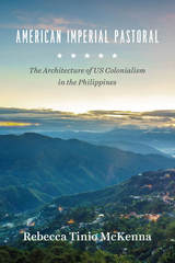
In American Imperial Pastoral, Rebecca Tinio McKenna examines the design, construction, and use of Baguio, making visible the physical shape, labor, and sustaining practices of the US’s new empire—especially the dispossessions that underwrote market expansion. In the process, she demonstrates how colonialists conducted market-making through state-building and vice-versa. Where much has been made of the racial dynamics of US colonialism in the region, McKenna emphasizes capitalist practices and design ideals—giving us a fresh and nuanced understanding of the American occupation of the Philippines.
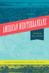
The naturalist Alexander von Humboldt, visiting the Gulf-Caribbean in the early nineteenth century, called it America’s Mediterranean. Almost a century later, Southern California was hailed as “Our Mediterranean, Our Italy!” Although “American Mediterranean” is not a household phrase in the United States today, it once circulated widely in French, Spanish, and English as a term of art and folk idiom. In this book, Susan Gillman asks what cultural work is done by this kind of unsystematic, open-ended comparative thinking.
American Mediterraneans tracks two centuries of this geohistorical concept, from Humboldt in the early 1800s, to writers of the 1890s reflecting on the Pacific world of the California coast, to writers of the 1930s and 40s speculating on the political past and future of the Caribbean. Following the term through its travels across disciplines and borders, American Mediterraneans reveals a little-known racialized history, one that paradoxically appealed to a range of race-neutral ideas and ideals.
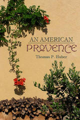
-From An American Provence
In this poetic personal narrative, Thomas P. Huber reflects on two seemingly unrelated places-the North Fork Valley in western Colorado and the Coulon River Valley in Provence, France-and finds a shared landscape and sense of place. What began as a simple comparison of two like places in distant locations turned into a more complex, interesting, and personal task. Much is similar-the light, the valleys, the climate, the agriculture. And much is less so-the history, the geology, the physical makeup of villages. Using a geographer's eye and passion for the land and people, Huber examines the regions' similarities and differences to explore the common emotional impact of each region. Part intimate travelogue and part case study of geography in the real world, An American Provence illuminates the importance sense of place plays in who we are.
The Anarchist Roots of Geography sets the stage for a radical politics of possibility and freedom through a discussion of the insurrectionary geographies that suffuse our daily experiences. By embracing anarchist geographies as kaleidoscopic spatialities that allow for nonhierarchical connections between autonomous entities, Simon Springer configures a new political imagination.
Experimentation in and through space is the story of humanity’s place on the planet, and the stasis and control that now supersede ongoing organizing experiments are an affront to our survival. Singular ontological modes that favor one particular way of doing things disavow geography by failing to understand the spatial as a mutable assemblage intimately bound to temporality. Even worse, such stagnant ideas often align to the parochial interests of an elite minority and thereby threaten to be our collective undoing. What is needed is the development of new relationships with our world and, crucially, with each other.
By infusing our geographies with anarchism we unleash a spirit of rebellion that foregoes a politics of waiting for change to come at the behest of elected leaders and instead engages new possibilities of mutual aid through direct action now. We can no longer accept the decaying, archaic geographies of hierarchy that chain us to statism, capitalism, gender domination, racial oppression, and imperialism. We must reorient geographical thinking towards anarchist horizons of possibility. Geography must become beautiful, wherein the entirety of its embrace is aligned to emancipation.
Katrina-Ann R. Kapa‘anaokalaokeola Nakoa Oliveira elucidates a Kanaka geography and provides contemporary scholars with insights regarding traditional culture—including the ways in which Kanaka utilize cartographic performances to map our ancestral places and retain our mo‘olelo, such as reciting creation accounts, utilizing nuances embedded in language, and dancing hula.
A Kanaka by birth, a kumu ‘olelo Hawai‘i (language teacher) by profession, and a geographer by training, Oliveira’s interests intersect at the boundary where words and place-making meet her ancestral land. Thus, Ancestral Places imbues the theoretical with sensual practice. The book’s language moves fluidly between Hawaiian and English, terms are nimbly defined, and the work of the field is embodied: geographic layers are enacted within the text, new understandings created—not just among lexica, but amidst illustrations, charts, terms, and poetry.
In Ancestral Places, Oliveira reasserts both the validity of ancestral knowledge systems and their impact in modernity. Her discussion of Kanaka geographies encompasses the entire archipelago, offering a new framework in Kanaka epistemology.
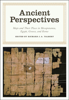
Ancient Perspectives encompasses a vast arc of space and time—Western Asia to North Africa and Europe from the third millennium BCE to the fifth century CE—to explore mapmaking and worldviews in the ancient civilizations of Mesopotamia, Egypt, Greece, and Rome. In each society, maps served as critical economic, political, and personal tools, but there was little consistency in how and why they were made. Much like today, maps in antiquity meant very different things to different people.
Focusing on long-term change, this book considers ethnographic literature, archaeological evidence, and environmental data spanning thousands of years of human presence to understand human perception and construction of landscape. The contributors offer cohesive and synthetic studies emphasizing hunter-gatherers and subsistence farmers.
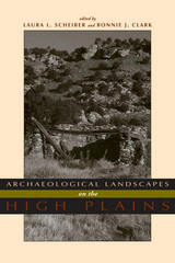
Using landscape as both reality and metaphor, Archaeological Landscapes on the High Plains explores the different and changing ways that people interacted with place in this transitional zone between the Rocky Mountains and the eastern prairies.
The contemporary archaeologists working in this small area have chosen diverse approaches to understand the past and its relationship to the present. Through these ten case studies, this variety is highlighted but leads to a common theme - that the High Plains contains important locales to which people, over generations or millennia, return. Providing both data and theory on a region that has not previously received much attention from archaeologists, especially compared with other regions in North America, this volume is a welcome addition to the literature. Contributors:
o Paul Burnett
o Oskar Burger
o Minette C. Church
o Philip Duke
o Kevin Gilmore
o Eileen Johnson
o Mark D. Mitchell
o Michael R. Peterson
o Lawrence Todd
Hewsen has divided the maps into five sections, each of which begins with a chronology of important dates and a historical introduction to the period. Specialized maps include Ptolemy's second-century map of Armenia, as well as maps of Roman, Cilician, Ottoman, tsarist, and Soviet Armenia. Other maps show the Persian khanate of Erevan, the Caucasian campaigns of World War I, the Armenian Genocide, the Armenian monuments in Turkey and Transcaucasia, the worldwide diaspora, ground plans of selected cities, and plans of the great monastery of Echmiadzin in 1660, 1890, and 1990. The atlas concludes with maps portraying the Karabagh war and the new Armenian Republic, and an extensive bibliography compiles references to the vast historical, ethnological, and travel literature on the region.
The first comprehensive and authoritative atlas of any of the former Soviet republics, this book does not treat Armenia in isolation, but instead sets it within the context of Caucasia as a whole, providing detailed information on neighboring regions such as Georgia and Azerbaijan. Armenia: A Historical Atlas will be an essential reference and an important teaching tool for generations to come.
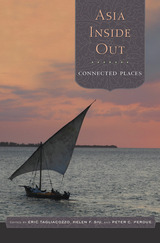
Asia Inside Out reveals the dynamic forces that have historically linked regions of the world’s largest continent, stretching from Japan and Korea to the South China Sea, the Indian Ocean, and the Middle East. Connected Places, the second installment in this pioneering three-volume survey, highlights the transregional flows of goods, ideas, and people across natural and political boundaries—sea routes, delta ecologies, and mountain passes, ports and oasis towns, imperial capitals and postmodern cities. It challenges the conventional idea that defines geopolitical regions as land-based, state-centered, and possessing linear histories.
Exploring themes of maritime connections, mobile landscapes, and spatial movements, the authors examine significant sites of linkage and disjuncture from the early modern period to the present. Readers discover how eighteenth-century pirates shaped the interregional networks of Vietnam’s Tonkin Gulf, how Kashmiri merchants provided intelligence of remote Himalayan territories to competing empires, and how for centuries a vibrant trade in horses and elephants fueled the Indian Ocean economy. Other topics investigated include cultural formations in the Pearl River delta, global trade in Chittagong’s transformation, gendered homemaking among mobile Samurai families, border zones in Qing China and contemporary Burma, colonial spaces linking India and Mesopotamia, transnational marriages in Oman’s immigrant populations, new cultural spaces in Korean pop, and the unexpected adoption of the Latin script by ethnically Chinese Muslims in Central Asia.
Connected Places shows the constant fluctuations over many centuries in the making of Asian territories and illustrates the confluence of factors in the historical construction of place and space.
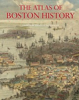
Edited by historian Nancy S. Seasholes, this landmark volume captures all aspects of Boston’s past in a series of fifty-seven stunning full-color spreads. Each section features newly created thematic maps that focus on moments and topics in that history. These maps are accompanied by hundreds of historical and contemporary illustrations and explanatory text from historians and other expert contributors. They illuminate a wide range of topics including Boston’s physical and economic development, changing demography, and social and cultural life. In lavishly produced detail, The Atlas of Boston History offers a vivid, refreshing perspective on the development of this iconic American city.
Contributors
Robert J. Allison, Robert Charles Anderson, John Avault, Joseph Bagley, Charles Bahne, Laurie Baise, J. L. Bell, Rebekah Bryer, Aubrey Butts, Benjamin L. Carp, Amy D. Finstein, Gerald Gamm, Richard Garver, Katherine Grandjean, Michelle Granshaw, James Green, Dean Grodzins, Karl Haglund, Ruth-Ann M. Harris, Arthur Krim, Stephanie Kruel, Kerima M. Lewis, Noam Maggor, Dane A. Morrison, James C. O’Connell, Mark Peterson, Marshall Pontrelli, Gayle Sawtelle, Nancy S. Seasholes, Reed Ueda, Lawrence J. Vale, Jim Vrabel, Sam Bass Warner, Jay Wickersham, and Susan Wilson
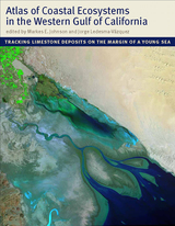
With an emphasis on the intricate workings of the Gulf, a team of scientists led by Markes E. Johnson and Jorge Ledesma-Vázquez explores how marine invertebrates such as corals and bivalves, as well as certain algae, contribute to the operation of a vast “organic engine” that acts as a significant carbon trap. The Atlas reveals that the role of these organisms in the ecology of the Gulf was greatly underestimated in the past. The organisms that live in these environments (or provide the sediments for beaches and dunes) are mass producers of calcium carbonate. Until now, no book has considered the centrality of calcium carbonate production as it functions today across multiple ecosystems and how it has evolved over time.
An important work of scholarship that also evokes the region’s natural splendor, the Atlas will be of interest to a wide range of scientists, including geologists, paleontologists, marine biologists, ecologists, and conservation biologists.
Oceans drive the world’s climate, nurture marine ecosystems full of aquatic life, and provide shipping lanes that have defined the global economy for centuries. And few realize that half of the world’s population lives in a coastal region within easy reach of one. Yet human activities such as commercial fishing, coastal real estate development, and industrial pollution have taken their toll on the seas. The first book of its kind, The Atlas of Coasts and Oceans documents the fraught relationship between humans and the earth’s largest bodies of water—and outlines the conservation steps needed to protect the marine environment for generations to come.
The Atlas offers a fascinating and often sobering account of how urbanization, climate change, offshore oil drilling, shipping routes, global tourism, and maritime conflict have had a profound impact on the world’s oceans and coasts. Combining text and images in visually engaging, thematically organized map spreads, this volume addresses the ecological, environmental, and economic importance of marine phenomena such as coral reefs, eroding shorelines, hurricanes, and fish populations—and how development threatens to destroy the ultimate source of all life on the “blue planet.” Lavishly illustrated with global and regional maps, from the Arabian Gulf to the Great Barrier Reef, from the Black Sea to the Mediterranean, and all the other major global waterways, The Atlas of Coasts and Oceans will be the definitive companion to any study of its subject for years to come.
Earlier this year, President Obama declared one of his top priorities to be “making sure that people are able to get enough to eat.” The United States spends about five billion dollars on food aid and related programs each year, but still, both domestically and internationally, millions of people are hungry. In 2006, the Food and Agricultural Organization of the United Nations counted 850 million hungry people worldwide, but as food prices soared, an additional 100 million or more who were vulnerable succumbed to food insecurity.
If hunger were simply a matter of food production, no one would go without. There is more than enough food produced annually to provide every living person with a healthy diet, yet so many suffer from food shortages, unsafe water, and malnutrition every year. That’s because hunger is a complex political, economic, and ecological phenomenon. The interplay of these forces produces a geography of hunger that Thomas J. Bassett and Alex Winter-Nelson illuminate in this empowering book. The Atlas of World Hunger uses a conceptual framework informed by geography and agricultural economics to present a hunger index that combines food availability, household access, and nutritional outcomes into a single tool—one that delivers a fuller understanding of the scope of global hunger, its underlying mechanisms, and the ways in which the goals for ending hunger can be achieved. The first depiction of the geography of hunger worldwide, the Atlas will be an important resource for teachers, students, and anyone else interested in understanding the geography and causes of hunger. This knowledge, the authors argue, is a critical first step toward eliminating unnecessary suffering in a world of plenty.
READERS
Browse our collection.
PUBLISHERS
See BiblioVault's publisher services.
STUDENT SERVICES
Files for college accessibility offices.
RECENTLY PUBLISHED


UChicago Accessibility Resources
home | accessibility | search | about | contact us
BiblioVault ® 2001 - 2024
The University of Chicago Press