
 A SCHOLARLY BOOK REPOSITORY
14 start with R start with R
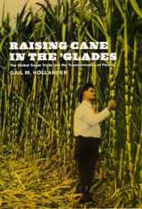
Using, among other sources, interviews, government and corporate documents, and recently declassified U.S. State Department memoranda, Gail M. Hollander demonstrates that the development of Florida’s sugar region was the outcome of pitched battles reaching the highest political offices in the U.S. and in countries around the world, especially Cuba—which emerges in her narrative as a model, a competitor, and the regional “other” to Florida’s “self.” Spanning the period from the age of empire to the era of globalization, the book shows how the “sugar question”—a label nineteenth-century economists coined for intense international debates on sugar production and trade—emerges repeatedly in new guises. Hollander uses the sugar question as a thread to stitch together past and present, local and global, in explaining Everglades transformation.
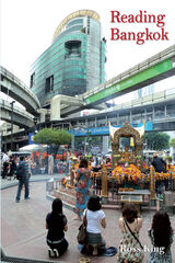
The author structures the book around external intrusions and local resistance. Geographically, this process is seen in movement from centre to periphery (Thonburi, Rattanakosin, Ratchadamnoen, Sukhumvit, Ratchadapisek, Khlong Toei, the universities). Chronologically, the city underwent various forms of colonization: incorporation of the periphery, which in turn colonized Bangkok; the economic colonization of the 19th and 20th centuries; colonization by consumption brought on in large part by globalized tourism; colonization by the "better" ideas of others (typically from the West); and finally colonization by "better" ways of thinking - notably the intrusions of the universities and of popular democracy.
This exceptionally innovative study draws on urban planning and development, history, anthropology, and political economy, and a rich body of empirical data to provide insights into the maze of power relations, inequalities and global influences that is normally hidden from view. Reading Bangkok is that rare thing, a study that genuinely changes the way its subject is seen and understood.
"This book provides a language for the architecture of everyday life."—Ross Miller, Chicago Tribune
"Spirited observations and capsule histories."—Suzanne Stephens, New York Times Book Review
"Compelling. . . . Included here are many nuggets of insight and illumination."—Brad Knickerbocker, Christian Science Monitor
"An amusing and touching book about the reality we Americans have captured in our language."—Boston Sunday Globe
Governance everywhere is concerned with spatial relationships. Modern states “map” local communities, making them legible for the purposes of control. Ethiopia has gone through several stages of “mapping” in its imperial, revolutionary, and postrevolutionary phases.
In 1986 The Southern Marches of Imperial Ethiopia, a cross-disciplinary collection edited by Don Donham and Wendy James, opened up the study of center/periphery relations in the Ethiopian empire until the fall of the monarchy in 1974. This new volume examines similar themes, taking the story forward through the major changes effected by the socialist regime from the revolution of 1974 to its overthrow in 1991, and then into the current period that has been marked by moves toward local democracy and political devolution.
Topics include the changing fortunes of new and historic towns and cities, the impact of the Mengistu regime’s policies of villagization and resettlement, local aspects of the struggle against Mengistu and its aftermath, and the fate of border regions. Special attention is given to developments since 1991: to new local institutions and forms of autonomy, the links between the international diasporas of Ethiopia and the fortunes of their home areas. The collection draws on the work of established scholars as well as a new generation of Ethiopian and international researchers in the disciplines of anthropology, political science, history, and geography.
Composed at the request of the Royal Spanish Chronicler of the Indies, Don Diego Torres y Vargas’s Report on the Island & Diocese of Puerto Rico was the first history of Puerto Rico written by a native of the Spanish island colony. Torres y Vargas, a fourth generation Puerto Rican and descendant of Ponce de Leon, records here the history of the Catholic Church in Puerto Rico as well as the political, social, military, economic, and natural history of the island.
This translation—the first ever into English—includes three historical essays by eminent Puerto Rican and Latino Studies scholar Anthony Stevens-Arroyo and extensive translator notes to guide the reader through the realities of seventeenth-century Puerto Rican culture and society.
Urban parks such as New York City's Central Park provide vital public spaces where city dwellers of all races and classes can mingle safely while enjoying a variety of recreations. By coming together in these relaxed settings, different groups become comfortable with each other, thereby strengthening their communities and the democratic fabric of society. But just the opposite happens when, by design or in ignorance, parks are made inhospitable to certain groups of people.
This pathfinding book argues that cultural diversity should be a key goal in designing and maintaining urban parks. Using case studies of New York City's Prospect Park, Orchard Beach in Pelham Bay Park, and Jacob Riis Park in the Gateway National Recreation Area, as well as New York's Ellis Island Bridge Proposal and Philadelphia's Independence National Historical Park, the authors identify specific ways to promote, maintain, and manage cultural diversity in urban parks. They also uncover the factors that can limit park use, including historical interpretive materials that ignore the contributions of different ethnic groups, high entrance or access fees, park usage rules that restrict ethnic activities, and park "restorations" that focus only on historical or aesthetic values. With the wealth of data in this book, urban planners, park professionals, and all concerned citizens will have the tools to create and maintain public parks that serve the needs and interests of all the public.
Because it distorts the proportionate size of countries, the Mercator map was criticized for inflating Europe and North America in a promotion of colonialism. In 1974, German historian Arno Peters proffered his own map, on which countries were ostensibly drawn in true proportion to one another. In the ensuing "map wars" of the 1970s and 1980s, these dueling projections vied for public support—with varying degrees of success.
Widely acclaimed for his accessible, intelligent books on maps and mapping, Monmonier here examines the uses and limitations of one of cartography's most significant innovations. With informed skepticism, he offers insightful interpretations of why well-intentioned clerics and development advocates rallied around the Peters projection, which flagrantly distorted the shape of Third World nations; why journalists covering the controversy ignored alternative world maps and other key issues; and how a few postmodern writers defended the Peters worldview with a self-serving overstatement of the power of maps. Rhumb Lines and Map Wars is vintage Monmonier: historically rich, beautifully written, and fully engaged with the issues of our time.
As the site of several miracles in the Jewish and Christian traditions, the Jordan is one of the world’s holiest rivers. It is also the major political and symbolic border contested by Israelis and Palestinians. Combining biblical and folkloric studies with historical geography, Rachel Havrelock explores how the complex religious and mythological representations of the river have shaped the current conflict in the Middle East.
The author was one of a small group of state waterfowl managers who saw it all happen, most sadly within the Obion-Forked Deer river system and at Reelfoot Lake. After much trial and error, Johnson and his colleagues in the Tennessee Wildlife Resources Agency began by the 1980s to abandon their old methods, resorting to management procedures more in line with the natural contours of the floodplains and the natural behavior of rivers. Preaching their new stewardship philosophy to anyone who might listen-their supervisors, duck hunters, conservationists, politicians, federal agencies-they were often ignored. The campaign dragged on for twenty years before an innovative and rational plan came from the Governor's Office and gained wide support. But then, too, that plan fell prey to politics, legal wrangling, self-interest, hardheadedness, and tradition. Yet, despite such heartbreaking setbacks, the author points to hopeful signs that West Tennessee's historic wetlands might yet be recovered for the benefit of all who use them and recognize their vital importance.
Jim W. Johnson, now retired, was for many years a lands management biologist with the Tennessee Wildlife Resources Agency. He was responsible for the overall supervision and coordination of thirteen wildlife management areas and refuges, primarily for waterfowl, in northwest Tennessee.
In Rome Measured and Imagined, Jessica Maier explores the history of this genre—which merged the accuracy of scientific endeavor with the imaginative aspects of art—during the rise of Renaissance print culture. Through an exploration of works dating from the fifteenth to the eighteenth centuries, her book interweaves the story of the city portrait with that of Rome itself.
Highly interdisciplinary and beautifully illustrated with nearly one hundred city portraits, Rome Measured and Imagined advances the scholarship on Renaissance Rome and print culture in fascinating ways.
The 1859 exploration of the Great Basin by army topographical engineer James Simpson opened up one of the West's most important transportation and communication corridors, a vital link between the Pacific Coast and the rest of the nation. It became the route of the Pony Express and the Overland Mail and Stage, the line of the Pacific telegraph, a major wagon road for freighters and emigrants, and, later, the first transcontinental auto road, the Lincoln Highway, now Highway 50.
No one has accurately tracked or mapped Simpson's original route, until now. Jesse Petersen shows in words, maps, and photos exactly where the explorer went. Sharing his detective-like reasoning as he walked or drove the entire trail west and Simpson's variant route returning east, Petersen takes readers on a mountain and desert trek through some of America's most remote and striking landscapes.
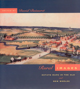
Generously illustrated with reproductions of rare manuscripts, including 8 color plates, these accounts reveal how estate maps performed vital economic and cultural functions for property owners until the end of the nineteenth century. From plans of plantations in Jamaica and South Carolina to a map of Queens College, Cambridge, handsome examples show that estate maps formed an important part of the historical record of property ownership for both individuals and corporations, and helped owners manage their land and appraise its value. Exhibited in public places for pleasure and as symbols of wealth, they often displayed elaborate cartouches and elegant coats-of-arms.
READERS
Browse our collection.
PUBLISHERS
See BiblioVault's publisher services.
STUDENT SERVICES
Files for college accessibility offices.
RECENTLY PUBLISHED


")


UChicago Accessibility Resources
home | accessibility | search | about | contact us
BiblioVault ® 2001 - 2024
The University of Chicago Press