
 A SCHOLARLY BOOK REPOSITORY
7 start with T start with T
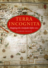
In Terra Incognita, Alfred Hiatt draws on sources both literary and visual to understand the appeal of the antipodes. Examining maps and diagrams, as well as evidence contained in geographical and historical works, poetry, travel narratives, and legal documents, he challenges long-standing characterizations of medieval spatiality as exclusively symbolic and religious. Instead, Hiatt finds, the idea of people on the other side of the Earth provided a potent and malleable symbol for political theorists, satirists, scholars, and poets—as well as for map makers. Terra Incognita is, in the end, the history of a non-place, of lands conjured by the scientific imagination, which nevertheless drove exploration, and which continued to shape the world map, even as they slowly vanished from it.
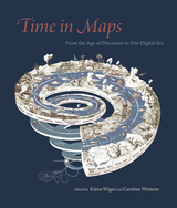
Focusing on maps created in Spanish America, Europe, the United States, and Asia, these essays take us from the Aztecs documenting the founding of Tenochtitlan, to early modern Japanese reconstructing nostalgic landscapes before Western encroachments, to nineteenth-century Americans grappling with the new concept of deep time. The book also features a defense of traditional paper maps by digital mapmaker William Rankin. With more than one hundred color maps and illustrations, Time in Maps will draw the attention of anyone interested in cartographic history.
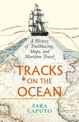
Sara Caputo’s Tracks on the Ocean is a sweeping history of how we have understood routes of travel over the ocean and how we came to represent that movement as a cartographical line. Focusing on the representation of sea journeys in the Western world from the early sixteenth century to the present, Caputo deftly argues that the depiction of these lines is inextricable from European imperialism, the rise of modernity, and attempts at mastery over nature. Caputo recounts the history of ocean tracks through an array of lively stories and characters, from the expeditions of Captain James Cook in the eighteenth century to tracks depicted in Moby Dick and popular culture of the nineteenth century to the use of navigational techniques by the British navy. She discusses how tracks evolved from tools of surveying into tools of surveillance and, eventually, into paths of environmental calamity. The impulse to record tracks on the ocean is, Caputo argues, reflective of an ongoing desire for order, schematization, and personal visibility, as well as occupation and permanent ownership—in this case over something that is unoccupiable and impossible to truly possess. Both beautifully written and deeply researched, Tracks on the Ocean shares how the lines drawn on maps tell the audacious and often tragic and violent stories of ocean voyages.
In the US, the 25 largest metropolitan areas and many smaller cities have fixed guideway transit—rail or bus rapid transit. Nearly all of them are talking about expanding. Yet discussions about transit are still remarkably unsophisticated. To build good transit, the discussion needs to focus on what matters—quality of service (not the technology that delivers it), all kinds of transit riders, the role of buildings, streets and sidewalks, and, above all, getting transit in the right places.
Christof Spieler has spent over a decade advocating for transit as a writer, community leader, urban planner, transit board member, and enthusiast. He strongly believes that just about anyone—regardless of training or experience—can identify what makes good transit with the right information. In the fun and accessible Trains, Buses, People: An Opinionated Atlas of US Transit, Spieler shows how cities can build successful transit. He profiles the 47 metropolitan areas in the US that have rail transit or BRT, using data, photos, and maps for easy comparison. The best and worst systems are ranked and Spieler offers analysis of how geography, politics, and history complicate transit planning. He shows how the unique circumstances of every city have resulted in very different transit systems.
Using appealing visuals, Trains, Buses, People is intended for non-experts—it will help any citizen, professional, or policymaker with a vested interest evaluate a transit proposal and understand what makes transit effective. While the book is built on data, it has a strong point of view. Spieler takes an honest look at what makes good and bad transit and is not afraid to look at what went wrong. He explains broad concepts, but recognizes all of the technical, geographical, and political difficulties of building transit in the real world. In the end,Trains, Buses, People shows that it is possible with the right tools to build good transit.
-Planning
In some US and Canadian cities, transit has quietly been expanding and improving over the last few years, despite funding and ridership challenges. How do we assess the advances and failures of our current systems to move forward strategically and wisely?
The first edition of Trains, Buses, People was dubbed “a transit wonk’s bible” and guided “a smarter conversation about urban transit” in the US. This second edition is fully updated and expanded to include eight Canadian cities and two new US cities (Indianapolis and San Juan, Puerto Rico).
In Trains, Buses, People, Second Edition: An Opinionated Atlas of US and Canadian Transit, transit expert and “transportation hero” Christof Spieler provides a new section on inclusivity to help agencies understand how to welcome riders regardless of race, gender, income, or disability. Select cities include new maps overlaying transit and poverty data, and systems that have started construction since the first edition in 2018 have been added. Other new sections address network typologies, guideway types, station types, and fares.
Spieler has spent over a decade advocating for transit as a writer, community leader, urban planner, transit board member, and enthusiast. He strongly believes that just about anyone—regardless of training or experience—can identify what makes good transit with the right information. In the fun, accessible, and visually appealing Trains, Buses, People, Second Edition: An Opinionated Atlas of US and Canadian Transit, Spieler shows how cities can build successful transit. He profiles the 49 metropolitan areas in the US and eight metropolitan areas in Canada that have rail transit or BRT, using data, photos, and maps for easy comparison. Spieler ranks the best and worst systems and he offers analysis of how geography, politics, and history complicate transit planning. He shows how the unique circumstances of every city have resulted in very different transit systems.
Trains, Buses, People, Second Edition is intended for non-experts—it will help any citizen, professional, or policymaker with a vested interest evaluate a transit proposal and understand what makes transit effective. It shows that it is possible, with the right tools, to build good transit.
From the sixteenth century until the early nineteenth, Europeans had envisioned New Spain (colonial Mexico) in texts, maps, and other images. In the first decades of the 1800s, ideas about Mexican, rather than Spanish, national character and identity began to cohere in written and illustrated narratives produced by foreign travelers. During the nineteenth century, technologies and processes of visual reproduction expanded to include lithography, daguerreotype, and photography. New methods of display—such as albums, museums, exhibitions, and world fairs—signaled new ideas about spectatorship. García Cubas participated in this emerging visual culture as he reconfigured geographic and cultural imagery culled from previous mapping practices and travel writing. In works such as the Atlas geográfico (1858) and the Atlas pintoresco é historico (1885), he presented independent Mexico to Mexican citizens and the world.
READERS
Browse our collection.
PUBLISHERS
See BiblioVault's publisher services.
STUDENT SERVICES
Files for college accessibility offices.
RECENTLY PUBLISHED


UChicago Accessibility Resources
home | accessibility | search | about | contact us
BiblioVault ® 2001 - 2024
The University of Chicago Press