3 books about Millea, Nick
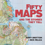
Fifty Maps and the Stories they Tell
Jerry Brotton and Nick Millea
Bodleian Library Publishing, 2019
The Bodleian Library’s map collection is a treasure trove of cartographic delights spanning more than a thousand years. This book features highlights from the collection together with rare artifacts and some stunning examples from twenty-first-century map-makers. Lavishly illustrated throughout, the book showcases a rich array: from military maps, digital cartograms, decorative portolan charts, and maps of heaven and hell; to a Siberian sealskin map and a twelfth-century Arabic map of the Mediterranean; to J. R. R. Tolkien’s cosmology of Middle-earth, C. S. Lewis’s map of Narnia, and a tapestry map by contemporary artist Grayson Perry. Each map is accompanied by a narrative revealing the story behind its creation and the significance of its design. The chronological arrangement highlights how the science and practice of cartography has changed over time and how this evolution reflects political and social transformations from century to century.
[more]
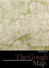
The Gough Map
The Earliest Road Map of Great Britain
Nick Millea
Bodleian Library Publishing, 2005
For centuries the Gough Map has amazed observers with its remarkable detail and baffled historians with its hidden secrets: who made it and why was it made? This gorgeously illustrated volume offers possible answers to these questions with a detailed examination of the map that employs the latest in technology, cartographic theories, and historical research.
Recent digitization of the Gough Map has made it more legible than at any other time since its arrival at the Bodleian Library in 1809. This work utilizes new georectification technology to project a modern map of Britain over the Gough Map, revealing the incredible accuracy of the 700-year-old manuscript. In stunningly detailed reproduction, The Gough Map charts a vast array of cities, routes, and landmarks, including the principal medieval settlements of Bristol, Oxford and Norwich; the Severn, Thames, and Humber rivers; the loop of the Wear at Durham; and routes between towns with distances marked in Roman numerals.
The volume also features a color fold-out print of the Gough map, as well as numerous close-up images of each area. The Gough Map offers an unparalleled opportunity to examine this fascinating example of medieval mapmaking.
[more]
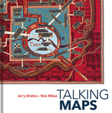
Talking Maps
Jerry Brotton and Nick Millea
Bodleian Library Publishing, 2019
Every map tells a story. Some provide a narrative for travelers, explorers, and surveyors or offer a visual account of changes to people’s lives and surroundings, while others tell imaginary tales, transporting us to fictional worlds created by writers and artists. In turn, maps generate more stories, taking users on new journeys in search of knowledge and adventure.
Drawing on the Bodleian Library’s outstanding map collection and covering almost a thousand years, Talking Maps takes a new approach to map-making by showing how maps and stories have always been intimately entwined. Including such rare treasures as a unique map of the Mediterranean from the eleventh-century Arabic Book of Curiosities, a twelfth-century map of the world by al-Sharīf al-Idrīsī, and C. S. Lewis’s map of Narnia, this fascinating book analyzes maps as objects that enable us to cross sea and land; as windows into alternative and imaginary worlds; as guides to reaching the afterlife; as tools to manage cities, nations, and empires; as images of environmental change; and as digitized visions of the global future.
By telling the stories behind the artifacts and those generated by them, Talking Maps reveals how each map is not just a tool for navigation but also a worldly proposal that helps us to understand who we are by describing where we are.
[more]
READERS
Browse our collection.
PUBLISHERS
See BiblioVault's publisher services.
STUDENT SERVICES
Files for college accessibility offices.
UChicago Accessibility Resources
home | accessibility | search | about | contact us
BiblioVault ® 2001 - 2024
The University of Chicago Press


