front cover of Birdwatching in New York City and on Long Island
Birdwatching in New York City and on Long Island
Deborah Rivel and Kellye Rosenheim
University Press of New England, 2016
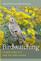
This easy-to-use guide gives seasonal information for both popular birding sites and those off the beaten path. Precise directions to the best viewing locations within the region’s diverse habitats enable birdwatchers to efficiently explore urban and wild birding hotspots. Over 500 species of birds can be seen in New York City’s five boroughs and on Long Island, one of the most densely populated and urbanized regions in North America, which also happens to be situated directly on the Atlantic Flyway. In this fragmented environment of scarce resources, birds concentrate on what’s available. This means that high numbers of birds are found in small spaces. In fact, Central Park alone attracts over 225 species of birds, which birders from around the world flock to see during spring and fall migration. Beyond Central Park, the five boroughs and Long Island have numerous wildlife refuges of extraordinary scenic beauty where resident and migratory birds inhabit forests, wetlands, grasslands, and beaches. These special places present an opportunity to see a wide array of songbirds, endangered nesting shorebirds, raptors, and an unprecedented number and variety of waterfowl. Including the latest information on the seasonal status and distribution of more than 400 species, with 39 maps and over 50 photographs, this full-color guide features information essential to planning a birding visit. It will become the go-to book for both the region’s longtime birders and those exploring the area for the first time.
[more]

front cover of Favored Flowers
Favored Flowers
Culture and Economy in a Global System
Catherine Ziegler
Duke University Press, 2007
Billions of fresh-cut flowers are flown into the United States every year, allowing Americans to choose from a broad array of blooms regardless of the season. Favored Flowers is a lively investigation of the worldwide production and distribution of fresh-cut flowers and their consumption in the New York metropolitan area. In an ethnography filled with roses, orchids, and gerberas, flower auctions, new hybrids, and new logistical systems, Catherine Ziegler unravels the economic and cultural strands of the global flower market. She provides an historical overview of the development of the cut flower industry in New York from the late nineteenth century to 1970, and on to its ultimate transformation from a domestic to a global industry. As she points out, cut flowers serve no utilitarian purpose; rather, they signal consumers’ social and cultural decisions about expressing love, mourning, status, and identity. Ziegler shows how consumer behavior and choices have changed over time and how they are shaped by the media, by the types of available flowers, and by flower retailing.

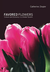
Ziegler interviewed more than 250 people as she followed flowers along the full length of the commodity chain, from cuttings in Europe and Latin America to vases in and around New York. She examines the daily experiences of flower growers in the Netherlands and Ecuador, two leading exporters of flowers to the United States. Primary focus, though, is on others in the commodity chain: exporters, importers, wholesalers, and retailers. She follows their activities as they respond to changing competition, supply, and consumer behavior in a market characterized by risk, volatility, and imperfect knowledge. By tracing changes in the wholesale and retail systems, she shows the recent development of two complementary commodity chains in New York and the United States generally. One leads to a high-end luxury market served by specialty florists and designers, and the other to a lower-priced mass market served by chain groceries, corner delis, and retail superstores.

[more]

front cover of A Guide to Native Plants of the New York City Region
A Guide to Native Plants of the New York City Region
Gargiullo, Margaret B
Rutgers University Press, 2010
It is no secret that with each new office park, strip mall, and housing development that slices through the New York, New Jersey, and Connecticut landscape, more and more indigenous plant habitats are being destroyed. Concrete, after all, is not a friendly neighbor to vegetative life. Less common wisdom, however, holds that plants native to this region have been disappearing rapidly for a variety of reasons, and some of the causes can be avoided, even as construction projects continue to move in.

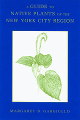
One of the most serious threats to indigenous plants is the introduction of invasive non-native species by landscapers after new developments are built. In this unique guide, ecologist Margaret B. Gargiullo presents a detailed look at the full scope of flora that is native to this region and available for propagation. Geared specifically for landscape architects, designers, land managers, and restorationists, this book offers practical advice on how to increase the amount of indigenous flora growing in the mepolitan area, and in some cases, to reintroduce plants that have completely disappeared.

More than one hundred line drawings of plants and their specific habitats, ranging from forests to beaches, help readers visualize the full potential for landscaping in the area. A separate entry for each plant also provides detailed information on size, flower color, blooming time, and its possible uses in wetland mitigation, erosion control, and natural area restoration. Some plants are also highlighted for their ability to thrive in areas that are typically considered inhospitable to greenery.

Easily searchable by plant type or habitat, this guide is an essential reference for everyone concerned with the region's natural plant life. Since most of the plants can also be grown well beyond the New York City metropolitan area, this book will also be useful for project managers doing restoration work in most of southern New England and the mid-Atlantic region, including Pennsylvania, Delaware, and Maryland.
[more]

front cover of Landscape of Modernity
Landscape of Modernity
Essays on New York City, 1900-1940
David Ward
Russell Sage Foundation, 1992
New York City stands as the first expression of the modern city, a mosaic of disparate neighborhoods born in 1898 with the amalgamation of the five boroughs and shaped by the passions of developers and regulators, architects and engineers, politicians and reformers, immigrant entrepreneurs and corporate builders. Through their labor, their ideals, and their often fierce battles, the physical and social dimensions—the landscape—of the modern city were forged. The original essays in The Landscape of Modernity tell the compelling story of the growth of New York City from 1900 to 1940, from the beginnings of its skyscraper skyline to the expanding reaches of suburbanization. At the beginning of the century, New York City was already one of the world's leading corporate and commercial centers. The Zoning Ordinance of 1916, initially proposed by Fifth Avenue merchants as a means of halting the uptown spread of the garment industry, became the nation's first comprehensive zoning law and the proving ground for a new occupation—the urban planner. During the 1920s, frenzied development created a vertical metamorphosis in Manhattan's booming business district, culminating in its most spectacularly modern icon, the Empire State Building. The city also spread laterally, with the controversial development of subway systems and the creation of the powerful Port of New York Authority, whose new bridges and tunnels decentralized the population and industry of New York. New York's older ethnic enclaves were irrevocably altered by this new urban landscape: the Lower East Side's Jewish community was nearly dismantled by the flight of the garment industry and the attractiveness of new suburbs, while Little Italy fought government forces eager to homogenize commercial use of the streets by eliminating the traditional pushcart peddlers. Illustrated with striking photographs and maps, The Landscape of Modernity links important scenes of growth and development to the larger political, economic, social, and cultural processes of the early twentieth century.
[more]

front cover of Politics Across the Hudson
Politics Across the Hudson
The Tappan Zee Megaproject
Philip Mark Plotch
Rutgers University Press, 2015
Winner of the 2015 American Planning Association New York Metro Chapter Journalism Award

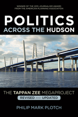
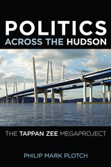
The State of New York built one of the world’s longest, widest, and most expensive bridges—the new Tappan Zee Bridge—stretching more than three miles across the Hudson River, approximately thirteen miles north of New York City. In Politics Across the Hudson, urban planner Philip Plotch offers a behind-the-scenes look at three decades of contentious planning and politics centered around this bridge, recently renamed for Governor Mario M. Cuomo, the state's governor from 1983 to 1994. He reveals valuable lessons for those trying to tackle complex public policies while also confirming our worst fears about government dysfunction.
 
Drawing on his extensive experience planning megaprojects, interviews with more than a hundred key figures—including governors, agency heads, engineers, civic advocates, and business leaders—and extraordinary access to internal government records, Plotch tells a compelling story of high-stakes battles between powerful players in the public, private, and civic sectors. He reveals how state officials abandoned viable options, squandered hundreds of millions of dollars, forfeited more than three billion dollars in federal funds, and missed out on important opportunities. Faced with the public’s unrealistic expectations, no one could identify a practical solution to a vexing problem, a dilemma that led three governors to study various alternatives rather than disappoint key constituencies. 
 
This revised and updated edition includes a new epilogue and more photographs, and continues where Robert Caro’s The Power Broker left off and illuminates the power struggles involved in building New York’s first major new bridge since the Robert Moses era. Plotch describes how one governor, Andrew Cuomo, shrewdly overcame the seemingly insurmountable obstacles of onerous environmental regulations, vehement community opposition, insufficient funding, interagency battles, and overly optimistic expectations...
 
 
[more]

front cover of Politics Across the Hudson
Politics Across the Hudson
The Tappan Zee Megaproject
Philip Mark Plotch
Rutgers University Press, 2015
The State of New York is now building one of the world’s longest, widest, and most expensive bridges—the new Tappan Zee Bridge—stretching more than three miles across the Hudson River, approximately thirteen miles north of New York City. In Politics Across the Hudson, urban planner Philip Plotch offers a behind-the-scenes look at three decades of contentious planning and politics centered around this bridge, recently renamed for Governor Mario M. Cuomo, the state's governor from 1983 to 1994. He reveals valuable lessons for those trying to tackle complex public policies while also confirming our worst fears about government dysfunction.
 
Drawing on his extensive experience planning megaprojects, interviews with more than a hundred key figures—including governors, agency heads, engineers, civic advocates, and business leaders—and extraordinary access to internal government records, Plotch tells a compelling story of high-stakes battles between powerful players in the public, private, and civic sectors. He reveals how state officials abandoned viable options, squandered hundreds of millions of dollars, forfeited more than three billion dollars in federal funds, and missed out on important opportunities. Faced with the public’s unrealistic expectations, no one could identify a practical solution to a vexing problem, a dilemma that led three governors to study various alternatives rather than disappoint key constituencies. 
 
Politics Across the Hudson continues where Robert Caro’s The Power Broker left off and illuminates the power struggles involved in building New York’s first major new bridge since the Robert Moses era. Plotch describes how one governor, Andrew Cuomo, shrewdly overcame the seemingly insurmountable obstacles of onerous environmental regulations, vehement community opposition, insufficient funding, interagency battles, and overly optimistic expectations. 
 
 
[more]

front cover of A Region at Risk
A Region at Risk
The Third Regional Plan For The New York-New Jersey-Connecticut Metropolitan Area
Robert D. Yaro and Tony Hiss
Island Press, 1996

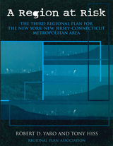
Regional Plan Association, the nation's oldest regional planning organization, has worked since 1929 to improve the quality of life in the New York-New Jersey-Connecticut metropolitan area. The Association has crafted two long-term plans and successfully promoted their implementation through advocacy and coalition building.

The Association's Third Regional Plan describes a series of key initiatives aimed at not only improving quality of life, but also at increasing economic competitiveness, encouraging more sustainable patterns of growth, and expanding opportunities and choice in employment, housing, and community.

The Plan presents five major campaigns, each of which combines the goals of economic, equity, and environmental improvements. They are:

  • Greensward -- to protect and restore large natural resource systems at the periphery of urbanized areas
  • Centers -- to "recenter" regions that have experienced decades of sprawl growth
  • Mobility -- to transform existing transit infrastructure to create a regional express rail network that would dramatically improve public transit, reduce highway congestion, and speed freight movement
  • Workforce -- to provide the region's workforce with the skills and opportunities needed to participate in the economy of the future
  • Governance -- to rationalize the activities of existing authorities, encourage service sharing among municipal governments, and encourage more effective state and regional land-use planning programs

While focusing on the New York-New Jersey-Connecticut metropolitan area, the Plan's broad themes have universal applicability to regions throughout the industrialized world.

[more]

front cover of Transnational Cultural Flow from Home
Transnational Cultural Flow from Home
Korean Community in Greater New York
Pyong Gap Min
Rutgers University Press, 2023
When the first wave of post-1965 Korean immigrants arrived in the New York-New Jersey area in the early 1970s, they were reliant on retail and service businesses in the minority neighborhoods where they were. This caused ongoing conflicts with customers in black neighborhoods of New York City, with white suppliers at Hunts Point Produce Market, and with city government agencies that regulated small business activities. In addition, because of the times, Korean immigrants had very little contact with their homeland. Korean immigrants in the area were highly segregated from both the mainstream New York society and South Korea. However, after the 1990 Immigration Act, Korean immigrants with professional and managerial backgrounds have found occupations in the mainstream economy. Korean community leaders also engaged in active political campaigns to get Korean candidates elected as city council members and higher levels of legislative positions in the area. The Korean community's integration into mainstream society also increasingly developed stronger transnational ties to their homeland and spurred the inclusion of "everyday Korean life" in the NY-NJ area.

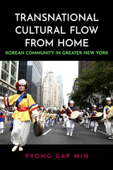
Transnational Cultural Flow from Home examines New York Korean immigrants’ collective efforts to preserve their cultural traditions and cultural practices and their efforts to transmit and promote them to New Yorkers by focusing on the Korean cultural elements such as language, foods, cultural festivals, and traditional and contemporary performing arts.

This publication was supported by the 2022 Korean Studies Grant Program of the Academy of Korean Studies (AKS-2022-P-009).
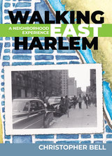
 
[more]


Send via email Share on Facebook Share on Twitter