3 books about Terracing

Ancient Maya Life in the Far West Bajo
Social and Environmental Change in the Wetlands of Belize
Julie L. Kunen
University of Arizona Press, 2004
Human activity during centuries of occupation significantly altered the landscape inhabited by the ancient Maya of northwestern Belize. In response, the Maya developed new techniques to harvest the natural resources of their surroundings, investing increased labor and raw materials into maintaining and even improving their ways of life.
In this lively story of life in the wetlands on the outskirts of the major site of La Milpa, Julie Kunen documents a hitherto unrecognized form of intensive agriculture in the Maya lowlands—one that relied on the construction of terraces and berms to trap soil and moisture around the margins of low-lying depressions called bajos. She traces the intertwined histories of residential settlements on nearby hills and ridges and agricultural terraces and other farming-related features around the margins of the bajo as they developed from the Late Preclassic perios (400 BC-AD 250) until the area's abandonment in the Terminal Classic period (about AD 850).
Kunen examines the organization of three bajo communities with respect to the use and management of resources critical to agricultural production. She argues that differences in access to spatially variable natural resources resulted in highly patterned settlement remains and that community founders and their descendents who had acquired the best quality and most diverse set of resources maintained an elevated status in the society.
The thorough integration of three lines of evidence—the settlement system, the agricultural system, and the ancient environment—breaks new ground in landscape research and in the study of Maya non-elite domestic organization. Kunen reports on the history of settlement and farming in a small corner of the Maya world but demonstrates that for any study of human-environment interactions, landscape history consists equally of ecological and cultural strands of influence.
[more]

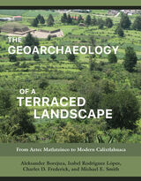
The Geoarchaeology of a Terraced Landscape
From Aztec Matlatzinco to Modern Calixtlahuaca
Aleksander Borejsza, Isabel Rodríguez López, Charles D. Frederick, and Michael E. Smith
University of Utah Press, 2021
The toil of several million peasant farmers in Aztec Mexico transformed lakebeds and mountainsides into a checkerboard of highly productive fields. This book charts the changing fortunes of one Aztec settlement and its terraced landscapes from the twelfth to the twenty-first century. It also follows the progress and missteps of a team of archaeologists as they pieced together this story.
Working at a settlement in the Toluca Valley of central Mexico, the authors used fieldwalking, excavation, soil and artifact analyses, maps, aerial photos, land deeds, and litigation records to reconstruct the changing landscape through time. Exploiting the methodologies and techniques of several disciplines, they bring context to eight centuries of the region’s agrarian history, exploring the effects of the Aztec and Spanish Empires, reform, and revolution on the physical shape of the Mexican countryside and the livelihoods of its people. Accessible to specialists and nonspecialists alike, this well-illustrated and well-organized volume provides a step-by-step guide that can be applied to the study of terraced landscapes anywhere in the world.
The four authors share an interest in terraced landscapes and have worked together and on their own on a variety of archaeological projects in Mesoamerica, the Mediterranean, Poland, and the United Kingdom.
[more]

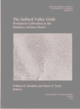
The Safford Valley Grids
Prehistoric Cultivation in the Southern Arizona Desert
William E. Doolittle
University of Arizona Press, 2004
Crisscrossing Pleistocene terrace tops and overlooking the Gila River in southeastern Arizona are acres and acres of rock alignments that have perplexed archaeologists for a century. Well known but poorly understood, these features have long been considered agricultural, but exactly what was cultivated, how, and why remained a mystery. Now we know. Drawing on the talents of a team of scholars representing various disciplines, including geology, soil science, remote sensing, geographical information sciences (GISc), hydrology, botany, palynology, and archaeology, the editors of this volume explain when and why the grids were built.
Between A.D. 750 and 1385, people gathered rocks from the tops of the terraces and rearranged them in grids of varying size and shape, averaging about 4 meters to 5 meters square. The grids captured rainfall and water accumulated under the rocks forming the grids. Agave was planted among the rocks, providing a dietary supplement to the maize and beans that were irrigated on the nearby bottom land, a survival crop when the staple crops failed, and possibly a trade commodity when yields were high. Stunning photographs by Adriel Heisey convey the vastness of the grids across the landscape.
Between A.D. 750 and 1385, people gathered rocks from the tops of the terraces and rearranged them in grids of varying size and shape, averaging about 4 meters to 5 meters square. The grids captured rainfall and water accumulated under the rocks forming the grids. Agave was planted among the rocks, providing a dietary supplement to the maize and beans that were irrigated on the nearby bottom land, a survival crop when the staple crops failed, and possibly a trade commodity when yields were high. Stunning photographs by Adriel Heisey convey the vastness of the grids across the landscape.
[more]
READERS
Browse our collection.
PUBLISHERS
See BiblioVault's publisher services.
STUDENT SERVICES
Files for college accessibility offices.
UChicago Accessibility Resources
home | accessibility | search | about | contact us
BiblioVault ® 2001 - 2024
The University of Chicago Press


