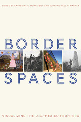
In Border Spaces, Katherine G. Morrissey, John-Michael H. Warner, and other essayists build on the insights of border dwellers, or fronterizos, and draw on two interrelated fields—border art history and border studies. The editors engage in a conversation on the physical landscape of the border and its representations through time, art, and architecture.
The volume is divided into two linked sections—one on border histories of built environments and the second on border art histories. Each section begins with a “conversation” essay—co-authored by two leading interdisciplinary scholars in the relevant fields—that weaves together the book’s thematic questions with the ideas and essays to follow.
Border Spaces is prompted by art and grounded in an academy ready to consider the connections between art, land, and people in a binational region.
Contributors
Maribel Alvarez
Geraldo Luján Cadava
Amelia Malagamba-Ansótegui
Mary E. Mendoza
Sarah J. Moore
Katherine G. Morrissey
Margaret Regan
Rebecca M. Schreiber
Ila N. Sheren
Samuel Truett
John-Michael H. Warner

The Pyramids on the Giza Plateau represent perhaps the most famous archaeological site in the world, capturing on tomb walls frozen moments from almost every aspect of life in ancient Egypt. This book, by one of the foremost experts on the history of Giza, explores new approaches to “cataloging” the site, highlighting efforts at the Museum of Fine Arts Boston and Harvard University.
The site experienced its first “golden age” as the burial place of three pharaohs of the Egyptian Old Kingdom (Dynasty 4, ca. 2640–2510 BCE). A second golden age came almost five millennia later, when the first modern excavators applied their newly devised archaeological craft to the Giza Plateau. Now, with the advent of many new technologies in the twenty-first century, the Giza Necropolis is available in two, three, and even four dimensions. Children and specialized scholars alike may study the material culture of this ancient civilization from afar, often with greater access than could be achieved in person. However, these new approaches do raise questions: Does 3-D modeling and animation truly improve scholarly comprehension and interpretation? Can interacting with animations still be called scholarship? Where is the border between academic knowledge and mere entertainment?
Through specific case studies and an in-depth history of this important project, Peter Der Manuelian provides an excellent model for other digital visualization initiatives. He also offers more general philosophical reflection on the nature of visualization in archaeology and speculates about emerging technologies and how they may be useful in the future.
Analyzing how artists reimagine migrant disappearance and visibility at the US–Mexico border.
In the mid-1990s, the US government implemented Prevention through Deterrence, a major buildup of troops, walls, and surveillance around El Paso and San Diego. Cut off from these crucial urban crossings, migrants flowed into the dangerous surrounding deserts, where some ten thousand have since died. This is all according to plan: Pentagon documents describe the strategy of funneling migrants toward “mortal danger.”
In this bracing critique, China Medel explores the aesthetics enabling and resisting the crisis of migrant death. The nation-state’s performance of sovereignty along the border, predicated on mass casualties, is tolerated and even celebrated, thanks to the images in our heads of racialized and therefore criminal bodies, made invisible as they disintegrate in the baking sand. Spectral Aesthetics shows how state officials and mainstream media, relying on postracial ideologies and white-supremacist agendas, collectively foster this picture of a brown body so abject that it is disposable. In close readings of artworks contesting this murderous visual regime, Medel discovers an alternative kind of sight, one emphasizing the ghostly traces of the dead. These are images not of the individual “alien” but of life itself, indisposable.
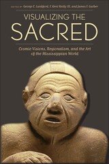
The prehistoric native peoples of the Mississippi River Valley and other areas of the Eastern Woodlands of the United States shared a complex set of symbols and motifs that constituted one of the greatest artistic traditions of the pre-Columbian Americas. Traditionally known as the Southeastern Ceremonial Complex, these artifacts of copper, shell, stone, clay, and wood were the subject of the groundbreaking 2007 book Ancient Objects and Sacred Realms: Interpretations of Mississippian Iconography, which presented a major reconstruction of the rituals, cosmology, ideology, and political structures of the Mississippian peoples.
Visualizing the Sacred advances the study of Mississippian iconography by delving into the regional variations within what is now known as the Mississippian Iconographic Interaction Sphere (MIIS). Bringing archaeological, ethnographic, ethnohistoric, and iconographic perspectives to the analysis of Mississippian art, contributors from several disciplines discuss variations in symbols and motifs among major sites and regions across a wide span of time and also consider what visual symbols reveal about elite status in diverse political environments. These findings represent the first formal identification of style regions within the Mississippian Iconographic Interaction Sphere and call for a new understanding of the MIIS as a network of localized, yet interrelated religious systems that experienced both continuity and change over time.
READERS
Browse our collection.
PUBLISHERS
See BiblioVault's publisher services.
STUDENT SERVICES
Files for college accessibility offices.
UChicago Accessibility Resources
home | accessibility | search | about | contact us
BiblioVault ® 2001 - 2025
The University of Chicago Press


