Results by title
577 books match the query 'Earth Sciences' and 12 start with h
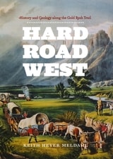
Hard Road West
History and Geology along the Gold Rush TrailKeith Heyer Meldahl
University of Chicago Press, 2007
“Alternates seamlessly between vivid accounts of the 19th-century journey and lucid explanations of the geological events that shaped the landscape traveled. . . . The reader comes away with both an appreciation for the arduous cross-continental wagon journey and an understanding of the events that created such a vast and difficult landscape.”—Library Journal
Haste
The Slow Politics of Climate UrgencyEdited by Håvard Haarstad, Jakob Grandin, Kristin Kjærås, and Eleanor Johnson
University College London, 2023
It’s understandable that we tend to present climate change as something urgently requiring action. Every day we fail to act, the potential for catastrophe grows. But is that framing itself a problem? When we hurry, we make more mistakes. We overlook things. We get tunnel vision.
In Haste, a group of distinguished contributors makes the case for a slow politics of urgency. Rather than rushing and speeding up, he argues, the sustainable future is better served by our challenging of the dominant framings through which we understand time and change in society. While recognizing the need for certain types of urgency in climate politics, Haste directs attention to the different and alternative temporalities at play in climate and sustainability politics. Divided into short and accessible chapters, written by both established and emerging scholars from different disciplines, Haste tackles a major problem in contemporary climate change research and offers creative perspectives on pathways out of the climate emergency.
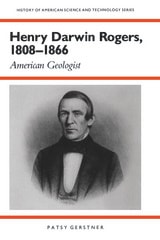
Henry Darwin Rogers, 1808–1866
American GeologistPatsy Gerstner
University of Alabama Press, 1994
The life and legacy of a pioneer who helped shape American geology.
Henry Darwin Rogers, 1808–1866: American Geologist is the first comprehensive biography of Henry Darwin Rogers, one of the pioneering figures who helped establish geology as a professional scientific discipline in the United States. Written by historian Patsy Gerstner, this meticulously researched study traces Rogers's life from his early education and scientific interests to his leadership of the groundbreaking geological surveys of New Jersey and Pennsylvania.
At a time when American science was still in its formative stages, Rogers distinguished himself through extensive fieldwork, influential publications, and innovative theories about the formation of mountain systems. His investigations of Pennsylvania's Appalachian region led to one of the first distinctly American theories of mountain elevation and helped advance understanding of the earth's geological structure. Gerstner places these achievements within the broader context of nineteenth-century scientific institutions, professional rivalries, and the growing importance of state-sponsored research
More than a scientific biography, the book offers a compelling account of the emergence of American geology and the individuals who transformed natural history into a rigorous scientific enterprise. It is an indispensable resource for understanding the history of science, the development of geological thought, and the evolution of scientific professionalism in the United States.
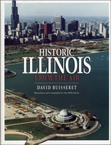
Historic Illinois from the Air
David Buisseret
University of Chicago Press, 1990
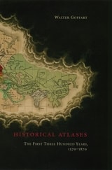
Historical Atlases
The First Three Hundred Years, 1570-1870Walter Goffart
University of Chicago Press, 2003
Beginning in the sixteenth century, and continuing down to the late nineteenth, Walter Goffart discusses milestones in the origins of historical atlases as well as individual maps illustrating historical events in alternating, paired chapters. He focuses on maps of the medieval period because the development of maps for history hinged particularly on portrayals of this segment of the postclassical, "modern" past. Goffart concludes the book with a detailed catalogue of more than 700 historical maps and atlases produced from 1570 to 1870.
Historical Atlases will immediately take its place as the single most important reference on its subject. Historians of cartography, medievalists, and anyone seriously interested in the role of maps in portraying history will find it invaluable.
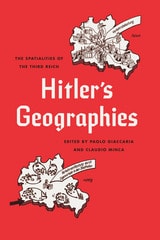
Hitler's Geographies
The Spatialities of the Third ReichEdited by Paolo Giaccaria and Claudio Minca
University of Chicago Press, 2016
With Hitler’s Geographies, editors Paolo Giaccaria and Claudio Minca examine the variety of ways in which spatial theory evolved and was translated into real-world action under the Third Reich. They have gathered an outstanding collection by leading scholars, presenting key concepts and figures as well exploring the undeniable link between biopolitical power and spatial expansion and exclusion.
How Green Became Good
Urbanized Nature and the Making of Cities and CitizensHillary Angelo
University of Chicago Press, 2021

How Oceans Become
Histories and Futures of the High Seas and Deep OceansThomas Brandt, Knut Ove Eliassen, Mats Ingulstad, Gard Paulsen
University of Chicago Press, 0
An anthology grounded in the idea that oceans are human realities, shaped by human interests, interactions, and technologies.
Historically and geographically diverse, oceans exist in the plural. Oceans become oceans through how they are represented, what resources they are deemed to hold, and the regulatory governance to which they are subjected. These are the three key components of “ocean making” this volume employs to shed light on the complex issues facing ocean governance today.
The anthology reaches back to the oceans of the early modern European expansion and up to the current concerns of anthropogenic changes and resource depletion. Chapters address activities and regulatory concerns regarding maritime transport, fisheries, deep-sea mining, wave energy, and whaling, and span from the southern oceans around Antarctica to the current shedding of the icy mantle of the Arctic Ocean. By drawing together scholars from a wide range of disciplines—including history, comparative literature, media studies, political science, law, and anthropology—How Oceans Become opens a multi-layered, interdisciplinary approach to studying the oceans’ entanglements with human cultures and societies.
How We See the Sky
A Naked-Eye Tour of Day and NightThomas Hockey
University of Chicago Press, 2002
Gazing up at the heavens from our backyards or a nearby field, most of us see an undifferentiated mess of stars—if, that is, we can see anything at all through the glow of light pollution. Today’s casual observer knows far less about the sky than did our ancestors, who depended on the sun and the moon to tell them the time and on the stars to guide them through the seas. Nowadays, we don’t need the sky, which is good, because we’ve made it far less accessible, hiding it behind the skyscrapers and the excessive artificial light of our cities.
How We See the Sky gives us back our knowledge of the sky, offering a fascinating overview of what can be seen there without the aid of a telescope. Thomas Hockey begins by scanning the horizon, explaining how the visible universe rotates through this horizon as night turns to day and season to season. Subsequent chapters explore the sun’s and moon’s respective motions through the celestial globe, as well as the appearance of solstices, eclipses, and planets, and how these are accounted for in different kinds of calendars. In every chapter, Hockey introduces the common vocabulary of today’s astronomers, uses examples past and present to explain them, and provides conceptual tools to help newcomers understand the topics he discusses.
Packed with illustrations and enlivened by historical anecdotes and literary references, How We See the Sky reacquaints us with the wonders to be found in our own backyards.
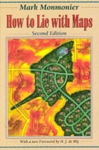
How to Lie with Maps
Mark Monmonier
University of Chicago Press, 1996
The second edition is updated with the addition of two new chapters, 10 color plates, and a new foreword by renowned geographer H. J. de Blij. One new chapter examines the role of national interest and cultural values in national mapping organizations, including the United States Geological Survey, while the other explores the new breed of multimedia, computer-based maps.
To show how maps distort, Monmonier introduces basic principles of mapmaking, gives entertaining examples of the misuse of maps in situations from zoning disputes to census reports, and covers all the typical kinds of distortions from deliberate oversimplifications to the misleading use of color.
"Professor Monmonier himself knows how to gain our attention; it is not in fact the lies in maps but their truth, if always approximate and incomplete, that he wants us to admire and use, even to draw for ourselves on the facile screen. His is an artful and funny book, which like any good map, packs plenty in little space."—Scientific American
"A useful guide to a subject most people probably take too much for granted. It shows how map makers translate abstract data into eye-catching cartograms, as they are called. It combats cartographic illiteracy. It fights cartophobia. It may even teach you to find your way. For that alone, it seems worthwhile."—Christopher Lehmann-Haupt, The New York Times
". . . witty examination of how and why maps lie. [The book] conveys an important message about how statistics of any kind can be manipulated. But it also communicates much of the challenge, aesthetic appeal, and sheer fun of maps. Even those who hated geography in grammar school might well find a new enthusiasm for the subject after reading Monmonier's lively and surprising book."—Wilson Library Bulletin
"A reading of this book will leave you much better defended against cheap atlases, shoddy journalism, unscrupulous advertisers, predatory special-interest groups, and others who may use or abuse maps at your expense."—John Van Pelt, Christian Science Monitor
"Monmonier meets his goal admirably. . . . [His] book should be put on every map user's 'must read' list. It is informative and readable . . . a big step forward in helping us to understand how maps can mislead their readers."—Jeffrey S. Murray, Canadian Geographic
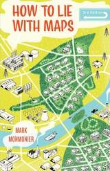
How to Lie with Maps, Third Edition
Mark Monmonier
University of Chicago Press, 2018
Fully updated for the digital age, this new edition of How to Lie with Maps examines the myriad ways that technology offers new opportunities for cartographic mischief, deception, and propaganda. While retaining the same brevity, range, and humor as its predecessors, this third edition includes significant updates throughout as well as new chapters on image maps, prohibitive cartography, and online maps. It also includes an expanded section of color images and an updated list of sources for further reading.
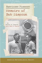
Hurricane Pioneer
Memoirs of Bob SimpsonRobert H. Simpson with Neal M. Dorst
American Meteorological Society, 2014
For Simpson this was just one of his many pioneering explorations of hurricanes and extreme storms. Over his decades-long career his research led to great leaps in our understanding of tropical meteorology and our approach to hurricane safety. He was the first director of the National Hurricane Research Project and the second director of the National Hurricane Center, though he may be best known as co-creator of the widely used Saffir-Simpson Hurricane Scale, familiar to anyone who has heard a reporter use the words “category five.”
Simpson’s memoirs take readers from his experience with the Corpus Christi hurricane of 1919 to his travels to study weather across the globe. Along the way he crosses paths with other weather greats, including his trailblazing wife, meteorologist Joanne Simpson. Hurricane Pioneer is a riveting first-hand account at a revolutionary time in meteorology.