Results by title
152 books match the query 'Cartography' and 24 start with m
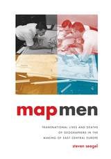
Map Men
Transnational Lives and Deaths of Geographers in the Making of East Central EuropeSteven Seegel
University of Chicago Press, 2018
Taking us deep into cartographical archives, Seegel re-creates the public and private worlds of these five mapmakers, who interacted with and influenced one another even as they played key roles in defining and redefining borders, territories, nations—and, ultimately, the interconnection of the world through two world wars. Throughout, he examines the transnational nature of these processes and addresses weighty questions about the causes and consequences of the world wars, the rise of Nazism and Stalinism, and the reasons East Central Europe became the fault line of these world-changing developments.
At a time when East Central Europe has surged back into geopolitical consciousness, Map Men offers a timely and important look at the historical origins of how the region was defined—and the key people who helped define it.
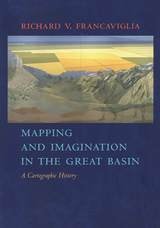
Mapping And Imagination In The Great Basin
A Cartographic HistoryRichard V. Francaviglia
University of Nevada Press, 2005
The Great Basin was the last region of continental North America to be explored and mapped, and it remained largely a mystery to Euro-Americans until well into the nineteenth century. In Mapping and Imagination in the Great Basin, geographer-historian Richard Francaviglia shows how the Great Basin gradually emerged from its “cartographic silence” as terra incognita and how this fascinating process both paralleled the development of the sciences of surveying, geology, hydrology, and cartography and reflected the changing geopolitical aspirations of the European colonial powers and the United States. Francaviglia’s interdisciplinary account of the mapping of the Great Basin combines a chronicle of the exploration of the region with a history of the art and science of cartography and of the political, economic, and cultural contexts in which maps are created. It also offers a compelling, wide-ranging discussion that combines a description of the daunting physical realities of the Great Basin with a cogent examination of the ways humans, from early Native Americans to nineteenth-century surveyors to twentieth-century highway and air travelers, have understood, defined, and organized this space, psychologically and through the medium of maps. Mapping and Imagination in the Great Basin continues Francaviglia’s insightful, richly nuanced meditation on the Great Basin landscape that began in Believing in Place.
Mapping Crisis
Participation, Datafication and Humanitarianism in the Age of Digital MappingEdited by Doug Specht
University of London Press, 2020
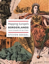
Mapping Europe's Borderlands
Russian Cartography in the Age of EmpireSteven Seegel
University of Chicago Press, 2012
Mapping Historical Las Vegas
A Cartographic JourneyJoe Weber
University of Nevada Press, 2022
Reaching past the city limits, Mapping Historical Las Vegas also examines the development of public lands, military bases, and the canyons and valleys of the Colorado River before the Hoover Dam was built and Lake Mead was created. Weber also includes information on dams, highways, railroads, and other projects that were planned but never constructed— showing what might have been in one of the nation’s largest cities.
With 137 color maps generated using Geographic Information Systems, along with extensive mapping by Weber that draws on his decades of experience in the region, Mapping Historical Las Vegas offers a unique perspective on one of the world’s most famous desert cities.
Mapping It Out
Expository Cartography for the Humanities and Social SciencesMark Monmonier
University of Chicago Press, 1993
In his acclaimed How to Lie with Maps, Mark Monmonier showed how maps can distort facts. In Mapping it Out: Expository Cartography for the Humanities and Social Sciences, he shows authors and scholars how they can use expository cartography—the visual, two-dimensional organization of information—to heighten the impact of their books and articles.
This concise, practical book is an introduction to the fundamental principles of graphic logic and design, from the basics of scale to the complex mapping of movement or change. Monmonier helps writers and researchers decide when maps are most useful and what formats work best in a wide range of subject areas, from literary criticism to sociology. He demonstrates, for example, various techniques for representing changes and patterns; different typefaces and how they can either clarify or confuse information; and the effectiveness of less traditional map forms, such as visibility base maps, frame-rectangle symbols, and complementary scatterplot designs for conveying complex spatial relationships.
There is also a wealth of practical information on map compilation, cartobibliographies, copyright and permissions, facsimile reproduction, and the evaluation of source materials. Appendixes discuss the benefits and limitations of electronic graphics and pen-and-ink drafting, and how to work with a cartographic illustrator.
Clearly written, and filled with real-world examples, Mapping it Out demystifies mapmaking for anyone writing in the humanities and social sciences.
"A useful guide to a subject most people probably take too much for granted. It shows how map makers translate abstract data into eye-catching cartograms, as they are called. It combats cartographic illiteracy. It fights cartophobia. It may even teach you to find your way."—Christopher Lehmann-Haupt, The New York Times
Mapping Latin America
A Cartographic ReaderEdited by Jordana Dym and Karl Offen
University of Chicago Press, 2011
For many, a map is nothing more than a tool used to determine the location or distribution of something—a country, a city, or a natural resource. But maps reveal much more: to really read a map means to examine what it shows and what it doesn’t, and to ask who made it, why, and for whom. The contributors to this new volume ask these sorts of questions about maps of Latin America, and in doing so illuminate the ways cartography has helped to shape this region from the Rio Grande to Patagonia.
In Mapping Latin America,Jordana Dym and Karl Offen bring together scholars from a wide range of disciplines to examine and interpret more than five centuries of Latin American maps.Individual chapters take on maps of every size and scale and from a wide variety of mapmakers—from the hand-drawn maps of Native Americans, to those by famed explorers such as Alexander von Humboldt, to those produced in today’s newspapers and magazines for the general public. The maps collected here, and the interpretations that accompany them, provide an excellent source to help readers better understand how Latin American countries, regions, provinces, and municipalities came to be defined, measured, organized, occupied, settled, disputed, and understood—that is, how they came to have specific meanings to specific people at specific moments in time.
The first book to deal with the broad sweep of mapping activities across Latin America, this lavishly illustrated volume will be required reading for students and scholars of geography and Latin American history, and anyone interested in understanding the significance of maps in human cultures and societies.
Mapping Nature across the Americas
Edited by Kathleen A. Brosnan & James R. Akerman
University of Chicago Press, 2021
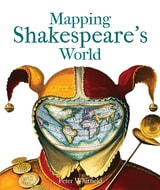
Mapping Shakespeare's World
Peter Whitfield
Bodleian Library Publishing, 2015
Mapping Shakespeare’s World explores these questions with surprising results. It has often been said that setting is irrelevant to Shakespeare’s plays—that, wherever they are set, their enduring appeal lies in their ability to speak to broad questions of human nature. Peter Whitfield shows that, on the contrary, many of Shakespeare’s locations were carefully chosen for their ability to convey subtle meanings an Elizabethan audience would have picked up on and understood. Through the use of paintings, drawings, contemporary maps and geographical texts, Whitfield suggests answers to such questions as where Illyria was located, why The Merry Wives of Windsor could only have taken place in Windsor, and how two utterly different comedies—The Comedy of Errors and Pericles, Prince of Tyre—both came to take place in ancient Ephesus.
Just when one might think there was nothing more to be said about Shakespeare, with Mapping Shakespeare’s World, Whitfield offers a fascinating new point of view.
Mapping Society
The Spatial Dimensions of Social CartographyLaura Vaughan
University College London, 2018
Mapping Wonderlands
Illustrated Cartography of Arizona, 1912–1962Dori Griffin
University of Arizona Press, 2013
Mapping Wonderlands fills part of this gap in existing regional studies by looking at early popular pictorial maps of Arizona. These cartographic representations of the state utilize formal mapmaking conventions to create a place-based state history. They introduce illustrations, unique naming conventions, and written narratives to create carefully visualized landscapes that emphasize the touristic aspects of Arizona.
Analyzing the visual culture of tourism in illuminating detail, this book documents how Arizona came to be identified as an appealing tourism destination. Providing a historically situated analysis, Dori Griffin draws on samples from a comprehensive collection of materials generated to promote tourism during Arizona’s first half-century of statehood. She investigates the relationship between natural and constructed landscapes, visual culture, and narratives of place. Featuring sixty-six examples of these aesthetically appealing maps, the book details how such maps offered tourists and other users a cohesive and storied image of the state. Using historical documentation and rhetorical analysis, this book combines visual design and historical narrative to reveal how early-twentieth-century mapmakers and map users collaborated to imagine Arizona as a tourist’s paradise.
Mapping an Empire
The Geographical Construction of British India, 1765-1843Matthew H. Edney
University of Chicago Press, 1997
"There is much to be praised in this book. It is an excellent history of how India came to be painted red in the nineteenth century. But more importantly, Mapping an Empire sets a new standard for books that examine a fundamental problem in the history of European imperialism."—D. Graham Burnett, Times Literary Supplement
"Mapping an Empire is undoubtedly a major contribution to the rapidly growing literature on science and empire, and a work which deserves to stimulate a great deal of fresh thinking and informed research."—David Arnold, Journal of Imperial and Commonwealth History
"This case study offers broadly applicable insights into the relationship between ideology, technology and politics. . . . Carefully read, this is a tale of irony about wishful thinking and the limits of knowledge."—Publishers Weekly
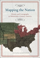
Mapping the Nation
History and Cartography in Nineteenth-Century AmericaSusan Schulten
University of Chicago Press, 2012
In the nineteenth century, Americans began to use maps in radically new ways. For the first time, medical men mapped diseases to understand and prevent epidemics, natural scientists mapped climate and rainfall to uncover weather patterns, educators mapped the past to foster national loyalty among students, and Northerners mapped slavery to assess the power of the South. After the Civil War, federal agencies embraced statistical and thematic mapping in order to profile the ethnic, racial, economic, moral, and physical attributes of a reunified nation. By the end of the century, Congress had authorized a national archive of maps, an explicit recognition that old maps were not relics to be discarded but unique records of the nation’s past.
All of these experiments involved the realization that maps were not just illustrations of data, but visual tools that were uniquely equipped to convey complex ideas and information. In Mapping the Nation, Susan Schulten charts how maps of epidemic disease, slavery, census statistics, the environment, and the past demonstrated the analytical potential of cartography, and in the process transformed the very meaning of a map.
Today, statistical and thematic maps are so ubiquitous that we take for granted that data will be arranged cartographically. Whether for urban planning, public health, marketing, or political strategy, maps have become everyday tools of social organization, governance, and economics. The world we inhabit—saturated with maps and graphic information—grew out of this sea change in spatial thought and representation in the nineteenth century, when Americans learned to see themselves and their nation in new dimensions.
Maps and Civilization
Cartography in Culture and Society, Third EditionNorman J. W. Thrower
University of Chicago Press, 2008
The third edition of Maps and Civilization incorporates numerous revisions, features new material throughout the book, and includes a new alphabetized bibliography.
Praise for previous editions of Maps and Civilization:
“A marvelous compendium of map lore. Anyone truly interested in the development of cartography will want to have his or her own copy to annotate, underline, and index for handy referencing.”—L. M. Sebert, Geomatica
Maps and Politics
Jeremy Black
University of Chicago Press, 1997

Maps in Tudor England
P. D. A. Harvey
University of Chicago Press, 1993
In Maps in Tudor England, P. D. A. Harvey traces this revolution of production, understanding, and use of maps in England from 1485 to 1603. By the mid-sixteenth century, mapmapers had begun to draw maps to a consistent scale, reproducing the results of measured survey. By the end of the century, maps drawn to scale and showing features by conventional signs were commonly used throughout England.
In this survey Harvey focuses on maps of small areas, up to the size of a county, exploring their impact on the political and social life of England in the spheres of the military, government, towns, landed estates, buildings, and the law. Richly illustrated with thirty color and fifty black and white reproductions of rare maps, his account is an informative and accessible introduction to this revolutionary period in the history of cartography, as well as a unique visual history of Tudor England.
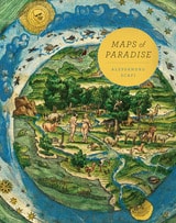
Maps of Paradise
Alessandro Scafi
University of Chicago Press, 2013
Maps of Paradise charts the diverse ways in which scholars and mapmakers from the eighth to the twenty-first century rose to the challenge of identifying the location of paradise on a map, despite the certain knowledge that it was beyond human reach. Over one hundred illustrations celebrate this history of a paradox: the mapping of the unmappable. It is also a mirror to the universal dream of perfection and happiness, and the yearning to discover heaven on earth.
Maps with the News
The Development of American Journalistic CartographyMark Monmonier
University of Chicago Press, 1989
"A most welcome and thorough investigation of a neglected aspect of both the history of cartography and modern cartographic practice."—Mapline
"A well-written, scholarly treatment of journalistic cartography. . . . It is well researched, thoroughly indexed and referenced . . . amply illustrated."—Judith A. Tyner, Imago Mundi
"There is little doubt that Maps with the News should be part of the training and on the desks of all those concerned with producing maps for mass consumption, and also on the bookshelves of all journalists, graphic artists, historians of cartography, and geographic educators."—W. G. V. Balchin, Geographical Journal
"A definitive work on journalistic cartography."—Virginia Chipperfield, Society of University Cartographers Bulletin
Maps
Finding Our Place in the WorldEdited by James R. Akerman and Robert W. Karrow Jr.
University of Chicago Press, 2007
The book begins by examining the use of maps for wayfinding, revealing that even maps as common and widely used as these are the product of historical circumstances and cultural differences. The second chapter considers maps whose makers employed the smallest of scales to envision the broadest of human stages—the world, the heavens, even the act of creation itself. The next chapter looks at maps that are, literally, at the opposite end of the scale from cosmological and world maps—maps that represent specific parts of the world and provide a close-up view of areas in which their makers lived, worked, and moved.
Having shown how maps help us get around and make sense of our greater and lesser worlds, Maps then turns to the ways in which certain maps can be linked to particular events in history, exploring how they have helped Americans, for instance, to understand their past, cope with current events, and plan their national future. The fifth chapter considers maps that represent data from scientific instruments, population censuses, and historical records. These maps illustrate, for example, how diseases spread, what the ocean floor looks like, and how the weather is tracked and predicted. Next comes a turn to the imaginary, featuring maps that depict entire fictional worlds, from Hell to Utopia and from Middle Earth to the fantasy game World of Warcraft. The final chapter traces the origins of map consumption throughout history and ponders the impact of cartography on modern society.
A companion volume to the most ambitious exhibition on the history of maps ever mounted in North America, Maps will challenge readers to stretch conventional thought about what constitutes a map and how many different ways we can understand graphically the environment in which we live. Collectors, historians, mapmakers and users, and anyone who has ever “gotten lost” in the lines and symbols of a map will find much to love and learn from in this book.
Mastering the Niger
James MacQueen's African Geography and the Struggle over Atlantic SlaveryDavid Lambert
University of Chicago Press, 2013
Masters of All They Surveyed
Exploration, Geography, and a British El DoradoD. Graham Burnett
University of Chicago Press, 2000
In answering these questions, D. Graham Burnett brings to light the work of several such explorers, particularly Sir Robert H. Schomburgk, the man who claimed to be the first to reach the site of Ralegh's El Dorado. Commissioned by the Royal Geographical Society and later by the British Crown, Schomburgk explored and mapped regions in modern Brazil, Venezuela, and Guyana, always in close contact with Amerindian communities. Drawing heavily on the maps, reports, and letters that Schomburgk sent back to England, and especially on the luxuriant images of survey landmarks in his Twelve Views in the Interior of Guiana (reproduced in color in this book), Burnett shows how a vast network of traverse surveys, illustrations, and travel narratives not only laid out the official boundaries of British Guiana but also marked out a symbolic landscape that fired the British imperial imagination.
Engagingly written and beautifully illustrated, Masters of All They Surveyed will interest anyone who wants to understand the histories of colonialism and science.
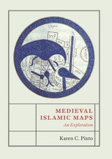
Medieval Islamic Maps
An ExplorationKaren C. Pinto
University of Chicago Press, 2016
Pinto focuses on the distinct tradition of maps known collectively as the Book of Roads and Kingdoms (Kitab al-Masalik wa al-Mamalik, or KMMS), examining them from three distinct angles—iconography, context, and patronage. She untangles the history of the KMMS maps, traces their inception and evolution, and analyzes them to reveal the identities of their creators, painters, and patrons, as well as the vivid realities of the social and physical world they depicted. In doing so, Pinto develops innovative techniques for approaching the visual record of Islamic history, explores how medieval Muslims perceived themselves and their world, and brings Middle Eastern maps into the forefront of the study of the history of cartography.
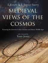
Medieval Views of the Cosmos
E. Edson and E. Savage-Smith
Bodleian Library Publishing, 2004
In the medieval world system—inherited by Christians and Muslims from the Greeks and Romans, and modified by their own religious tenets—spheres bearing the planets and stars wheeled around the earth, and at every level there was a moral lesson for humanity and a satisfying metaphor for the nature of God. The authors of this volume explain how the medieval view of the universe was harmonious on theological and practical levels, providing answers to the most puzzling of questions.
Medieval Views of the Cosmos is an engaging and beautifully illustrated introduction to a world where every moment was a theater of human drama directed by the hand of God.
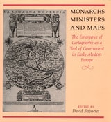
Monarchs, Ministers, and Maps
The Emergence of Cartography as a Tool of Government in Early Modern EuropeEdited by David Buisseret
University of Chicago Press, 1992
consolidate their power realized that better knowledge of
their lands would strengthen their control over them. By
1550, the cartographer's art had already become an important
instrument for bringing territories under the control of
centralized government; increasing governmental reliance on
maps stimulated the refinement of cartographic techniques
throughout the following century.
This volume, a detailed survey of the political uses of
cartography between 1400 and 1700 in Italy, France, England,
Poland, Austria, and Spain, answers these questions: When
did monarchs and ministers begin to perceive that maps could
be useful in government? For what purposes were maps
commissioned? How accurate and useful were they? How did
cartographic knowledge strengthen the hand of government?
The chapters offer new insights into the development of
cartography and its role in European history.
Contributors to the volume are John Marino, Peter
Barber, David Buisseret, Geoffrey Parker, James Vann, and
Michael J. Mikòs.