Results by title
153 books match the query 'Cities and towns' and 9 start with p
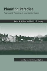
Planning Paradise
Politics and Visioning of Land Use in OregonBy Peter A. Walker and Patrick T. Hurley
University of Arizona Press, 2011
Oregon is one of the nation’s most celebrated exceptions. In the early 1970s Oregon established the nation’s first and only comprehensive statewide system of land-use planning and largely succeeded in confining residential and commercial growth to urban areas while preserving the state’s rural farmland, forests, and natural areas. Despite repeated political attacks, the state’s planning system remained essentially politically unscathed for three decades. In the early- and mid-2000s, however, the Oregon public appeared disenchanted, voting repeatedly in favor of statewide ballot initiatives that undermined the ability of the state to regulate growth. One of America’s most celebrated “success stories” in the war against sprawl appeared to crumble, inspiring property rights activists in numerous other western states to launch copycat ballot initiatives against land-use regulation.
This is the first book to tell the story of Oregon’s unique land-use planning system from its rise in the early 1970s to its near-death experience in the first decade of the 2000s. Using participant observation and extensive original interviews with key figures on both sides of the state’s land use wars past and present, this book examines the question of how and why a planning system that was once the nation’s most visible and successful example of a comprehensive regulatory approach to preventing runaway sprawl nearly collapsed.
Planning Paradise is tough love for Oregon planning. While admiring much of what the state’s planning system has accomplished, Walker and Hurley believe that scholars, professionals, activists, and citizens engaged in the battle against sprawl would be well advised to think long and deeply about the lessons that the recent struggles of one of America’s most celebrated planning systems may hold for the future of land-use planning in Oregon and beyond.

Political Economy of the Urban Ghetto
Daniel R. Fusfeld and Timothy Bates
Southern Illinois University Press, 1984
The income of blacks in most northern industrial states today is lower relative to the income of whites than in 1949.Fusfeld and Bates examine the forces that have led to this state of affairs and find that these economic relationships are the product of a complex pattern of historical development and change in which black-white economic relationships play a major part, along with patterns of industrial, agricultural, and technological change and urban development. They argue that today’s urban racial ghettos are the result of the same forces that created modern America and that one of the by-products of American affluence is a ghettoized racial underclass.
These two themes, they state, are essential for an understanding of the problem and for the formulation of policy. Poverty is not simply the result of poor education, skills, and work habits but one outcome of the structure and functioning of the economy. Solutions require more than policies that seek to change people: they await a recognition that basic economic relationships must be changed.
Population Trends in New Jersey
James W. Hughes
Rutgers University Press, 2022
The authors also highlight key trends that will continue to transform the state: domestic migration out of the state and immigration into it; increasing diversity; slower overall population growth; contracting fertility; the household revolution and changing living arrangements; generational disruptions; and suburbanization versus re-urbanization. All of these factors help place in context the result of the 2020 decennial U.S. Census.
While the book focuses on New Jersey, the Garden State is a template of demographic, economic, social, and other forces characterizing the United States in the twenty-first century.
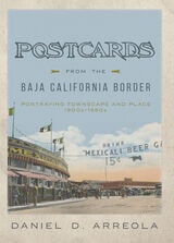
Postcards from the Baja California Border
Portraying Townscape and Place, 1900s–1950sDaniel D. Arreola
University of Arizona Press, 2021
This form of place study calls attention to how we can see a past through a serial view of places, by the nature of repetition, and the photographing of the same place over and over again. Arreola draws our focus to townscapes, or built landscapes, of four border towns—Tijuana, Mexicali, Tecate, and Algodones—during the first half of the twentieth century. With an emphasis on the tourist’s view of these places, this book creates a vivid picture of what life was like for tourists and residents of these towns in the early and mid-twentieth century. Postcards from the Baja California Border is a rich and fascinating experience, one that takes you on a time-travel journey through border town histories and geographies while celebrating the visual intrigue of postcards.
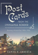
Postcards from the Chihuahua Border
Revisiting a Pictorial Past, 1900s–1950sDaniel D. Arreola
University of Arizona Press, 2019
In Postcards from the Chihuahua Border Daniel D. Arreola captures the exhilaration of places in time, taking us back to Mexico’s northern border towns of Cuidad Juárez, Ojinaga, and Palomas in the early twentieth century. Drawing on more than three decades of archival work, Arreola uses postcards and maps to unveil the history of these towns along west Texas’s and New Mexico’s southern borders.
Postcards offer a special kind of visual evidence. Arreola’s collection of imagery and commentary about them shows us singular places, enriching our understandings of history and the history of change in Chihuahua. No one postcard tells the entire story. But image after image offers a collected view and insight into changing perceptions. Arreola’s geography of place looks both inward and outward. We see what tourists see, while at the same time gaining insight about what postcard photographers and postcard publishers wanted to be seen and perceived about these border communities.
Postcards from the Chihuahua Border is a colorful and dynamic visual history. It invites the reader to time travel, to revisit another era—the first half of the last century—when these border towns were framed and made popular through picture postcards.
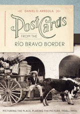
Postcards from the Río Bravo Border
Picturing the Place, Placing the Picture, 1900s–1950sBy Daniel D. Arreola
University of Texas Press, 2013
Between 1900 and the late 1950s, Mexican border towns came of age both as tourist destinations and as emerging cities. Commercial photographers produced thousands of images of their streets, plazas, historic architecture, and tourist attractions, which were reproduced as photo postcards. Daniel Arreola has amassed one of the largest collections of these border town postcards, and in this book, he uses this amazing visual archive to offer a new way of understanding how the border towns grew and transformed themselves in the first half of the twentieth century, as well as how they were pictured to attract American tourists.
Postcards from the Río Bravo Border presents nearly two hundred images of five significant towns on the lower Río Bravo—Matamoros, Reynosa, Nuevo Laredo, Piedras Negras, and Villa Acuña. Using multiple images of sites within each city, Arreola tracks changes both within the cities as places and in the ways in which the cities have been pictured for tourist consumption. He makes a strong case that visual imagery has a shaping influence on how we negotiate and think about places, creating a serial scripting or narrating of the place. Arreola also shows how postcard images, when systematically and chronologically arranged, can tell us a great deal about how Mexican border towns have been viewed over time. This innovative visual approach demonstrates that historical imagery, no less than text or maps, can be assembled to tell a compelling geographical story about place and time.
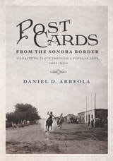
Postcards from the Sonora Border
Visualizing Place Through a Popular Lens, 1900s–1950sDaniel D. Arreola
University of Arizona Press, 2017
Young men ride horses on a dusty main road through town. Cars and gas stations gradually intrude on the land, and, years later, curiosity shops and cantinas change the face of Mexican border towns south of Arizona. Between 1900 and the late 1950s, Mexican border towns came of age both as centers of commerce and as tourist destinations. Postcards from the Sonora Border reveals how images—in this case the iconic postcard—shape the way we experience and think about place.
Making use of his personal collection of historic images, Daniel D. Arreola captures the evolution of Sonoran border towns, creating a sense of visual “time travel” for the reader. Supported by maps and visual imagery, the author shares the geographical and historical story of five unique border towns—Agua Prieta, Naco, Nogales, Sonoyta, and San Luis Río Colorado.
Postcards from the Sonora Border introduces us to these important towns and provides individual stories about each, using the postcards as markers. No one postcard view tells the complete story—rather, the sense of place emerges image by image as the author pulls readers through the collection as an assembled view. Arreola reveals how often the same locations and landmarks of a town were photographed as postcard images generation after generation, giving a long and dynamic view of the inhabitants through time. Arranged chronologically, Arreola’s postcards allow us to discover the changing perceptions of place in the borderlands of Sonora, Mexico.
Preserving and Enhancing Communities
A Guide for Citizens, Planners, and PolicymakersElisabeth M. Hamin
University of Massachusetts Press, 2007
This book starts from the premise that each community chooses its future every day, through the incremental decisions made by planning and zoning boards and other citizen volunteers, as well as professional staff. The challenge is to ensure that these decisions support the preservation of what is special about the community, while still fostering necessary and appropriate growth.
In this volume, twenty-nine experts from a variety of fields describe in very practical terms the “community preservation” approach to these issues. As opposed to the top-down regulatory mechanisms that are sometimes used to manage growth, the contributors favor a more flexible, locally based approach that has proven successful in Massachusetts and elsewhere. They show how residents can be empowered to become involved in local decision-making, building coalitions and expressing their views on a wide range of issues, such as zoning, water and land protection, transportation, historic preservation, economic diversity, affordable housing, and reuse of brown-fields. When done properly, development can enhance the sense of place and provide needed homes and jobs. Done improperly, it can generate sprawl and a multitude of problems.
Preserving and Enhancing Communities will be particularly useful to members of planning and other regulatory boards, as well as students of community planning. The book covers not just typical ways of doing things, but also the full spectrum of innovative and emerging practices. Each chapter includes illustrations and case studies, some from Massachusetts and many from other states. The volume concludes with a set of indicators that communities can use to track their progress in community preservation and enhancement.
Prospect Of Cities
John Friedmann
University of Minnesota Press, 2002