Results by title
152 books match the query 'Cartography' and 5 start with w
Waves of Knowing
A Seascape EpistemologyKarin Amimoto Ingersoll
Duke University Press, 2016
When Maps Become the World
Rasmus Grønfeldt Winther
University of Chicago Press, 2020
This book is about the promises and perils of map thinking. Maps are purpose-driven abstractions, discarding detail to highlight only particular features of a territory. By preserving certain features at the expense of others, they can be used to reinforce a privileged position.
When Maps Become the World shows us how the scientific theories, models, and concepts we use to intervene in the world function as maps, and explores the consequences of this, both good and bad. We increasingly understand the world around us in terms of models, to the extent that we often take the models for reality. Winther explains how in time, our historical representations in science, in cartography, and in our stories about ourselves replace individual memories and become dominant social narratives—they become reality, and they can remake the world.
Why North Is Up
Map Conventions and Where They Came FromMick Ashworth
Bodleian Library Publishing, 2019
This book tells the story of how widely accepted mapping conventions originated and evolved—from map orientation, projections, typography, and scale, to the use of color, symbols, ways of representing relief, and the treatment of boundaries and place names. It charts the fascinating story of how conventions have changed in response to new technologies and ever-changing mapping requirements, how symbols can be a matter of life or death, why universal acceptance of conventions can be difficult to achieve, and how new mapping conventions are developing to meet the needs of modern cartography. Why North is Up offers an accessible and enlightening guide to the sometimes hidden techniques of map-making through the centuries.
Worldly Consumers
The Demand for Maps in Renaissance ItalyGenevieve Carlton
University of Chicago Press, 2015
Drawing on a variety of sixteenth-century sources, including household inventories, epigrams, dedications, catalogs, travel books, and advice manuals, Worldly Consumers studies how individuals displayed different maps in their homes as deliberate acts of self-fashioning. One citizen decorated with maps of Bruges, Holland, Flanders, and Amsterdam to remind visitors of his military prowess, for example, while another hung maps of cities where his ancestors fought or governed, in homage to his auspicious family history. Renaissance Italians turned domestic spaces into a microcosm of larger geographical places to craft cosmopolitan, erudite identities for themselves, creating a new class of consumers who drew cultural capital from maps of the time.
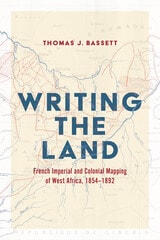
Writing the Land
French Imperial and Colonial Mapping of West Africa, 1854–1892Thomas J. Bassett
University of Chicago Press, 2027
Reveals the intertwined nature of imperial mapping and map history through the making of the colony of French Soudan in nineteenth-century West Africa.
Thomas J. Bassett’s Writing the Land argues that mapping played a key role in France’s territorial conquest of Africa, and that the process of imperial expansion and colonization shaped map history by influencing how maps were constructed, circulated, and used. Analyzing military and surveying campaigns over half a century in an area that became the colony of French Soudan, Bassett focuses on the social and spatial problems that surveyors and mapmakers tried to solve in the process of territorial conquest, as well as the conflicts that arose as they pursued their goals.
In their efforts to obtain this territory, French military leaders, cartographers, and expedition members came into continual contact with local Africans, with whom they negotiated and clashed. Often, imperial officers relied on intermediaries to navigate West African geography, drawing on the knowledge of political authorities, interpreters, guides, and long-distance traders; the maps they produced are inextricable from these interactions. Ultimately, Bassett claims, examining the processes of mapping in the context of these encounters leads us to understand these maps anew as Euro-African constructions, ones that emerge from a complex process of exchange and domination.