Results by title
228 books match the query 'Guidebooks' and 9 start with w

Walking East Harlem
A Neighborhood ExperienceChristopher Bell
Rutgers University Press, 2025
Now East Harlem native Christopher Bell takes you on a tour of his beloved neighborhood. He takes you on three separate walking tours, each visiting a different part of East Harlem and each full of stories about its theaters, museums, art spaces, schools, community centers, churches, mosques, and synagogues. You’ll also learn about the famous people who lived in El Barrio, such as actress Cecily Tyson, opera singer Marian Anderson, portrait artist Alice Neel, incomparable poet Julia De Burgos, and King of Latin Music Tito Puente.
Lavishly illustrated with over fifty photos, Walking East Harlem points out not only the many architectural and cultural landmarks in the neighborhood but also the historical buildings that have since been demolished. Whether you are a tourist or a resident, this guide will give you a new appreciation for El Barrio’s exciting history, cultural diversity, and continued artistic vibrancy.
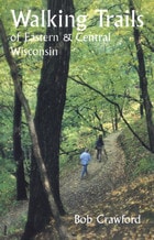
Walking Trails of Eastern and Central Wisconsin
Bob Crawford
University of Wisconsin Press, 1997
A companion to the popular Walking Trails of Southern Wisconsin, this book describes more than 200 trails in 72 locations throughout five of the state's major regions. Bob Crawford provides maps and detailed instructions to make the trails easy to locate.
With each trail description you'll find:
* details about the route and terrain, as well as geographical, biological, or historical features of interest;
* regulations including open days and hours, and rules regarding dogs, trail bikes, cross-country skiing, and other activities;
* information about available restrooms, drinking water, nature centers, and other facilities at the site;
* a description assessing degree of difficulty—slope, width, maintenance, and other such factors—and a helpful rating of "walkability" on a scale from 1 to 5.
The only comprehensive guide to hiking locations in the eastern part of the state, this book also provides lists of trail locations that include playground equipment for kids and picnic facilities for those who want to make a day trip of their hiking outing. Appendices spotlight trails that boast historical significance, ice age features, picnic areas, and cross-country skiing opportunities.
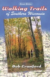
Walking Trails of Southern Wisconsin
Bob Crawford
University of Wisconsin Press, 2000
Take a walk on the wild side with the completely updated version of this popular guide.
This edition now includes coverage of Lafayette and Vernon counties, plus new information on more trails, including ones at Avoca Prairie Savanna State Natural Area, Wildcat Mountain State Park, and Blackhawk Lake Recreational Area. Author Bob Crawford has also revised eleven trail maps in nine counties and updated material throughout the book, which now describes more than 150 trails at more than sixty locations.
These trails wind across southern Wisconsin—into forests and along shores, over glacial formations and around Native American earthworks—and showcase some of the most beautiful and interesting walking trails in the nation. Walking Trails of Southern Wisconsin retains its handy, pocket-sized format plus all the other features that made the first edition so successful:
• details about routes and terrain plus geographical, biological, or historical features of interest
• regulations including open days and hours, and rules regarding dogs, trail bikes, cross-country skiing, and other activities
• information about available restrooms, drinking water, nature centers, and other facilities at the site
• a description assessing degree of difficulty—slope, width, maintenance, and other such factors—and a helpful rating of “walkability” on a scale from 1 to 5
Crawford also provides information about nearby parks, preserves, glacial formations, historical sites, tourist attractions, and other points of interest for those who want to turn a hike into a day trip or weekend outing. Staying fit was never so easy nor so much fun.

Walking the Steps Of Cincinnati
A Guide to the Queen City’s Scenic and Historic SecretsMary Anna DuSablon
Ohio University Press, 2014
Walking the Steps of Cincinnati: A Guide to the Queen City’s Scenic and Historic Secrets is a revised and updated version of Mary Anna DuSablon’s original guidebook, first published in 1998. This new edition describes and maps thirty-four walks of varying lengths and levels of difficulty around the neighborhoods of Cincinnati, following scenic or historic routes and taking in many of the city’s more than four hundred sets of steps. Some of these walks follow the same routes laid out by DuSablon in the first edition of the guide; others have been revised to reflect changes in the city and its neighborhoods, the physical condition of the steps, and the scenic views of Cincinnati that they afford; and still others are altogether new.
In writing their descriptions of the walks, authors Connie J. Harrell and John Cicmanec have retraced each path and taken all new photographs of the steps as well as architectural and natural landmarks along the way. Cartographer Brian Balsley has drawn a fresh set of maps, and Roxanne Qualls, vice-mayor of Cincinnati, has graciously written a new foreword.

Wasatch Eleveners
A Hiking and Climbing Guide to the 11,000 foot Mountains of Utah's Wasatch RangeWinters, Randy
University of Utah Press, 2006
This guide provides information on trailhead access, approaches, and routes for every 11,000-foot peak. It includes overview maps of major roads, topographical overview maps, and detailed route maps for each peak. There are also total roundtrip mileages, elevation-gain (or loss) figures, and alternate routes to help hikers plan their adventures.
Featured peaks include North Mount Nebo, South Mount Nebo, Middle Mount Nebo, Mount Timpanogos, 'South' Timpanogos, West American Fork Twin Peak, 'North' Timpanogos, 'South' American Fork Twin Peak, Unnamed 11,383, Unnamed 11,347, East Broads Fork Twin Peak, West Broads Fork Twin Peak, Pfeifferhorn, White Baldy, Sunrise Peak, Unnamed 11,288, Lone Peak, North Peak, Red Baldy, Red Top Mountain, South Thunder, North Thunder, Unnamed 11,137, Monte Cristo Peak, Dromedary Peak, Box Elder Peak, Mount Baldy, Provo Peak, Sugarloaf Mountain, 'East' Provo Peak, Mount Superior, and 'East' American Fork Twin Peak.

Washtenaw County Bike Rides
A Guide to Road Rides in and around Ann ArborJoel D. Howell
University of Michigan Press, 2009
Washtenaw County Bike Rides is ideal for people who are new to the county, are new to bike riding, or simply want to expand their repertoire of rides. All routes described in the book start or end in Washtenaw County and have been selected with a preference for rides outside of the city. All the routes are paved. Joel Howell details the roads, the areas that require caution, the difficulty of the rides, and routes that can be extended for longer rides.
Includes routes and maps for Dixboro, Dexter-Chelsea, Gallup Park, Hell, Huron River Drive, Manchester, Waterloo, East Lansing, and more, as well as an overview map and ride log.
Joel D. Howell is a physician, medical historian, and avid biker who has personally ridden all of the trails featured in the book. He lives in Ann Arbor.
"Two of the strongest predictors of an active lifestyle are convenient access to exercise opportunities, and pleasant and beautiful exercise environments. Joel Howell's book has solved both of these factors with a collection of some of the most beautiful and accessible biking (and running!) routes in the upper Midwest."
---Thomas L. Schwenk, M.D., Chair of Family Medicine, University of Michigan
"This book includes all the main biking routes making it a 'must have' for any cyclist new to the Ann Arbor area. There are also great tidbits of local lore and super photographs that make it a welcome addition to the libraries of cyclists who have ridden these roads countless times."
---Mark Lovejoy, President, Ann Arbor Velo Club
"Howell has performed a genuine service for county residents and visitors. Get moving, Washtenaw!"
---Kenneth Warner, Dean, University of Michigan School of Public Health

Wend Your Way
A Guide To Sites Along The Iowa Mormon TrailL. Matthew Chatterley
University of Iowa Press, 2007
Wend Your Way: A Guide to Sites Along the Mormon Trail tells the story of this great movement through Iowa. Tracing the trail from east to west through 12 counties the guide includes:
• Mormon Trail history for each county•Directs visitors to the 27 interpretive roadside panels that were constructed on the trail by U.S. National Park Service and Iowa Mormon Trails Association
•Reproduces the poignant illustrations that author L. Matthew Chatterley drew for these wayside exhibits
•Provides a map and directions by county to guide travelers to the route of the Mormon Trail, sites of Mormon camps and settlements and the interpretive roadside panels
•Lists other locations in southern Iowa that visitors will want to explore

Wisconsin's Best Breweries and Brewpubs
Searching for the Perfect PintRobin Shepard
University of Wisconsin Press, 2001
This information-packed guidebook introduces you to more than sixty breweries and brewpubs—from the Shipwrecked Brew Pub in Egg Harbor, to smaller craft breweries like Capital Brewery west of Madison, to the world-famous Miller Brewing Company of Milwaukee. Robin Shepard includes descriptions and his personal ratings of some 600 local beers, plus a taster’s chart you can use to record your own preferences.
For each brewpub and brewery site you’ll find:
• a description and brief history, plus any "Don’t miss" features
• names, comments, and ratings for all their specialty beers
• notes on the pub food, with recommendations
• suggestions of other sites to see and activities in the local area
• information about bottling and distribution
• availability of tours, tastings, gift shops, mug clubs, and "growlers"
• address and contact data, including Web sites and GPS coordinates!
Shepard also introduces novices to the brewing process and a wide variety of beer styles. And, you’ll find a list of helpful books and Web sites, as well as information on Wisconsin beer tastings and festivals. As we say in Wisconsin, "So, have a couple a two, three beers, hey?"

Wisconsin's Natural Communities
How to Recognize Them, Where to Find ThemRandy Hoffman
University of Wisconsin Press, 2002
Cattails grow in a marsh, pitcher plants grow in a bog, jewelweed grows in a swamp, right? Do sandhill cranes live among sandy hills? Frogs live near lakes and ponds, but can they live on prairies, too? What is a pine barrens, an oak opening, a calcareous fen?
Wisconsin’s Natural Communities is an invitation to discover, explore, and understand Wisconsin’s richly varied natural environment, from your backyard or neighborhood park to stunning public preserves.Part 1 of the book explains thirty-three distinct types of natural communities in Wisconsin—their characteristic trees, beetles, fish, lichens, butterflies, reptiles, mammals, wildflowers—and the effects of geology, climate, and historical events on these habitats. Part 2 describes and maps fifty natural areas on public lands that are outstanding examples of these many different natural communities: Crex Meadows, Horicon Marsh, Black River Forest, Maribel Caves, Whitefish Dunes, the Blue Hills, Avoca Prairie, the Moquah Barrens and Chequamegon Bay, the Ridges Sanctuary, Cadiz Springs, Devil’s Lake, and many others.
Intended for anyone who has a love for the natural world, this book is also an excellent introduction for students. And, it provides landowners, public officials, and other stewards of our environment with the knowledge to recognize natural communities and manage them for future generations.