Results by title
3 books match the query 'Allen, Steve'
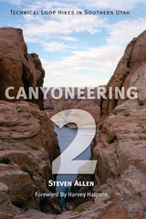
Canyoneering 2
Technical Loop Hikes in Southern UtahSteve Allen
University of Utah Press, 2002
Canyoneering 2: Technical Loop Hikes is a guide to seven, week-long backpack trips into some for the most unspoiled and least-visited areas in the Utah section of the Colorado Plateau. Every hike contains the four essentials of a great canyoneering route: spectacular canyons, intimate narrows, big views, and physical challenge. Although the routes are difficult, newcomers to the canyons will also find detailed information here that can be used to plan less demanding excursions. Hikes include Muddy Creek in the San Rafael Swell, Dirty Devil North, Dirty Devil South, Dark Canyon, White Canyon, Escalante East, and Escalante South. For experienced canyoneers.
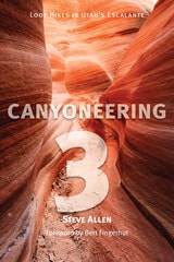
Canyoneering 3
Loop Hikes in Utah’s EscalanteSteve Allen
University of Utah Press, 1997
Utah’s Escalante country: a vast jigsaw puzzle of desert canyons, draws, defiles, gorges, slots, and washes demarcating upland expanses of slickrock, benches, and ridges, above which stand towers, pinnacles, and peaks. Inhabited for centuries by the ancient Puebloans and now managed primarily by various federal agencies, it is a land of stark contrasts and unforgettable beauty.
This guide features 37 major hikes designed to satisfy any canyoneer from novice to expert, including 20 in the new Grand Staircase-Escalante National Monument. All hikes are designed as loops, eliminating the need to backtrack or car shuttle for those inclined to do the full routes. Dayhikers can choose routes from an hour to all day, backpackers will find multi-day hikes, and those who prefer charting their own course will also profit from the information here.
Aside from the detailed route descriptions, Canyoneering 3 describes 14 road sections plus side roads to ensure time will not be lost finding a trailhead in this often confusing country. Also included are sections on geology, history, equipment, and technical canyoneering. Thoroughly researched, this is now the most comprehensive guide to the wonderland of the Escalante.
Hikes include: Death Hollow; Sand Creek; Boulder Mail Trail; Big Flat Wash, the Escalante River, and the Bowington Road; Middle Boulder Creek; Upper Boulder Creek and Dry Hollow; Phipps Wash; Big Horn Canyon; The Escalante River and the Sand Slides; Red Breaks Canyon; Harris Wash; Egypt 3-The Slot; Lower Harris Wash; Fence Canyon, the Escalante River, and Twenty-five Mile Wash; Twenty-five Mile Wash, the Escalante River, and Scorpion Gulch; Spooky and Peek-a-Book Gulches-The Long Loop; Upper Brimstone Gulch-The Slot; Scorpion Gulch and the Scorpion Horse Trail; Peek-a-Boo and Spooky Gulches-The Standard Loop; Coyote Gulch; Stevens Canyon and the Waterpocket Fold; Stevens and Fold Canyons; The Pollywog Bench Area; Forty-mile Creek and Willow Gulch Everett Russ; Fifty-mile Creek; Sixty Point and Twilight Canyon; Llewellyn and Cottonwood Gulches; Davis Gulch; Clear Creek and the Cathedral in the Desert; Deer Creek; Steep Creek and Horse Canyon; The Gulch and Horse Canyon; Little Death Hollow and Wolverine Creek; Egg Canyon and Lamanite Arch; Silver Falls Creek and Choprock Canyon; Deer Point-An Ascent; Moody Creek Canyons
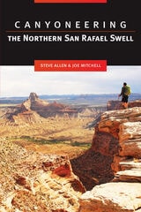
Canyoneering the Northern San Rafael Swell
Steve Allen
University of Utah Press, 2013
A second volume covering the southern portion of the San Rafael Swell is in preparation.