
 A SCHOLARLY BOOK REPOSITORY
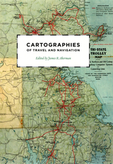
Finding one’s way with a map is a relatively recent phenomenon. In premodern times, maps were used, if at all, mainly for planning journeys in advance, not for guiding travelers on the road. With the exception of navigational sea charts, the use of maps by travelers only became common in the modern era; indeed, in the last two hundred years, maps have become the most ubiquitous and familiar genre of modern cartography.
Examining the historical relationship between travelers, navigation, and maps, Cartographies of Travel and Navigation considers the cartographic response to the new modalities of modern travel brought about by technological and institutional developments in the twentieth century. Highlighting the ways in which the travelers, operators, and planners of modern transportation systems value maps as both navigation tools and as representatives of a radical new mobility, this collection brings the cartography of travel—by road, sea, rail, and air—to the forefront, placing maps at the center of the history of travel and movement.
Richly and colorfully illustrated, Cartographies of Travel and Navigation ably fills the void in historical literature on transportation mapping.
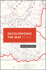
These essays, originally delivered as the 2010 Kenneth Nebenzahl, Jr., Lectures in the History of Cartography at the Newberry Library, encompass more than two centuries and three continents—Latin America, Africa, and Asia. Ranging from the late eighteenth century through the mid-twentieth, contributors study topics from mapping and national identity in late colonial Mexico to the enduring complications created by the partition of British India and the racialized organization of space in apartheid and post-apartheid South Africa. A vital contribution to studies of both colonization and cartography, Decolonizing the Map is the first book to systematically and comprehensively examine the engagement of mapping in the long—and clearly unfinished—parallel processes of decolonization and nation building in the modern world.
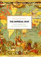
Critically reflecting on elements of mapping and imperialism from the late seventeenth century to the early twentieth century, the essays discuss the nature of the imperial map through a series of case studies of empires, from the Qing dynasty of China, to the Portuguese empire in South America, to American imperial pretensions in the Pacific Ocean, among others. Collectively, the essays reveal that the relationship between mapping and imperialism, as well as the practice of political and economic domination of weak polities by stronger ones, is a rich and complex historical theme that continues to resonate in our modern day.
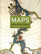
The book begins by examining the use of maps for wayfinding, revealing that even maps as common and widely used as these are the product of historical circumstances and cultural differences. The second chapter considers maps whose makers employed the smallest of scales to envision the broadest of human stages—the world, the heavens, even the act of creation itself. The next chapter looks at maps that are, literally, at the opposite end of the scale from cosmological and world maps—maps that represent specific parts of the world and provide a close-up view of areas in which their makers lived, worked, and moved.
Having shown how maps help us get around and make sense of our greater and lesser worlds, Maps then turns to the ways in which certain maps can be linked to particular events in history, exploring how they have helped Americans, for instance, to understand their past, cope with current events, and plan their national future. The fifth chapter considers maps that represent data from scientific instruments, population censuses, and historical records. These maps illustrate, for example, how diseases spread, what the ocean floor looks like, and how the weather is tracked and predicted. Next comes a turn to the imaginary, featuring maps that depict entire fictional worlds, from Hell to Utopia and from Middle Earth to the fantasy game World of Warcraft. The final chapter traces the origins of map consumption throughout history and ponders the impact of cartography on modern society.
A companion volume to the most ambitious exhibition on the history of maps ever mounted in North America, Maps will challenge readers to stretch conventional thought about what constitutes a map and how many different ways we can understand graphically the environment in which we live. Collectors, historians, mapmakers and users, and anyone who has ever “gotten lost” in the lines and symbols of a map will find much to love and learn from in this book.
READERS
Browse our collection.
PUBLISHERS
See BiblioVault's publisher services.
STUDENT SERVICES
Files for college accessibility offices.
RECENTLY PUBLISHED


UChicago Accessibility Resources
home | accessibility | search | about | contact us
BiblioVault ® 2001 - 2024
The University of Chicago Press