
 A SCHOLARLY BOOK REPOSITORY
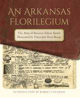
Thirty-five years later, with Smith retired and Bonar long gone from the park service but still drawing, Bonar’s weathered and battered copy of the atlas was seized by a diverse cadre of amateur admirers motivated by fears of its damage or loss. Their fears were certainly justified; after all, the pages were now jammed to the margins with some 3,500 drawings, and the volume had already survived one accidental dunking in an Ozark stream.
An Arkansas Florilegium brings Smith’s and Bonar’s knowledge and lifelong diligence to the world in this unique mix of art, science, and Arkansas saga.

In Atlas of a Threatened Planet, award-winning book and graphic designer Esther Gonstalla digs into these questions and many more through her attractive and easy-to-understand infographics. Gonstalla is known for breaking complex topics into digestible and memorable pieces in her popular “Our World in 50 Graphics” book series. In this book, she turns her designer’s eye to the most critical threats to our environment, from shrinking glaciers and declining biodiversity to shifting ocean currents. These accessible and fun illustrations will show readers that, although the threats are grave, not all is lost. Changes in technology, infrastructure, and our outlook can still help us protect the places we love.
Atlas of a Threatened Planet will spark your curiosity and invite you to see the Earth in a new way. It is written for all who want to understand the interlocking pieces of our home—and fight for the best ideas and strategies to save it.
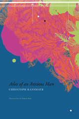
Translated by Simon Pare, this unique account follows Ransmayr across the globe: from the shadow of Java’s volcanoes to the rapids of the Mekong and Danube Rivers, from the drift ice of the Arctic Circle to Himalayan passes, and on to the disenchanted islands of the South Pacific. Ransmayr begins again and again with, “I saw. . .” recounting to the reader the stories of continents, eras, and landscapes of the soul. Like maps, the episodes come together to become a book of the world—one that charts the life and death, happiness and fate of people bound up in images of breathtaking beauty.
“One of the German language’s most gifted young novelists.”—Library Journal, on The Terrors of Ice and Darkness
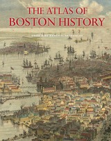
Edited by historian Nancy S. Seasholes, this landmark volume captures all aspects of Boston’s past in a series of fifty-seven stunning full-color spreads. Each section features newly created thematic maps that focus on moments and topics in that history. These maps are accompanied by hundreds of historical and contemporary illustrations and explanatory text from historians and other expert contributors. They illuminate a wide range of topics including Boston’s physical and economic development, changing demography, and social and cultural life. In lavishly produced detail, The Atlas of Boston History offers a vivid, refreshing perspective on the development of this iconic American city.
Contributors
Robert J. Allison, Robert Charles Anderson, John Avault, Joseph Bagley, Charles Bahne, Laurie Baise, J. L. Bell, Rebekah Bryer, Aubrey Butts, Benjamin L. Carp, Amy D. Finstein, Gerald Gamm, Richard Garver, Katherine Grandjean, Michelle Granshaw, James Green, Dean Grodzins, Karl Haglund, Ruth-Ann M. Harris, Arthur Krim, Stephanie Kruel, Kerima M. Lewis, Noam Maggor, Dane A. Morrison, James C. O’Connell, Mark Peterson, Marshall Pontrelli, Gayle Sawtelle, Nancy S. Seasholes, Reed Ueda, Lawrence J. Vale, Jim Vrabel, Sam Bass Warner, Jay Wickersham, and Susan Wilson
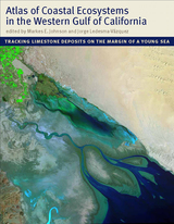
With an emphasis on the intricate workings of the Gulf, a team of scientists led by Markes E. Johnson and Jorge Ledesma-Vázquez explores how marine invertebrates such as corals and bivalves, as well as certain algae, contribute to the operation of a vast “organic engine” that acts as a significant carbon trap. The Atlas reveals that the role of these organisms in the ecology of the Gulf was greatly underestimated in the past. The organisms that live in these environments (or provide the sediments for beaches and dunes) are mass producers of calcium carbonate. Until now, no book has considered the centrality of calcium carbonate production as it functions today across multiple ecosystems and how it has evolved over time.
An important work of scholarship that also evokes the region’s natural splendor, the Atlas will be of interest to a wide range of scientists, including geologists, paleontologists, marine biologists, ecologists, and conservation biologists.
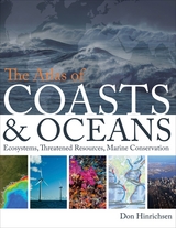
Oceans drive the world’s climate, nurture marine ecosystems full of aquatic life, and provide shipping lanes that have defined the global economy for centuries. And few realize that half of the world’s population lives in a coastal region within easy reach of one. Yet human activities such as commercial fishing, coastal real estate development, and industrial pollution have taken their toll on the seas. The first book of its kind, The Atlas of Coasts and Oceans documents the fraught relationship between humans and the earth’s largest bodies of water—and outlines the conservation steps needed to protect the marine environment for generations to come.
The Atlas offers a fascinating and often sobering account of how urbanization, climate change, offshore oil drilling, shipping routes, global tourism, and maritime conflict have had a profound impact on the world’s oceans and coasts. Combining text and images in visually engaging, thematically organized map spreads, this volume addresses the ecological, environmental, and economic importance of marine phenomena such as coral reefs, eroding shorelines, hurricanes, and fish populations—and how development threatens to destroy the ultimate source of all life on the “blue planet.” Lavishly illustrated with global and regional maps, from the Arabian Gulf to the Great Barrier Reef, from the Black Sea to the Mediterranean, and all the other major global waterways, The Atlas of Coasts and Oceans will be the definitive companion to any study of its subject for years to come.
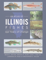
Scientifically up-to-date and illustrated with over 240 color photos, An Atlas of Illinois Fishes is a benchmark in the study of Illinois’s ever-changing fish communities and the habitats that support them.
Atlas of Nevada Conifers is a major scientific contribution to our understanding of the ecology of Nevada. It documents in great detail the distribution of all native conifer species in the state—critical information because of the primary ecological importance of conifers for all organisms and because of the lack of documentation of these distributions in the scientific literature before now. Charlet maps and documents the exact location of herbarium records for 1,600 individual trees. The data found in 23 tables and 22 range maps will serve as a primary reference for botanists, land managers, and conservation biologists for years to come.
This first vegetation atlas for Madagascar, supported by the Critical Ecosystem Partnership Fund, has combined vegetation data from fieldwork and satellite images into a map-based information system. The result is a conservation tool which will help Madagascar’s government and people to plan a more sustainable future. This atlas is also of great use to anyone studying or visiting the island.
Presented in both French and English, the atlas gives a brief history of vegetation mapping in Madagascar; the methodology used in compiling these new maps; and detailed descriptions of each vegetation type, illustrated with photographs and diagrams. Trends in deforestation, extent of occurrence and levels of protection are assessed for each vegetation type. Additional information includes roads, trails, rivers, airports, reserves and a full place name index.
The atlas comprises 36 maps in A3 format, all in high resolution colour.
This dazzling book takes us on a voyage of discovery around the world at the turn of the last millennium, when for the first time the world was in essence a unity. Islam bridged Eurasia, western Europe, and North Africa. Vikings, with links to Scandinavia and Russia, had just arrived in North America. These and other peoples reached out to create links and put isolated cultures unwittingly in touch. John Man vividly captures these epochal events, and depicts the colorful peoples that defined the world’s mix of stability and change, of isolation and contact. In an immensely learned portrayal, he traces enduring cultural strands that became part of the world as we know it today.
In text, maps, and pictures, most in color, and drawing on the expertise of two dozen consultants, John Man has created a concise compendium of all the major cultures of the lost millennial world of 1000. In some cultures—Europe, Islam, China, and Japan—written records contain a vast range of materials, often revealing sharply focused details of life and personality. Here lie startling contrasts with today’s world, and even foreshadowing of the future that are equally astonishing in their familiarity. For nonliterate cultures—in the United States, Southeast Asia, Polynesia, Africa—this book draws on a wealth of archeological research, some of it made available to nonspecialists for the first time.

Terry Root has used the data from the 1963-72 counts to provide the first large-scale biogeographical account of birds wintering in North America. Using sophisticated computer techniques, Root has translated the data into both traditional contour maps and innovative new maps that stimulate three dimensions. The maps show at a glance that, for example, the Baltimore Oriole winters primarily along the eastern seaboard, with the densest populations in Florida between Tallahassee and Gainesville and in North Carolina from Rocky Mount to the Croatan National Forest.
Earlier this year, President Obama declared one of his top priorities to be “making sure that people are able to get enough to eat.” The United States spends about five billion dollars on food aid and related programs each year, but still, both domestically and internationally, millions of people are hungry. In 2006, the Food and Agricultural Organization of the United Nations counted 850 million hungry people worldwide, but as food prices soared, an additional 100 million or more who were vulnerable succumbed to food insecurity.
If hunger were simply a matter of food production, no one would go without. There is more than enough food produced annually to provide every living person with a healthy diet, yet so many suffer from food shortages, unsafe water, and malnutrition every year. That’s because hunger is a complex political, economic, and ecological phenomenon. The interplay of these forces produces a geography of hunger that Thomas J. Bassett and Alex Winter-Nelson illuminate in this empowering book. The Atlas of World Hunger uses a conceptual framework informed by geography and agricultural economics to present a hunger index that combines food availability, household access, and nutritional outcomes into a single tool—one that delivers a fuller understanding of the scope of global hunger, its underlying mechanisms, and the ways in which the goals for ending hunger can be achieved. The first depiction of the geography of hunger worldwide, the Atlas will be an important resource for teachers, students, and anyone else interested in understanding the geography and causes of hunger. This knowledge, the authors argue, is a critical first step toward eliminating unnecessary suffering in a world of plenty.
In this illustrated exploration of Warburg and his great work, Georges Didi-Huberman leaps from Mnemosyne Atlas into a set of musings on the relation between suffering and knowledge in Western thought, and on the creative results of associative thinking. Deploying writing that delights in dramatic jump cuts reminiscent of Warburg’s idiosyncratic juxtapositions, and drawing on a set of sources that ranges from ancient Babylon to Walter Benjamin, Atlas, or the Anxious Gay Science is rich in Didi-Huberman’s trademark combination of elan and insight.
Where do you draw the line? In the context of geopolitics, much hinges on the answer to that question. For thousands of years, it has been the work of diplomats to draw the lines in ways that were most advantageous to their leaders, fellow citizens, and sometimes themselves. Carving Up the Globe offers vivid documentation of their handiwork. With hundreds of full-color maps and other images, this atlas illustrates treaties that have determined the political fates of millions. In rich detail, it chronicles everything from ancient Egyptian and Hittite accords to the first Sino-Tibetan peace in 783 CE, the Sykes-Picot Agreement of 1916, and the 2014 Minsk Protocol looming over the war in Ukraine.
But there is more here than shifting territorial frontiers. Throughout history, diplomats have also drawn boundaries around valuable resources and used treaties to empower, liberate, and constrain. Carving Up the Globe encompasses these agreements, too, across land, sea, and air. Missile and nuclear pacts, environmental treaties, chemical weapons conventions, and economic deals are all carefully rendered.
Led by Malise Ruthven, a team of experts provides lively historical commentary, which—together with finely crafted visuals—conjures the ceaseless ambition of princes and politicians. Whether they sought the glory and riches of empire or pursued hegemony, security, stability, and GDP within the modern international system, their efforts culminated in lines on a map—and the enormous real-life consequences those lines represent and enforce.
Volume IIA of East African Mammals begins a two-part study of East Africa's smallest and least conspicuous mammals. It deals with bats and insectivores, including tenrecs, moles, hedgehogs, and shrews.
In each volume Kingdon combines his text with hundreds of finished drawings and quick sketches, the latter a form of field note that provides an incomparable description of the animal's movements and personality. Kingdom explains his drawings "as a wordless questioning of form. . . . The probing pencil is like the dissecting scalpel, seeking to expose relevant structures that may not be immediately obvious and are certainly hidden from the shadowy world of the camera lens." As an artist, Kingdon's achievement has been compared with Audubon's; as a scientist, his work has made these volumes indispensable to any serious student of East African mammals.
Volume IIB of East African Mammals is a study of some of East Africa's smallest and least conspicuous mammals, hares and rodents.
In each volume Kingdon combines his text with hundreds of finished drawings and quick sketches, the latter a form of field note that provides an incomparable description of the animal's movements and personality. Kingdom explains his drawings "as a wordless questioning of form. . . . The probing pencil is like the dissecting scalpel, seeking to expose relevant structures that may not be immediately obvious and are certainly hidden from the shadowy world of the camera lens." As an artist, Kingdon's achievement has been compared with Audubon's; as a scientist, his work has made these volumes indispensable to any serious student of East African mammals.
Volume IIIA documents the carnivores of East Africa—lions, cheetahs, jackals, otters, civets, genets, mongooses, hyenas, and such lesser-known species as the zorilla and the aardwolf.
The beauty of the animals, so vivid in these incomparable drawings, is made more poignant by the acknowledgment of their increasingly endangered status. Kingdon discusses the inevitable problems posed by large mammal communities in a developing continent and includes numerous maps indicating their declining ranges and populations.
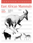
Volume IIIB celebrates the large mammals for which the African plains are so famous—elephants, rhinos, zebras, bushpigs, and warthogs, hippopotamuses, camels, chevrotains, giraffes. Kingdon brings his artist's eye to such puzzles as the zebra's stripes and the giraffe's spots, making original observations throughout the seven volumes about the evolutionary and functional significance of coat color, facial expressions, and curious forms and markings.
The beauty of the animals, so vivid in these incomparable drawings, is made more poignant by the acknowledgment of their increasingly endangered status. Kingdon discusses the inevitable problems posed by large mammal communities in a developing continent and includes numerous maps indicating their declining ranges and populations.

Media studies courses, particularly introductory courses, are often narrowly focused on US and Western European canons. Instructors for introductory media studies courses wishing to expand the offerings in their curricula will find in these essays new ways of approaching foundational concepts and issues in the field, including globalization, social difference, and diverse media cultures. Scholars wishing to expand their research into specific media forms or representational issues can also turn to these case studies for approaches from beyond the US. By including a variety of media and several geographical areas, the collection introduces readers to the formal, technological, and cultural diversity of global media studies.
Edited by Juan Llamas-Rodriguez with contributions from Anthony Adah and Añulika Agina, Maria Corrigan, Benjamin Han, Anna Shah Hoque, Meryem Kamil, Angelica Marie Lawson, Lilia Adriana Perez Limon, Sonia Robles, Kuhu Tanvir, David Tenorio, and Rachel van der Merwe.
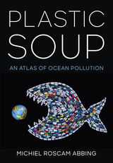
In Plastic Soup, Michiel Roscam Abbing of the Plastic Soup Foundation reveals the scope of the issue: plastic trash now lurks on every corner of the planet. With striking photography and graphics, Plastic Soup brings this challenge to brilliant life for readers. Yet it also sends a message of hope; although the scale of the problem is massive, so is the dedication of activists working to check it. Plastic Soup highlights a diverse array of projects to curb plastic waste and raise awareness, from plastic-free grocery stores to innovative laws and art installations.
According to some estimates, if we continue on our current path, the oceans will contain more plastic than fish by the year 2050. Created to inform and inspire readers, Plastic Soup is a critical tool in the fight to reverse this trend.
Vascular Plants of Minnesota was first published in 1991. Minnesota Archive Editions uses digital technology to make long-unavailable books once again accessible, and are published unaltered from the original University of Minnesota Press editions.
A definitive reference to the 2,010 vascular plant species (ferns, conifers, and flowering plants) currently found in Minnesota. The maps of he Atlas section show the geographic distribution of each plant, allowing the reader to visualize—for the first time—exactly where a species occurs in the state. Historical plant collections as well as records from detailed surveys conducted in the 1970s and 1980s by the Minnesota DNR, The Nature Conservancy, and individual researchers are included in this volume.
The flora of Minnesota is of special interest because it represents the western limits of the vast eastern deciduous forest flora, the northern and eastern boundaries of the flora of the prairies and great plains, and the southwestern limits of the northern coniferous forest. These three contrasting continental floras meet more sharply in Minnesota than in other regions.
The Checklist section provides both an authoritative summary of the nomenclature of Minnesota plants and extensive references to taxonomic literature. As such, it is the most complete list ever prepared for the entire state. Arranged alphabetically, group within group, the Checklist provides both Latin and common names for all species, subspecies, and varieties.
Gerald B. Ownbey is an emeritus professor in the Department of Plant Biology at the University of Minnesota, Twin Cities. As the curator of the University Herbarium for more than thirty years, he developed its collection of almost 750,000 specimens to make it the largest in the Midwest. Professor Ownbey is the author of Common Wild Flowers of Minnesota (University of Minnesota Press, 1971).
Thomas Morley is also an emeritus professor in the Department of Plant Biology at the University of Minnesota, Twin Cities. In addition to introducing hundreds of students to Minnesota flora in his popular course "Minnesota Plant Life," he is widely recognized for his pioneering efforts to protect remnants of Minnesota's native habitats. Professor Morley is the author of Spring Flora in Minnesota (University of Minnesota Press, 1966).
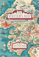
Philip Pullman recounts the experience of drawing a map as he set out on one of his early novels, The Tin Princess. Miraphora Mina recalls the creative challenge of drawing up ”The Marauder’s Map” for the Harry Potter films. David Mitchell leads us to the Mappa Mundi by way of Cloud Atlas and his own sketch maps. Robert Macfarlane reflects on the cartophilia that has informed his evocative nature writing, which was set off by Robert Louis Stevenson and his map of Treasure Island. Joanne Harris tells of her fascination with Norse maps of the universe. Reif Larsen writes about our dependence on GPS and the impulse to map our experience. Daniel Reeve describes drawing maps and charts for The Hobbit film trilogy. This exquisitely crafted and illustrated atlas explores these and so many more of the maps writers create and are inspired by—some real, some imagined—in both words and images.
Amid a cornucopia of 167 full-color images, we find here maps of the world as envisaged in medieval times, as well as maps of adventure, sci-fi and fantasy, nursery rhymes, literary classics, and collectible comics. An enchanting visual and verbal journey, The Writer’s Map will be irresistible for lovers of maps, literature, and memories—and anyone prone to flights of the imagination.
READERS
Browse our collection.
PUBLISHERS
See BiblioVault's publisher services.
STUDENT SERVICES
Files for college accessibility offices.
RECENTLY PUBLISHED


UChicago Accessibility Resources
home | accessibility | search | about | contact us
BiblioVault ® 2001 - 2025
The University of Chicago Press