4 books about Brotton, Jerry
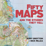
Fifty Maps and the Stories they Tell
Jerry Brotton and Nick Millea
Bodleian Library Publishing, 2019
The Bodleian Library’s map collection is a treasure trove of cartographic delights spanning more than a thousand years. This book features highlights from the collection together with rare artifacts and some stunning examples from twenty-first-century map-makers. Lavishly illustrated throughout, the book showcases a rich array: from military maps, digital cartograms, decorative portolan charts, and maps of heaven and hell; to a Siberian sealskin map and a twelfth-century Arabic map of the Mediterranean; to J. R. R. Tolkien’s cosmology of Middle-earth, C. S. Lewis’s map of Narnia, and a tapestry map by contemporary artist Grayson Perry. Each map is accompanied by a narrative revealing the story behind its creation and the significance of its design. The chronological arrangement highlights how the science and practice of cartography has changed over time and how this evolution reflects political and social transformations from century to century.
[more]
Global Interests
Renaissance Art Between East and West
Lisa Jardine and Jerry Brotton
Reaktion Books, 2000
Looking outward for confirmation of who they were and what defined them as "civilized," Europeans encountered the returning gaze of what we now call the East, in particular the attention of the powerful Ottoman Empire. Global Interests explores the historical interactions that arose from these encounters as it considers three less-examined art objects—portrait medals, tapestries, and equestrian art—from a fresh and stimulating perspective. As portable artifacts, these objects are particularly potent tools for exploring the cultural currents flowing between the Orient and Occident.
Global Interests offers a timely reconsideration of the development of European imperialism, focusing on the Habsburg Empire of Charles V. Lisa Jardine and Jerry Brotton analyze the impact this history continues to have on contemporary perceptions of European culture and ethnic identity. They also investigate the ways in which European culture came to define itself culturally and aesthetically during the century-long span of 1450 to 1550. Ultimately, their study offers a radical and wide-ranging reassessment of Renaissance art.
Global Interests offers a timely reconsideration of the development of European imperialism, focusing on the Habsburg Empire of Charles V. Lisa Jardine and Jerry Brotton analyze the impact this history continues to have on contemporary perceptions of European culture and ethnic identity. They also investigate the ways in which European culture came to define itself culturally and aesthetically during the century-long span of 1450 to 1550. Ultimately, their study offers a radical and wide-ranging reassessment of Renaissance art.
[more]
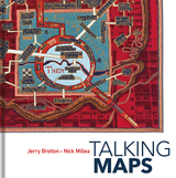
Talking Maps
Jerry Brotton and Nick Millea
Bodleian Library Publishing, 2019
Every map tells a story. Some provide a narrative for travelers, explorers, and surveyors or offer a visual account of changes to people’s lives and surroundings, while others tell imaginary tales, transporting us to fictional worlds created by writers and artists. In turn, maps generate more stories, taking users on new journeys in search of knowledge and adventure.
Drawing on the Bodleian Library’s outstanding map collection and covering almost a thousand years, Talking Maps takes a new approach to map-making by showing how maps and stories have always been intimately entwined. Including such rare treasures as a unique map of the Mediterranean from the eleventh-century Arabic Book of Curiosities, a twelfth-century map of the world by al-Sharīf al-Idrīsī, and C. S. Lewis’s map of Narnia, this fascinating book analyzes maps as objects that enable us to cross sea and land; as windows into alternative and imaginary worlds; as guides to reaching the afterlife; as tools to manage cities, nations, and empires; as images of environmental change; and as digitized visions of the global future.
By telling the stories behind the artifacts and those generated by them, Talking Maps reveals how each map is not just a tool for navigation but also a worldly proposal that helps us to understand who we are by describing where we are.
[more]
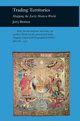
Trading Territories
Mapping the Early Modern World
Jerry Brotton
Reaktion Books, 1997
Trading Territories is a beautifully illustrated book that offers a new account of the status of maps and geographical knowledge in the early modern world. Focusing on how early European geographers mapped the territories of the Old World—Africa and Southeast Asia—Jerry Brotton contends that the historical preoccupation with Columbus’s “discovery” of the New World in 1492 has tended to obscure the importance of the mapping of territories that have been defined as “eastern.”
Brotton situates the rise of early modern mapping within the context of the seaborne commercial adventures of the early maritime empires—the Portuguese, the Spanish, the Ottomans, the Dutch, and the English—and explores the ways in which maps and globes were used to mediate the commercial and diplomatic disputes between these empires. Rather than the development of early maps being shaped by disinterested intellectual pursuits, Trading Territories argues that trade, diplomacy, and financial speculation played the most essential role.
“In this outstanding study of maps and mapping, Jerry Brotton reveals a dynamism in the transaction between East and West beyond anything we have previously appreciated.”—Lisa Jardine, Queen Mary, University of London
[more]
READERS
Browse our collection.
PUBLISHERS
See BiblioVault's publisher services.
STUDENT SERVICES
Files for college accessibility offices.
UChicago Accessibility Resources
home | accessibility | search | about | contact us
BiblioVault ® 2001 - 2024
The University of Chicago Press


