
 A SCHOLARLY BOOK REPOSITORY
30 start with C start with C
Discover the Far North hand-in-hand with two leading authorities on the Arctic.
This travel guide offers a unique eight-day tour of the Canadian Arctic, starting at Iqaluit near the head of Frobisher Bay (2,000 kilometers north of Ottawa), flying across the line of the Arctic Circle to Resolute, and onward to Ward Hunt Island, the northernmost airstrip in North America. Whether you make the journey in person or as an armchair traveler, this eye-opening book will tell you just what makes this region so extraordinary. Stager and Swain comment on everything that's likely to catch your attention from the air, on the ground, or in the frigid waters--from the lay of the land to the cost of the food, from frost polygons to sea smoke, from narwhals to snow geese, from kayaks to icebreakers, from soapstone sculptures to satellite dishes.
Canada North: Journey to the High Arctic makes the best of traveling companions: compact, informed, and lively. You'll want to read and reread it as you plan the journey of a lifetime.
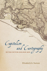
Building her exploration around the central figure of Claes Jansz Vischer, an Amsterdam-based publisher closely tied to the Dutch West India Company, Sutton shows how printed maps of Dutch Atlantic territories helped rationalize the Dutch Republic’s global expansion. Maps of land reclamation projects in the Netherlands, as well as the Dutch territories of New Netherland (now New York) and New Holland (Dutch Brazil), reveal how print media were used both to increase investment and to project a common narrative of national unity. Maps of this era showed those boundaries, commodities, and topographical details that publishers and the Dutch West India Company merchants and governing Dutch elite deemed significant to their agenda. In the process, Sutton argues, they perpetuated and promoted modern state capitalism.
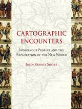
There’s no excuse for getting lost these days—satellite maps on our computers can chart our journey in detail and electronics on our car dashboards instruct us which way to turn. But there was a time when the varied landscape of North America was largely undocumented, and expeditions like that of Lewis and Clark set out to map its expanse. As John Rennie Short argues in Cartographic Encounters, that mapping of the New World was only possible due to a unique relationship between the indigenous inhabitants and the explorers.
In this vital reinterpretation of American history, Short describes how previous accounts of the mapping of the new world have largely ignored the fundamental role played by local, indigenous guides. The exchange of information that resulted from this “cartographic encounter” allowed the native Americans to draw upon their wide knowledge of the land in the hope of gaining a better position among the settlers.
This account offers a radical new understanding of Western expansion and the mapping of the land and will be essential to scholars in cartography and American history.
G. Malcolm Lewis provides accessible and detailed overviews of the history of native North American maps, mapmaking, and scholarly interest in these topics. Other contributions include a study of colonial Aztec cartography that highlights the connections among maps, space, and history; an account of the importance of native maps as archaeological evidence; and an interpretation of an early-contact-period hide painting of an actual encounter involving whites and two groups of warring natives.
Although few original native maps have survived, contemporary copies and accounts of mapmaking form a rich resource for anyone interested in the history of Native American encounters or the history of cartography and geography.
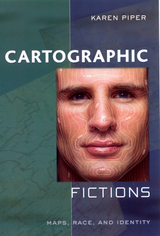
Maps are stories as much about us as about the landscape. They reveal changing perceptions of the natural world, as well as conflicts over the acquisition of territories. Cartographic Fictions looks at maps in relation to journals, correspondence, advertisements, and novels by authors such as Joseph Conrad and Michael Ondaatje. In her innovative study, Karen Piper follows the history of cartography through three stages: the establishment of the prime meridian, the development of aerial photography, and the emergence of satellite and computer mapping.
Piper follows the cartographer’s impulse to “leave the ground” as the desire to escape the racialized or gendered subject. With the distance that the aerial view provided, maps could then be produced “objectively,” that is, devoid of “problematic” native interference. Piper attempts to bring back the dialogue of the “native informant,” demonstrating how maps have historically constructed or betrayed anxieties about race. The book also attempts to bring back key areas of contact to the map between explorer/native and masculine/feminine definitions of space.
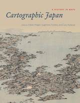
But this was not always the case: a thousand years ago, maps were solely a privilege of the ruling elite in Japan. Only in the past four hundred years has Japanese cartography truly taken off, and between the dawn of Japan’s cartographic explosion and today, the nation’s society and landscape have undergone major transformations. At every point, maps have documented those monumental changes. Cartographic Japan offers a rich introduction to the resulting treasure trove, with close analysis of one hundred maps from the late 1500s to the present day, each one treated as a distinctive window onto Japan’s tumultuous history.
Forty-seven distinguished contributors—hailing from Japan, North America, Europe, and Australia—uncover the meanings behind a key selection of these maps, situating them in historical context and explaining how they were made, read, and used at the time. With more than one hundred gorgeous full-color illustrations, Cartographic Japan offers an enlightening tour of Japan’s magnificent cartographic archive.
California, for example, takes earthquakes seriously, with a comprehensive program of seismic mapping, whereas Washington has been comparatively lax about earthquakes in Puget Sound. But as the Northridge earthquake in January 1994 demonstrated all too clearly to Californians, even reliable seismic-hazard maps can deceive anyone who misinterprets "known fault-lines" as the only places vulnerable to earthquakes.
Important as it is to predict and prepare for catastrophic natural hazards, more subtle and persistent phenomena such as pollution and crime also pose serious dangers that we have to cope with on a daily basis. Hazard-zone maps highlight these more insidious hazards and raise awareness about them among planners, local officials, and the public.
With the help of many maps illustrating examples from all corners of the United States, Monmonier demonstrates how hazard mapping reflects not just scientific understanding of hazards but also perceptions of risk and how risk can be reduced. Whether you live on a faultline or a coastline, near a toxic waste dump or an EMF-generating power line, you ignore this book's plain-language advice on geographic hazards and how to avoid them at your own peril.
"No one should buy a home, rent an apartment, or even drink the local water without having read this fascinating cartographic alert on the dangers that lurk in our everyday lives. . . . Who has not asked where it is safe to live? Cartographies of Danger provides the answer."—H. J. de Blij, NBC News
"Even if you're not interested in maps, you're almost certainly interested in hazards. And this book is one of the best places I've seen to learn about them in a highly entertaining and informative fashion."—John Casti, New Scientist
Finding one’s way with a map is a relatively recent phenomenon. In premodern times, maps were used, if at all, mainly for planning journeys in advance, not for guiding travelers on the road. With the exception of navigational sea charts, the use of maps by travelers only became common in the modern era; indeed, in the last two hundred years, maps have become the most ubiquitous and familiar genre of modern cartography.
Examining the historical relationship between travelers, navigation, and maps, Cartographies of Travel and Navigation considers the cartographic response to the new modalities of modern travel brought about by technological and institutional developments in the twentieth century. Highlighting the ways in which the travelers, operators, and planners of modern transportation systems value maps as both navigation tools and as representatives of a radical new mobility, this collection brings the cartography of travel—by road, sea, rail, and air—to the forefront, placing maps at the center of the history of travel and movement.
Richly and colorfully illustrated, Cartographies of Travel and Navigation ably fills the void in historical literature on transportation mapping.
In this book Edney disavows the term cartography, rejecting the notion that maps represent an undifferentiated category of objects for study. Rather than treating maps as a single, unified group, he argues, scholars need to take a processual approach that examines specific types of maps—sea charts versus thematic maps, for example—in the context of the unique circumstances of their production, circulation, and consumption. To illuminate this bold argument, Edney chronicles precisely how the ideal of cartography that has developed in the West since 1800 has gone astray. By exposing the flaws in this ideal, his book challenges everyone who studies maps and mapping practices to reexamine their approach to the topic. The study of cartography will never be the same.
Turning to a previously undiscovered archive of popular maps, Cartophilia reveals Alsace-Lorraine’s lively world of citizen mapmakers that included linguists, ethnographers, schoolteachers, hikers, and priests. Together, this fresh group of mapmakers invented new genres of maps that framed French and German territory in original ways through experimental surveying techniques, orientations, scales, colors, and iconography. In focusing on the power of “bottom-up” maps to transform modern European identities, Cartophilia argues that the history of cartography must expand beyond the study of elite maps and shift its emphasis to the democratization of cartography in the modern world.
Fifteen years in the making, this catalogue will be an essential reference for bibliographers and archivists dealing with rare books and maps of the period, for map collectors, map librarians, and scholars and librarians working with early printed items and manuscripts.
Porter first began work on this project in 1972, asking 250 farmers in the region about life history, environmental and agricultural changes, types of crops grown and methods of planting, environmental assessments, agricultural practices, food and water supplies, training and education, and attitudes toward nature. Twenty years later, he returned and reinterviewed as many farmers as could be found from the first survey. The result contextualizes the environmental history of the region while informing current and future agricultural development.
Cormack demonstrates that geography was part of the Arts curriculum between 1580 and 1620, read at university by a broad range of soon-to-be political, economic, and religious leaders. By teaching these young Englishmen to view their country in a global context, and to see England playing a major role on that stage, geography supplied a set of shared assumptions about the feasibility and desirability of an English empire. Thus, the study of geography helped create an ideology of empire that made possible the actual forays of the next century.
Geography emerges in Cormack's account as the fruitful ground between college and court, in whose well-prepared soil the seeds of English imperialism took root. Charting an Empire will interest historians of science, geography, cartography, education, and empire.
Renowned geographer John C. Hudson leaves no aspect unexplored in this ambitious and peerless book. Beginning with an overview of metropolitan Chicago, Hudson describes how the city has served as a model to social scientists and examines its unique neighborhoods and communities from the perspectives of Chicagoans themselves. A thorough description of the physical geography of the region introduces a series of studies in historical geography that consider the origins of the city and its early development through to its present state, paying particular attention to race, ethnicity, and suburbanization, as well as commuting patterns, neighborhood change, and patterns of income distribution. Chicago concludes with a comparison of the balanced geography that prevailed in the early twentieth century with the skewed pattern of sectoral imbalances that exists today.
Supplemented with more than one hundred maps that illustrate the evolution of Chicago over time and sixty-four black-and-white and color photographs that capture iconic images of the city’s landscapes and its people, Chicago beautifully synthesizes the city’s social and economic strata with geographical features to provide an authoritative guide to modern Chicagoland.
This volume, however, which comprises over 1,000 pictures and 50 maps, tries to do more than show physical development—it attempts to suggest how the city expanded and why it looks the way it does. Because it asks different questions, this book differs markedly from other "pictorial histories" of American cities. Instead of emphasizing society and customs, this volume deals with the physical conditions of life. In place of the conventional interest in "founding fathers" and leading families, it is more concerned with street scenes and ordinary people. Without neglecting downtown, it also reaches into the residential areas and neighborhood shopping centers. Moreover, this volume is concerned with suburbs and "satellite" towns as well as the historic city.
"Chicago: Growth of a Metropolis is an incredible book. Like its subject it is excessive, and nothing succeeds like excess. It is handsomely designed, with a thousand photographs that document the physical growth and the spatial patterns of the city. . . . A dimensionalism comes through that no other city has. Carl Sandburg sang it in his poetry, and the book does more to grasp it . . . than any other book I have seen."—Hugh Newell Jacobson, New Republic
Robert Lewis documents how manufacturers, attracted to greenfield sites on the city’s outskirts, began to build factory districts there with the help of an intricate network of railroad owners, real estate developers, financiers, and wholesalers. These immense networks of social ties, organizational memberships, and financial relationships were ultimately more consequential, Lewis demonstrates, than any individual achievement. Beyond simply giving Chicago businesses competitive advantages, they transformed the economic geography of the region. Tracing these transformations across seventy-five years, Chicago Made establishes a broad new foundation for our understanding of urban industrial America.
For Beauregard, the city is a cauldron for four haunting contradictions. First, cities are equally defined by both their wealth and their poverty. Second, cities are simultaneously environmentally destructive and yet promise sustainability. Third, cities encourage rule by political machines and oligarchies, even as they are essentially democratic and at least nominally open to all. And fourth, city life promotes tolerance among disparate groups, even as the friction among them often erupts into violence. Beauregard offers no simple solutions or proposed remedies for these contradictions; indeed, he doesn’t necessarily hold that they need to be resolved, since they are generative of city life. Without these four tensions, cities wouldn’t be cities. Rather, Beauregard argues that only by recognizing these ambiguities and contradictions can we even begin to understand our moral obligations, as well as the clearest paths toward equality, justice, and peace in urban settings.
That strategy seems to make sense, but in Citizens, Cops, and Power, Steve Herbert reveals the reasons why it rarely, if ever, works. Drawing on data he collected in diverse Seattle neighborhoods from interviews with residents, observation of police officers, and attendance at community-police meetings, Herbert identifies the many obstacles that make effective collaboration between city dwellers and the police so unlikely to succeed. At the same time, he shows that residents’ pragmatic ideas about the role of community differ dramatically from those held by social theorists.
Surprising and provocative, Citizens, Cops, and Power provides a critical perspective not only on the future of community policing, but on the nature of state-society relations as well.
Spanning the 1950s to the post-recession 2010s, The City Creative highlights the roles of such prominent individuals and organizations as Jane Jacobs, Christopher Alexander, Richard Sennett, Project for Public Spaces, and the National Endowment for the Arts in the development of urban placemaking, both in the abstract and on the ground. But that’s only half the story. Bringing the narrative to the present, Michael H. Carriere and David Schalliol also detail placemaking interventions at more than 200 sites in more than 40 cities, combining archival research, interviews, participant observation, and Schalliol’s powerful documentary photography. Carriere and Schalliol find that while these formal and informal placemaking interventions can bridge local community development and regional economic plans, more often than not, they push the boundaries of mainstream placemaking. Rather than simply stressing sociability or market-driven economic development, these initiatives offer an alternative model of community-led progress with the potential to redistribute valuable resources while producing tangible and intangible benefits for their communities. The City Creative provides a kaleidoscopic overview of how these initiatives grow, and sometimes collapse, illustrating the centrality of placemaking in the evolution of the American city and how it can be reoriented to meet demands for a more equitable future.
Combining insights from urban studies, cultural geography, and urban sociology with extensive research in South Africa, Murray reflects on the implications of Johannesburg’s dual character as a city of fortified enclaves that proudly displays the ostentatious symbols of global integration and the celebrated “enterprise culture” of neoliberal design, and as the “miasmal city” composed of residual, peripheral, and stigmatized zones characterized by signs of a new kind of marginality. He suggests that the “global cities” paradigm is inadequate to understanding the historical specificity of cities in the Global South, including the colonial mining town turned postcolonial megacity of Johannesburg.
Drawing on more than thirty years of meticulous research, Kay Rippelmeyer details the Depression-era history of the simultaneous creation of the Civilian Conservation Corps (CCC) and the Shawnee National Forest in southern Illinois. Through the stories of the men who worked in CCC camps devoted to soil and forest conservation projects, she offers a fascinating look into an era of utmost significance to the identity, citizens, wildlife, and natural landscape of the region.
Rippelmeyer outlines the geologic and geographic history of southern Illinois, from Native American uses of the land to the timber industry’s decimation of the forest by the 1920s. Detailing both the economic hardships and agricultural land abuse plaguing the region during the Depression, she reveals how the creation of the CCC under Franklin Delano Roosevelt coincided with the regional campaign for a national forest and how locals first became aware of and involved with the program.
Rippelmeyer mined CCC camp records from the National Archives, newspaper accounts and other correspondence and conducted dozens of oral interviews with workers and their families to re-create life in the camps. An extensive camp compendium augments the volume, featuring numerous photographs, camp locations and dates of operation, work history, and company rosters. Satisfying public curiosity and the need for factual information about the camps in southern Illinois, this is an essential contribution to regional history and a window to the national impact of the CCC.
Plato’s solution was a map-and-directory combo that used direction and distance from a local business center to give farmers a real address, just like city dwellers. He patented his invention called the “Clock System” and tried to sell it to the Post Office Department. What follows is a tale of persistence and failure as rural farming declined and technology and capitalism overtook John Byron Plato’s chances at geographic immortality.
Whether for sailing charts or property maps, Monmonier shows, coastlines challenge mapmakers to capture on paper a highly irregular land-water boundary perturbed by tides and storms and complicated by rocks, wrecks, and shoals. Coast Lines is peppered with captivating anecdotes about the frustrating effort to expunge fictitious islands from nautical charts, the tricky measurement of a coastline’s length, and the contentious notions of beachfront property and public access.
Combing maritime history and the history of technology, Coast Lines charts the historical progression from offshore sketches to satellite images and explores the societal impact of coastal cartography on everything from global warming to homeland security. Returning to the form of his celebrated Air Apparent, Monmonier ably renders the topic of coastal cartography accessible to both general readers and historians of science, technology, and maritime studies. In the post-Katrina era, when the map of entire regions can be redrawn by a single natural event, the issues he raises are more important than ever.
In each chapter of this book, you will find some questions, activities, and suggested reading to help you learn more of Colorado's story than we can present here. In these pages. you will discover a high, dry state with rugged natural beauty and an awesome history.
Each chapter is followed by questions, suggested activities, recommended reading, a "Did you know?" trivia section, and recommended websites, movies, and other multimedia that highlight the important concepts covered and lead the reader to more information. Additionally, the book is filled with photographs, making Colorado: The Highest State a fantastic text for middle and high school Colorado history courses.
In the summer of 2005, distinguished geographer Yi-Fu Tuan ventured to China to speak at an international architectural conference, returning for the first time to the place he had left as a child sixty-four years before. He traveled from Beijing to Shanghai, addressing college audiences, floating down the Yangtze River on a riverboat, and visiting his former home in Chongqing.
In this enchanting volume, Tuan’s childhood memories and musings on the places encountered during this homecoming are interspersed with new lectures, engaging overarching principles of human geography as well as the changing Chinese landscape. Throughout, Tuan’s interactions with his hosts, with his colleague’s children, and even with a garrulous tour guide, offer insights into one who has spent his life studying place, culture, and self.
At the beginning of his trip, Tuan wondered if he would be a stranger among people who looked like him. By its end, he reevaluates his own self-definition as a hyphenated American and sheds new light on human identity’s complex roots in history, geography, and language.
Yi-Fu Tuan is author of Cosmos and Hearth, Dear Colleague, and Space and Place, all from Minnesota. He retired from the University of Wisconsin-Madison in 1998.
Founded in 1902, the Bureau became enmeshed in the US State Department’s push for geopolitical power following World War II, a response to the Soviet Union’s increasing global sway. By offering technical and water resource management advice to the world’s underdeveloped regions, the Bureau found that it could not only provide them with economic assistance and the United States with investment opportunities, but also forge alliances and shore up a country’s global standing in the face of burgeoning communist influence. Drawing on a number of international case studies—from the Bureau’s early forays into overseas development and the launch of its Foreign Activities Office in 1950 to the Blue Nile investigation in Ethiopia—Concrete Revolution offers insights into this historic damming boom, with vital implications for the present. If, Sneddon argues, we can understand dams as both technical and political objects rather than instruments of impartial science, we can better participate in current debates about large dams and river basin planning.
Geographic knowledge generated for the Cold War was a form of power, Farish argues, and it was given an urgency in the panels, advisory boards, and study groups established to address the challenges of an atomic world. He investigates how the scales of the city, the continent, the region, the globe, and, by extension, outer space, were brought together as strategic spaces, categories that provided a cartographic orientation for the Cold War and influenced military deployments, diplomacy, espionage, and finance.
Farish analyzes the surprising range of knowledge production involved in the project of claiming and classifying American space. Backed by military and intelligence funding, physicists and policy makers, soldiers and social scientists came together to study and shape the United States and its place in a divided world.
READERS
Browse our collection.
PUBLISHERS
See BiblioVault's publisher services.
STUDENT SERVICES
Files for college accessibility offices.
RECENTLY PUBLISHED


UChicago Accessibility Resources
home | accessibility | search | about | contact us
BiblioVault ® 2001 - 2024
The University of Chicago Press