
 A SCHOLARLY BOOK REPOSITORY
19 start with S start with S
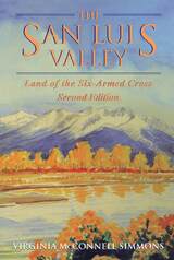
In this sparkling new edition of The San Luis Valley: Land of the Six-Armed Cross, Virginia McConnell Simmons lays before the reader the stories and voices of this multicultural land. Ranging from prehistoric peoples and historic Indians to early Spanish settlers, trappers, American explorers, railroads, and Euro-American pioneers, this book is a comprehensive volume covering the geography and social history of Colorado's San Luis Valley.
New to the second edition is additional material on Hispanic culture (in particular a description of their fiber arts) and a lengthy appendix cataloging and describing all of the San Luis Valley's Hispanic place names. In addition, the notes and bibliography have been expanded, and the book contains a new introduction by David Fridtjof Halaas, Chief Historian of the Colorado Historical Society. Acclaimed as the standard history for the south-central region of Colorado, The San Luis Valley: Land of the Six-Armed Cross is a book for students, scholars, and others interested in the history of this fascinating and culturally rich corner of the state.
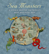
Nearly two meters wide in total, the map’s nine wood-block panels comprise the largest and first realistic portrayal of Northern Europe. But in addition to these important geographic elements, Magnus’s map goes beyond cartography to scenes both domestic and mystic. Close to shore, Magnus shows humans interacting with common sea life—boats struggling to stay afloat, merchants trading, children swimming, and fisherman pulling lines. But from the offshore deeps rise some of the most magical and terrifying sea creatures imaginable at the time or thereafter—like sea swine, whales as large as islands, and the Kraken. In this book, Nigg provides a thorough tour of the map’s cartographic details, as well as a colorful look at its unusual pictorial and imaginative elements. He draws on Magnus’s own text to further describe and illuminate the inventive scenes and to flesh out the stories of the monsters.
Sea Monsters is a stunning tour of a world that still holds many secrets for us land dwellers, who will forever be fascinated by reports of giant squid and the real-life creatures of the deep that have proven to be as bizarre and otherworldly as we have imagined for centuries. It is a gorgeous guide for enthusiasts of maps, monsters, and the mythic.
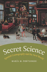
The discovery of the New World raised many questions for early modern scientists: What did these lands contain? Where did they lie in relation to Europe? Who lived there, and what were their inhabitants like? Imperial expansion necessitated changes in the way scientific knowledge was gathered, and Spanish cosmographers in particular were charged with turning their observations of the New World into a body of knowledge that could be used for governing the largest empire the world had ever known.
As María M. Portuondo here shows, this cosmographic knowledge had considerable strategic, defensive, and monetary value that royal scientists were charged with safeguarding from foreign and internal enemies. Cosmography was thus a secret science, but despite the limited dissemination of this body of knowledge, royal cosmographers applied alternative epistemologies and new methodologies that changed the discipline, and, in the process, how Europeans understood the natural world.
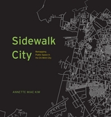
With Sidewalk City, Annette Miae Kim provides the first multidisciplinary case study of sidewalks in a distinctive geographical area. She focuses on Ho Chi Minh City, Vietnam, a rapidly growing and evolving city that throughout its history, her multicultural residents have built up alternative legitimacies and norms about how the sidewalk should be used. Based on fieldwork over 15 years, Kim developed methods of spatial ethnography to overcome habitual seeing, and recorded both the spatial patterns and the social relations of how the city’s vibrant sidewalk life is practiced.
In Sidewalk City, she transforms this data into an imaginative array of maps, progressing through a primer of critical cartography, to unveil new insights about the importance and potential of this quotidian public space. This richly illustrated and fascinating study of Ho Chi Minh City’s sidewalks shows us that it is possible to have an aesthetic sidewalk life that is inclusive of multiple publics’ aspirations and livelihoods, particularly those of migrant vendors.
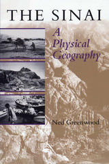
One of the world's oldest crossroads, the Sinai joins the great continental land masses of Africa and Eurasia. Its physical geography of rugged mountain peaks, desert plains, and sea coasts was formed by the collision of the two continental plates, while the human tides that have swept across the region over millennia have left an intricate web of cultures and ethnicities.
In this book, Ned Greenwood offers a complete, up-to-date physical geography of Sinai. After an introductory chapter that situates Sinai within world history and geography, he focuses in detail on the following areas: plate tectonics and geology, geomorphology and drainage, weather and climate, soils, and biogeography.
In the concluding chapter, Greenwood considers the human geography of Sinai, including the pressures currently posed by population growth, political extremism, and environmental constrictions on development. He offers a fully rounded picture of the physical environment of Sinai that will be vital reading for everyone concerned about the future of this strategic yet fragile land.
A land where some streams ran with gold. A landscape nearly empty of inhabitants in the wake of Apache raids from the north. And a former desert transformed by irrigation into vast fields of wheat and cotton. This was and is the state of Sonora in northwest Mexico.
In this cultural historical geography, Robert C. West explores the dual geographic "personality" of this part of Mexico's northern frontier. Utilizing the idea of "old" and "new" landscapes, he describes two Sonoras—to the east, a semiarid to subhumid mountainous region that reached its peak of development in the colonial era and still lives largely in its colonial past; and, to the west, a desert region that in the twentieth century has become a major agricultural producer and the modern center of economic and cultural activity.
After a description of the physical and biotic aspects of Sonora, West describes the aboriginal farming cultures that inhabited eastern Sonora before the Spanish conquest. Following the conquest, he traces the spread of Jesuit missions and Spanish mining and ranching communities into this land where gold, silver, and copper ores were easily extracted by surface mining. He charts the decline of eastern Sonora with the coming of Apache and Seri raids during the eighteenth and nineteenth centuries. And he shows how western Sonora has become one of Mexico's most powerful political and economic entities in the twentieth century.
For geographers, historians, anthropologists, and economists, as well as travelers to Sonora and its coastal resorts, this lively and interesting book will be important reading.
This remarkable volume presents a panorama of geographical writings from Hesiod to Humboldt, from the beginnings of geographical thought in the Western world to the emergence of topical specialization. It includes a wealth of material from non-Western sources, particularly Moslem and Chinese, that has not been collected before.
The selections are arranged chronologically, and contain geographical theory, descriptions of terrestrial phenomena by early observers, and excerpts from major voyages of discovery. Some are obvious classics: Socrates on the nature of the Earth, Ezekiel’s description of the commerce of Tyre, Columbus’s first glimpse of the West Indies, Buffon on the history of the Earth, and Kant’s geographical lectures. Yet more commonly, George Kish provides a sense of the discovery with such finds as the ambassador’s report to the Caliph of Baghdad on the lands and customs of the Norsemen, the study of the Tartar Empire by John of Monte Corvino, Archbishop of Peking, and Jefferson’s private memo to Alexander von Humboldt seeking information on the American West.
Each section is highlighted by a brief but engagingly written introduction by the editor. Throughout, the unique cultural and professional perspective of Kish is very much in evidence.
Beginning with a historical overview of maps and their creation—from those traced in the dirt by primitive hands to the monumental Dutch atlases and ornate maps on Italian palace walls—Jacob goes on to consider the visual components of cartography: the decorative periphery, geometric grid, topographical lines, dots, details of iconographic figures, and many other aspects. Considering text on maps—titles, toponyms, legends, and keys—Jacob proposes that writing can both clarify and interfere with a map's visual presentation. Finally Jacob examines the role of the viewer in decoding a map's meaning and the role of society in defining the power of maps as authoritative depictions of space.
Innovative in its philosophical motivation and its interdisciplinary approach to looking at and writing about maps, The Sovereign Map is eagerly awaited by scholars from many different fields.

A geographic study of race and gender, Spatializing Blackness casts light upon the ubiquitous--and ordinary--ways carceral power functions in places where African Americans live. Moving from the kitchenette to the prison cell, and mining forgotten facts from sources as diverse as maps and memoirs, Rashad Shabazz explores the myriad architectures of confinement, policing, surveillance, urban planning, and incarceration. In particular, he investigates how the ongoing carceral effort oriented and imbued black male bodies and gender performance from the Progressive Era to the present. The result is an essential interdisciplinary study that highlights the racialization of space, the role of containment in subordinating African Americans, the politics of mobility under conditions of alleged freedom, and the ways black men cope with--and resist--spacial containment.
A timely response to the massive upswing in carceral forms within society, Spatializing Blackness examines how these mechanisms came to exist, why society aimed them against African Americans, and the consequences for black communities and black masculinity both historically and today.
Despite our apprehension about surveillance technology, Spying with Maps is not a jeremiad, crammed with dire warnings about eyes in the sky and invasive tracking. Monmonier's approach encompasses both skepticism and the acknowledgment that geospatial technology brings with it unprecedented benefits to governments, institutions, and individuals, especially in an era of asymmetric warfare and bioterrorism. Monmonier frames his explanations of what this new technology is and how it works with the question of whether locational privacy is a fundamental right. Does the right to be left alone include not letting Big Brother (or a legion of Little Brothers) know where we are or where we've been? What sacrifices must we make for homeland security and open government?
With his usual wit and clarity, Monmonier offers readers an engaging, even-handed introduction to the dark side of the new technology that surrounds us—from traffic cameras and weather satellites to personal GPS devices and wireless communications.
Chaudhuri starts with a discussion of a "poetics of exile" in early modern drama, where the figure of home is constructed as a locus of two conflicting impulses: the desire to find a stable site for individual identity and the desire to deterritorialize the self. By mid-century, she argues, a new discourse of "failed homecoming" begins to displace this geopathic model and replace the poetics of exile with a grim anti-poetics of immigration. She then employs postmodern and postcolonial theories of place and culture to define the emerging multiculturalism as a creative reworking of the figures of home, homecoming, homelessness, immigration and exile.
"This is a book of real originality. Its treatment of space in modern drama is elegant and powerful. . . ." --William B. Worthen, Northwestern University
"Staging Place is a powerfully written book, deft in its handling of familiar and unfamiliar plays alike and eclectic in its use of theatrical sources." --Essays in Theatre/ Études théâtrales
"This sophisticated and well-written study for graduate students and their teachers explores modern drama's preoccupation with the seemingly irreconcilable discontinuities between the notions of home and homelessness, belonging and exile. . . . The readings of individual plays are fresh and invigorating. . . ." --Choice
Una Chaudhuri is Associate Professor of English, New York University.
Despite their twin positions as two of North America’s most iconic Italian neighborhoods, South Philly and Toronto’s Little Italy have functioned in dramatically different ways since World War II. Inviting readers into the churches, homes, and businesses at the heart of these communities, Staying Italian reveals that daily experience in each enclave created two distinct, yet still Italian, ethnicities.
As Philadelphia struggled with deindustrialization, Jordan Stanger-Ross shows, Italian ethnicity in South Philly remained closely linked with preserving turf and marking boundaries. Toronto’s thriving Little Italy, on the other hand, drew Italians together from across the wider region. These distinctive ethnic enclaves, Stanger-Ross argues, were shaped by each city’s response to suburbanization, segregation, and economic restructuring. By situating malleable ethnic bonds in the context of political economy and racial dynamics, he offers a fresh perspective on the potential of local environments to shape individual identities and social experience.
The traditional Chinese notion of itself as the “middle kingdom”—literally the cultural and political center of the world—remains vital to its own self-perceptions and became foundational to Western understandings of China. This worldview was primarily constructed during the earliest imperial unification of China during the Qin and Han dynasties (221 BCE–220 CE). But the fragmentation of empire and subsequent “Age of Disunion” (220–589 CE) that followed undermined imperial orthodoxies of unity, centrality, and universality. In response, geographical writing proliferated, exploring greater spatial complexities and alternative worldviews.
This book is the first study of the emergent genre of geographical writing and the metageographies that structured its spatial thought during that period. Early medieval geographies highlighted spatial units and structures that the Qin–Han empire had intentionally sought to obscure—including those of regional, natural, and foreign spaces. Instead, these postimperial metageographies reveal a polycentric China in a polycentric world. Sui–Tang (581–906 CE) officials reasserted the imperial model as spatial orthodoxy. But since that time these alternative frameworks have persisted in geographical thought, continuing to illuminate spatial complexities that have been incompatible with the imperial and nationalist ideal of a monolithic China at the center of the world.
READERS
Browse our collection.
PUBLISHERS
See BiblioVault's publisher services.
STUDENT SERVICES
Files for college accessibility offices.
RECENTLY PUBLISHED


UChicago Accessibility Resources
home | accessibility | search | about | contact us
BiblioVault ® 2001 - 2024
The University of Chicago Press