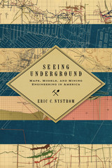
Starting in the late nineteenth century, mining engineers developed a new set of practices, artifacts, and discourses to visualize complex, pitch-dark three-dimensional spaces. These maps and models became necessary tools in creating and controlling those spaces. They made mining more understandable, predictable, and profitable. Nystrom shows that this new visual culture was crucial to specific developments in American mining, such as implementing new safety regulations after the Avondale, Pennsylvania fire of 1869 killed 110 men and boys; understanding complex geology, as in the rich ores of Butte, Montana; and settling high-stakes litigation, such as the Tonopah, Nevada, Jim Butler v. West End lawsuit, which reached the US Supreme Court.
Nystrom demonstrates that these neglected artifacts of the nineteenth and early twentieth centuries have much to teach us today. The development of a visual culture helped create a new professional class of mining engineers and changed how mining was done. Seeing Undergound is the winner of the 2015 Mining History Association’s Clark Spence Award for the best book on mining history.
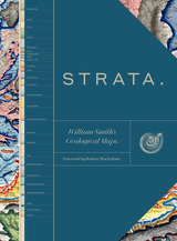
This sumptuous volume begins with an introduction by Douglas Palmer that places Smith’s work in the context of earlier, concurrent, and subsequent ideas regarding the structure and natural processes of the earth, geographical mapping, and biostratigraphical theories. The book is then organized into four parts, each beginning with four sheets from Smith’s hand-colored, 1815 strata map, accompanied by related geological cross-sections and county maps, and followed by fossil illustrations by Smith contemporary James Sowerby, all organized by strata. Essays between each section explore the aims of Smith’s work and its application in the fields of mining, agriculture, cartography and hydrology. Strata concludes with reflections on Smith’s later years as an itinerant geologist and surveyor, plagiarism by a rival, receipt of the first Wollaston Medal in recognition of his achievements, and the influence of his geological mapping and biostratigraphical theories on the sciences—all of which culminated in the establishment of the modern geological timescale.
Featuring a foreword by Robert Macfarlane, Strata is a glorious testament to the lasting geological and illustrative genius of William Smith, a collection as colossal and awe-inspiring as the layers of the Earth themselves.
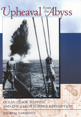
The deep oceans are the last great frontier remaining on Earth. Humans have conquered the vast wilderness of the terrestrial surface, from the searing deserts and dark forests of the tropics to the icy polar regions. Today, anyone with enough ambition and money can travel upriver into the heart of the Borneo jungle, climb Mount Everest, or spend the night at the South Pole. But the oceans beyond the continental shelves remain forbidding, beyond the reach of science, adventurism, and commerce.
Not long ago, scientists viewed the ocean floor as a vast, featureless plain, an ancient repository of detritus eroded from the surface of an unchanging Earth. Light never reached the seemingly lifeless depths. The ocean basins were only of marginal scholarly interest. This all changed with the Herculean quest to discover what lay on the world's ocean floor—a quest that inspired the continental drift-plate tectonics revolution and overturned prevailing scientific notions of how the Earth’s surface was created, rearranged, and destroyed.
Upheaval from the Abyss spans a 130-year period, beginning with the early, backbreaking efforts to map the depths during the age of sail; continuing with improvements in research methods spurred by maritime disaster and war; and culminating in the publication of the first map of the world’s ocean floor in 1977. The author brings this tale to life by weaving through it the personalities of the scientists-explorers who struggled to see the face of the deep, and reveals not only the facts of how the ocean floor was mapped, but also the human dimensions of what the scientists experienced and felt while in the process.
READERS
Browse our collection.
PUBLISHERS
See BiblioVault's publisher services.
STUDENT SERVICES
Files for college accessibility offices.
UChicago Accessibility Resources
home | accessibility | search | about | contact us
BiblioVault ® 2001 - 2024
The University of Chicago Press


