How perceptual technologies have shaped the history of war from the Renaissance to the present
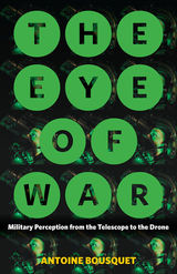
From ubiquitous surveillance to drone strikes that put “warheads onto foreheads,” we live in a world of globalized, individualized targeting. The perils are great. In The Eye of War, Antoine Bousquet provides both a sweeping historical overview of military perception technologies and a disquieting lens on a world that is, increasingly, one in which anything or anyone that can be perceived can be destroyed—in which to see is to destroy.
Arguing that modern-day global targeting is dissolving the conventionally bounded spaces of armed conflict, Bousquet shows that over several centuries, a logistical order of militarized perception has come into ascendancy, bringing perception and annihilation into ever-closer alignment. The efforts deployed to evade this deadly visibility have correspondingly intensified, yielding practices of radical concealment that presage a wholesale disappearance of the customary space of the battlefield. Beginning with the Renaissance’s fateful discovery of linear perspective, The Eye of War discloses the entanglement of the sciences and techniques of perception, representation, and localization in the modern era amid the perpetual quest for military superiority. In a survey that ranges from the telescope, aerial photograph, and gridded map to radar, digital imaging, and the geographic information system, Bousquet shows how successive technological systems have profoundly shaped the history of warfare and the experience of soldiering.
A work of grand historical sweep and remarkable analytical power, The Eye of War explores the implications of militarized perception for the character of war in the twenty-first century and the place of human subjects within its increasingly technical armature.

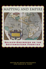
From the sixteenth through the mid-nineteenth centuries, Spain, then Mexico, and finally the United States took ownership of the land from the Gulf Coast of Texas and Mexico to the Pacific Coast of Alta and Baja California—today's American Southwest. Each country faced the challenge of holding on to territory that was poorly known and sparsely settled, and each responded by sending out military mapping expeditions to set boundaries and chart topographical features. All three countries recognized that turning terra incognita into clearly delineated political units was a key step in empire building, as vital to their national interest as the activities of the missionaries, civilian officials, settlers, and adventurers who followed in the footsteps of the soldier-engineers.
With essays by eight leading historians, this book offers the most current and comprehensive overview of the processes by which Spanish, Mexican, and U.S. soldier-engineers mapped the southwestern frontier, as well as the local and even geopolitical consequences of their mapping. Three essays focus on Spanish efforts to map the Gulf and Pacific Coasts, to chart the inland Southwest, and to define and defend its boundaries against English, French, Russian, and American incursions. Subsequent essays investigate the role that mapping played both in Mexico's attempts to maintain control of its northern territory and in the United States' push to expand its political boundary to the Pacific Ocean. The concluding essay draws connections between mapping in the Southwest and the geopolitical history of the Americas and Europe.

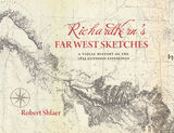
Robert Shlaer came across them many years later at the Newberry Library in Chicago and was inspired to locate the views depicted in the drawings and to photograph them, as nearly as was possible, from the same spot where Kern stood when he sketched them.
Richard Kern’s Far West Sketches juxtaposes Kern’s drawings with Shlaer's photographs, presenting 389 illustrations in geographic sequence from east to west, as well as a detailed narrative of the expedition. An associated website will include maps, drawings, and photographs so that they can be enlarged, compared, and studied in detail, providing an immersive experience of this important and ill-fated expedition.
READERS
Browse our collection.
PUBLISHERS
See BiblioVault's publisher services.
STUDENT SERVICES
Files for college accessibility offices.
UChicago Accessibility Resources
home | accessibility | search | about | contact us
BiblioVault ® 2001 - 2024
The University of Chicago Press


