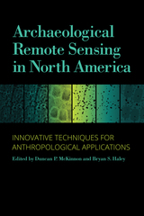
Updating the highly praised 2006 publication Remote Sensing in Archaeology, edited by Jay K. Johnson, Archaeological Remote Sensing in North America: Innovative Techniques for Anthropological Applications is a must-have volume for today’s archaeologist. Targeted to practitioners of archaeological remote sensing as well as students, this suite of current and exemplary applications adheres to high standards for methodology, processing, presentation, and interpretation.
The use of remote sensing technologies to address academic and applied archaeological and anthropological research problems is growing at a tremendous rate in North America. Fueling this growth are new research paradigms using innovative instrumentation technologies and broader-area data collection methods. Increasingly, investigators pursuing these new approaches are integrating remote sensing data collection with theory-based interpretations to address anthropological questions within larger research programs.
In this indispensable volume, case studies from around the country demonstrate the technically diverse and major remote sensing methods and their integration with relevant technologies, such as geographic information systems (GIS) and global positioning systems (GPS), and include various uses of the “big four”: magnetometry, resistivity, ground-penetrating radar (GPR), and electromagnetic induction.
The study explores four major anthropological themes: site structure and community organization; technological transformation and economic change; archaeological landscapes; and earthen mound construction and composition. Concluding commentary from renowned expert Kenneth L. Kvamme overviews the practices, advances, and trends of geophysics and remote sensing in the past decade.

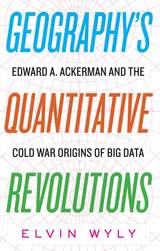
Do you have a smartphone? Billions of people on the planet now navigate their daily lives with the kind of advanced Global Positioning System capabilities once reserved for the most secretive elements of America’s military-industrial complex. But when so many people have access to the most powerful technologies humanity has ever devised for the precise determination of geographical coordinates, do we still need a specialized field of knowledge called geography?
Just as big data and artificial intelligence promise to automate occupations ranging from customer service and truck driving to stock trading and financial analysis, our age of algorithmic efficiency seems to eliminate the need for humans who call themselves geographers—at the precise moment when engaging with information about the peoples, places, and environments of a diverse world is more popular than ever before. How did we get here? This book traces the recent history of geography, information, and technology through the biography of Edward A. Ackerman, an important but forgotten figure in geography’s “quantitative revolution.” It argues that Ackerman’s work helped encode the hidden logics of a distorted philosophical heritage—a dangerous, cybernetic form of thought known as militant neo-Kantianism—into the network architectures of today’s pervasive worlds of surveillance capitalism.

A riveting introduction to the complex and evolving field of geospatial intelligence.
Although geospatial intelligence is a term of recent origin, its underpinnings have a long and interesting history. Geospatial Intelligence: Origins and Evolution shows how the current age of geospatial knowledge evolved from its ancient origins to become ubiquitous in daily life across the globe. Within that framework, the book weaves a tapestry of stories about the people, events, ideas, and technologies that affected the trajectory of what has become known as GEOINT.
Author Robert M. Clark explores the historical background and subsequent influence of fields such as geography, cartography, remote sensing, photogrammetry, geopolitics, geophysics, and geographic information systems on GEOINT. Although its modern use began in national security communities, Clark shows how GEOINT has rapidly extended its reach to other government agencies, NGOs, and corporations. This global explosion in the use of geospatial intelligence has far-reaching implications not only for the scientific, academic, and commercial communities but for a society increasingly reliant upon emerging technologies. Drones, the Internet of things, and cellular devices transform how we gather information and how others can collect that information, to our benefit or detriment.

READERS
Browse our collection.
PUBLISHERS
See BiblioVault's publisher services.
STUDENT SERVICES
Files for college accessibility offices.
UChicago Accessibility Resources
home | accessibility | search | about | contact us
BiblioVault ® 2001 - 2024
The University of Chicago Press


