front cover of Boston's Oldest Buildings and Where to Find Them
Boston's Oldest Buildings and Where to Find Them
Joseph M. Bagley
Brandeis University Press, 2021

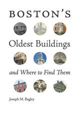
As Boston approaches its four-hundredth anniversary, it is remarkable that it still maintains its historic character despite constant development. The fifty buildings featured in this book all pre-date 1800 and illustrate Boston’s early history. This is the first book to survey Boston’s fifty oldest buildings and does so through an approachable narrative which will appeal to nonarchitects and those new to historic preservation. Beginning with a map of the buildings’ locations and an overview of the historic preservation movement in Boston, the book looks at the fifty buildings in order from oldest to most ­recent. Geographically, the majority of the buildings are located within the downtown area of Boston along the Freedom Trail and within easy walking distance from the core of the city. This makes the book an ideal guide for tourists, and residents of the city will also find it interesting as it includes numerous properties in the surrounding neighborhoods. The buildings span multiple uses from homes to churches and warehouses to restaurants. Each chapter features a building, a narrative focusing on its historical significance, and the efforts made to preserve it over time. Full ­color photos and historical drawings illustrate each building and area. Boston’s Oldest Buildings and Where to Find Them presents the ideals of historic preservation in an approachable and easy­-to-­read manner appropriate for the broadest audience. Perfect for history lovers, architectural enthusiasts, and tourists alike. 

[more]

front cover of The Changing Mile Revisited
The Changing Mile Revisited
An Ecological Study of Vegetation Change with Time in the Lower Mile of an Arid and Semiarid Region
Raymond M. Turner, Robert H. Webb, Janice E. Bowers, and James Rodney Hastings
University of Arizona Press, 2003
The Changing Mile, originally published in 1965, was a benchmark in ecological studies, demonstrating the prevalence of change in a seemingly changeless place. Photographs made throughout the Sonoran Desert region in the late 1800s and early 1900s were juxtaposed with photographs of the same locations taken many decades later. The nearly one hundred pairs of images revealed that climate has played a strong role in initiating many changes in the region. This new book updates the classic by adding recent photographs to the original pairs, providing another three decades of data and showing even more clearly the extent of change across the landscape. During these same three decades, abundant information about climatic variability, land use, and plant ecology has accumulated, making it possible to determine causes of change with more confidence.

Using nearly two hundred additional triplicate sets of unpublished photographs, The Changing Mile Revisited utilizes repeat photographs selected from almost three hundred stations located in southern Arizona, in the Pinacate region of Mexico, and along the coast of the Gulf of California. Coarse photogrammetric analysis of this enlarged photographic set shows the varied response of the region's major plant species to the forces of change. The images show vegetation across the entire region at sites ranging in elevation from sea level to a mile above sea level. Some sites are truly arid, while others are located above the desert in grassland and woodland. Common names are used for most plants and animals (with Latin equivalents in endnotes) to make the book more accessible to non-technical readers.

The original Changing Mile was based upon a unique set of data that allowed the authors to evaluate the extent and magnitude of vegetation change in a large geographic region. By extending the original landmark study, The Changing Mile Revisited will remain an indispensable reference for all concerned with the fragile desert environment.
[more]

front cover of Grand Canyon, A Century of Change
Grand Canyon, A Century of Change
Rephotography of the 1889-1890 Stanton Expedition
Robert H. Webb
University of Arizona Press, 1996
Photographs made in Grand Canyon a century ago may provide us today with a sense of history; photographs made a century later from the same vantage points give us a more precise picture of change in this seemingly timeless place. Between 1889 and 1890, Robert Brewster Stanton made photographs every 1-2 miles through the river corridor for the purpose of planning a water-level railroad route and produced the largest collection of photographs of the Colorado River at one point in time. Robert Webb, a USGS hydrologist conducting research on debris flows in the Canyon, obtained the photographs and from 1989 to 1995 replicated all 445 of the views captured by Stanton, matching as closely as possible the original camera positions and lighting conditions. Grand Canyon, a Century of Change assembles the most dramatic of these paired photographs to demonstrate both the persistence of nature and the presence of humanity. Unexpected longevity of some plant species, effects of animal grazing, and expansion of cacti are all captured by the replicate photographs. More telling is evidence of the impact of Glen Canyon Dam: increased riparian vegetation, new marshes, aggraded debris fans, and eroded sand bars. In the accompanying text, Webb provides a thorough analysis of what each pair of photographs shows and places the project in its historical context. Complementing his narrative are six sidebar articles by authorities on Canyon natural history that further attest to a century of change. The level of detail obtained from the photographs represents one of the most extensive long-term monitoring efforts ever conducted in a national park; it is the most detailed documentation effort ever performed using repeat photography. Much more than simply a picture book, Grand Canyon, a Century of Change is an environmental history of the river corridor, a fascinating book that clearly shows the impact of human influence on Grand Canyon and warns us that its future is very much in our hands.
[more]

front cover of Passage to Wonderland
Passage to Wonderland
Rephotographing Joseph Stimson's Views of the Cody Road to Yellowstone National Park, 1903 and 2008
Michael A. Amundson
University Press of Colorado, 2012
In 1903 the Cody Road opened, leading travelers from Cody, Wyoming, to Yellowstone National Park. Cheyenne photographer J. E. Stimson traveled the route during its first week in existence, documenting the road for the state of Wyoming's contribution to the 1904 World's Fair. His images of now-famous landmarks like Cedar Mountain, the Shoshone River, the Holy City, Chimney Rock, Sylvan Pass, and Sylvan Lake are some of the earliest existing photographs of the route. In 2008, 105 years later, Michael Amundson traveled the same road, carefully duplicating Stimson's iconic original photographs. In Passage to Wonderland, these images are paired side by side and accompanied by a detailed explanation of the land and history depicted.

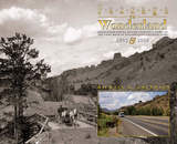
Amundson examines the physical changes along "the most scenic fifty miles in America" and explores the cultural and natural history behind them. This careful analysis of the paired images make Passage to Wonderland more than a "then and now" photography book--it is a unique exploration of the interconnectedness between the Old West and the New West. It will be a wonderful companion for those touring the Cody Road as well as those armchair tourists who can follow the road on Google Earth using the provided GPS coordinates.


The University Press of Colorado gratefully acknowledges the generous support of the Charles Redd Center for Western Studies at Brigham Young University toward the publication of this book.


[more]

front cover of Repeat Photography
Repeat Photography
Methods and Applications in the Natural Sciences
Edited by Robert H. Webb, Diane E. Boyer, and Raymond M. Turner
Island Press, 2010
First developed in the 1880s as a way to monitor glaciers in Europe, repeat photography —the practice of taking photographs at different points in times from the same physical vantage point—remains an essential and cost-effective technique for scientists and researchers working to track and study landscape change.
 
This volume explores the technical and geographic scope of this important technique, focusing particularly on the intertwined influences of climatic variation and land-use practices in sculpting landscapes. Contributors offer a broad-perspective review of the state-of-the-art of repeat photography, with twenty-three chapters written by researchers around the globe who have made use of repeat photography in their work. Topics addressed include
the history of repeat photography
techniques for creating and analyzing repeat photographs
applications in the geosciences
applications in population ecology
applications in ecosystem change
cultural applications

Repeat Photography demonstrates the wide range of potential applications, examines new techniques for acquiring data from repeat photography, and clearly shows that repeat photography remains a valuable and efficient means of monitoring change in both developed and developing regions. Over one hundred sets of photographs, including thirty-two pages of color photos, serve as examples.
 
Recent concerns about climate change and its effects on natural landscapes, combined with ongoing concerns about land-use practices, make this state-of-the-art review a timely contribution to the literature.
[more]

front cover of The Ribbon of Green
The Ribbon of Green
Change in Riparian Vegetation in the Southwestern United States
Robert H. Webb, Stanley A. Leake, and Raymond M. Turner
University of Arizona Press, 2007
Woody wetlands constitute a relatively small but extremely important part of the landscape in the southwestern United States. These riparian habitats support more than one-third of the region’s vascular plant species, are home to a variety of wildlife, and provide essential havens for dozens of migratory animals. Because of their limited size and disproportionately high biological value, the goal of protecting wetland environments frequently takes priority over nearly all other habitat types. In The Ribbon of Green, hydrologists Robert H. Webb, and Stanley A. Leake and botanist Raymond M. Turner examine the factors that affect the stability of woody riparian vegetation, one of the largest components of riparian areas. Such factors include the diversion of surface water, flood control, and the excessive use of groundwater. Combining repeat photography with historical context and information on species composition, they document more than 140 years of change. Contrary to the common assumption of widespread losses of this type of ecosystem, the authors show that vegetation has increased on many river reaches as a result of flood control, favorable climatic conditions, and large winter floods that encourage ecosystem disturbance, germination, and the establishment of species in newly generated openings. Bringing well-documented and accessible insights to the ecological study of wetlands, this book will influence our perception of change in riparian ecosystems and how riparian restoration is practiced in the Southwest, and it will serve as an important reference in courses on plant ecology, riparian ecology, and ecosystem management.
[more]

front cover of Wyoming Revisited
Wyoming Revisited
Rephotographing the Scenes of Joseph E. Stimson
Michael A. Amundson
University Press of Colorado, 2014
In Wyoming Revisited, Michael A. Amundson uses the power of rephotography to show how landscapes across the state have endured over the last century. Three sets of photographs—the original black-and-white photographs taken by famed Wyoming photographer Joseph E. Stimson more than a century ago, repeat black-and-white images taken by Amundson in the 1980s, and a third view in color taken by the author in 2007–2008—are accompanied by captions explaining the history and importance of each site as well as information on the process of repeat photographic fieldwork.

The 117 locations feature street views of Wyoming towns and cities, as well as views from the state's famous natural landmarks like Yellowstone National Park, Grand Teton National Park, Devil's Tower National Monument, Hot Springs State Park, and Big Horn and Shoshone National Forests. In addition, Amundson provides six in-depth essays that explore the life of Joseph E. Stimson, the rephotographic process and how it has evolved, and how repeat photography can be used to understand history, landscape, historic preservation, and globalization.

Wyoming Revisited highlights the historic evolution of the American West over the past century and showcases the significant changes that have occurred over the past twenty-five years. This book will appeal to photographers, historians of the American West, and anyone interested in Wyoming's history or landscape.

The publication of this book is supported in part by the Wyoming Cultural Trust Fund.


[more]


Send via email Share on Facebook Share on Twitter