By Mark Lambert, James Harkins, Brian A. Stauffer, and Patrick Walsh
2025 Second Place, Presidio La Bahía Award, Sons of the Republic of Texas
2026 Ron Tyler Award for Best Illustrated Book on Texas History and Culture, Texas State Historical Association (TSHA)
A comprehensive volume on historical mapping in Texas.
The Texas General Land Office’s map collection contains over 45,000 maps, some dating from the sixteenth century, making it one of the most important cartographic archives in Texas. As products and agents of history drawn by cartographers with motives and means as diverse as the places they document, maps provide a unique perspective on geopolitical, cultural, and economic processes. The maps of the GLO offer key insights into Texas’s sprawling history. They speak to issues of changing borders, social and political upheaval, and questions of sovereignty and power.
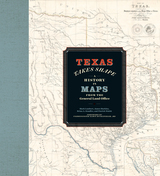
Texas Takes Shape offers an illuminating selection from the GLO archive: over one hundred maps that tell—and sometimes obscure—the stories of European colonization, Spanish and Mexican rule, the Republic of Texas, and the modern US state. There are maps here of every scale, from the hemispheric visions of European explorers to individual survey plats. Accompanying essays offer fascinating lessons on topics ranging from Indigenous cartography to military and railroad mapmaking and frontier surveys. Artful and informative, Texas Takes Shape examines a unique place through the eyes and imaginations of those who sought to govern it, profit from it, understand it, and call it home.