
 A SCHOLARLY BOOK REPOSITORY
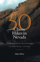
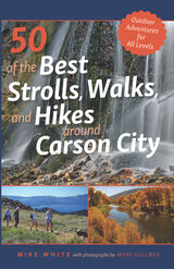
One of the area’s foremost experts on the outdoors, Mike White, author of 50 of the Best Strolls, Walks, and Hikes Around Reno, returns with a new guidebook dedicated to Carson City and its surrounding areas in northern Nevada. With over three hundred days of sunshine a year, this capital city’s parks, trails, lakes, and soaring peaks provide the perfect attractions for residents and visitors alike. This guide provides readers with the most precise information for a wide range of detailed paths and trails throughout the greater Carson City region and includes interesting sidebars about human and natural history for each trip.
From Virginia City and the Carson River on the east to the Sierra Nevada mountains to the west, this comprehensive guidebook offers the most complete guide for walkers, joggers, and hikers. Whether you are looking for a short and easy stroll on a city path or an extended hike along the Tahoe Rim Trail, this is your all-inclusive resource for your next outdoor adventure.
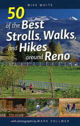
Reno, Nevada is one of the best communities in the nation for outdoor recreational opportunities. With over three hundred days of sunshine a year, the weather beckons residents and visitors alike to step outside and enjoy a casual stroll in a city park, a stiff climb to the top of one of the area’s surrounding mountains, or just about anything in between. White offers the most complete guide for walkers, joggers, runners, and hikers to the best paths and trails in the greater Reno-Sparks region.
This guide provides readers the most complete and detailed information for each excursion, from the Truckee River corridor to the Northern Valleys, including lakes, parks, trails, and mountains. Whether you are looking for a short and easy stroll on a paved path along one of the city’s greenbelts, or an extended hike into the mountains of the Mount Rose wilderness, this is your all-inclusive resource. White is one of the area’s foremost experts on the outdoors, and he includes interesting sidebars about human and natural history for each trip. This is a guide for anyone who enjoys a stroll, walk, or hike in and around Northern Nevada’s premier outdoor playgrounds.

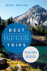
The guide includes thirteen detailed trail descriptions, along with information on additional resources, governing agencies, and permits and fees. It also provides listings of the nearest airports, outdoor retailers, campgrounds, transportation, and amenities and attractions. Accompanying the specific information on each trip are captivating historical vignettes and entertaining personal essays, enhancing the reader’s understanding of the area. Whether journeying from near or far, Best Backpacking Trips of California and Nevada is the most complete resource for turning a dream trip into reality.
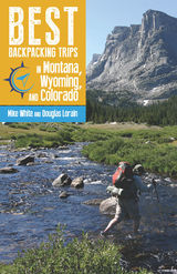
Best Backpacking Trips in Montana, Wyoming, and Colorado provides everything you need to know to organize and execute the best backpacking trips in the Mountain West. Mike White and Douglas Lorain, who have walked every mile of the trails described inside, take readers and hikers into some of the wildest and most scenic backcountry landscapes in the nation and help them design the ultimate trip.
Focusing on one-week excursions, the book offers details on all the aspects of trip planning—trail narratives, technical data, maps, gear, food, information on regulations and permits, and more. But it is more than a basic guidebook. Trip information is enriched by valuable and interesting sidebars on history and ecology that will increase appreciation for these natural areas and the people who were instrumental in their discovery or protection.
In Best Backpacking Trips in Montana, Wyoming, and Colorado, White and Lorain pass on their knowledge of quality hikes, planning and preparation, and the unique satisfaction of multi-day backpacking. This guide, put into practice, will result in the trip of a lifetime.
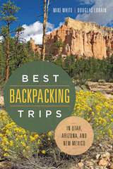
This is the second book in a series of detailed guidebooks covering all the best “life-list” backpacking vacations in the spectacular backcountry of the American West. This new volume specifically covers the best such adventures in the states of Utah, Arizona, and New Mexico. Every conceivable aspect of trip planning is covered in the guide, including maps and descriptions of the trail, where to locate the nearest airport, other area attractions that shouldn’t be missed, and guide services that are available. A noteworthy feature of the book is the individual vignettes that give insight into the historical significance of many of the trails. Also unique are the interesting and humorous personal accounts that the authors share from their personal experiences hiking these routes. Backpackers will find a wide range of outstanding trips, from high mountain adventures to some of the world’s best lower-elevation canyon hikes. Best Backpacking Trips in Utah, Arizona, and New Mexico provides an extensive choice of terrific expeditions.


Many changes have taken place in the decade since Follow the Blue Blazes was first published, changes in the trails themselves and in the way we hike them. The Buckeye Trail still wends its way around the state of Ohio, following the course marked out by the characteristic blue blazes on trees and signposts along the way. In the intervening years, however, sections of the trail have changed their route, added amenities, or just grown more interesting. From the startling rock formations and graceful waterfalls of Old Man’s Cave, to Native American mounds, battlefields, and scenic rivers, Connie and Robert J. Pond provide a captivating guide to often-overlooked treasures around the state.
Each chapter features an overview of a 100-mile section of the trail and three self-guided featured hikes. The overviews and the accompanying maps may be read consecutively to acquaint the reader with the entire course of the trail. But most readers will best enjoy the trail by taking the guide along on one of the featured hikes. Each route is outlined on an easy-to-read map with GPS coordinates and waypoints to guide the hiker, as well as explicit directions from parking lot to trailhead.
The Buckeye Trail is readily accessible from Cincinnati, Dayton, Toledo, Cleveland, and Akron. Even a short trip can lead to an adventure near your own backyard.

Unique among hiking trails is the one that forms a complete loop around the state of Ohio. That 1,200-mile trail is called the Buckeye Trail. Showing the way on tree trunks, rocks, and other natural signposts are the blue painted markings called “the blue blazes.” In Follow the Blue Blazes, the reader embarks on a journey to discover a part of Ohio largely unseen except along this great path.
Beginning with the startling rock formations and graceful waterfalls of Old Man’s Cave in southern Ohio, and leading clockwise around the state to visit expansive forests, lovely parks, ancient mounds, historic canals and battlefields, and scenic river trails, experienced trailsman Robert J. Pond provides a captivating look at each section of the trail.
Each chapter features an overview of a 100-mile section of the trail and three self-guided featured hikes. The overviews, with accompanying maps, may be read consecutively to acquaint the reader with the entire course of the blue blazes. But most readers will best enjoy the Buckeye Trail by taking the guide along on featured hikes. Each hike is supported by a detailed but easy-to-follow map and includes explicit directions to trailheads and approximate hiking times.
In addition to many outlying areas, the extensive Buckeye Trail is accessible in or near Cincinnati, Dayton, Toledo, Cleveland, and Akron. Robert Pond has supplemented each description with interesting details about the geology and the diverse habitats of flora and fauna. Readers, too, can enjoy the beauty and wonders of Ohio if they Follow the Blue Blazes.

Organized by the age of the young adventures, from days-old infants to independent teens, each section invites readers to learn from the humorous real-life adventures and misadventures of the author, her husband, and their twin girls. Weaving in the kids’ advice in their own words, this guide covers challenges ranging from unexpected hailstorms to very-much-expected mosquitoes. Tips include everything from how to avoid moose, to how to get out in the rain, to the benefits of setting big kids free to explore. This family’s enthusiastic, joyful, and often hilarious tales offer the impetus and the tools to encourage new parents—or more experienced parents, or anyone who loves kids —to go play outside.
High in Utah is quite consciously a book for peak baggers, complete with a checklist and elevations. Summits range from Kings Peak, Utah’s highest at 13,528’ to the unnamed peak in Rich County, a mere 9,255’. In addition to the county high points, this book also has four “classic” climbs: Mt. Olympus in Salt Lake County; Mt. Timpanogos above Provo; Notch Peak in the House Range west of Delta; and Wellsville Cone, Cache Valley’s western landmark.
Since finding a place to start can often be the most frustrating part of a hike, emphasis is placed on directions to each trailhead. There is a road map for each hike, as well as a trail map showing contours. The routes in this guide are not always the easiest or most practical, but they may be the most appealing and are often the most commonly used (lessening human impact on other potential routes). Difficulty levels range from 'extreme'—long, steep routes that may require some route finding—to 'too easy'—reachable by car. Two sets of hiking times are provided to accommodate variations in hiking speed, and there are also sections on flora and fauna, mountain weather, low-impact hiking and camping, equipment, and altitude sickness.
"Alaska is our biggest, buggiest, boggiest state. Texas remains our largest unfrozen state. But mountainous Utah, if ironed out flat, would take up more space on a map than either."
—Edward Abbey, 1927–1989
is an indispensable guide for travelers who wish to retrace the various frontier
routes taken by the Mormons and other pioneers in their treks westward. Traversing
fifteen states from New York to California, Stanley Kimball presents some of
America's most famous trails--the Mormon, the Oregon-California, the Santa Fe,
the Overland, and many others--and describes important points of interest, including
forts, trail centers, and museums.
"An important contribution
to the history of the West and perhaps the most comprehensive mile-by-mile guide
to trail markers and historical sites ever prepared."
-- Brigham D. Madsen, author of The Shoshoni Frontier and the Bear
River Massacre

FINALIST, 2023 Society of Midland Authors Award in Adult Nonfiction!
Exploring Illinois history through the paths we travel
Illinois Trails & Traces partners the deft writing of Gary Marx with vivid photography by Daniel Overturf to illuminate ever evolving patterns of travel and settlement. Taking the reader on a journey down early buffalo traces and Native American trails, this book shows how these paths evolved into wagon roads and paved highways. Marx and Overturf explore historic routes ranging from Route 66 to the Underground Railroad, all the way back to post-Ice Age animal migration trails followed by Paleo-Indian people. The authors also examine how rivers, canals, and railroads spurred the rapid rise of Illinois as a modern state.
Marx and Overturf bring history into the present by including over forty photographic portraits and written profiles of individuals who live along these routes today. Many of the people you will meet on these pages work to preserve and honor the history of these passages. Others profiled here embody the spirit of the old roads and provide a vivid link between past and present. Through this journey, we discover that we’ve all been traveling the same road all along.

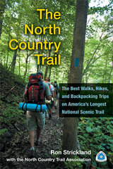
The North Country Trail is the longest of America’s eleven congressionally designated National Scenic Trails. Winding through seven states—New York, Pennsylvania, Ohio, Michigan, Wisconsin, Minnesota, and North Dakota—the NCT’s 4,600 miles attract more than one million visitors annually. These hikers are treated to a smorgasbord of Upper Midwest hiking featuring everything from urban strolls to backcountry adventure through mountains, rivers, prairies, and shoreline. This book is the definitive guide for NCT hikers—whether first-timers, seasoned backpackers, or any level in between—who wish to maximize their experience on this splendid trail.
In addition to a full overview of the trail’s tread in each state, the guide describes in detail forty of the NCT’s premier segments, with helpful information including easy-to-read trail descriptions, physical and navigation difficulties, trail highlights, hiking tips, and precise maps incorporating the latest GPS technology.
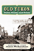
In this humorous and upbeat memoir, James Wickersham describes his career as a pioneer judge and later as a congressional representative assigned to a vast, snow-covered district, extending over 300,000 square miles in the undeveloped Alaska Territory. Wickersham’s many adventures include traveling by dogsled over hundreds of miles through snow-covered mountains; serving as judge for the trials of many famous outlaws in the midst of the gold strikes; and hunting, mining, and climbing in his local Alaska wilderness. Though he was instrumental in the early history of Alaska, and his legacy is evident throughout the state—for example, he named the city of Fairbanks—this is the first and only work to focus on Wickersham’s life during this pivotal time in Alaska’s history.
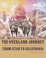
The wagon trail between Salt Lake City and Los Angeles is one of the most important and least-known elements of nineteenth-century Western migration. Known as the Southern Route, it included the western half of the Old Spanish Trail and was favored because it could be used for travel and freighting year-round. It was, however, likely the most difficult route that pioneers traveled with any consistency, following not rivers but leading from one--sometimes dubious--desert watering place to the next and offering few havens for the sick, weary, or unfortunate. Historian Edward Leo Lyman has provided the first history of the complete Southern Route and of the people who developed and used it. Based on extensive research in primary sources--including many early travelers’ accounts--and on Lyman’s own investigation of the route and its branches, the book discusses the exploration and development of the Old Spanish Trail, its horse thieves and traders, including Jed Smith and Kit Carson, along with government explorere John C. Frémont. Developing the old pack mule trail as a wagon road between Salt Lake City and Los Angeles, miners heading for the California gold fields first used the route extensively. Mormon missionaries and the colonizers of San Bernardino and other communities also traveled that way, as did a wide array of mail carriers, soldiers and world travelers. Later, a steady stream of Anglo-American emigrants seeking new homes or fortunes in California shared the road with a surprising number of freight wagon operators. The trail passed through the territories of numerous Native American peoples, and contacts with them--both friendly and hostile--played a significant role in the experiences of travelers and in the fates of Native American cultures in this region. Lyman’s discussions of Mormon-Indian relations and of the infamous Mountain Meadows Massacre offer fresh and important analyses of these vital aspects of the westward movement.

Stu Fliege highlights historical events, such as the Herrin Massacre and Chicago’s Iroquois Theatre fire, and covers the diverse terrain of Illinois’s natural and constructed wonders, from Lusk Creek Canyon to Robert Allerton Park. Readers will meet a colorful cast of characters including pioneers, squatters, miners, gangsters, and utopian leaders. They’ll travel back in time to when salt production was the state’s main industry and learn of the Illinois ingenuity that spawned inventions including barbed wire, the steel plow, and the Ferris wheel. From Oquawka’s elephant memorial to Murphysboro’s mysterious mud monster, the book also offers quirky facts and spooky stories that aren’t found in the average history book.
Liberally illustrated and clearly written, Tales and Trails of Illinois is a helpful learning tool for Illinoisans of all ages, perfect for families, history buffs, libraries, and the classroom.

Eastern Massachusetts offers incredible trail-running opportunities, ranging from popular long-distance routes like the Bay Circuit Trail to lesser-known loops that run through the mountains and forests of the Quabbin watershed and Merrimack Valley region, and trails that pass alongside the shores of Cape Cod. All over the Bay State, there are trails suitable for runners of all levels waiting to be discovered and explored.
Avid trail runner Ben Kimball offers a selection of fifty-one of eastern Massachusetts’s most spectacular trail sites, including detailed trail descriptions, topographic maps, directions, parking information, safety tips, and much more. Both experienced and novice trail runners will find Trail Running Eastern Massachusetts to be an invaluable resource for exploring nature and getting a good workout, in the Boston area and beyond.

The wild and rural landscape of southern Vermont offers a true bounty of great trail-running opportunities, from out-and-back (or pointtopoint) runs on popular long-distance routes, such as segments of the Long Trail or Appalachian Trail, to quiet, little-known loops hidden away in the woods. This helpful guide is just the resource needed for trip planning or for a spontaneous run in a beautiful place.
Local expert trail runner Ben Kimball offers a range of suggested route options, sometimes even several at the same site, for runners of all skill levels. He also provides important practical information, such as the full distance of the suggested route; a difficulty rating; the trail style and type; the total ascent; and directions, along with a detailed description of the trail itself. There are also scannable codes for downloading trail maps to your smartphone. The trails included vary in difficulty and terrain type, and range from low elevations in the Connecticut River Valley to as high as 4,000 feet at Killington Peak in the Green Mountains. This indispensable book is the perfect companion for adventurous runners and hikers interested in exploring southern Vermont.


Communities across the country are working to convert unused railway and canal corridors into trails for pedestrians, cyclists, horseback riders, and others, serving the needs of both recreationists and commuters alike. These multi-use trails can play a key role in improving livability, as they offer an innovative means of addressing sprawl, revitalizing urban areas, and reusing degraded lands.
Trails for the Twenty-First Century is a step-by-step guide to all aspects of the planning, design, and management of multi-use trails. Originally published in 1993, this completely revised and updated edition offers a wealth of new information including.
- discussions of recent regulations and federal programs, including ADA and TEA-21
- recently revised design standards from AASHTO
- current research on topics ranging from trail surfacing to conflict resolution
- information about designing and building trails in brownfields and other
- environmentally troubled landscapes
Also included is a new introduction that describes the importance of rail-trails to the sustainable communities movement, and an expanded discussion of maintenance costs. Enhanced with a wealth of illustrations, Trails for the Twenty-First Century provides detailed guidance on topics such as: taking a physical inventory and assessment of a site; involving the public and meeting the needs of adjacent landowners; understanding and complying with existing legislation; designing, managing, and promoting a trail; and where to go for more information. It is the only comprehensive guidebook available for planners, landscape architects, local officials, and community activists interested in creating a multi-use trail.
- how to make physical and cultural assessments of the site and surrounding communities
- planning the trail: public involvement, meeting the needs of adjacent landowners, compliance with legislation
- designing the trail: making it unique,meeting the needs of different users, working with special features
- managing the trail
- maximizing the trail's potential
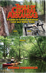
Trails of Central Arkansas delivers:
* Sixty trails in 36 parks or locations from Benton and Bryant to Cabot, from Wrightsville to Conway
* Color maps of every trail
* GPS coordinates for every trailhead
* Color-coded distinctions between paved and unpaved trails
* Level of difficulty ratings
* Scenery Scores
* Top-ten lists: Most Scenic, Trails for Kids, and Trails for Solitude


A self-taught scientist in the newly forming field of anthropology, McGee led two expeditions through southern Arizona and northern Sonora for the Bureau of American Ethnology. There he conducted ethnographic research among the Papagos (Tohono O'odham) and the Seris, and his subsequent publication The Seri Indians helped secure his place in the anthropological community.
McGee's complete journals of the expeditions, kept in small field notebooks and preserved in the Library of Congress, are published here for the first time. These journals contain detailed descriptions of the country and people McGee encountered and convey the adventure of traveling through wild and unfamiliar places—including a voyage to Isla Tiburón, or Shark Island, in the Gulf of California—and being plagued by foul weather, a shortage of supplies, and fear of attack from hostile Indians.
Trails to Tiburón features 57 historical photographs taken on the expedition, capturing the places McGee saw and the people he encountered. Fontana's notes to the diary provide useful botanical, geological, and ethnographic information, while his introduction places McGee and his field work in the context of late-nineteenth-century anthropology and science.
Trails to Tiburón reveals McGee's versatility as a field worker and shows his methods, often questioned today, to be the reasonable response of a man caught up in the intellectual fervor of his time. For anyone wanting to share in the spirit of adventure, these journals are a landmark in the annals of exploration.
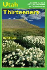
Most Utahns are familiar with the Uinta Mountains, but few realize that the range has twenty-one peaks above 13,000 feet, some of them still unnamed. The elevation, challenging terrain and weather, solitude, and beautiful setting in Utah’s largest wilderness area make climbing these peaks a particularly rewarding experience. Better yet, in the summer and early fall every one of them can be climbed by a reasonably fit hiker without rope or climbing gear.
This guide provides detailed topographical maps and information on trailheads, access and summit routes with difficulty ratings, camp locations, estimated hiking times, weather, advice, and brief facts about geology and the history of the wilderness area. It also includes over fifty photographs of this breathtaking country.
A companion to the popular Walking Trails of Southern Wisconsin, this book describes more than 200 trails in 72 locations throughout five of the state's major regions. Bob Crawford provides maps and detailed instructions to make the trails easy to locate.
With each trail description you'll find:
* details about the route and terrain, as well as geographical, biological, or historical features of interest;
* regulations including open days and hours, and rules regarding dogs, trail bikes, cross-country skiing, and other activities;
* information about available restrooms, drinking water, nature centers, and other facilities at the site;
* a description assessing degree of difficulty—slope, width, maintenance, and other such factors—and a helpful rating of "walkability" on a scale from 1 to 5.
The only comprehensive guide to hiking locations in the eastern part of the state, this book also provides lists of trail locations that include playground equipment for kids and picnic facilities for those who want to make a day trip of their hiking outing. Appendices spotlight trails that boast historical significance, ice age features, picnic areas, and cross-country skiing opportunities.
READERS
Browse our collection.
PUBLISHERS
See BiblioVault's publisher services.
STUDENT SERVICES
Files for college accessibility offices.
RECENTLY PUBLISHED
")


UChicago Accessibility Resources
home | accessibility | search | about | contact us
BiblioVault ® 2001 - 2025
The University of Chicago Press