
 A SCHOLARLY BOOK REPOSITORY
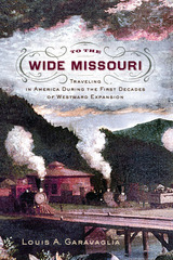
The Fascinating History of the Rapid Expansion of Roads, Canals, and Railways in the First Decades of the United States
While the great overland migration routes to America’s far west are well known and documented—the California, Oregon, Mormon, and Santa Fe Trails, the Central Overland and Pony Express—less attention has been given to how Americans in the first decades of the republic traveled across the western frontiers of the original colonies. Following the revolution, Americans began to seek their fortunes to the west in greater numbers. Land grants to veterans inspired others to move, including tradesmen, merchants, and tavern owners. With the Louisiana Purchase in 1803, the country doubled in size, and the rate of migration became extraordinary, with wider and more durable roads built, ferries installed at river crossings, canals cut to move goods, regular stage routes established, and ultimately the first railroad tracks laid down. Entire regions that supported few communities in the 1790s exploded in population, and as a result seven new states were admitted to the Union in the decade following the War of 1812. John Bradbury, who traveled through the United States between 1809 and 1811, wrote that “In passing through the upper parts of Virginia, I observed a great number of farms that had been abandoned, on many of which good houses had been erected, and fine apple and peach orchards had been planted. On enquiring the reason, I was always informed that the owners had gone to the western country.” In Maryland, a newspaper reporter wrote, “The time is close at hand when the region west of the Allegheny mountains will sway the destinies of the nation.” By 1839, the National Road extended more than 700 miles from Washington, DC, to central Illinois, New York’s Erie Canal operated from Albany to Buffalo, and the Baltimore and Ohio Railroad carried passengers briskly west, ultimately to the Ohio River.
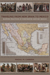
From the sixteenth century until the early nineteenth, Europeans had envisioned New Spain (colonial Mexico) in texts, maps, and other images. In the first decades of the 1800s, ideas about Mexican, rather than Spanish, national character and identity began to cohere in written and illustrated narratives produced by foreign travelers. During the nineteenth century, technologies and processes of visual reproduction expanded to include lithography, daguerreotype, and photography. New methods of display—such as albums, museums, exhibitions, and world fairs—signaled new ideas about spectatorship. García Cubas participated in this emerging visual culture as he reconfigured geographic and cultural imagery culled from previous mapping practices and travel writing. In works such as the Atlas geográfico (1858) and the Atlas pintoresco é historico (1885), he presented independent Mexico to Mexican citizens and the world.
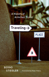
Organized into twenty-one “legs”—or short chapters—Traveling in Place begins with a consideration of Xavier de Maistre’s 1794 Voyage autour de ma chambre, an account of the forty-two-day “journey around his room” Maistre undertook as a way to entertain himself while under house arrest. Stiegler is fascinated by the notion of exploring the familiar as though it were completely new and strange. He engages writers as diverse as Roussel, Beckett, Perec, Robbe-Grillet, Cortázar, Kierkegaard, and Borges, all of whom show how the everyday can be brilliantly transformed. Like the best guidebooks, Traveling in Place is more interested in the idea of travel as a state of mind than as a physical activity, and Stiegler reflects on the different ways that traveling at home have manifested themselves in the modern era, from literature and film to the virtual possibilities of the Internet, blogs, and contemporary art.
Reminiscent of the pictorial meditations of Sebald, but possessed of the intellectual playfulness of Calvino, Traveling in Place offers an entertaining and creative Baedeker to journeying at home.
About Occasional Publications of the Bounds Law Library
This collection offers a series of edited documents that contribute to an understanding of the development of legal history, culture, or doctrine. Series editors Paul M. Pruitt Jr. and David I. Durham have selected a variety of materials—a lecture, diaries, letters, speeches, a ledger, commonplace books, a code of ethics, court reports—to illustrate unique examples of legal life and thought.
John Wright's collection of interviews and stories about Ralph Stanley puts readers around a campfire at a bluegrass festival while old-timers weave yarns far into the night. Told by those who create, produce, stage, love, and virtually live for old-time mountain music, these tales come from the longtime coworkers, sidemen, promoters, friends, and others in the orbit of the music legend. The storytellers include a scholar who knew Stanley from the early days, the housewife who ran the Stanley Brothers Fan Club, and a souvenir seller for whom the discovery of Stanley's music was almost a religious experience.
Wright also uses these invaluable oral histories as a foundation to describe and evaluate Stanley's long career with the Clinch Mountain Boys and the development of his music after the death of his brother Carter. An appendix covers Ralph's prolific recording activity through the mid-1990s, including a breathtaking forty-five albums compromising more than 550 songs and tunes.
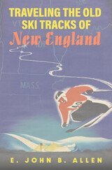
For over a century New Englanders have taken to the slopes in search of ways to enjoy the coldest months, and skiing has deep roots in the region. In the late nineteenth century Scandinavian immigrants worked to educate snowbound locals on how to ski, make equipment, and prepare trails. Soon thereafter, colleges across the Northeast built world-class ski programs, massive jumps were constructed in Brattleboro and Berlin, and dozens of ski areas—big and small—cropped up from the 1930s through the 1960s.
Traveling the Old Ski Tracks of New England offers a fascinating history of downhill, cross-country, and backcountry skiing across the region and its leading personalities. Moving from popular destinations like Stowe, Cannon, Bromley, and Mount Washington to the less intimidating hills surrounding Boston, Rhode Island, and Connecticut, E. John B. Allen also recovers the forgotten stories of ski areas that have been abandoned in the face of changing tastes and a warming climate.

READERS
Browse our collection.
PUBLISHERS
See BiblioVault's publisher services.
STUDENT SERVICES
Files for college accessibility offices.
RECENTLY PUBLISHED
")


UChicago Accessibility Resources
home | accessibility | search | about | contact us
BiblioVault ® 2001 - 2024
The University of Chicago Press