Results by title
341 books match the query 'Geography' and 30 start with a
A Geography of New Jersey
The City in the GardenStansfield, Charles A.
Rutgers University Press, 1998
A Historical Atlas of Tibet
Karl E. Ryavec
University of Chicago Press, 2015
Cradled among the world’s highest mountains—and sheltering one of its most devout religious communities—Tibet is, for many of us, an ultimate destination, a place that touches the heavens, a place only barely in our world, at its very end. In recent decades Western fascination with Tibet has soared, from the rise of Tibetan studies in academia to the rock concerts aimed at supporting its independence to the simple fact that most of us—far from any base camp—know exactly what a sherpa is. And yet any sustained look into Tibet as a place, any attempt to find one’s way around its high plateaus and through its deep history, will yield this surprising fact: we have barely mapped it. With this atlas, Karl E. Ryavec rights that wrong, sweeping aside the image of Tibet as Shangri-La and putting in its place a comprehensive vision of the region as it really is, a civilization in its own right. And the results are absolutely stunning.
The product of twelve years of research and eight more of mapmaking, A Historical Atlas of Tibet documents cultural and religious sites across the Tibetan Plateau and its bordering regions from the Paleolithic and Neolithic times all the way up to today. It ranges through the five main periods in Tibetan history, offering introductory maps of each followed by details of western, central, and eastern regions. It beautifully visualizes the history of Tibetan Buddhism, tracing its spread throughout Asia, with thousands of temples mapped, both within Tibet and across North China and Mongolia, all the way to Beijing. There are maps of major polities and their territorial administrations, as well as of the kingdoms of Guge and Purang in western Tibet, and of Derge and Nangchen in Kham. There are town plans of Lhasa and maps that focus on history and language, on population, natural resources, and contemporary politics.
Extraordinarily comprehensive and absolutely gorgeous, this overdue volume will be a cornerstone in cartography, Asian studies, Buddhist studies, and in the libraries or on the coffee tables of anyone who has ever felt the draw of the landscapes, people, and cultures of the highest place on Earth.

A Jumble of Needs
Women’s Activism and Neoliberalism in the Colonias of the SouthwestRebecca Dolhinow
University of Minnesota Press, 2010
A Nation of Neighborhoods
Imagining Cities, Communities, and Democracy in Postwar AmericaBenjamin Looker
University of Chicago Press, 2015
Looker investigates the cultural, social, and political complexities of the idea of “neighborhood” in postwar America and how Americans grappled with vast changes in their urban spaces from World War II to the Reagan era. In the face of urban decline, competing visions of the city neighborhood’s significance and purpose became proxies for broader debates over the meaning and limits of American democracy. By studying the way these contests unfolded across a startling variety of genres—Broadway shows, radio plays, urban ethnographies, real estate documents, and even children’s programming—Looker shows that the neighborhood ideal has functioned as a central symbolic site for advancing and debating theories about American national identity and democratic practice.
A Neighborhood That Never Changes
Gentrification, Social Preservation, and the Search for AuthenticityJaponica Brown-Saracino
University of Chicago Press, 2009
Newcomers to older neighborhoods are usually perceived as destructive, tearing down everything that made the place special and attractive. But as A Neighborhood That Never Changes demonstrates, many gentrifiers seek to preserve the authentic local flavor of their new homes, rather than ruthlessly remake them. Drawing on ethnographic research in four distinct communities—the Chicago neighborhoods of Andersonville and Argyle and the New England towns of Provincetown and Dresden—Japonica Brown-Saracino paints a colorful portrait of how residents new and old, from wealthy gay homeowners to Portuguese fishermen, think about gentrification.
The new breed of gentrifiers, Brown-Saracino finds, exhibits an acute self-consciousness about their role in the process and works to minimize gentrification’s risks for certain longtime residents. In an era of rapid change, they cherish the unique and fragile, whether a dilapidated house, a two-hundred-year-old landscape, or the presence of people deeply rooted in the place they live. Contesting many long-standing assumptions about gentrification, Brown-Saracino’s absorbing study reveals the unexpected ways beliefs about authenticity, place, and change play out in the social, political, and economic lives of very different neighborhoods.
A Resonant Ecology
Max Ritts
Duke University Press, 2024
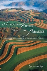
A Thousand Pieces of Paradise
Landscape and Property in the Kickapoo ValleyLynne Heasley
University of Wisconsin Press, 2012
A Thousand Pieces of Paradise is an ecological history of property and a cultural history of rural ecosystems set in one of the Midwest’s most historically significant regions, the Kickapoo River Valley. Whether examining the national war on soil erosion, Amish migration, a Corps of Engineers dam project, or Native American land claims, Lynne Heasley traces the history of modern American property debates. Her book holds powerful lessons for rural communities seeking to reconcile competing values about land and their place in it.
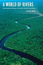
A World of Rivers
Environmental Change on Ten of the World's Great RiversEllen Wohl
University of Chicago Press, 2010
Far from being the serene, natural streams of yore, modern rivers have been diverted, dammed, dumped in, and dried up, all in efforts to harness their power for human needs. But these rivers have also undergone environmental change. The old adage says you can’t step in the same river twice, and Ellen Wohl would agree—natural and synthetic change are so rapid on the world’s great waterways that rivers are transforming and disappearing right before our eyes.
A World of Rivers explores the confluence of human and environmental change on ten of the great rivers of the world. Ranging from the Murray-Darling in Australia and the Yellow River in China to Central Europe’s Danube and the United States’ Mississippi, the book journeys down the most important rivers in all corners of the globe. Wohl shows us how pollution, such as in the Ganges and in the Ob of Siberia, has affected biodiversity in the water. But rivers are also resilient, and Wohl stresses the importance of conservation and restoration to help reverse the effects of human carelessness and hubris.
What all these diverse rivers share is a critical role in shaping surrounding landscapes and biological communities, and Wohl’s book ultimately makes a strong case for the need to steward positive change in the world’s great rivers.
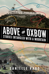
Above the Oxbow
Stories Entangled with a MountainDanielle R. Raad
West Virginia University Press, 2026
Above the Oxbow is a journey through the tangle of rich narratives surrounding Mount Holyoke, a locally cherished mountain in Western Massachusetts. It explores how visitors have forged connections with the mountain through various activities over the past two centuries. In an accessible blend of storytelling and scholarly analysis, Danielle Raad shows the significance of the landscape, historic sites, and material culture, revealing how cultural perspectives, community activism, collective memory, and personal experiences shape our understanding of a place. Situated at the intersection of public history and environmental history, this ethnography of place also discloses the curious stories of the Summit House, an erstwhile tramway, an airplane crash, and the local fight to conserve Mount Holyoke as a natural space and celebrates its myriad uses today.
Abysmal
A Critique of Cartographic ReasonGunnar Olsson
University of Chicago Press, 2007
People rely on reason to think about and navigate the abstract world of human relations in much the same way they rely on maps to study and traverse the physical world. Starting from that simple observation, renowned geographer Gunnar Olsson offers in Abysmal an astonishingly erudite critique of the way human thought and action have become deeply immersed in the rhetoric of cartography and how this cartographic reasoning allows the powerful to map out other people’s lives.
A spectacular reading of Western philosophy, religion, and mythology that draws on early maps and atlases, Plato, Kant, and Wittgenstein, Thomas Pynchon, Gilgamesh, and Marcel Duchamp, Abysmal is itself a minimalist guide to the terrain of Western culture. Olsson roams widely but always returns to the problems inherent in reason, to question the outdated assumptions and fixed ideas that thinking cartographically entails. A work of ambition, scope, and sharp wit, Abysmal will appeal to an eclectic audience—to geographers and cartographers, but also to anyone interested in the history of ideas, culture, and art.
Acting with the World
Agency in the AnthropoceneAndrew Pickering
Duke University Press, 2025
Africa South
Harm J. de Blij
Northwestern University Press, 1962
After the Map
Cartography, Navigation, and the Transformation of Territory in the Twentieth CenturyWilliam Rankin
University of Chicago Press, 2016
In After the Map, William Rankin argues that although this shift did not render traditional maps obsolete, it did radically change our experience of geographic knowledge, from the God’s-eye view of the map to the embedded subjectivity of GPS. Likewise, older concerns with geographic truth and objectivity have been upstaged by a new emphasis on simplicity, reliability, and convenience. After the Map shows how this change in geographic perspective is ultimately a transformation of the nature of territory, both social and political.
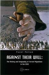
Against Their Will
The History and Geography of Forced Migrations in the USSRPavel Polian
Central European University Press, 2003
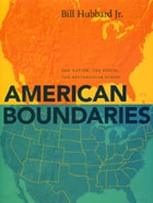
American Boundaries
The Nation, the States, the Rectangular SurveyBill Hubbard Jr.
University of Chicago Press, 2009
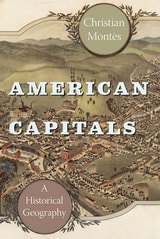
American Capitals
A Historical GeographyChristian Montès
University of Chicago Press, 2014
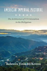
American Imperial Pastoral
The Architecture of US Colonialism in the PhilippinesRebecca Tinio McKenna
University of Chicago Press, 2017
In American Imperial Pastoral, Rebecca Tinio McKenna examines the design, construction, and use of Baguio, making visible the physical shape, labor, and sustaining practices of the US’s new empire—especially the dispossessions that underwrote market expansion. In the process, she demonstrates how colonialists conducted market-making through state-building and vice-versa. Where much has been made of the racial dynamics of US colonialism in the region, McKenna emphasizes capitalist practices and design ideals—giving us a fresh and nuanced understanding of the American occupation of the Philippines.
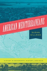
American Mediterraneans
A Study in Geography, History, and RaceSusan Gillman
University of Chicago Press, 2022
The naturalist Alexander von Humboldt, visiting the Gulf-Caribbean in the early nineteenth century, called it America’s Mediterranean. Almost a century later, Southern California was hailed as “Our Mediterranean, Our Italy!” Although “American Mediterranean” is not a household phrase in the United States today, it once circulated widely in French, Spanish, and English as a term of art and folk idiom. In this book, Susan Gillman asks what cultural work is done by this kind of unsystematic, open-ended comparative thinking.
American Mediterraneans tracks two centuries of this geohistorical concept, from Humboldt in the early 1800s, to writers of the 1890s reflecting on the Pacific world of the California coast, to writers of the 1930s and 40s speculating on the political past and future of the Caribbean. Following the term through its travels across disciplines and borders, American Mediterraneans reveals a little-known racialized history, one that paradoxically appealed to a range of race-neutral ideas and ideals.
An American Provence
Thomas P. Huber
University Press of Colorado, 2011
-From An American Provence
In this poetic personal narrative, Thomas P. Huber reflects on two seemingly unrelated places-the North Fork Valley in western Colorado and the Coulon River Valley in Provence, France-and finds a shared landscape and sense of place. What began as a simple comparison of two like places in distant locations turned into a more complex, interesting, and personal task. Much is similar-the light, the valleys, the climate, the agriculture. And much is less so-the history, the geology, the physical makeup of villages. Using a geographer's eye and passion for the land and people, Huber examines the regions' similarities and differences to explore the common emotional impact of each region. Part intimate travelogue and part case study of geography in the real world, An American Provence illuminates the importance sense of place plays in who we are.
An Errant Eye
Poetry and Topography in Early Modern FranceTom Conley
University of Minnesota Press, 2010
This tension, Conley demonstrates, cuts through literature and graphic matter of various shapes and forms-hybrid genres that include the comic novel, the emblem-book, the eclogue, sonnets, and the personal essay. An Errant Eye differs from historical treatments of spatial invention through Conley's argument that the topographic sensibility is one in which the ocular faculty, vital to the description of locale, is endowed with tact and touch.
Detailed close readings of Apian, Rabelais, Montaigne, and others empower the reader with a lively sense of the topographical impulse, deriving from Conley's own "errant eye," which is singularly discerning in attentiveness to the ambiguities of charted territory, the contours of woodcut images, and the complex combinations of word and figure in French Renaissance poetry, emblem, and politics.
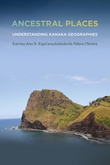
Ancestral Places
Understanding Kanaka GeographiesKatrina-Ann R. Kapa'anaokalaokeola Nakoa Oliveira
Oregon State University Press, 2014
Katrina-Ann R. Kapa‘anaokalaokeola Nakoa Oliveira elucidates a Kanaka geography and provides contemporary scholars with insights regarding traditional culture—including the ways in which Kanaka utilize cartographic performances to map our ancestral places and retain our mo‘olelo, such as reciting creation accounts, utilizing nuances embedded in language, and dancing hula.
A Kanaka by birth, a kumu ‘olelo Hawai‘i (language teacher) by profession, and a geographer by training, Oliveira’s interests intersect at the boundary where words and place-making meet her ancestral land. Thus, Ancestral Places imbues the theoretical with sensual practice. The book’s language moves fluidly between Hawaiian and English, terms are nimbly defined, and the work of the field is embodied: geographic layers are enacted within the text, new understandings created—not just among lexica, but amidst illustrations, charts, terms, and poetry.
In Ancestral Places, Oliveira reasserts both the validity of ancestral knowledge systems and their impact in modernity. Her discussion of Kanaka geographies encompasses the entire archipelago, offering a new framework in Kanaka epistemology.
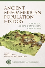
Ancient Mesoamerican Population History
Urbanism, Social Complexity, and ChangeAdrian S. Z. Chase, Arlen F. Chase, and Diane Z. Chase
University of Arizona Press, 2024
Establishing ancient population numbers and determining how they were distributed across a landscape over time constitute two of the most pressing problems in archaeology. Accurate population data is crucial for modeling, interpreting, and understanding the past. Now, advances in both archaeology and technology have changed the way that such approximations can be achieved.
Including research from both highland central Mexico and the tropical lowlands of the Maya and Olmec areas, this book reexamines the demography in ancient Mesoamerica. Contributors present methods for determining population estimates, field methods for settlement pattern studies to obtain demographic data, and new technologies such as LiDAR (light detecting and ranging) that have expanded views of the ground in forested areas. Contributions to this book provide a view of ancient landscape use and modification that was not possible in the twentieth century. This important new work provides new understandings of Mesoamerican urbanism, development, and changes over time.
Contributors
Traci Ardren
M. Charlotte Arnauld
Bárbara Arroyo
Luke Auld-Thomas
Marcello A. Canuto
Adrian S. Z. Chase
Arlen F. Chase
Diane Z. Chase
Elyse D. Z. Chase
Javier Estrada
Gary M. Feinman
L. J. Gorenflo
Julien Hiquet
Scott R. Hutson
Gerardo Jiménez Delgado
Eva Lemonnier
Rodrigo Liendo Stuardo
José Lobo
Javier López Mejía
Michael L. Loughlin
Deborah L. Nichols
Christopher A. Pool
Ian G. Robertson
Jeremy A. Sabloff
Travis W. Stanton
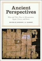
Ancient Perspectives
Maps and Their Place in Mesopotamia, Egypt, Greece, and RomeEdited by Richard J. A. Talbert
University of Chicago Press, 2012
Ancient Perspectives encompasses a vast arc of space and time—Western Asia to North Africa and Europe from the third millennium BCE to the fifth century CE—to explore mapmaking and worldviews in the ancient civilizations of Mesopotamia, Egypt, Greece, and Rome. In each society, maps served as critical economic, political, and personal tools, but there was little consistency in how and why they were made. Much like today, maps in antiquity meant very different things to different people.

Annotated World List of Selected Current Geographical Serials
Chauncey D. Harris
University of Chicago Press, 1980
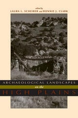
Archaeological Landscapes on the High Plains
Laura L. Scheiber
University Press of Colorado, 2008
Focusing on long-term change, this book considers ethnographic literature, archaeological evidence, and environmental data spanning thousands of years of human presence to understand human perception and construction of landscape. The contributors offer cohesive and synthetic studies emphasizing hunter-gatherers and subsistence farmers.
Using landscape as both reality and metaphor, Archaeological Landscapes on the High Plains explores the different and changing ways that people interacted with place in this transitional zone between the Rocky Mountains and the eastern prairies.
The contemporary archaeologists working in this small area have chosen diverse approaches to understand the past and its relationship to the present. Through these ten case studies, this variety is highlighted but leads to a common theme - that the High Plains contains important locales to which people, over generations or millennia, return. Providing both data and theory on a region that has not previously received much attention from archaeologists, especially compared with other regions in North America, this volume is a welcome addition to the literature. Contributors:
o Paul Burnett
o Oskar Burger
o Minette C. Church
o Philip Duke
o Kevin Gilmore
o Eileen Johnson
o Mark D. Mitchell
o Michael R. Peterson
o Lawrence Todd
Armenia
A Historical AtlasRobert H. Hewsen
University of Chicago Press, 2001
Hewsen has divided the maps into five sections, each of which begins with a chronology of important dates and a historical introduction to the period. Specialized maps include Ptolemy's second-century map of Armenia, as well as maps of Roman, Cilician, Ottoman, tsarist, and Soviet Armenia. Other maps show the Persian khanate of Erevan, the Caucasian campaigns of World War I, the Armenian Genocide, the Armenian monuments in Turkey and Transcaucasia, the worldwide diaspora, ground plans of selected cities, and plans of the great monastery of Echmiadzin in 1660, 1890, and 1990. The atlas concludes with maps portraying the Karabagh war and the new Armenian Republic, and an extensive bibliography compiles references to the vast historical, ethnological, and travel literature on the region.
The first comprehensive and authoritative atlas of any of the former Soviet republics, this book does not treat Armenia in isolation, but instead sets it within the context of Caucasia as a whole, providing detailed information on neighboring regions such as Georgia and Azerbaijan. Armenia: A Historical Atlas will be an essential reference and an important teaching tool for generations to come.
Art and Cartography
Six Historical EssaysEdited by David Woodward
University of Chicago Press, 1987
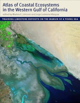
Atlas of Coastal Ecosystems in the Western Gulf of California
Tracking Limestone Deposits on the Margin of a Young SeaEdited by Markes E. Johnson and Jorge Ledesma-Vásquez
University of Arizona Press, 2009
With an emphasis on the intricate workings of the Gulf, a team of scientists led by Markes E. Johnson and Jorge Ledesma-Vázquez explores how marine invertebrates such as corals and bivalves, as well as certain algae, contribute to the operation of a vast “organic engine” that acts as a significant carbon trap. The Atlas reveals that the role of these organisms in the ecology of the Gulf was greatly underestimated in the past. The organisms that live in these environments (or provide the sediments for beaches and dunes) are mass producers of calcium carbonate. Until now, no book has considered the centrality of calcium carbonate production as it functions today across multiple ecosystems and how it has evolved over time.
An important work of scholarship that also evokes the region’s natural splendor, the Atlas will be of interest to a wide range of scientists, including geologists, paleontologists, marine biologists, ecologists, and conservation biologists.
Atlas of Iowa
Robert C. Shepard
University of Iowa Press, 2024
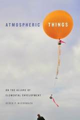
Atmospheric Things
On the Allure of Elemental EnvelopmentDerek P. McCormack
Duke University Press, 2018