Results by title
341 books match the query 'Geography' and 35 start with m
Making the Heartland Quilt
A Geographical History of Settlement and Migration in Early-Nineteenth-Century IllinoisDouglas K. Meyer
Southern Illinois University Press, 2000
In Making the Heartland Quilt, Douglas K. Meyer reconstructs the settlement patterns of thirty-three immigrant groups and confirms the emergence of discrete culture regions and regional way stations. Meyer argues that midcontinental Illinois symbolizes a historic test strip of the diverse population origins that unfolded during the Great Migration. Basing his research on the 1850 U.S. manuscript schedules, Meyer dissects the geographical configurations of twenty-three native and ten foreign-born adult male immigrant groups who peopled Illinois. His historical geographical approach leads to the comprehension of a new and clearer map of settlement and migration history in the state.
Meyer finds that both cohesive and mixed immigrant settlements were established. Balkan-like immigrant enclaves or islands were interwoven into evolving local, regional, and national settlement networks. The midcontinental location of Illinois, its water and land linkages, and its lengthy north-south axis enhanced cultural diversity. The barrier effect of Lake Michigan contributed to the convergence and mixing of immigrants. Thus, Meyer demonstrates, Illinois epitomizes midwestern dichotomies: northern versus southern; native-born versus foreign-born; rural versus urban; and agricultural versus manufacturing.
Making the Mission
Planning and Ethnicity in San FranciscoOcean Howell
University of Chicago Press, 2015
In Making the Mission, Ocean Howell tells the story of how residents of the Mission District organized to claim the right to plan their own neighborhood and how they mobilized a politics of place and ethnicity to create a strong, often racialized identity—a pattern that would repeat itself again and again throughout the twentieth century. Surveying the perspectives of formal and informal groups, city officials and district residents, local and federal agencies, Howell articulates how these actors worked with and against one another to establish the very ideas of the public and the public interest, as well as to negotiate and renegotiate what the neighborhood wanted. In the process, he shows that national narratives about how cities grow and change are fundamentally insufficient; everything is always shaped by local actors and concerns.

Man's Role in Changing the Face of the Earth
Edited by William L. Thomas Jr.
University of Chicago Press, 1956
The volume is organized into three parts. Part 1 deals with man's rise to the status of ecological dominance, and includes discussions of such topics as the role of fire as the first great force harnessed by man, early food-producing populations, the clearing of Europe's woodlands, subsistence economies and commercial economies, and the natural history of urbanization.
Part 2 investigates environmental changes such as man's impact upon the seas and coastlines. The highly topical ecology of wastes is discussed, as well as urban-industrial demands and the depletion of natural resources.
Part 3 is concerned with the limits of the earth's resources. It includes papers dealing with the population spiral, possible limitations of raw-material consumption and energy use, and technological denudation.
Each part is accompanied by a report summarizing the ideas discussed at the conference by the participants.
Map Men
Transnational Lives and Deaths of Geographers in the Making of East Central EuropeSteven Seegel
University of Chicago Press, 2018
Taking us deep into cartographical archives, Seegel re-creates the public and private worlds of these five mapmakers, who interacted with and influenced one another even as they played key roles in defining and redefining borders, territories, nations—and, ultimately, the interconnection of the world through two world wars. Throughout, he examines the transnational nature of these processes and addresses weighty questions about the causes and consequences of the world wars, the rise of Nazism and Stalinism, and the reasons East Central Europe became the fault line of these world-changing developments.
At a time when East Central Europe has surged back into geopolitical consciousness, Map Men offers a timely and important look at the historical origins of how the region was defined—and the key people who helped define it.
Mapping And Imagination In The Great Basin
A Cartographic HistoryRichard V. Francaviglia
University of Nevada Press, 2005
The Great Basin was the last region of continental North America to be explored and mapped, and it remained largely a mystery to Euro-Americans until well into the nineteenth century. In Mapping and Imagination in the Great Basin, geographer-historian Richard Francaviglia shows how the Great Basin gradually emerged from its “cartographic silence” as terra incognita and how this fascinating process both paralleled the development of the sciences of surveying, geology, hydrology, and cartography and reflected the changing geopolitical aspirations of the European colonial powers and the United States. Francaviglia’s interdisciplinary account of the mapping of the Great Basin combines a chronicle of the exploration of the region with a history of the art and science of cartography and of the political, economic, and cultural contexts in which maps are created. It also offers a compelling, wide-ranging discussion that combines a description of the daunting physical realities of the Great Basin with a cogent examination of the ways humans, from early Native Americans to nineteenth-century surveyors to twentieth-century highway and air travelers, have understood, defined, and organized this space, psychologically and through the medium of maps. Mapping and Imagination in the Great Basin continues Francaviglia’s insightful, richly nuanced meditation on the Great Basin landscape that began in Believing in Place.
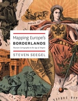
Mapping Europe's Borderlands
Russian Cartography in the Age of EmpireSteven Seegel
University of Chicago Press, 2012
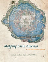
Mapping Latin America
A Cartographic ReaderEdited by Jordana Dym and Karl Offen
University of Chicago Press, 2011
For many, a map is nothing more than a tool used to determine the location or distribution of something—a country, a city, or a natural resource. But maps reveal much more: to really read a map means to examine what it shows and what it doesn’t, and to ask who made it, why, and for whom. The contributors to this new volume ask these sorts of questions about maps of Latin America, and in doing so illuminate the ways cartography has helped to shape this region from the Rio Grande to Patagonia.
In Mapping Latin America,Jordana Dym and Karl Offen bring together scholars from a wide range of disciplines to examine and interpret more than five centuries of Latin American maps.Individual chapters take on maps of every size and scale and from a wide variety of mapmakers—from the hand-drawn maps of Native Americans, to those by famed explorers such as Alexander von Humboldt, to those produced in today’s newspapers and magazines for the general public. The maps collected here, and the interpretations that accompany them, provide an excellent source to help readers better understand how Latin American countries, regions, provinces, and municipalities came to be defined, measured, organized, occupied, settled, disputed, and understood—that is, how they came to have specific meanings to specific people at specific moments in time.
The first book to deal with the broad sweep of mapping activities across Latin America, this lavishly illustrated volume will be required reading for students and scholars of geography and Latin American history, and anyone interested in understanding the significance of maps in human cultures and societies.
Mapping Nature across the Americas
Edited by Kathleen A. Brosnan & James R. Akerman
University of Chicago Press, 2021
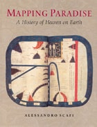
Mapping Paradise
A History of Heaven on EarthAlessandro Scafi
University of Chicago Press, 2006
Mapping Paradise is a history of the cartography of paradise that journeys from the beginning of Christianity to the present day. Instead of dismissing the medieval belief in a paradise on earth as a picturesque legend and the cartography of paradise as an example of the period’s many superstitions, Alessandro Scafi explores the intellectual conditions that made the medieval mapping of paradise possible. The challenge for mapmakers, Scafi argues, was to make visible a place that was geographically inaccessible and yet real, remote in time and yet still the scene of an essential episode of the history of salvation. Mapping Paradise also accounts for the transformations, in both theological doctrine and cartographical practice, that brought about the decline of the belief in a terrestrial paradise and the emergence of the new historical and regional mapping of the Garden of Eden that began at the time of the Reformation and still continues today.
The first book to show how paradise has been expressed in cartographic form throughout two millennia, Mapping Paradise reveals how the most deeply reflective thoughts about the ultimate destiny of all human life have been molded and remolded, generation by generation.
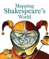
Mapping Shakespeare's World
Peter Whitfield
Bodleian Library Publishing, 2015
Mapping Shakespeare’s World explores these questions with surprising results. It has often been said that setting is irrelevant to Shakespeare’s plays—that, wherever they are set, their enduring appeal lies in their ability to speak to broad questions of human nature. Peter Whitfield shows that, on the contrary, many of Shakespeare’s locations were carefully chosen for their ability to convey subtle meanings an Elizabethan audience would have picked up on and understood. Through the use of paintings, drawings, contemporary maps and geographical texts, Whitfield suggests answers to such questions as where Illyria was located, why The Merry Wives of Windsor could only have taken place in Windsor, and how two utterly different comedies—The Comedy of Errors and Pericles, Prince of Tyre—both came to take place in ancient Ephesus.
Just when one might think there was nothing more to be said about Shakespeare, with Mapping Shakespeare’s World, Whitfield offers a fascinating new point of view.
Mapping Wisconsin History
Teacher's Guide and Student MaterialsWisconsin Historical Society Press, 2000
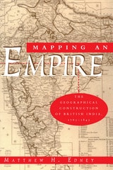
Mapping an Empire
The Geographical Construction of British India, 1765-1843Matthew H. Edney
University of Chicago Press, 1997
"There is much to be praised in this book. It is an excellent history of how India came to be painted red in the nineteenth century. But more importantly, Mapping an Empire sets a new standard for books that examine a fundamental problem in the history of European imperialism."—D. Graham Burnett, Times Literary Supplement
"Mapping an Empire is undoubtedly a major contribution to the rapidly growing literature on science and empire, and a work which deserves to stimulate a great deal of fresh thinking and informed research."—David Arnold, Journal of Imperial and Commonwealth History
"This case study offers broadly applicable insights into the relationship between ideology, technology and politics. . . . Carefully read, this is a tale of irony about wishful thinking and the limits of knowledge."—Publishers Weekly
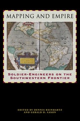
Mapping and Empire
Soldier-Engineers on the Southwestern FrontierEdited by Dennis Reinhartz and Gerald D. Saxon
University of Texas Press, 2005
From the sixteenth through the mid-nineteenth centuries, Spain, then Mexico, and finally the United States took ownership of the land from the Gulf Coast of Texas and Mexico to the Pacific Coast of Alta and Baja California—today's American Southwest. Each country faced the challenge of holding on to territory that was poorly known and sparsely settled, and each responded by sending out military mapping expeditions to set boundaries and chart topographical features. All three countries recognized that turning terra incognita into clearly delineated political units was a key step in empire building, as vital to their national interest as the activities of the missionaries, civilian officials, settlers, and adventurers who followed in the footsteps of the soldier-engineers.
With essays by eight leading historians, this book offers the most current and comprehensive overview of the processes by which Spanish, Mexican, and U.S. soldier-engineers mapped the southwestern frontier, as well as the local and even geopolitical consequences of their mapping. Three essays focus on Spanish efforts to map the Gulf and Pacific Coasts, to chart the inland Southwest, and to define and defend its boundaries against English, French, Russian, and American incursions. Subsequent essays investigate the role that mapping played both in Mexico's attempts to maintain control of its northern territory and in the United States' push to expand its political boundary to the Pacific Ocean. The concluding essay draws connections between mapping in the Southwest and the geopolitical history of the Americas and Europe.
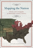
Mapping the Nation
History and Cartography in Nineteenth-Century AmericaSusan Schulten
University of Chicago Press, 2012
In the nineteenth century, Americans began to use maps in radically new ways. For the first time, medical men mapped diseases to understand and prevent epidemics, natural scientists mapped climate and rainfall to uncover weather patterns, educators mapped the past to foster national loyalty among students, and Northerners mapped slavery to assess the power of the South. After the Civil War, federal agencies embraced statistical and thematic mapping in order to profile the ethnic, racial, economic, moral, and physical attributes of a reunified nation. By the end of the century, Congress had authorized a national archive of maps, an explicit recognition that old maps were not relics to be discarded but unique records of the nation’s past.
All of these experiments involved the realization that maps were not just illustrations of data, but visual tools that were uniquely equipped to convey complex ideas and information. In Mapping the Nation, Susan Schulten charts how maps of epidemic disease, slavery, census statistics, the environment, and the past demonstrated the analytical potential of cartography, and in the process transformed the very meaning of a map.
Today, statistical and thematic maps are so ubiquitous that we take for granted that data will be arranged cartographically. Whether for urban planning, public health, marketing, or political strategy, maps have become everyday tools of social organization, governance, and economics. The world we inhabit—saturated with maps and graphic information—grew out of this sea change in spatial thought and representation in the nineteenth century, when Americans learned to see themselves and their nation in new dimensions.
Maps and Civilization
Cartography in Culture and Society, Third EditionNorman J. W. Thrower
University of Chicago Press, 2008
The third edition of Maps and Civilization incorporates numerous revisions, features new material throughout the book, and includes a new alphabetized bibliography.
Praise for previous editions of Maps and Civilization:
“A marvelous compendium of map lore. Anyone truly interested in the development of cartography will want to have his or her own copy to annotate, underline, and index for handy referencing.”—L. M. Sebert, Geomatica
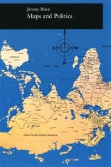
Maps and Politics
Jeremy Black
University of Chicago Press, 1997
Maps in Tudor England
P. D. A. Harvey
University of Chicago Press, 1993
In Maps in Tudor England, P. D. A. Harvey traces this revolution of production, understanding, and use of maps in England from 1485 to 1603. By the mid-sixteenth century, mapmapers had begun to draw maps to a consistent scale, reproducing the results of measured survey. By the end of the century, maps drawn to scale and showing features by conventional signs were commonly used throughout England.
In this survey Harvey focuses on maps of small areas, up to the size of a county, exploring their impact on the political and social life of England in the spheres of the military, government, towns, landed estates, buildings, and the law. Richly illustrated with thirty color and fifty black and white reproductions of rare maps, his account is an informative and accessible introduction to this revolutionary period in the history of cartography, as well as a unique visual history of Tudor England.
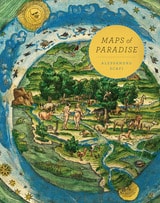
Maps of Paradise
Alessandro Scafi
University of Chicago Press, 2013
Maps of Paradise charts the diverse ways in which scholars and mapmakers from the eighth to the twenty-first century rose to the challenge of identifying the location of paradise on a map, despite the certain knowledge that it was beyond human reach. Over one hundred illustrations celebrate this history of a paradox: the mapping of the unmappable. It is also a mirror to the universal dream of perfection and happiness, and the yearning to discover heaven on earth.
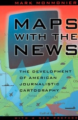
Maps with the News
The Development of American Journalistic CartographyMark Monmonier
University of Chicago Press, 1989
"A most welcome and thorough investigation of a neglected aspect of both the history of cartography and modern cartographic practice."—Mapline
"A well-written, scholarly treatment of journalistic cartography. . . . It is well researched, thoroughly indexed and referenced . . . amply illustrated."—Judith A. Tyner, Imago Mundi
"There is little doubt that Maps with the News should be part of the training and on the desks of all those concerned with producing maps for mass consumption, and also on the bookshelves of all journalists, graphic artists, historians of cartography, and geographic educators."—W. G. V. Balchin, Geographical Journal
"A definitive work on journalistic cartography."—Virginia Chipperfield, Society of University Cartographers Bulletin
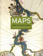
Maps
Finding Our Place in the WorldEdited by James R. Akerman and Robert W. Karrow Jr.
University of Chicago Press, 2007
The book begins by examining the use of maps for wayfinding, revealing that even maps as common and widely used as these are the product of historical circumstances and cultural differences. The second chapter considers maps whose makers employed the smallest of scales to envision the broadest of human stages—the world, the heavens, even the act of creation itself. The next chapter looks at maps that are, literally, at the opposite end of the scale from cosmological and world maps—maps that represent specific parts of the world and provide a close-up view of areas in which their makers lived, worked, and moved.
Having shown how maps help us get around and make sense of our greater and lesser worlds, Maps then turns to the ways in which certain maps can be linked to particular events in history, exploring how they have helped Americans, for instance, to understand their past, cope with current events, and plan their national future. The fifth chapter considers maps that represent data from scientific instruments, population censuses, and historical records. These maps illustrate, for example, how diseases spread, what the ocean floor looks like, and how the weather is tracked and predicted. Next comes a turn to the imaginary, featuring maps that depict entire fictional worlds, from Hell to Utopia and from Middle Earth to the fantasy game World of Warcraft. The final chapter traces the origins of map consumption throughout history and ponders the impact of cartography on modern society.
A companion volume to the most ambitious exhibition on the history of maps ever mounted in North America, Maps will challenge readers to stretch conventional thought about what constitutes a map and how many different ways we can understand graphically the environment in which we live. Collectors, historians, mapmakers and users, and anyone who has ever “gotten lost” in the lines and symbols of a map will find much to love and learn from in this book.
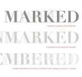
Marked, Unmarked, Remembered
A Geography of American MemoryAndrew Lichtenstein
West Virginia University Press, 2017
These powerful photographs by award-winning photojournalist Andrew Lichtenstein are interspersed with short essays by some of the leading historians of the United States. The book is introduced with substantive meditations on meaning and landscape by Alex Lichtenstein, editor of the American Historical Review, and Edward T. Linenthal, former editor of the Journal of American History. Individually, these images convey American history in new and sometimes startling ways. Taken as a whole, the volume amounts to a starkly visual reckoning with the challenges of commemorating a violent and conflictual history of subjugation and resistance that we forget at our peril.
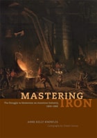
Mastering Iron
The Struggle to Modernize an American Industry, 1800-1868Anne Kelly Knowles
University of Chicago Press, 2012
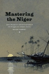
Mastering the Niger
James MacQueen's African Geography and the Struggle over Atlantic SlaveryDavid Lambert
University of Chicago Press, 2013
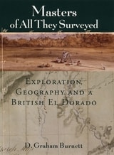
Masters of All They Surveyed
Exploration, Geography, and a British El DoradoD. Graham Burnett
University of Chicago Press, 2000
In answering these questions, D. Graham Burnett brings to light the work of several such explorers, particularly Sir Robert H. Schomburgk, the man who claimed to be the first to reach the site of Ralegh's El Dorado. Commissioned by the Royal Geographical Society and later by the British Crown, Schomburgk explored and mapped regions in modern Brazil, Venezuela, and Guyana, always in close contact with Amerindian communities. Drawing heavily on the maps, reports, and letters that Schomburgk sent back to England, and especially on the luxuriant images of survey landmarks in his Twelve Views in the Interior of Guiana (reproduced in color in this book), Burnett shows how a vast network of traverse surveys, illustrations, and travel narratives not only laid out the official boundaries of British Guiana but also marked out a symbolic landscape that fired the British imperial imagination.
Engagingly written and beautifully illustrated, Masters of All They Surveyed will interest anyone who wants to understand the histories of colonialism and science.
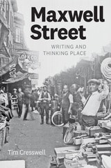
Maxwell Street
Writing and Thinking PlaceTim Cresswell
University of Chicago Press, 2019
In Maxwell Street, Cresswell advocates approaching the study of place as an “assemblage” of things, meanings, and practices. He models this innovative approach through a montage format that exposes the different types of texts—primary, secondary, and photographic sources—that have attempted to capture the essence of the area. Cresswell studies his historical sources just as he explores the different elements of Maxwell Street—exposing them layer by layer. Brilliantly interweaving words and images, Maxwell Street sheds light on a historic Chicago neighborhood and offers a new model for how to write about place that will interest anyone in the fields of geography, urban studies, or cultural history.
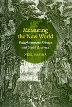
Measuring the New World
Enlightenment Science and South AmericaNeil Safier
University of Chicago Press, 2008
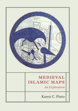
Medieval Islamic Maps
An ExplorationKaren C. Pinto
University of Chicago Press, 2016
Pinto focuses on the distinct tradition of maps known collectively as the Book of Roads and Kingdoms (Kitab al-Masalik wa al-Mamalik, or KMMS), examining them from three distinct angles—iconography, context, and patronage. She untangles the history of the KMMS maps, traces their inception and evolution, and analyzes them to reveal the identities of their creators, painters, and patrons, as well as the vivid realities of the social and physical world they depicted. In doing so, Pinto develops innovative techniques for approaching the visual record of Islamic history, explores how medieval Muslims perceived themselves and their world, and brings Middle Eastern maps into the forefront of the study of the history of cartography.
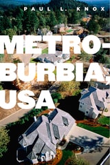
Metroburbia, USA
Knox, Paul L
Rutgers University Press, 2008
Upper-middle-class Americans are moving into larger homes in greater numbers, which leads Knox to explore the relationship between built form and material culture in contemporary society. He covers changes in home design, real estate, the work of developers, and the changing wishes of consumers. Knox shows that contemporary suburban landscapes are a product of consumer demand, combined with the logic of real estate development, mediated by design and policy professionals and institutions of governance. Suburban landscapes not only echo the fortunes of successive generations of inhabitants, Knox argues, they also reflect the country's changing core values.
Knox addresses key areas of concern and importance to today's urban planners and suburban residents including McMansions, traffic disasters, house design, homeowner's associations, exclusionary politics, and big box stores. Through the inclusion of examples and photos, Metroburbia, USA creates an accessible portrait of today's suburbs supported by data, anecdotes, and social theory. It is a broad interpretation of the American metropolitan form that looks carefully at the different influences that contribute to where and how we live today.
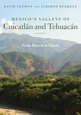
Mexico’s Valleys of Cuicatlán and Tehuacán
From Deserts to CloudsDavid Yetman and Alberto Búrquez
University of Arizona Press, 2023
Through firsthand experience and engaging prose, the authors provide a synthesis of the geology, ecology, history, and cultures of the valleys, showing their importance and influence as Mesoamerican arteries for environmental and cultural interchange through Mexico. It also reveals the extraordinary plant life that draws from habitats ranging from deserts to tropical forests.
The authors, both experts in their respective fields, begin with a general description of the geography of the valleys, followed by an introduction to climate and hydrology, a look at the valleys’ often bewildering geology. The book delves into cultural and linguistic backgrounds of the valleys and discusses archaeological sites that that encapsulate the valleys’ fascinating history prior to the arrival of Europeans. The book concludes by describing the flora that makes the region so singular.
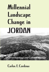
Millennial Landscape Change in Jordan
Geoarchaeology and Cultural EcologyCarlos E. Cordova
University of Arizona Press, 2007
Cordova focuses on geoarchaeological and cultural ecological aspects of research, presenting data from physical, chemical, and biological sources. He examines the changing influence of climate, vegetation, and hunting opportunities on cultural exploitation tactics, as well as the effects of the growing population and agriculture on the environment. Cordova argues that an interdisciplinary approach to studying the area is crucial to achieving a true understanding of Jordan’s changing landscape.
Chapter topics include approaches to the study of ancient Jordanian landscapes in the Near Eastern context; the physical scene; endowed landscapes of the woodlands; the encroaching drylands; the current and future state of the paleoecological and geoarchaeological record; patterns of millennial landscape change; and the process of interpreting millennial landscape change. The text is abundantly illustrated with photos, line illustrations, tables, and maps, providing a valuable assessment of archaeological developments over the prehistory and history of what today is the Hashemite Kingdom of Jordan. This volume will be especially welcomed by scholars interested in the archaeology, history, and geography of Jordan, the Levant, and the Near East and by field-school students working on archaeological projects in Jordan.
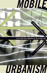
Mobile Urbanism
Cities and Policymaking in the Global AgeEugene McCann
University of Minnesota Press, 2010
The essays in this volume argue for a theorizing of both urban policymaking and place-making that understands them as groups of territorial and relational geographies. It broadens our comprehension of agents of transference, reconceiving how policies are made mobile, and acknowledging the importance of interlocal policy mobility. Through the richness of its empirical examples from Europe, North America, South America, Africa, Asia, and Australia, contributors bring to light the significant methodological challenges that researchers face in the study of an urban–global, territorial–relational conceptualization of cities and suggest productive new approaches to understanding urbanism in a networked world.
Contributors: S. Harris Ali, York U, Toronto; Allan Cochrane, Open U; Roger Keil , York U, Toronto; Doreen Massey, Open U; Donald McNeill, U of Western Sydney; Jamie Peck, U of British Columbia; Jennifer Robinson, University College London.
Mobility and the Small Town, 1900-1930
Norman T. Moline
University of Chicago Press, 1971
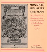
Monarchs, Ministers, and Maps
The Emergence of Cartography as a Tool of Government in Early Modern EuropeEdited by David Buisseret
University of Chicago Press, 1992
consolidate their power realized that better knowledge of
their lands would strengthen their control over them. By
1550, the cartographer's art had already become an important
instrument for bringing territories under the control of
centralized government; increasing governmental reliance on
maps stimulated the refinement of cartographic techniques
throughout the following century.
This volume, a detailed survey of the political uses of
cartography between 1400 and 1700 in Italy, France, England,
Poland, Austria, and Spain, answers these questions: When
did monarchs and ministers begin to perceive that maps could
be useful in government? For what purposes were maps
commissioned? How accurate and useful were they? How did
cartographic knowledge strengthen the hand of government?
The chapters offer new insights into the development of
cartography and its role in European history.
Contributors to the volume are John Marino, Peter
Barber, David Buisseret, Geoffrey Parker, James Vann, and
Michael J. Mikòs.
Monstrous Politics
Geography, Rights, and the Urban Revolution in Mexico CityBen Gerlofs
Vanderbilt University Press, 2022
Transdisciplinary by design, Monstrous Politics first moves historically through Mexico City’s turbulent twentieth century, driven centrally by the contentious imbrication of the Institutional Revolutionary Party (PRI) and its capital city. Participant observation, expert interviews, and archival materials demonstrate the shifting strategies and alliances of recent decades, provide the reader with a sense of the texture of contemporary political life in the city during a time of unprecedented change, and locate these dynamics within the history and geography of twentieth-century urbanization and political revolution. Substantive ethnographic chapters trace the emergence and decline of the political language of “the right to the city,” the establishment and contestation of a “postpolitical” governance regime, and the culmination of a century of urban politics in the processes of “political reform” by which Mexico City finally wrested back significant political autonomy and local democracy from the federal state.
A four-fold transection of the revolutionary structure of feeling that pervades the city in this historic moment illustrates the complex and contradictory sentiments, appraisals, and motivations through which contemporary politics are understood and enacted. Drawing on theories of social revolution that embrace complexity, and espousing a methodology that foregrounds the everyday nature of politics, Monstrous Politics develops an understanding of revolutionary urban politics at once contextually nuanced and conceptually expansive, and thus better able to address the realities of politics in the “urban age” even beyond Mexico City.
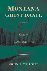
Montana Ghost Dance
Essays on Land and LifeBy John B. Wright
University of Texas Press, 1998
Montana has been the "last best place" for so many people. A century ago, Native Americans gathered here to perform the Ghost Dance—a last, doomed attempt to make white settlers vanish and bring back the old ways of life. Today, people are still pouring into Montana, looking for the pristine wilderness they saw in A River Runs through It.
The reality of Montana—indeed, of all the West—has never matched the myths, but this book eloquently explores how the search for a perfect place is driving growth, development, and resource exploitation in Big Sky country. In ten personal essays, John Wright looks at such things as Montana myths; old-timers; immigrants; elk; ways of seeing the landscape; land conservation and land trusts; the fate of the Blackfoot, Bitterroot, and Paradise valleys; and some means of preserving the last, best places.
These reflections offer a way of understanding Montana that goes far beyond the headlines about militia groups and celebrities' ranches. Montana never was or will be a pristine wilderness, but Wright believes that much can be saved if natives and newcomers alike see what stands to be lost. His book is a wake-up call, not a ghost dance.