Results by title
28167 books match the query 'History' and 1583 start with m
Manic Minds
Mania's Mad History and Its Neuro-FutureLisa M. Hermsen
Rutgers University Press, 2012
Spanning several centuries, Manic Minds traces the multiple ways in which the word "mania" has been used by popular, medical, and academic writers. It reveals why the rhetorical history of the word is key to appreciating descriptions and meanings of the "manic" episode." Lisa M. Hermsen examines the way medical professionals analyzed the manic condition during the nineteenth and twentieth centuries and offers the first in-depth analysis of contemporary manic autobiographies: bipolar figures who have written from within the illness itself.

Manichaeism
Michel Tardieu. Translated from the French by Malcolm DeBevoise.
University of Illinois Press, 2007
Manichaeism, once the state religion of Persia and long a vigorous contender for converts throughout the ancient Near East, is best remembered for the simplicity of its teachings about divine power. For Manicheans, the universe was ruled by a Lord of Light and a Lord of Darkness, who fought continuously for supremacy. All that was good was a gift from the Lord of Light, and all that was evil was an affliction visited by the Lord of Darkness. This dualism extended to cosmogony and ethics, splitting the universe into a spiritual realm that acted on the goodness of the human soul and a material realm that abetted the evil of the human body. These stark oppositions mask a remarkable degree of doctrinal and liturgical complexity, the details of which have been obscured by centuries of suppression and persecution, first by the Christian church, then by Islam.
One of the world's foremost experts on ancient religions, Michel Tardieu examines the fragmentary sources that have come down to us, pieces together the life and teachings of the prophet Mani (the itinerant Persian preacher and founder of this long lost faith), illuminates Manichaeism's ecclesiastical hierarchy and distinctive moral code, and investigates its ideas about the pre-life and afterlife. Manichaeism provides a brilliantly compact survey of what was once one of the world's great faiths, and then became one of its great heresies, surviving now only as a shadowy presence haunting the religions that superseded it.
Manifest Perdition
Shipwreck Narrative And The Disruption Of EmpireJosiah Blackmore
University of Minnesota Press, 2002
A new take on a famous collection of shipwreck narratives that places them at the center of resistance to colonialism
Shipwreck, death, and survival; terror, hunger, and salvation—these are the experiences of the passengers onboard merchant Portuguese ships sailing the high seas in the sixteenth and seventeenth centuries. And this is the stuff of the stories committed to print by survivors upon their return to the homeland. These Portuguese shipwreck narratives, rescued for all time in the eighteenth century by Bernardo Gomes de Brito in História Trágico-Marítima (1735-36), or The Tragic History of the Sea, are the subject of Manifest Perdition, a work that reveals their important—and until now, largely ignored—place in literary history.
In this book we see how the dramatic, compelling, and often gory accounts of shipwreck, depicting a world out of control, challenge state-sponsored versions of events in the prevailing historiographic culture. Written during the heyday of Iberian maritime expansion and colonialism, the shipwreck narrative builds an alternative historical record to the vision and reality of empire elaborated by the official chroniclers of the realm. Manifest Perdition presents both theoretical considerations this genre and close readings of several texts, readings that disclose a poetics of the shipwreck text, of how survivors characteristically yet multifariously narrated their world. Included is a study of the medieval Iberian poetic predecessors of the shipwreck tale, as well as an exploration of the Portuguese Inquisition’s attempt to commandeer and steer the reading of the unruly narratives. The book engages issues of literary theory, historiography, and colonialism to portray the Portuguese shipwreck narrative for the first time as both a product of and a resistance to the prolific culture of sixteenth- and seventeenth-century expansionist history.
Manifold Greatness
The Making of the King James BibleEdited by Helen Moore and Julian Reid
Bodleian Library Publishing, 2011
Published to commemorate the four hundredth anniversary of the publication of the King James Bible, Manifold Greatness tells the story of the creation and immediate afterlife of the King James translation of the Bible, first published in 1611. Revolutionary at its time, the King James translation quickly became the dominant authorized translation of the Christian Bible in English. There are more than one billion copies in print, making it the best-selling book of all time, and its effect on the English language is incalculable, both in common speech and in literature.
This accessible and richly illustrated visual history contains eighty color illustrations, including images of rare manuscripts, artifacts, and archival material such as the annotated Bodleian Bishops’ Bible of 1602, pages from the Wycliffite and Tyndale Bibles, and an edition of the Bishop’s Bible owned by Elizabeth I. Eight chapters contributed by leading academics in the field discuss the history of biblical translation, the political background of the project, the Oxford Translators—including Henry Savile, John Rainolds, and John Harmar—and their working milieu, the cultural politics, and the reception and influence of the King James Bible up until the 1769 publication of the Oxford Standard Edition, which was the first revision of the original 1611 translation. Also included is a look at the later reception of the King James Bible in America, including a chapter specifically on the King James Bible and the Folger Shakespeare Library.
Manifold Greatness brings together key research and documentation to provide a lively and comprehensive visual account to celebrate one of the most important occasions in publishing and modern religious history.

Manitoba Medicine
A Brief HistoryIan Carr
University of Manitoba Press, 1999
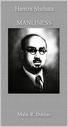
Manliness
Malik R. Dahlan
Haus Publishing, 2016
Using a framework that was both scientific and philosophical, Shehata convinced his audience that conventional views of virtue and vice were a deceptive simplification and that social and religious reform was necessary. A humble man at heart, he was reluctant to publish his talk in his lifetime, but thanks to Malik R. Dahlan’s expert translation and insightful discussion of the larger historical and geographical context for the speech, readers are now able to appreciate a fascinating snapshot of Arabian history that would otherwise be lost.
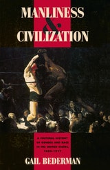
Manliness and Civilization
A Cultural History of Gender and Race in the United States, 1880-1917Gail Bederman
University of Chicago Press, 1995
In turn-of-the-century America, cultural ideals of manhood changed profoundly, as Victorian notions of self-restrained, moral manliness were challenged by ideals of an aggressive, overtly sexualized masculinity. Bederman traces this shift in values and shows how it brought together two seemingly contradictory ideals: the unfettered virility of racially "primitive" men and the refined superiority of "civilized" white men. Focusing on the lives and works of four very different Americans—Theodore Roosevelt, educator G. Stanley Hall, Ida B. Wells, and Charlotte Perkins Gilman—she illuminates the ideological, cultural, and social interests these ideals came to serve.
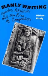
Manly Writing
Gender, Rhetoric and the Rise of CompostionMiriam Brody
Southern Illinois University Press, 1993
In this critical history of the gendered politics of rhetoric and the rise of composition, Miriam Brody argues that nothing about words or their arrangement is innately gendered. Yet since the English Enlightenment, teachers have encouraged their students to admire and imitate "manly" writing, writing that is plain, forceful, cogent, and true. Similarly, students have been enjoined to avoid so-called effeminate or feminine writing—writing characterized as vague, unorganized, ornate, and deceitful.
Such advice, part of what Brody terms the hidden curriculum, has served the interests of discourse communities as various as the early Enlightenment Royal Society in seventeenth-century London (by urging a clear and masculine style for the work of science) and the land-grant universities of nineteenth-century America (by claiming that the work of writing was similar to clearing the land and pushing back the frontier). Brody’s discussion in fact becomes a social history of canonical rhetorical essays and important late Enlightenment, nineteenth-century, and early modern school texts. She points out that in their advice to writers even the Strunks and Whites and Peter Elbows of more recent times have extolled masculine virtues and urged control over invasive and problematic feminine qualities.
Brody’s book not only clarifies rhetoric’s inheritance and transformation of the classical ideal of manliness, it also is the first critical work to explore the ideological significance of gendered imagery and to interpret in light of this imagery rhetorical essays and hard-to-locate early composition texts against a background of previously unpublished archival materials.
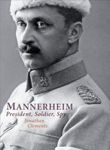
Mannerheim
President, Soldier, SpyJonathan Clements
Haus Publishing, 2012

Manoomin
The Story of Wild Rice in MichiganBarbara J Barton
Michigan State University Press, 2018
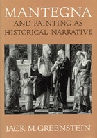
Mantegna and Painting as Historical Narrative
Jack M. Greenstein
University of Chicago Press, 1992
"Greenstein has raised the level of sophistication of the historical criticism of Renaissance painting by at least one whole notch; at the same time, he has written a book for everyone interested in problems of interpretation."—David Summers, University of Virginia
Manufactured Light
Mirrors in the Mesoamerican RealmEmiliano Gallaga
University Press of Colorado, 2015
Complex and time-consuming to produce, iron-ore mirrors stand out among Prehispanic artifacts for their aesthetic beauty, their symbolic implications, and the complexity and skill of their assembly. Manufactured Light presents the latest archaeological research on these items, focusing on the intersection of their significance and use and on the technological aspects of the manufacturing processes that created them.
The volume covers the production, meaning, and utilization of iron-ore mirrors in various Mesoamerican communities. Chapters focus on topics such as experimental archaeology projects and discussions of workshops in archaeological contexts in the Maya, Central Mexico, and northwest Mexico regions. Other chapters concentrate on the employment and ideological associations of these mirrors in Prehispanic times, especially as both sacred and luxury items. The final chapters address continuities in the use of mirrors from Prehispanic to modern times, especially in contemporary indigenous communities, with an emphasis on examining the relationship between ethnographic realities and archaeological interpretations.
While the symbolism of these artifacts and the intricacy of their construction have long been recognized in archaeological discussions, Manufactured Light is the first synthesis of this important yet under-studied class of material culture. It is a must-read for students and scholars of Mesoamerican archaeology, ethnography, religion, replicative experimentation, and lithic technology.
Contirbutors include: Marc G. Blainey, Thomas Calligaro, Carrie L. Dennett, Emiliano Gallaga, Julie Gazzola, Sergio Gómez Chávez, Olivia Kindl, Brigitte Kovacevich, Achim Lelgemann, José J. Lunazzi, John J. McGraw, Emiliano Melgar, Joseph Mountjoy, Reyna Solis, and Karl Taube.
Manufacturing Independence
Industrial Innovation in the American RevolutionRobert F. Smith
Westholme Publishing, 2021
Benjamin Franklin was serious when he suggested the colonists arm themselves with the longbow. The American colonies were not logistically prepared for the revolution and this became painfully obvious in war’s first years. Trade networks were destroyed, inflation undermined the economy, and American artisans could not produce or repair enough weapons to keep the Continental Army in the field. The Continental Congress responded to this crisis by mobilizing the nation’s manufacturing sector for war. With information obtained from Europe through both commercial exchange and French military networks, Congress became familiar with the latest manufacturing techniques and processes of the nascent European industrial revolution. They therefore initiated an innovative program of munitions manufacturing under the Department of the Commissary General of Military Stores. The department gathered craftsmen and workers into three national arsenals where they were trained for the large-scale production of weapons. The department also engaged private manufacturers, providing them with materials and worker training, and instituting a program of inspecting their finished products.
As historian Robert F. Smith relates in Manufacturing Independence: Industrial Innovation in the American Revolution, the colonies were able to provide their military with the arms it needed to fight, survive, and outlast the enemy—supplying weapons for the victory at Saratoga, rearming their armies in the South on three different occasions, and providing munitions to sustain the siege at Yorktown. But this manufacturing system not only successfully supported the Continental Army, it also demonstrated new production ideas to the nation. Through this system, the government went on to promote domestic manufacturing after the war, becoming a model for how the nation could produce goods for its own needs. The War for Independence was not just a political revolution, it was an integral part of the Industrial Revolution in America.
Manufacturing Modern Japanese Literature
Publishing, Prizes, and the Ascription of Literary ValueEdward Mack
Duke University Press, 2010
Manufacturing Suburbs
Building Work And Homeedited by Robert Lewis
Temple University Press, 2004
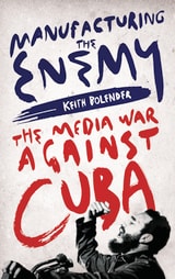
Manufacturing the Enemy
The Media War Against CubaKeith Bolender
Pluto Press, 2019
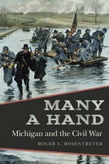
Many a Hand
Michigan and the Civil WarRoger L. Rosentreter
Michigan State University Press, 2026
When war came to the nation in 1861, Michiganians rallied around the Stars and Stripes and readily agreed with a veteran politician who declared, “He who is not for his country is against her.” Even as the conflict grew bloody and costly, they remained committed to suppressing the rebellion. By war’s end, an astonishing 50 percent of its military-age males had enlisted in the army. This Michigan Civil War chronicle is more than a story about soldiers’ heroism on distant battlefields. It also includes the often-overlooked role of women—some of whom refused to stay home and went to war. Also buried in the historical record are accounts of white soldiers whose views on slavery and African Americans, especially those in uniform, were transformed. There is also a much-needed exploration of Michigan’s response to the shocking assassination of a beloved president. Many a Hand captures these stories in a single volume.
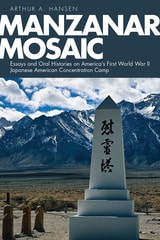
Manzanar Mosaic
Essays and Oral Histories on America's First World War II Japanese American Concentration CampArthur A. Hansen
University Press of Colorado, 2023
To begin, Hansen presents two essays, the first centering on his work with Ronald Larson in the mid-1970s on the history of Doho, a Japanese and English dual-language newspaper, and the second an article with David Hacker on revisionist ethnic perspectives of the Manzanar “riot.” A second section is composed of five oral history interviews of selected camp personalities—a female Nisei journalist, a male Nisei historical documentarian, a male Kibei Communist block manager, the Caucasian wife and comrade of the block manager, and the male Kibei who was the central figure in the Manzanar Riot/Revolt—that offer powerful insight into the controversial content of the two essays that precede them.
Manzanar can be understood only by being considered within the much wider context of Japanese American community formation and contestation before, during, and after World War II. A varied collection of scholarly articles and interviews, Manzanar Mosaic engages diverse voices and considers multiple perspectives to illuminate aspects of the Japanese American community, the ethnic press, the Manzanar concentration camp, and the movement for redress and reparations.
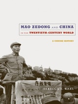
Mao Zedong and China in the Twentieth-Century World
A Concise HistoryRebecca E. Karl
Duke University Press, 2010

Mao's Bestiary
Medicinal Animals and Modern ChinaLiz P. Y. Chee
Duke University Press, 2021
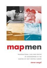
Map Men
Transnational Lives and Deaths of Geographers in the Making of East Central EuropeSteven Seegel
University of Chicago Press, 2018
Taking us deep into cartographical archives, Seegel re-creates the public and private worlds of these five mapmakers, who interacted with and influenced one another even as they played key roles in defining and redefining borders, territories, nations—and, ultimately, the interconnection of the world through two world wars. Throughout, he examines the transnational nature of these processes and addresses weighty questions about the causes and consequences of the world wars, the rise of Nazism and Stalinism, and the reasons East Central Europe became the fault line of these world-changing developments.
At a time when East Central Europe has surged back into geopolitical consciousness, Map Men offers a timely and important look at the historical origins of how the region was defined—and the key people who helped define it.

Map is not Territory
Studies in the History of ReligionsJonathan Z. Smith
University of Chicago Press, 1992
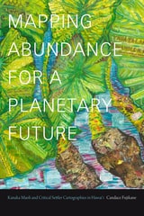
Mapping Abundance for a Planetary Future
Kanaka Maoli and Critical Settler Cartographies in Hawai'iCandace Fujikane
Duke University Press, 2021

Mapping American Culture
Wayne Franklin
University of Iowa Press, 1995
What connections can be drawn between oral history and the shopping mall? Gospel music and the Diablo Canyon nuclear power plant? William Carlos Williams's Patterson and the Manhattan Project's secret cities? The answers lie in this insightful collection of essays that read and illuminate the American landscape. Through literature and folklore, music and oral history, autobiography, architecture, and photography, eleven leading writers and thinkers explore the dialectic between space and place in modern American life. The result is an eloquent and provocative reminder of the environmental context of events—the deceptively simple fact that events “take place.”
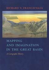
Mapping And Imagination In The Great Basin
A Cartographic HistoryRichard V. Francaviglia
University of Nevada Press, 2005
The Great Basin was the last region of continental North America to be explored and mapped, and it remained largely a mystery to Euro-Americans until well into the nineteenth century. In Mapping and Imagination in the Great Basin, geographer-historian Richard Francaviglia shows how the Great Basin gradually emerged from its “cartographic silence” as terra incognita and how this fascinating process both paralleled the development of the sciences of surveying, geology, hydrology, and cartography and reflected the changing geopolitical aspirations of the European colonial powers and the United States. Francaviglia’s interdisciplinary account of the mapping of the Great Basin combines a chronicle of the exploration of the region with a history of the art and science of cartography and of the political, economic, and cultural contexts in which maps are created. It also offers a compelling, wide-ranging discussion that combines a description of the daunting physical realities of the Great Basin with a cogent examination of the ways humans, from early Native Americans to nineteenth-century surveyors to twentieth-century highway and air travelers, have understood, defined, and organized this space, psychologically and through the medium of maps. Mapping and Imagination in the Great Basin continues Francaviglia’s insightful, richly nuanced meditation on the Great Basin landscape that began in Believing in Place.
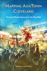
Mapping AsiaTown Cleveland
Race and Redevelopment in the Rust BeltRebecca Jo Kinney
Temple University Press, 2025
Mapping AsiaTown Cleveland challenges ideas about the invisibility of Asian Americans in the urban Midwest by linking the contemporary development of Cleveland’s “AsiaTown” to the multiple and fragmented histories of Cleveland’s Asian American communities from the 1940s to present day. Kinney’s sharp insights illustrate how region matters for Japanese Americans who resettled from concentration camps and Chinese Americans food purveyors, as well as the ways in which Asian American community leaders have had to fight for visibility and representation in city planning—even as the Cleveland Asian Festival is branded as a marquee “diversity” event for the city.
Mapping AsiaTown Cleveland recognizes the vibrant Asian American community formations and belonging that have developed in seemingly unexpected spaces and places.
In the series Asian American History and Culture
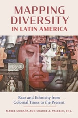
Mapping Diversity in Latin America
Race and Ethnicity from Colonial Times to the PresentEdited by Mabel Moraña and Miguel A. Valerio
Vanderbilt University Press, 2025
Taking an interdisciplinary approach to understanding issues of collective identity, otherness, alterity, and the like, Mapping Diversity in Latin America sheds light on histories that have been traditionally overlooked in texts on race in Latin America, such as the rich history of diasporic Asian, Syrian Lebanese, and Jewish communities, and the more recent emergence of Latinx populations in the United States. The book includes a critical examination of fundamental concepts such as mestizaje, mulataje, creolization, negritud, and blanquitud, as well as critical and theoretical approaches to the study of these issues in postcolonial societies.
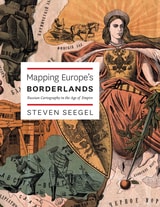
Mapping Europe's Borderlands
Russian Cartography in the Age of EmpireSteven Seegel
University of Chicago Press, 2012
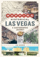
Mapping Historical Las Vegas
A Cartographic JourneyJoe Weber
University of Nevada Press, 2022
Reaching past the city limits, Mapping Historical Las Vegas also examines the development of public lands, military bases, and the canyons and valleys of the Colorado River before the Hoover Dam was built and Lake Mead was created. Weber also includes information on dams, highways, railroads, and other projects that were planned but never constructed— showing what might have been in one of the nation’s largest cities.
With 137 color maps generated using Geographic Information Systems, along with extensive mapping by Weber that draws on his decades of experience in the region, Mapping Historical Las Vegas offers a unique perspective on one of the world’s most famous desert cities.
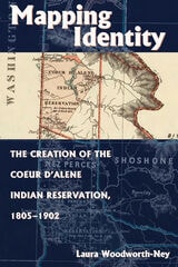
Mapping Identity
The Creation of the Coeur d'Alene Indian Reservation, 1805-1902Laura Woodworth-Ney
University Press of Colorado, 2004
Mapping Identity builds on the growing body of literature that presents a more complex picture of federal policy, native identity, and the creation of Indian reservations in the western United States. It will be important to readers interested in western U.S. history, legal and administrative history, Native American history, and interior Northwest history.
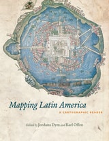
Mapping Latin America
A Cartographic ReaderEdited by Jordana Dym and Karl Offen
University of Chicago Press, 2011
For many, a map is nothing more than a tool used to determine the location or distribution of something—a country, a city, or a natural resource. But maps reveal much more: to really read a map means to examine what it shows and what it doesn’t, and to ask who made it, why, and for whom. The contributors to this new volume ask these sorts of questions about maps of Latin America, and in doing so illuminate the ways cartography has helped to shape this region from the Rio Grande to Patagonia.
In Mapping Latin America,Jordana Dym and Karl Offen bring together scholars from a wide range of disciplines to examine and interpret more than five centuries of Latin American maps.Individual chapters take on maps of every size and scale and from a wide variety of mapmakers—from the hand-drawn maps of Native Americans, to those by famed explorers such as Alexander von Humboldt, to those produced in today’s newspapers and magazines for the general public. The maps collected here, and the interpretations that accompany them, provide an excellent source to help readers better understand how Latin American countries, regions, provinces, and municipalities came to be defined, measured, organized, occupied, settled, disputed, and understood—that is, how they came to have specific meanings to specific people at specific moments in time.
The first book to deal with the broad sweep of mapping activities across Latin America, this lavishly illustrated volume will be required reading for students and scholars of geography and Latin American history, and anyone interested in understanding the significance of maps in human cultures and societies.
Mapping Nature across the Americas
Edited by Kathleen A. Brosnan & James R. Akerman
University of Chicago Press, 2021
Mapping Norwood
An Irish-American MemoirCharles Fanning
University of Massachusetts Press, 2010
This memoir is an act of map making, of plotting out overlapping territories—topographical, temporal, and psychological. Centered on family life in a Massachusetts town from the 1920s to the 1960s, the author's investigation extends outward to include the Boston area from colonial times to the recent past, encounters with Boston's Museum of Fine Arts and with Harvard College, the American Civil War, and Ireland and Germany in the nineteenth century.
Charles Fanning re-creates the landscape of childhood and adolescence in a place and time both ordinary and rich with possibility. An expert on Irish immigration, he was born and raised in Norwood, Massachusetts, twelve miles outside of Boston, where Yankee and Irish cultures bumped against each other. The narrative traces his personal growth, shaped by family, school, baseball, radio drama, and art. He was the first in his family to attend college, and the book ends with his undergraduate experience at Harvard, class of 1964.
Along with this coming-of-age story, Mapping Norwood features forays back in time, including chapters on each of Fanning's parents and historical excavations and meditations on three ancestors. Guided by his own experience as a scholar, the pressure of these chapters is epistemological—the thrill of the hunt toward knowing. Fanning's great-grandfather, John Fanning, disappeared from the family in the late 1880s, and a chapter chronicles the discovery of “Walking John's” fifty years of hidden later life in East St. Louis, Illinois, where he died alone in 1946. Fanning's great-great-grandfather, Winslow Radcliffe, was a veteran of the 35th Massachusetts Infantry in the Civil War, and the author traces this regiment through the horrors of Antietam and Fredericksburg, by means of diaries and letters by four men from Winslow's company. The evidence gleaned helps explain Winslow's suicide after the war. An Irish immigrant ancestor, Phillip Fanning, came to Boston from County Monaghan just after the Great Famine of the late 1840s. Relying on historical research, Fanning imagines vividly the lives led by Phillip's family and thousands like them in the wake of Ireland's nineteenth-century catastrophe.
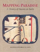
Mapping Paradise
A History of Heaven on EarthAlessandro Scafi
University of Chicago Press, 2006
Mapping Paradise is a history of the cartography of paradise that journeys from the beginning of Christianity to the present day. Instead of dismissing the medieval belief in a paradise on earth as a picturesque legend and the cartography of paradise as an example of the period’s many superstitions, Alessandro Scafi explores the intellectual conditions that made the medieval mapping of paradise possible. The challenge for mapmakers, Scafi argues, was to make visible a place that was geographically inaccessible and yet real, remote in time and yet still the scene of an essential episode of the history of salvation. Mapping Paradise also accounts for the transformations, in both theological doctrine and cartographical practice, that brought about the decline of the belief in a terrestrial paradise and the emergence of the new historical and regional mapping of the Garden of Eden that began at the time of the Reformation and still continues today.
The first book to show how paradise has been expressed in cartographic form throughout two millennia, Mapping Paradise reveals how the most deeply reflective thoughts about the ultimate destiny of all human life have been molded and remolded, generation by generation.
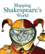
Mapping Shakespeare's World
Peter Whitfield
Bodleian Library Publishing, 2015
Mapping Shakespeare’s World explores these questions with surprising results. It has often been said that setting is irrelevant to Shakespeare’s plays—that, wherever they are set, their enduring appeal lies in their ability to speak to broad questions of human nature. Peter Whitfield shows that, on the contrary, many of Shakespeare’s locations were carefully chosen for their ability to convey subtle meanings an Elizabethan audience would have picked up on and understood. Through the use of paintings, drawings, contemporary maps and geographical texts, Whitfield suggests answers to such questions as where Illyria was located, why The Merry Wives of Windsor could only have taken place in Windsor, and how two utterly different comedies—The Comedy of Errors and Pericles, Prince of Tyre—both came to take place in ancient Ephesus.
Just when one might think there was nothing more to be said about Shakespeare, with Mapping Shakespeare’s World, Whitfield offers a fascinating new point of view.
Mapping Society
The Spatial Dimensions of Social CartographyLaura Vaughan
University College London, 2018
Mapping The Empty
Eight Artists And NevadaWilliam L. Fox
University of Nevada Press, 1999
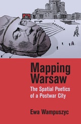
Mapping Warsaw
The Spatial Poetics of a Postwar CityEwa Wampuszyc
Northwestern University Press, 2018
Juxtaposing close readings of photo books, socialist-era newsreels called the Polska Kronika Filmowa, the comedies of Leonard Buczkowski and Jan Fethke, the writing and films of Tadeusz Konwicki, and a case study on the Palace of Culture and Science—a "gift" from none other than Stalin—this study investigates the rhetorical and visual, rather than physical, reconstruction of Warsaw in various medias and genres.
Ewa Wampuszyc roots her analysis in the historical context of the postwar decade and shows how and why Poland's capital became an essential part of a propaganda program inspired by communist ideology and the needs of a newly established socialist People's Republic. Mapping Warsaw demonstrates how physical space manifests itself in culture, and how culture, history, and politics leave an indelible mark on places. It points out ways in which we take for granted our perception of space and the meanings we assign to it.
Mapping Wisconsin History
Teacher's Guide and Student MaterialsWisconsin Historical Society Press, 2000
Mapping Wonderlands
Illustrated Cartography of Arizona, 1912–1962Dori Griffin
University of Arizona Press, 2013
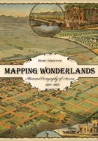
Mapping Wonderlands fills part of this gap in existing regional studies by looking at early popular pictorial maps of Arizona. These cartographic representations of the state utilize formal mapmaking conventions to create a place-based state history. They introduce illustrations, unique naming conventions, and written narratives to create carefully visualized landscapes that emphasize the touristic aspects of Arizona.
Analyzing the visual culture of tourism in illuminating detail, this book documents how Arizona came to be identified as an appealing tourism destination. Providing a historically situated analysis, Dori Griffin draws on samples from a comprehensive collection of materials generated to promote tourism during Arizona’s first half-century of statehood. She investigates the relationship between natural and constructed landscapes, visual culture, and narratives of place. Featuring sixty-six examples of these aesthetically appealing maps, the book details how such maps offered tourists and other users a cohesive and storied image of the state. Using historical documentation and rhetorical analysis, this book combines visual design and historical narrative to reveal how early-twentieth-century mapmakers and map users collaborated to imagine Arizona as a tourist’s paradise.
Mapping Yorùbá Networks
Power and Agency in the Making of Transnational CommunitiesKamari Maxine Clarke
Duke University Press, 2004
Examining how the development of a deterritorialized network of black cultural nationalists became aligned with a lucrative late-twentieth-century roots heritage market, Clarke explores the dynamics of Òyótúnjí Village’s religious and tourist economy. She discusses how the community generates income through the sale of prophetic divinatory consultations, African market souvenirs—such as cloth, books, candles, and carvings—and fees for community-based tours and dining services. Clarke accompanied Òyótúnjí villagers to Nigeria, and she describes how these heritage travelers often returned home feeling that despite the separation of their ancestors from Africa as a result of transatlantic slavery, they—more than the Nigerian Yorùbá—are the true claimants to the ancestral history of the Great Òyó Empire of the Yorùbá people. Mapping Yorùbá Networks is a unique look at the political economy of homeland identification and the transnational construction and legitimization of ideas such as authenticity, ancestry, blackness, and tradition.
Mapping an Empire
The Geographical Construction of British India, 1765-1843Matthew H. Edney
University of Chicago Press, 1997
"There is much to be praised in this book. It is an excellent history of how India came to be painted red in the nineteenth century. But more importantly, Mapping an Empire sets a new standard for books that examine a fundamental problem in the history of European imperialism."—D. Graham Burnett, Times Literary Supplement
"Mapping an Empire is undoubtedly a major contribution to the rapidly growing literature on science and empire, and a work which deserves to stimulate a great deal of fresh thinking and informed research."—David Arnold, Journal of Imperial and Commonwealth History
"This case study offers broadly applicable insights into the relationship between ideology, technology and politics. . . . Carefully read, this is a tale of irony about wishful thinking and the limits of knowledge."—Publishers Weekly

Mapping an Indigenous Future
The Uppsala Map of Colonial Mexico CityJennifer R. Saracino
University of Texas Press, 0
The only known Indigenous-authored rendering of Mexico City from the sixteenth century.
Rediscovered in a Swedish library in the 1800s, the Uppsala Map of colonial Mexico City is a crucial Indigenous-authored document. Nearly a square meter, it was created by Nahua artists in 1540 shortly after the Spanish invasion. The Franciscan-trained artists have long been characterized as having passively adopted European aesthetics in their representation.
Jennifer Saracino challenges this view, arguing that the artists purposefully blended both Nahua and European visual strategies to legitimize and improve their position in colonial society. Building upon archival, ethnohistorical, and archaeological research, Saracino reinterprets the map’s network of roads and waterways, agricultural and urban features, glyphs, and depictions of Nahua people. Saracino argues that, amid dispossession and exploitation, the artists made a visual case for Nahuas to steward the local population and land in collaboration with colonial officials as privileged intermediaries. Challenging the assumption that the map was made merely in service to the crown, Mapping an Indigenous Future contends that these Nahua mapmakers capitalized on their proximity to viceregal elites to appeal for their rightful role as custodians of New Spain.
Mapping and Empire
Soldier-Engineers on the Southwestern FrontierEdited by Dennis Reinhartz and Gerald D. Saxon
University of Texas Press, 2005
From the sixteenth through the mid-nineteenth centuries, Spain, then Mexico, and finally the United States took ownership of the land from the Gulf Coast of Texas and Mexico to the Pacific Coast of Alta and Baja California—today's American Southwest. Each country faced the challenge of holding on to territory that was poorly known and sparsely settled, and each responded by sending out military mapping expeditions to set boundaries and chart topographical features. All three countries recognized that turning terra incognita into clearly delineated political units was a key step in empire building, as vital to their national interest as the activities of the missionaries, civilian officials, settlers, and adventurers who followed in the footsteps of the soldier-engineers.
With essays by eight leading historians, this book offers the most current and comprehensive overview of the processes by which Spanish, Mexican, and U.S. soldier-engineers mapped the southwestern frontier, as well as the local and even geopolitical consequences of their mapping. Three essays focus on Spanish efforts to map the Gulf and Pacific Coasts, to chart the inland Southwest, and to define and defend its boundaries against English, French, Russian, and American incursions. Subsequent essays investigate the role that mapping played both in Mexico's attempts to maintain control of its northern territory and in the United States' push to expand its political boundary to the Pacific Ocean. The concluding essay draws connections between mapping in the Southwest and the geopolitical history of the Americas and Europe.
Mapping the Nation
History and Cartography in Nineteenth-Century AmericaSusan Schulten
University of Chicago Press, 2012
In the nineteenth century, Americans began to use maps in radically new ways. For the first time, medical men mapped diseases to understand and prevent epidemics, natural scientists mapped climate and rainfall to uncover weather patterns, educators mapped the past to foster national loyalty among students, and Northerners mapped slavery to assess the power of the South. After the Civil War, federal agencies embraced statistical and thematic mapping in order to profile the ethnic, racial, economic, moral, and physical attributes of a reunified nation. By the end of the century, Congress had authorized a national archive of maps, an explicit recognition that old maps were not relics to be discarded but unique records of the nation’s past.
All of these experiments involved the realization that maps were not just illustrations of data, but visual tools that were uniquely equipped to convey complex ideas and information. In Mapping the Nation, Susan Schulten charts how maps of epidemic disease, slavery, census statistics, the environment, and the past demonstrated the analytical potential of cartography, and in the process transformed the very meaning of a map.
Today, statistical and thematic maps are so ubiquitous that we take for granted that data will be arranged cartographically. Whether for urban planning, public health, marketing, or political strategy, maps have become everyday tools of social organization, governance, and economics. The world we inhabit—saturated with maps and graphic information—grew out of this sea change in spatial thought and representation in the nineteenth century, when Americans learned to see themselves and their nation in new dimensions.

Mapping the State
English Boundaries and the 1832 Reform ActMartin Spychal
University of London Press, 2024
The 1832 Reform Act was a landmark moment in the development of modern British politics. By overhauling the country’s ancient representative system, the legislation reshaped constitutional arrangements at Westminster, reinvigorated political relationships between the center and the provinces, and established the political structures and precedents that both shaped and hindered Britain’s slow lurch towards democracy by 1928.
Mapping the State leads to a fundamental rethinking of the 1832 Reform Act by demonstrating how boundary reform and the reconstruction of England’s electoral map by the little-known 1831–1832 boundary commission underpinned this turning point in the development of the British political nation. Eschewing traditional approaches to the 1832 Reform Act, it draws from a significant new archival discovery—the working papers of the boundary commission—and a range of innovative quantitative techniques to provide a major reassessment of why and how the 1832 Reform Act passed, its impact on reformed politics both at Westminster and in the constituencies, and its significance to the expansion of the modern British state.
Maps and Civilization
Cartography in Culture and Society, Third EditionNorman J. W. Thrower
University of Chicago Press, 2008
The third edition of Maps and Civilization incorporates numerous revisions, features new material throughout the book, and includes a new alphabetized bibliography.
Praise for previous editions of Maps and Civilization:
“A marvelous compendium of map lore. Anyone truly interested in the development of cartography will want to have his or her own copy to annotate, underline, and index for handy referencing.”—L. M. Sebert, Geomatica
Maps and Politics
Jeremy Black
University of Chicago Press, 1997

Maps in Tudor England
P. D. A. Harvey
University of Chicago Press, 1993
In Maps in Tudor England, P. D. A. Harvey traces this revolution of production, understanding, and use of maps in England from 1485 to 1603. By the mid-sixteenth century, mapmapers had begun to draw maps to a consistent scale, reproducing the results of measured survey. By the end of the century, maps drawn to scale and showing features by conventional signs were commonly used throughout England.
In this survey Harvey focuses on maps of small areas, up to the size of a county, exploring their impact on the political and social life of England in the spheres of the military, government, towns, landed estates, buildings, and the law. Richly illustrated with thirty color and fifty black and white reproductions of rare maps, his account is an informative and accessible introduction to this revolutionary period in the history of cartography, as well as a unique visual history of Tudor England.
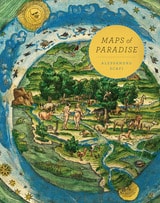
Maps of Paradise
Alessandro Scafi
University of Chicago Press, 2013
Maps of Paradise charts the diverse ways in which scholars and mapmakers from the eighth to the twenty-first century rose to the challenge of identifying the location of paradise on a map, despite the certain knowledge that it was beyond human reach. Over one hundred illustrations celebrate this history of a paradox: the mapping of the unmappable. It is also a mirror to the universal dream of perfection and happiness, and the yearning to discover heaven on earth.