Results by title
577 books match the query 'Earth Sciences' and 113 start with t
Taken by Storm, 1938
A Social and Meteorological History of the Great New England HurricaneLourdes B. Avilés
American Meteorological Society, 2013
On September 21, 1938 one of the most powerful storms of the twentieth century came unannounced into the lives of New Yorkers and New Englanders, leaving utter devastation in its wake. The Great Hurricane, as it came to be known, changed everything, from the landscape and its inhabitants’ lives, to Weather Bureau practices, to the measure and kind of relief New Englanders would receive during the Great Depression and the resulting pace of regional economic recovery.
Taken by Storm, 1938
A Social and Meteorological History of the Great New England HurricaneLourdes B. Avilés
American Meteorological Society, 2018
The storm formed near the Cape Verde Islands on September 10, but was not spotted until several days later, and was predicted by the understaffed Weather Bureau to head toward Florida. Junior forecaster Charlie Pierce correctly projected the northerly storm track, but senior meteorologists ignored his forecast, a mistake that cost many lives—including those of immigrants who had arrived to the Northeast in waves in the preceding decades. Updated for the 80th anniversary of the hurricane, this compelling history successfully weaves science, historical accounts, and social analyses to create a comprehensive picture of the most powerful and devastating hurricane to hit New England to date.

Taking Place
Location and the Moving ImageJohn David Rhodes
University of Minnesota Press, 2011
Taking Place argues that the relation between geographical location and the moving image is fundamental and that place grounds our experience of film and media. Its original essays analyze film, television, video, and installation art from diverse national and transnational contexts to rethink both the study of moving images and the theorization of place. Through its unprecedented—and at times even obsessive— attention to actual places, this volume traces the tensions between the global and the local, the universal and the particular, that inhere in contemporary debates on global cinema, television, art, and media.
Contributors: Rosalind Galt, U of Sussex; Frances Guerin, U of Kent; Ji-hoon Kim; Hugh S. Manon, Clark U; Ara Osterweil, McGill U; Brian Price, U of Toronto; Linda Robinson, U of Wisconsin–Whitewater; Michael Siegel; Noa Steimatsky, U of Chicago; Meghan Sutherland, U of Toronto; Mark W. Turner, Kings College London; Aurora Wallace, New York U; Charles Wolfe, U of California, Santa Barbara.
Teaching About Place
Learning From The LandLaird Christensen
University of Nevada Press, 2008
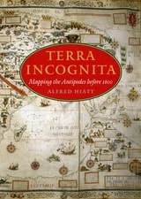
Terra Incognita
Mapping the Antipodes before 1600Alfred Hiatt
University of Chicago Press, 2008
In Terra Incognita, Alfred Hiatt draws on sources both literary and visual to understand the appeal of the antipodes. Examining maps and diagrams, as well as evidence contained in geographical and historical works, poetry, travel narratives, and legal documents, he challenges long-standing characterizations of medieval spatiality as exclusively symbolic and religious. Instead, Hiatt finds, the idea of people on the other side of the Earth provided a potent and malleable symbol for political theorists, satirists, scholars, and poets—as well as for map makers. Terra Incognita is, in the end, the history of a non-place, of lands conjured by the scientific imagination, which nevertheless drove exploration, and which continued to shape the world map, even as they slowly vanished from it.
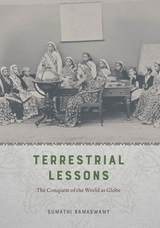
Terrestrial Lessons
The Conquest of the World as GlobeSumathi Ramaswamy
University of Chicago Press, 2017
In Terrestrial Lessons, Ramaswamy provides the first in-depth analysis of the globe’s history in and impact on the Indian subcontinent during the colonial era and its aftermath. Drawing on a wide array of archival sources, she delineates its transformation from a thing of distinction possessed by elite men into that mass-produced commodity used in classrooms worldwide—the humble school globe. Traversing the length and breadth of British India, Terrestrial Lessons is an unconventional history of this master object of pedagogical modernity that will fascinate historians of cartography, science, and Asian studies.
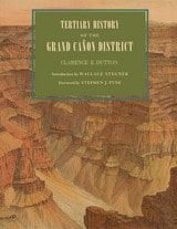
Tertiary History of the Grand Cañon District
Clarence E. Dutton; Introduction by Wallace Stegner; Foreword by Stephen J. Pyne
University of Arizona Press, 2001
Originally published in 1882, Clarence Dutton’s Tertiary History of the Grand Cañon District has become one of the definitive books on the Grand Canyon. Commissioned as a study of the region’s geology and issued by the fledgling U.S. Geological Survey, it is as much admired today for its literary as its scientific merits. With its beautiful illustrations by Thomas Moran and William Henry Holmes, it is a seminal work on the Canyon that has never been surpassed for its eloquence and authority.
This new edition of Dutton’s magnum opus makes that work available once again. Visitors to the Canyon will gain a new appreciation of its majesty as Dutton takes readers on several excursions among its castellated and cathedral-like peaks and ridges. Along the way, he explains the peculiar characteristics of different rocks, the water-sculpturing process, volcanic cones and outflows, the extent of the river’s erosion, and other geological features.
Dutton’s Tertiary History remains arguably the most evocative and compelling geological writing ever done on the Grand Canyon region. As Stephen J. Pyne observes in his foreword, Dutton “recast a rocky peninsula into geo-poetry, reshaped an amorphous panorama of Time into narrative History, and transformed an American scene into a universal symbol.” No one who has thrilled to the majesty of the Grand Canyon will fail to be moved by this timeless work.

The AMS Weather Book
The Ultimate Guide to America's WeatherJack Williams
University of Chicago Press, 2009
America has some of the most varied and dynamic weather in the world. Every year, the Gulf Coast is battered by hurricanes, the Great Plains are ravaged by tornados, the Midwest is pummeled by blizzards, and the temperature in the Southwest reaches a sweltering 120 degrees. Extreme weather can be a matter of life and death, but even when it is pleasant—72 degrees and sunny—weather is still central to the lives of all Americans. Indeed, it’s hard to imagine a topic of greater collective interest. Whether we want to know if we should close the storm shutters or just carry an umbrella to work, we turn to forecasts. But few of us really understand the science behind them.
All that changes with The AMS Weather Book. The most comprehensive and up-to-date guide to our weather and our atmosphere, it is the ultimate resource for anyone who wants to understand how hurricanes form, why tornados twirl, or even why the sky is cerulean blue. Written by esteemed science journalist and former USA Today weather editor Jack Williams, The AMS Weather Book, copublished with the American Meteorological Society, covers everything from daily weather patterns, air pollution, and global warming to the stories of people coping with severe weather and those who devote their lives to understanding the atmosphere, oceans, and climate. Words alone, of course, are not adequate to explain many meteorological concepts, so The AMS Weather Book is filled with engaging full-color graphics that explain such concepts as why winds blow in a particular direction, how Doppler weather radar works, what happens inside hurricanes, how clouds create wind and snow, and what’s really affecting the earth’s climate.
For Weather Channel junkies, amateur meteorologists, and storm chasers alike, The AMS Weather Book is an invaluable tool for anyone who wants to better understand how weather works and how it affects our lives.

The Administrative Partitioning of Costa Rica
Marilyn April Dorn
University of Chicago Press, 1989
The Age of Everything
How Science Explores the PastMatthew Hedman
University of Chicago Press, 2007
Hedman details, for example, how interdisciplinary studies of the Great Pyramids of Egypt can determine exactly when and how these incredible structures were built. He shows how the remains of humble trees can illuminate how the surface of the sun has changed over the past ten millennia. And he also explores how the origins of the earth, solar system, and universe are being discerned with help from rocks that fall from the sky, the light from distant stars, and even the static seen on television sets.
Covering a wide range of time scales, from the Big Bang to human history, The Age of Everything is a provocative and far-ranging look at how science has determined the age of everything from modern mammals to the oldest stars, and will be indispensable for all armchair time travelers.
“We are used to being told confidently of an enormous, measurable past: that some collection of dusty bones is tens of thousands of years old, or that astronomical bodies have an age of some billions. But how exactly do scientists come to know these things? That is the subject of this quite fascinating book. . . . As told by Hedman, an astronomer, each story is a marvel of compressed exegesis that takes into account some of the most modern and intriguing hypotheses.”—Steven Poole, Guardian

The Archeology of New Hampshire
Exploring 10,000 Years in the Granite StateDavid Starbuck
University of New Hampshire Press, 2006
Several states already boast volumes showcasing their archeological history, but not New Hampshire—until now. David R. Starbuck's volume fills that void. Going beyond standard state guides that focus primarily on prehistoric sites, Starbuck also devotes equal time to historic, industrial, and nautical sites. This approach reflects the thinking of most contemporary archeologists who conduct research at a diverse range of sites.
A veteran of thirty years of field research throughout the Granite State, Starbuck revisits some of his own sites, including excavations at the New England Glassworks in Temple, two prehistoric sites on the Merrimack River, the Joseph Hazeltine pottery workshop outside Concord, the Governor Wentworth Estate in Wolfeboro, and his own long-term survey and excavation project at Canterbury Shaker Village. At the same time, though, Starbuck includes the work of other contemporary New Hampshire archeologists, representative sites of “old-timers” whose digs preceded his arrival, and the investigations of avocational diggers.
Starbuck's introduction offers an anecdotal history of archeological research in New Hampshire through the people who shaped it. Part I discusses discoveries that predate white settlement: the Paleo-Indian Period; the Archaic Period; and the Woodland Period. Part II moves from the seventeenth century to the present. Chapters include historical archeology (forts, farms, potters, Shakers); industrial archeology (mills, factories, railroads, dams, and bridges); and nautical archeology (discoveries in the state's lakes and on the seacoast).
In addition to summarizing some of the more interesting finds, Starbuck includes stories about archeologists and the techniques they have used to glean information from the past. Overall, he provides a lively account of what it is like to practice archeology in a small but dynamic New England state.
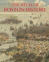
The Atlas of Boston History
Edited by Nancy S. Seasholes
University of Chicago Press, 2019
Edited by historian Nancy S. Seasholes, this landmark volume captures all aspects of Boston’s past in a series of fifty-seven stunning full-color spreads. Each section features newly created thematic maps that focus on moments and topics in that history. These maps are accompanied by hundreds of historical and contemporary illustrations and explanatory text from historians and other expert contributors. They illuminate a wide range of topics including Boston’s physical and economic development, changing demography, and social and cultural life. In lavishly produced detail, The Atlas of Boston History offers a vivid, refreshing perspective on the development of this iconic American city.
Contributors
Robert J. Allison, Robert Charles Anderson, John Avault, Joseph Bagley, Charles Bahne, Laurie Baise, J. L. Bell, Rebekah Bryer, Aubrey Butts, Benjamin L. Carp, Amy D. Finstein, Gerald Gamm, Richard Garver, Katherine Grandjean, Michelle Granshaw, James Green, Dean Grodzins, Karl Haglund, Ruth-Ann M. Harris, Arthur Krim, Stephanie Kruel, Kerima M. Lewis, Noam Maggor, Dane A. Morrison, James C. O’Connell, Mark Peterson, Marshall Pontrelli, Gayle Sawtelle, Nancy S. Seasholes, Reed Ueda, Lawrence J. Vale, Jim Vrabel, Sam Bass Warner, Jay Wickersham, and Susan Wilson
The Atlas of Coasts and Oceans
Ecosystems, Threatened Resources, Marine ConservationDon Hinrichsen
University of Chicago Press, 2011
Oceans drive the world’s climate, nurture marine ecosystems full of aquatic life, and provide shipping lanes that have defined the global economy for centuries. And few realize that half of the world’s population lives in a coastal region within easy reach of one. Yet human activities such as commercial fishing, coastal real estate development, and industrial pollution have taken their toll on the seas. The first book of its kind, The Atlas of Coasts and Oceans documents the fraught relationship between humans and the earth’s largest bodies of water—and outlines the conservation steps needed to protect the marine environment for generations to come.
The Atlas offers a fascinating and often sobering account of how urbanization, climate change, offshore oil drilling, shipping routes, global tourism, and maritime conflict have had a profound impact on the world’s oceans and coasts. Combining text and images in visually engaging, thematically organized map spreads, this volume addresses the ecological, environmental, and economic importance of marine phenomena such as coral reefs, eroding shorelines, hurricanes, and fish populations—and how development threatens to destroy the ultimate source of all life on the “blue planet.” Lavishly illustrated with global and regional maps, from the Arabian Gulf to the Great Barrier Reef, from the Black Sea to the Mediterranean, and all the other major global waterways, The Atlas of Coasts and Oceans will be the definitive companion to any study of its subject for years to come.
The Atlas of World Hunger
Thomas J. Bassett and Alex Winter-Nelson
University of Chicago Press, 2010
Earlier this year, President Obama declared one of his top priorities to be “making sure that people are able to get enough to eat.” The United States spends about five billion dollars on food aid and related programs each year, but still, both domestically and internationally, millions of people are hungry. In 2006, the Food and Agricultural Organization of the United Nations counted 850 million hungry people worldwide, but as food prices soared, an additional 100 million or more who were vulnerable succumbed to food insecurity.
If hunger were simply a matter of food production, no one would go without. There is more than enough food produced annually to provide every living person with a healthy diet, yet so many suffer from food shortages, unsafe water, and malnutrition every year. That’s because hunger is a complex political, economic, and ecological phenomenon. The interplay of these forces produces a geography of hunger that Thomas J. Bassett and Alex Winter-Nelson illuminate in this empowering book. The Atlas of World Hunger uses a conceptual framework informed by geography and agricultural economics to present a hunger index that combines food availability, household access, and nutritional outcomes into a single tool—one that delivers a fuller understanding of the scope of global hunger, its underlying mechanisms, and the ways in which the goals for ending hunger can be achieved. The first depiction of the geography of hunger worldwide, the Atlas will be an important resource for teachers, students, and anyone else interested in understanding the geography and causes of hunger. This knowledge, the authors argue, is a critical first step toward eliminating unnecessary suffering in a world of plenty.

The Biology of Reefs and Reef Organisms
Walter M. Goldberg
University of Chicago Press, 2013
Goldberg examines the nature not only of coral reefs—the best known among types of reefs—but also of sponge reefs, worm reefs, and oyster reefs, explaining the factors that influence their growth, distribution, and structure. A central focus of the book is reef construction, and Goldberg details the plants and animals that form the scaffold of the reef system and allow for the attachment and growth of other organisms, including those that function as bafflers, binders, and cementing agents. He also tours readers through reef ecology, paleontology, and biogeography, all of which serve as background for the problems reefs face today and the challenge of their conservation.
The Birth of Territory
Stuart Elden
University of Chicago Press, 2013
The Broken Land
Adventures in Great Basin GeologyFrank DeCourten
University of Utah Press, 2003
"The desert may seem timeless from within the Yellow Circle tonight, but the permanence of the surrounding landscape is only an illusion. Even the land is alive here, constantly changing and evolving as do all living things. Nothing here is 'finished.' Everything around us—the plants, the animals, the rocks, and the terrain itself—is in the process of becoming something else. And, of course, so are we. None of us around the campfire tonight are the same people we were yesterday, or will be tomorrow."—from the book
The Broken Land surveys the geological phenomena of the magnificent Great Basin landscape of western Utah, Nevada, eastern California, and adjacent regions. Each chapter focuses on a locality or area that provides insight into the deep history of one of North America's most remote regions—one of its continental margins. It is the only book available covering the geology of the entire Great Basin. Written for anyone with a casual to serious interest in natural history, The Broken Land conveys Frank DeCourten's awe at the story written in the rock of the basin.
The Callendar Effect
The Life and Work of Guy Stewart Callendar (1898-1964)James Rodger Fleming
American Meteorological Society, 2007
The City Creative
The Rise of Urban Placemaking in Contemporary AmericaMichael H. Carriere and David Schalliol
University of Chicago Press, 2021
Spanning the 1950s to the post-recession 2010s, The City Creative highlights the roles of such prominent individuals and organizations as Jane Jacobs, Christopher Alexander, Richard Sennett, Project for Public Spaces, and the National Endowment for the Arts in the development of urban placemaking, both in the abstract and on the ground. But that’s only half the story. Bringing the narrative to the present, Michael H. Carriere and David Schalliol also detail placemaking interventions at more than 200 sites in more than 40 cities, combining archival research, interviews, participant observation, and Schalliol’s powerful documentary photography. Carriere and Schalliol find that while these formal and informal placemaking interventions can bridge local community development and regional economic plans, more often than not, they push the boundaries of mainstream placemaking. Rather than simply stressing sociability or market-driven economic development, these initiatives offer an alternative model of community-led progress with the potential to redistribute valuable resources while producing tangible and intangible benefits for their communities. The City Creative provides a kaleidoscopic overview of how these initiatives grow, and sometimes collapse, illustrating the centrality of placemaking in the evolution of the American city and how it can be reoriented to meet demands for a more equitable future.
The Climate of History in a Planetary Age
Dipesh Chakrabarty
University of Chicago Press, 2021
Chakrabarty argues that we must see ourselves from two perspectives at once: the planetary and the global. This distinction is central to Chakrabarty’s work—the globe is a human-centric construction, while a planetary perspective intentionally decenters the human. Featuring wide-ranging excursions into historical and philosophical literatures, The Climate of History in a Planetary Age boldly considers how to frame the human condition in troubled times. As we open ourselves to the implications of the Anthropocene, few writers are as likely as Chakrabarty to shape our understanding of the best way forward.
The Contours of America’s Cold War
Matthew Farish
University of Minnesota Press, 2010
Geographic knowledge generated for the Cold War was a form of power, Farish argues, and it was given an urgency in the panels, advisory boards, and study groups established to address the challenges of an atomic world. He investigates how the scales of the city, the continent, the region, the globe, and, by extension, outer space, were brought together as strategic spaces, categories that provided a cartographic orientation for the Cold War and influenced military deployments, diplomacy, espionage, and finance.
Farish analyzes the surprising range of knowledge production involved in the project of claiming and classifying American space. Backed by military and intelligence funding, physicists and policy makers, soldiers and social scientists came together to study and shape the United States and its place in a divided world.
The Deep
The Extraordinary Creatures of the AbyssClaire Nouvian
University of Chicago Press, 2007
On dry land, most organisms are confined to the surface, or at most to altitudes of a hundred meters—the height of the tallest trees. In the oceans, though, living space has both vertical and horizontal dimensions: with an average depth of 3800 meters, the oceans offer 99% of the space on Earth where life can develop. And the deep sea, which has been immersed in total darkness since the dawn of time, occupies 85% of ocean space, forming the planet’s largest habitat. Yet these depths abound with mystery. The deep sea is mostly uncharted—only about 5 percent of the seafloor has been mapped with any reasonable degree of detail—and we know very little about the creatures that call it home. Current estimates about the number of species yet to be found vary between ten and thirty million. The deep sea no longer has anything to prove; it is without doubt Earth’s largest reservoir of life.
Combining the latest scientific discoveries with astonishing color imagery, The Deep takes readers on a voyage into the darkest realms of the ocean. Revealing nature’s oddest and most mesmerizing creatures in crystalline detail, The Deep features more than two hundred color photographs of terrifying sea monsters, living fossils, and ethereal bioluminescent creatures, some photographed here for the very first time. Accompanying these breathtaking photographs are contributions from some of the world’s most respected researchers that examine the biology of deep-sea organisms, the ecology of deep-sea habitats, and the history of deep-sea exploration.
An unforgettable visual and scientific tour of the teeming abyss, The Deep celebrates the incredible diversity of life on Earth and will captivate anyone intrigued by the unseen—and unimaginable—creatures of the deep sea.
The Design and Implementation of US Climate Policy
Edited by Don Fullerton and Catherine D. Wolfram
University of Chicago Press, 2012
The Discovery of the World
Maps of the Earth and the CosmosElizabeth Hale
University of Chicago Press, 1985
The Earthquake Observers
Disaster Science from Lisbon to RichterDeborah R. Coen
University of Chicago Press, 2012
In The Earthquake Observers, Deborah R. Coen acquaints readers not only with the century’s most eloquent seismic commentators, including Alexander von Humboldt, Charles Darwin, Mark Twain, Charles Dickens, Karl Kraus, Ernst Mach, John Muir, and William James, but also with countless other citizen-observers, many of whom were women. Coen explains how observing networks transformed an instant of panic and confusion into a field for scientific research, turning earthquakes into natural experiments at the nexus of the physical and human sciences. Seismology abandoned this project of citizen science with the introduction of the Richter Scale in the 1930s, only to revive it in the twenty-first century in the face of new hazards and uncertainties. The Earthquake Observers tells the history of this interrupted dialogue between scientists and citizens about living with environmental risk.
The Elements
A Visual History of Their DiscoveryPhilip Ball
University of Chicago Press, 2021
The Elements is a stunning visual journey through the discovery of the chemical building blocks of our universe. By piecing together the history of the periodic table, Ball explores not only how we have come to understand what everything is made of, but also how chemistry developed into a modern science. Ball groups the elements into chronological eras of discovery, covering seven millennia from the first known to the last named. As he moves from prehistory and classical antiquity to the age of atomic bombs and particle accelerators, Ball highlights images and stories from around the world and sheds needed light on those who struggled for their ideas to gain inclusion. By also featuring some elements that aren’t true elements but were long thought to be—from the foundational prote hyle and heavenly aetherof the ancient Greeks to more recent false elements like phlogiston and caloric—The Elements boldly tells the full history of the central science of chemistry.

The Emergence of Tropical Medicine in France
Michael A. Osborne
University of Chicago Press, 2014
Osborne argues that physicians formulated localized concepts of diseases according to specific climatic and meteorological conditions, and assessed, diagnosed, and treated patients according to their ethnic and cultural origins. He also demonstrates that regions, more so than a coherent nation, built the empire and specific medical concepts and practices. Thus, by considering tropical medicine’s distinctive history, Osborne brings to light a more comprehensive and nuanced view of French medicine, medical geography, and race theory, all the while acknowledging the navy’s crucial role in combating illness and investigating the racial dimensions of health.
The Epochs of Nature
Georges-Louis Leclerc, le comte de Buffon
University of Chicago Press, 2018
In seven epochs, Buffon reveals the main features of an evolving Earth, from its hard rock substrate to the sedimentary layers on top, from the minerals and fossils found within these layers to volcanoes, earthquakes, and rises and falls in sea level—and he even touches on age-old mysteries like why the sun shines. In one of many moments of striking scientific prescience, Buffon details evidence for species extinction a generation before Cuvier’s more famous assertion of the phenomenon. His seventh and final epoch does nothing less than offer the first geological glimpse of the idea that humans are altering the very foundations of the Earth—an idea of remarkable resonance as we debate the designation of another epoch: the Anthropocene. Also featuring Buffon’s extensive “Notes Justificatives,” in which he offers further evidence to support his assertions (and discusses vanished monstrous North American beasts—what we know as mastodons—as well as the potential existence of human giants), plus an enlightening introduction by editor and translator Jan Zalasiewicz and historians of science Sverker Sörlin, Libby Robin, and Jacques Grinevald, this extraordinary new translation revives Buffon’s quite literally groundbreaking work for a new age.
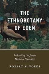
The Ethnobotany of Eden
Rethinking the Jungle Medicine NarrativeRobert A. Voeks
University of Chicago Press, 2018
By exploring the interconnected worlds of anthropology, botany, and geography, Voeks shows that well-intentioned scientists and environmentalists originally crafted the jungle narrative with the primary goal of saving the world’s tropical rainforests from destruction. It was a strategy deployed to address a pressing environmental problem, one that appeared at a propitious point in history just as the Western world was taking a more globalized view of environmental issues. And yet, although supported by science and its practitioners, the story was also underpinned by a persuasive mix of myth, sentimentality, and nostalgia for a long-lost tropical Eden. Resurrecting the fascinating history of plant prospecting in the tropics, from the colonial era to the present day, The Ethnobotany of Eden rewrites with modern science the degradation narrative we’ve built up around tropical forests, revealing the entangled origins of our fables of forest cures.
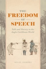
The Freedom of Speech
Talk and Slavery in the Anglo-Caribbean WorldMiles Ogborn
University of Chicago Press, 2019
The Gaia Hypothesis
Science on a Pagan PlanetMichael Ruse
University of Chicago Press, 2013

The Gateway to the Pacific
Japanese Americans and the Remaking of San FranciscoMeredith Oda
University of Chicago Press, 2018
Focusing on the development of the Center, Meredith Oda shows how this multilayered story was embedded within a larger story of the changing institutions and ideas that were shaping the city. During these formative decades, Oda argues, San Francisco’s relations with and ideas about Japan were being forged within the intimate, local sites of civic and community life. This shift took many forms, including changes in city leadership, new municipal institutions, and especially transformations in the built environment. Newly friendly relations between Japan and the United States also meant that Japanese Americans found fresh, if highly constrained, job and community prospects just as the city’s African Americans struggled against rising barriers. San Francisco’s story is an inherently local one, but it also a broader story of a city collectively, if not cooperatively, reimagining its place in a global economy.
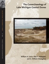
The Geoarchaeology of Lake Michigan Coastal Dunes
William A. Lovis, Alan F. Arbogast, and G. William Monaghan
Michigan State University Press, 2012
Complex sets of environmental factors have interacted over the past 5,000 years to affect how changes in climate, temperature, relative precipitation, and the levels of Lake Michigan influence the preservation of archaeological sites in coastal sand dunes along Lake Michigan. As a collaboration between earth scientists, archaeologists, and geoarchaeologists, this study draws on a wealth of research and multidisciplinary insights to explore the conditions necessary to safeguard ancient human settlements in these landscapes. A variety of contemporary and innovative techniques, including numerous dating methods and approaches, were employed to determine when and for how long sand dunes were active and when and for how long archaeological sites were occupied. Knowledge of dune processes and settlement patterns not only affects archaeological interpretations, but it is also consummately important to land planners responsible for managing heritage archaeological sites in the Lake Michigan coastal zone.
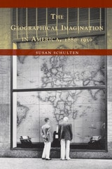
The Geographical Imagination in America, 1880-1950
Susan Schulten
University of Chicago Press, 2001
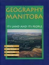
The Geography of Manitoba
Its Land and its PeopleJohn Welsted
University of Manitoba Press, 1996
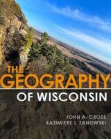
The Geography of Wisconsin
John A. Cross and Kazimierz J. Zaniewski
University of Wisconsin Press, 2022
- physical features: bedrock geology, glaciation, landforms, soils, climate, and vegetation
- cultural landscapes: population density, ethnic populations, demographics, and political affiliations
- economic activity: agriculture, forestry, mining, manufacturing, transportation, recreation, and tourism
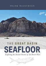
The Great Basin Seafloor
Exploring the Ancient Oceans of the Desert WestFrank DeCourten
University of Utah Press, 2022
Written for a nontechnical audience, this book interprets the rock record left by more than 500 million years of oceanic activity, when mud and sand accumulated and solidified to produce today’s Great Basin across parts of modern Utah, Nevada, and California. DeCourten deciphers clues within exposed slopes and canyons to reconstruct the vanished seafloor and its volcanic events and examines fossils to reveal once-thriving ancient marine communities. Supplemental material is available online to serve as a field guide for readers wishing to explore this ancient ocean themselves as they travel through the region.
The Great Derangement
Climate Change and the UnthinkableAmitav Ghosh
University of Chicago Press, 2016
The extreme nature of today’s climate events, Ghosh asserts, make them peculiarly resistant to contemporary modes of thinking and imagining. This is particularly true of serious literary fiction: hundred-year storms and freakish tornadoes simply feel too improbable for the novel; they are automatically consigned to other genres. In the writing of history, too, the climate crisis has sometimes led to gross simplifications; Ghosh shows that the history of the carbon economy is a tangled global story with many contradictory and counterintuitive elements.
Ghosh ends by suggesting that politics, much like literature, has become a matter of personal moral reckoning rather than an arena of collective action. But to limit fiction and politics to individual moral adventure comes at a great cost. The climate crisis asks us to imagine other forms of human existence—a task to which fiction, Ghosh argues, is the best suited of all cultural forms. His book serves as a great writer’s summons to confront the most urgent task of our time.
The Great Devonian Controversy
The Shaping of Scientific Knowledge among Gentlemanly SpecialistsMartin J. S. Rudwick
University of Chicago Press, 1985
"After a superficial first glance, most readers of good will and broad knowledge might dismiss [this book] as being too much about too little. They would be making one of the biggest mistakes in their intellectual lives. . . . [It] could become one of our century's key documents in understanding science and its history."—Stephen Jay Gould, New York Review of Books
"Surely one of the most important studies in the history of science of recent years, and arguably the best work to date in the history of geology."—David R. Oldroyd, Science
The Great Lake Sturgeon
Nancy Auer and Dave Dempsey
Michigan State University Press, 2013
The Great Paleolithic War
How Science Forged an Understanding of America's Ice Age PastDavid J. Meltzer
University of Chicago Press, 2015
In The Great Paleolithic War, David J. Meltzer tells the story of a scientific quest that set off one of the longest-running feuds in the history of American anthropology, one so vicious at times that anthropologists were deliberately frightened away from investigating potential sites. Through his book, we come to understand how and why this controversy developed and stubbornly persisted for as long as it did; and how, in the process, it revolutionized American archaeology.
The Highlands Controversy
Constructing Geological Knowledge through Fieldwork in Nineteenth-Century BritainDavid R. Oldroyd
University of Chicago Press, 1990
Oldroyd uses archival material and his own extensive reconstruction of the nineteenth-century fieldwork in a case study showing how detailed maps and sections made it possible to understand the exceptionally complex geological structure of the Highlands
An invaluable addition to the history of geology, The Highlands Controversy also makes important contributions to our understanding of the social and conceptual processes of scientific work, especially in times of heated dispute.
The History of Cartography, Volume 3 (Replacement Volume)
Cartography in the European Renaissance, Part 1Edited by David Woodward
University of Chicago Press, 2007
Cartography in the European Renaissance treats the period from 1450 to 1650, long considered the most important in the history of European mapping. This period witnessed a flowering in the production of maps comparable to that in the fields of literature and fine arts. Scientific advances, appropriations of classical mapping techniques, burgeoning trade routes—all such massive changes drove an explosion in the making and using of maps. While this volume presents detailed histories of mapping in such well-documented regions as Italy and Spain, it also breaks significant new ground by treating Renaissance Europe in its most expansive geographical sense, giving careful attention to often-neglected regions like Scandinavia, East-Central Europe, and Russia, and by providing innovative interpretive essays on the technological, scientific, cultural, and social aspects of cartography.
Lavishly illustrated with more than a thousand maps, many in color, the two volumes of Cartography in the European Renaissance will be the unsurpassable standard in its field, both defining it and propelling it forward.
The History of Cartography, Volume 3 (Replacement Volume)
Cartography in the European Renaissance, Part 2Edited by David Woodward
University of Chicago Press, 2007
Cartography in the European Renaissance treats the period from 1450 to 1650, long considered the most important in the history of European mapping. This period witnessed a flowering in the production of maps comparable to that in the fields of literature and fine arts. Scientific advances, appropriations of classical mapping techniques, burgeoning trade routes—all such massive changes drove an explosion in the making and using of maps. While this volume presents detailed histories of mapping in such well-documented regions as Italy and Spain, it also breaks significant new ground by treating Renaissance Europe in its most expansive geographical sense, giving careful attention to often-neglected regions like Scandinavia, East-Central Europe, and Russia, and by providing innovative interpretive essays on the technological, scientific, cultural, and social aspects of cartography.
Lavishly illustrated with more than a thousand maps, many in color, the two volumes of Cartography in the European Renaissance will be the unsurpassable standard in its field, both defining it and propelling it forward.
The History of Cartography, Volume Four
Cartography in the European EnlightenmentEdited by Matthew H. Edney and Mary Sponberg Pedley
University of Chicago Press, 2020
The social and intellectual changes that swept Enlightenment Europe also transformed many of its mapmaking practices. A new emphasis on geometric principles gave rise to improved tools for measuring and mapping the world, even as large-scale cartographic projects became possible under the aegis of powerful states. Yet older mapping practices persisted: Enlightenment cartography encompassed a wide variety of processes for making, circulating, and using maps of different types. The volume’s more than four hundred encyclopedic articles explore the era’s mapping, covering topics both detailed—such as geodetic surveying, thematic mapping, and map collecting—and broad, such as women and cartography, cartography and the economy, and the art and design of maps. Copious bibliographical references and nearly one thousand full-color illustrations complement the detailed entries.
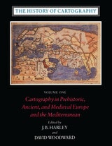
The History of Cartography, Volume One
Cartography in Prehistoric, Ancient, and Medieval Europe and the MediterraneanEdited by J. B. Harley and David Woodward
University of Chicago Press, 1987
Volume One addresses the prehistorical and historical mapping traditions of premodern Europe and the Mediterranean world. A substantial introductory essay surveys the historiography and theoretical development of the history of cartography and situates the work of the multi-volume series within this scholarly tradition. Cartographic themes include an emphasis on the spatial-cognitive abilities of Europe's prehistoric peoples and their transmission of cartographic concepts through media such as rock art; the emphasis on mensuration, land surveys, and architectural plans in the cartography of Ancient Egypt and the Near East; the emergence of both theoretical and practical cartographic knowledge in the Greco-Roman world; and the parallel existence of diverse mapping traditions (mappaemundi, portolan charts, local and regional cartography) in the Medieval period.
Throughout the volume, a commitment to include cosmographical and celestial maps underscores the inclusive definition of "map" and sets the tone for the breadth of scholarship found in later volumes of the series.
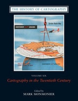
The History of Cartography, Volume Six
Cartography in the Twentieth CenturyEdited by Mark Monmonier
University of Chicago Press, 2015
The twentieth century is a pivotal period in map history. The transition from paper to digital formats led to previously unimaginable dynamic and interactive maps. Geographic information systems radically altered cartographic institutions and reduced the skill required to create maps. Satellite positioning and mobile communications revolutionized wayfinding. Mapping evolved as an important tool for coping with complexity, organizing knowledge, and influencing public opinion in all parts of the globe and at all levels of society. Volume 6 covers these changes comprehensively, while thoroughly demonstrating the far-reaching effects of maps on science, technology, and society—and vice versa.
The lavishly produced volume includes more than five hundred articles accompanied by more than a thousand images. Hundreds of expert contributors provide both original research, often based on their own participation in the developments they describe, and interpretations of larger trends in cartography. Designed for use by both scholars and the general public, this definitive volume is a reference work of first resort for all who study and love maps.
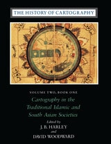
The History of Cartography, Volume Two, Book One
Cartography in the Traditional Islamic and South Asian SocietiesEdited by J. B. Harley and David Woodward
University of Chicago Press, 1992
"[The six-volume set] is certain to be the standard reference for all subsequent scholarship. The editors . . . have assembled and analyzed a vast collection of knowledge. . . . If the first volume is an indication, the complete set will be comprehensive and judicious." —John Noble Wilford, New York Times Book Review
"As well as enlarging the mind and lifting the spirits through the sheer magnitude of its endeavor, the collection delights the senses. The illustrations are exquisite: browsing fingers will instinctively alight on the sheaf of maps reproduced on stock slightly thicker than that of the text. The maps are so beguiling in the tantalizing glimpses they offer of other, seemingly incomprehensible, worlds, that the sight of them will stir the connoisseur in even the most-guarded scholar." —Ronald Rees, Geographical Review
"The corpus it brings to light, along with the extensive references, bibliography, and exhaustive appendices containing valuable comments about many of the pieces discussed, together make this book an important resource for the scholar."—Robert Provin, Professional Geographer
"This volume is a landmark of new research and will certainly contribute to further discoveries, translations, interpretations, inventories, more precise dating and the construction of stemmata." —Christian Jacob, Cartographica
"In seeking to characterize the cartography of premodern Islamic and south Asian societies, the editors offer the image of an archipelago of cartographically conscious islands in a silent sea. The research potential which they have revealed is clearly vast and underappreciated, with many islands still to be discovered or enlarged. This important book, does more, therefore, than plug a huge gap in cartographic historiography. It provides the foundation for crosscultural cartographic research in two major world regions."-Jeffrey Stone, Ecumene
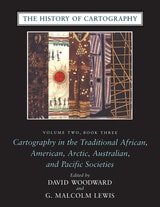
The History of Cartography, Volume Two, Book Three
Cartography in the Traditional African, American, Arctic, Australian, and Pacific SocietiesEdited by David Woodward and G. Malcolm Lewis
University of Chicago Press, 1998
"The maps in this book provide an evocative picture of how indigenous peoples view and represent their worlds. They illuminate not only questions of material culture but also the cognitive systems and social motivations that underpin them" (from the introduction).
Although they are often rendered in forms unfamiliar to Western eyes, maps have existed in most cultures. In this latest book of the acclaimed History of Cartography, contributors from a broad variety of disciplines collaborate to describe and address the significance of traditional cartographies. Whether painted on rock walls in South Africa, chanted in a Melanesian ritual, or fashioned from palm fronds and shells in the Marshall Islands, all indigenous maps share a crucial role in representing and codifying the spatial knowledge of their various cultures. Some also serve as repositories of a group's sacred or historical traditions, while others are exquisite art objects.
The indigenous maps discussed in this book offer a rich resource for disciplines such as anthropology, archaeology, art history, ethnology, geography, history, psychology, and sociology. Copious illustrations and carefully researched bibliographies enhance the scholarly value of this definitive reference.
The History of Cartography, Volume Two, Book Two
Cartography in the Traditional East and Southeast Asian SocietiesEdited by J. B. Harley and David Woodward
University of Chicago Press, 1994
Volume 2, book 2, considers the cartographic traditions of China, Korea, Japan, Vietnam, Tibet, Burma, Thailand, Laos, Malaysia, Indonesia, Brunei, and the Philippines, presenting significant new research and interpretation of archaeological, literary, and graphic sources. Richly illustrated with forty color plates and over five hundred black and white illustrations, the book includes a number of rare and elaborate maps, many previously unpublished.