Results by title
341 books match the query 'Geography' and 66 start with t

Taking Place
Location and the Moving ImageJohn David Rhodes
University of Minnesota Press, 2011
Taking Place argues that the relation between geographical location and the moving image is fundamental and that place grounds our experience of film and media. Its original essays analyze film, television, video, and installation art from diverse national and transnational contexts to rethink both the study of moving images and the theorization of place. Through its unprecedented—and at times even obsessive— attention to actual places, this volume traces the tensions between the global and the local, the universal and the particular, that inhere in contemporary debates on global cinema, television, art, and media.
Contributors: Rosalind Galt, U of Sussex; Frances Guerin, U of Kent; Ji-hoon Kim; Hugh S. Manon, Clark U; Ara Osterweil, McGill U; Brian Price, U of Toronto; Linda Robinson, U of Wisconsin–Whitewater; Michael Siegel; Noa Steimatsky, U of Chicago; Meghan Sutherland, U of Toronto; Mark W. Turner, Kings College London; Aurora Wallace, New York U; Charles Wolfe, U of California, Santa Barbara.
Teaching About Place
Learning From The LandLaird Christensen
University of Nevada Press, 2008
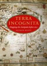
Terra Incognita
Mapping the Antipodes before 1600Alfred Hiatt
University of Chicago Press, 2008
In Terra Incognita, Alfred Hiatt draws on sources both literary and visual to understand the appeal of the antipodes. Examining maps and diagrams, as well as evidence contained in geographical and historical works, poetry, travel narratives, and legal documents, he challenges long-standing characterizations of medieval spatiality as exclusively symbolic and religious. Instead, Hiatt finds, the idea of people on the other side of the Earth provided a potent and malleable symbol for political theorists, satirists, scholars, and poets—as well as for map makers. Terra Incognita is, in the end, the history of a non-place, of lands conjured by the scientific imagination, which nevertheless drove exploration, and which continued to shape the world map, even as they slowly vanished from it.
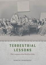
Terrestrial Lessons
The Conquest of the World as GlobeSumathi Ramaswamy
University of Chicago Press, 2017
In Terrestrial Lessons, Ramaswamy provides the first in-depth analysis of the globe’s history in and impact on the Indian subcontinent during the colonial era and its aftermath. Drawing on a wide array of archival sources, she delineates its transformation from a thing of distinction possessed by elite men into that mass-produced commodity used in classrooms worldwide—the humble school globe. Traversing the length and breadth of British India, Terrestrial Lessons is an unconventional history of this master object of pedagogical modernity that will fascinate historians of cartography, science, and Asian studies.

The Administrative Partitioning of Costa Rica
Marilyn April Dorn
University of Chicago Press, 1989
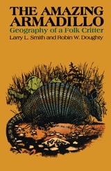
The Amazing Armadillo
Geography of a Folk CritterBy Larry L. Smith and Robin W. Doughty
University of Texas Press, 1984
Perhaps no creature has so fired the imagination of a populace as the armadillo—that most ungainly, awkward, and timid little animal. Its detractors call it a varmint and wish it good speed from the Lone Star State and its other natural territories. But its supporters claim that it is the animal kingdom's representative of all that's truly Texan: tough, pioneering, adaptable, and generous in sharing its habitation with others. What is it that sets this quizzical little creature apart from the rest of the animal kingdom?
Larry L. Smith and Robin W. Doughty ably answer this question in The Amazing Armadillo: Geography of a Folk Critter. This informative book traces the spread of the nine-banded armadillo from its first notice in South Texas late in the 1840s to its current range east to Florida and north to Missouri. The authors look at the armadillo's natural history and habitat as well as the role of humans in promoting its spread, projecting that the animal is increasing in both range and number, continuing its ecological success in areas where habitat and climate are favorable.
The book also contributes to a long-standing research theme in geography—the relationship between humans and wildlife. It explores the armadillo's value to the medical community in current research in Hansen's Disease (leprosy) as well as commercial uses, and abuses, of the armadillo in recent times. Of particular note is the author's engaging look at the armadillo as a symbol of popular culture, the efforts now underway to make it a "totem animal" symbolizing the easy-going lifestyles of some Sunbelt cities, and the spread of the craze for armadilliana to other urban centers.
The Anarchist Roots of Geography
Toward Spatial EmancipationSimon Springer
University of Minnesota Press, 2016
The Anarchist Roots of Geography sets the stage for a radical politics of possibility and freedom through a discussion of the insurrectionary geographies that suffuse our daily experiences. By embracing anarchist geographies as kaleidoscopic spatialities that allow for nonhierarchical connections between autonomous entities, Simon Springer configures a new political imagination.
Experimentation in and through space is the story of humanity’s place on the planet, and the stasis and control that now supersede ongoing organizing experiments are an affront to our survival. Singular ontological modes that favor one particular way of doing things disavow geography by failing to understand the spatial as a mutable assemblage intimately bound to temporality. Even worse, such stagnant ideas often align to the parochial interests of an elite minority and thereby threaten to be our collective undoing. What is needed is the development of new relationships with our world and, crucially, with each other.
By infusing our geographies with anarchism we unleash a spirit of rebellion that foregoes a politics of waiting for change to come at the behest of elected leaders and instead engages new possibilities of mutual aid through direct action now. We can no longer accept the decaying, archaic geographies of hierarchy that chain us to statism, capitalism, gender domination, racial oppression, and imperialism. We must reorient geographical thinking towards anarchist horizons of possibility. Geography must become beautiful, wherein the entirety of its embrace is aligned to emancipation.
The Atlas of Boston History
Edited by Nancy S. Seasholes
University of Chicago Press, 2019
Edited by historian Nancy S. Seasholes, this landmark volume captures all aspects of Boston’s past in a series of fifty-seven stunning full-color spreads. Each section features newly created thematic maps that focus on moments and topics in that history. These maps are accompanied by hundreds of historical and contemporary illustrations and explanatory text from historians and other expert contributors. They illuminate a wide range of topics including Boston’s physical and economic development, changing demography, and social and cultural life. In lavishly produced detail, The Atlas of Boston History offers a vivid, refreshing perspective on the development of this iconic American city.
Contributors
Robert J. Allison, Robert Charles Anderson, John Avault, Joseph Bagley, Charles Bahne, Laurie Baise, J. L. Bell, Rebekah Bryer, Aubrey Butts, Benjamin L. Carp, Amy D. Finstein, Gerald Gamm, Richard Garver, Katherine Grandjean, Michelle Granshaw, James Green, Dean Grodzins, Karl Haglund, Ruth-Ann M. Harris, Arthur Krim, Stephanie Kruel, Kerima M. Lewis, Noam Maggor, Dane A. Morrison, James C. O’Connell, Mark Peterson, Marshall Pontrelli, Gayle Sawtelle, Nancy S. Seasholes, Reed Ueda, Lawrence J. Vale, Jim Vrabel, Sam Bass Warner, Jay Wickersham, and Susan Wilson
The Atlas of Coasts and Oceans
Ecosystems, Threatened Resources, Marine ConservationDon Hinrichsen
University of Chicago Press, 2011
Oceans drive the world’s climate, nurture marine ecosystems full of aquatic life, and provide shipping lanes that have defined the global economy for centuries. And few realize that half of the world’s population lives in a coastal region within easy reach of one. Yet human activities such as commercial fishing, coastal real estate development, and industrial pollution have taken their toll on the seas. The first book of its kind, The Atlas of Coasts and Oceans documents the fraught relationship between humans and the earth’s largest bodies of water—and outlines the conservation steps needed to protect the marine environment for generations to come.
The Atlas offers a fascinating and often sobering account of how urbanization, climate change, offshore oil drilling, shipping routes, global tourism, and maritime conflict have had a profound impact on the world’s oceans and coasts. Combining text and images in visually engaging, thematically organized map spreads, this volume addresses the ecological, environmental, and economic importance of marine phenomena such as coral reefs, eroding shorelines, hurricanes, and fish populations—and how development threatens to destroy the ultimate source of all life on the “blue planet.” Lavishly illustrated with global and regional maps, from the Arabian Gulf to the Great Barrier Reef, from the Black Sea to the Mediterranean, and all the other major global waterways, The Atlas of Coasts and Oceans will be the definitive companion to any study of its subject for years to come.
The Atlas of World Hunger
Thomas J. Bassett and Alex Winter-Nelson
University of Chicago Press, 2010
Earlier this year, President Obama declared one of his top priorities to be “making sure that people are able to get enough to eat.” The United States spends about five billion dollars on food aid and related programs each year, but still, both domestically and internationally, millions of people are hungry. In 2006, the Food and Agricultural Organization of the United Nations counted 850 million hungry people worldwide, but as food prices soared, an additional 100 million or more who were vulnerable succumbed to food insecurity.
If hunger were simply a matter of food production, no one would go without. There is more than enough food produced annually to provide every living person with a healthy diet, yet so many suffer from food shortages, unsafe water, and malnutrition every year. That’s because hunger is a complex political, economic, and ecological phenomenon. The interplay of these forces produces a geography of hunger that Thomas J. Bassett and Alex Winter-Nelson illuminate in this empowering book. The Atlas of World Hunger uses a conceptual framework informed by geography and agricultural economics to present a hunger index that combines food availability, household access, and nutritional outcomes into a single tool—one that delivers a fuller understanding of the scope of global hunger, its underlying mechanisms, and the ways in which the goals for ending hunger can be achieved. The first depiction of the geography of hunger worldwide, the Atlas will be an important resource for teachers, students, and anyone else interested in understanding the geography and causes of hunger. This knowledge, the authors argue, is a critical first step toward eliminating unnecessary suffering in a world of plenty.
The Birth of Territory
Stuart Elden
University of Chicago Press, 2013
The City Creative
The Rise of Urban Placemaking in Contemporary AmericaMichael H. Carriere and David Schalliol
University of Chicago Press, 2021
Spanning the 1950s to the post-recession 2010s, The City Creative highlights the roles of such prominent individuals and organizations as Jane Jacobs, Christopher Alexander, Richard Sennett, Project for Public Spaces, and the National Endowment for the Arts in the development of urban placemaking, both in the abstract and on the ground. But that’s only half the story. Bringing the narrative to the present, Michael H. Carriere and David Schalliol also detail placemaking interventions at more than 200 sites in more than 40 cities, combining archival research, interviews, participant observation, and Schalliol’s powerful documentary photography. Carriere and Schalliol find that while these formal and informal placemaking interventions can bridge local community development and regional economic plans, more often than not, they push the boundaries of mainstream placemaking. Rather than simply stressing sociability or market-driven economic development, these initiatives offer an alternative model of community-led progress with the potential to redistribute valuable resources while producing tangible and intangible benefits for their communities. The City Creative provides a kaleidoscopic overview of how these initiatives grow, and sometimes collapse, illustrating the centrality of placemaking in the evolution of the American city and how it can be reoriented to meet demands for a more equitable future.
The Civilian Conservation Corps in Southern Illinois, 1933-1942
Kay Rippelmeyer
Southern Illinois University Press, 2015
Drawing on more than thirty years of meticulous research, Kay Rippelmeyer details the Depression-era history of the simultaneous creation of the Civilian Conservation Corps (CCC) and the Shawnee National Forest in southern Illinois. Through the stories of the men who worked in CCC camps devoted to soil and forest conservation projects, she offers a fascinating look into an era of utmost significance to the identity, citizens, wildlife, and natural landscape of the region.
Rippelmeyer outlines the geologic and geographic history of southern Illinois, from Native American uses of the land to the timber industry’s decimation of the forest by the 1920s. Detailing both the economic hardships and agricultural land abuse plaguing the region during the Depression, she reveals how the creation of the CCC under Franklin Delano Roosevelt coincided with the regional campaign for a national forest and how locals first became aware of and involved with the program.
Rippelmeyer mined CCC camp records from the National Archives, newspaper accounts and other correspondence and conducted dozens of oral interviews with workers and their families to re-create life in the camps. An extensive camp compendium augments the volume, featuring numerous photographs, camp locations and dates of operation, work history, and company rosters. Satisfying public curiosity and the need for factual information about the camps in southern Illinois, this is an essential contribution to regional history and a window to the national impact of the CCC.
The Contours of America’s Cold War
Matthew Farish
University of Minnesota Press, 2010
Geographic knowledge generated for the Cold War was a form of power, Farish argues, and it was given an urgency in the panels, advisory boards, and study groups established to address the challenges of an atomic world. He investigates how the scales of the city, the continent, the region, the globe, and, by extension, outer space, were brought together as strategic spaces, categories that provided a cartographic orientation for the Cold War and influenced military deployments, diplomacy, espionage, and finance.
Farish analyzes the surprising range of knowledge production involved in the project of claiming and classifying American space. Backed by military and intelligence funding, physicists and policy makers, soldiers and social scientists came together to study and shape the United States and its place in a divided world.
The Discovery of the World
Maps of the Earth and the CosmosElizabeth Hale
University of Chicago Press, 1985

The Emergence of Tropical Medicine in France
Michael A. Osborne
University of Chicago Press, 2014
Osborne argues that physicians formulated localized concepts of diseases according to specific climatic and meteorological conditions, and assessed, diagnosed, and treated patients according to their ethnic and cultural origins. He also demonstrates that regions, more so than a coherent nation, built the empire and specific medical concepts and practices. Thus, by considering tropical medicine’s distinctive history, Osborne brings to light a more comprehensive and nuanced view of French medicine, medical geography, and race theory, all the while acknowledging the navy’s crucial role in combating illness and investigating the racial dimensions of health.
The Eternal City
A History of Rome in MapsJessica Maier
University of Chicago Press, 2020
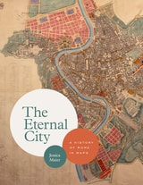
In this unique and visually engaging book, Jessica Maier considers Rome through the eyes of mapmakers and artists who have managed to capture something of its essence over the centuries. Viewing the city as not one but ten “Romes,” she explores how the varying maps and art reflect each era’s key themes. Ranging from modest to magnificent, the images comprise singular aesthetic monuments like paintings and grand prints as well as more popular and practical items like mass-produced tourist plans, archaeological surveys, and digitizations. The most iconic and important images of the city appear alongside relatively obscure, unassuming items that have just as much to teach us about Rome’s past. Through 140 full-color images and thoughtful overviews of each era, Maier provides an accessible, comprehensive look at Rome’s many overlapping layers of history in this landmark volume.
The first English-language book to tell Rome’s rich story through its maps, The Eternal City beautifully captures the past, present, and future of one of the most famous and enduring places on the planet.
The Ethnobotany of Eden
Rethinking the Jungle Medicine NarrativeRobert A. Voeks
University of Chicago Press, 2018
By exploring the interconnected worlds of anthropology, botany, and geography, Voeks shows that well-intentioned scientists and environmentalists originally crafted the jungle narrative with the primary goal of saving the world’s tropical rainforests from destruction. It was a strategy deployed to address a pressing environmental problem, one that appeared at a propitious point in history just as the Western world was taking a more globalized view of environmental issues. And yet, although supported by science and its practitioners, the story was also underpinned by a persuasive mix of myth, sentimentality, and nostalgia for a long-lost tropical Eden. Resurrecting the fascinating history of plant prospecting in the tropics, from the colonial era to the present day, The Ethnobotany of Eden rewrites with modern science the degradation narrative we’ve built up around tropical forests, revealing the entangled origins of our fables of forest cures.
The Freedom of Speech
Talk and Slavery in the Anglo-Caribbean WorldMiles Ogborn
University of Chicago Press, 2019
The Future City on the Inland Sea
A History of Imaginative Geographies of Lake SuperiorEric D. Olmanson
Ohio University Press, 2007
Winner of the AAG’s John Brinckerhoff Jackson Prize
Winner of the Great Lakes American Studies Association/Ohio University Press Book Award
Throughout the nineteenth century, the southern shores of Lake Superior held great promise for developers imagining the next great metropolis. These new territories were seen as expanses to be filled, first with romantic visions, then with scientific images, and later with vistas designed to entice settlement and economic development. The Future City on the Inland Sea describes the attempts of explorers under government, commercial, or scientific sponsorship to project their imaginative visions on a region where the future did not happen as planned.
Author Eric D. Olmanson takes a fresh look at the settlements in the vicinity of Chequamegon Bay and the Apostle Islands by analyzing the texts and images left by the missionaries, geologists, ordinance surveyors, newspaper editors, and boosters. The Future City on the Inland Sea shows how new visions of the place absorbed and replaced the old ones, eventually producing what might be called for the first time “a region.”
More than a regional geography, The Future City on the Inland Sea is an appraisal of these early efforts to meld geographies of physical nature with those of human ideals, a demonstration of how thoroughly and paradoxically those two realms are entangled.
The Gateway to the Pacific
Japanese Americans and the Remaking of San FranciscoMeredith Oda
University of Chicago Press, 2018
Focusing on the development of the Center, Meredith Oda shows how this multilayered story was embedded within a larger story of the changing institutions and ideas that were shaping the city. During these formative decades, Oda argues, San Francisco’s relations with and ideas about Japan were being forged within the intimate, local sites of civic and community life. This shift took many forms, including changes in city leadership, new municipal institutions, and especially transformations in the built environment. Newly friendly relations between Japan and the United States also meant that Japanese Americans found fresh, if highly constrained, job and community prospects just as the city’s African Americans struggled against rising barriers. San Francisco’s story is an inherently local one, but it also a broader story of a city collectively, if not cooperatively, reimagining its place in a global economy.
The Geographical Imagination in America, 1880-1950
Susan Schulten
University of Chicago Press, 2001

The Geography of Hate
The Great Migration through Small-Town AmericaJennifer Sdunzik
University of Illinois Press, 2023
During the Great Migration, Black Americans sought new lives in midwestern small towns only to confront the pervasive efforts of white residents determined to maintain their area’s preferred cultural and racial identity. Jennifer Sdunzik explores this widespread phenomenon by examining how it played out in one midwestern community. Sdunzik merges state and communal histories, interviews and analyses of population data, and spatial and ethnographic materials to create a rich public history that reclaims Black contributions and history. She also explores the conscious and unconscious white actions that all but erased Black Americans--and the terror and exclusion used against them--from the history of many midwestern communities.
An innovative challenge to myth and perceived wisdom, The Geography of Hate reveals the socioeconomic, political, and cultural forces that prevailed in midwestern towns and helps explain the systemic racism and endemic nativism that remain entrenched in American life.
The Geography of Manitoba
Its Land and its PeopleJohn Welsted
University of Manitoba Press, 1996
The Geography of Wisconsin
John A. Cross and Kazimierz J. Zaniewski
University of Wisconsin Press, 2022
- physical features: bedrock geology, glaciation, landforms, soils, climate, and vegetation
- cultural landscapes: population density, ethnic populations, demographics, and political affiliations
- economic activity: agriculture, forestry, mining, manufacturing, transportation, recreation, and tourism
The History of Cartography, Volume 3 (Replacement Volume)
Cartography in the European Renaissance, Part 1Edited by David Woodward
University of Chicago Press, 2007
Cartography in the European Renaissance treats the period from 1450 to 1650, long considered the most important in the history of European mapping. This period witnessed a flowering in the production of maps comparable to that in the fields of literature and fine arts. Scientific advances, appropriations of classical mapping techniques, burgeoning trade routes—all such massive changes drove an explosion in the making and using of maps. While this volume presents detailed histories of mapping in such well-documented regions as Italy and Spain, it also breaks significant new ground by treating Renaissance Europe in its most expansive geographical sense, giving careful attention to often-neglected regions like Scandinavia, East-Central Europe, and Russia, and by providing innovative interpretive essays on the technological, scientific, cultural, and social aspects of cartography.
Lavishly illustrated with more than a thousand maps, many in color, the two volumes of Cartography in the European Renaissance will be the unsurpassable standard in its field, both defining it and propelling it forward.
The History of Cartography, Volume 3 (Replacement Volume)
Cartography in the European Renaissance, Part 2Edited by David Woodward
University of Chicago Press, 2007
Cartography in the European Renaissance treats the period from 1450 to 1650, long considered the most important in the history of European mapping. This period witnessed a flowering in the production of maps comparable to that in the fields of literature and fine arts. Scientific advances, appropriations of classical mapping techniques, burgeoning trade routes—all such massive changes drove an explosion in the making and using of maps. While this volume presents detailed histories of mapping in such well-documented regions as Italy and Spain, it also breaks significant new ground by treating Renaissance Europe in its most expansive geographical sense, giving careful attention to often-neglected regions like Scandinavia, East-Central Europe, and Russia, and by providing innovative interpretive essays on the technological, scientific, cultural, and social aspects of cartography.
Lavishly illustrated with more than a thousand maps, many in color, the two volumes of Cartography in the European Renaissance will be the unsurpassable standard in its field, both defining it and propelling it forward.
The History of Cartography, Volume Four
Cartography in the European EnlightenmentEdited by Matthew H. Edney and Mary Sponberg Pedley
University of Chicago Press, 2020
The social and intellectual changes that swept Enlightenment Europe also transformed many of its mapmaking practices. A new emphasis on geometric principles gave rise to improved tools for measuring and mapping the world, even as large-scale cartographic projects became possible under the aegis of powerful states. Yet older mapping practices persisted: Enlightenment cartography encompassed a wide variety of processes for making, circulating, and using maps of different types. The volume’s more than four hundred encyclopedic articles explore the era’s mapping, covering topics both detailed—such as geodetic surveying, thematic mapping, and map collecting—and broad, such as women and cartography, cartography and the economy, and the art and design of maps. Copious bibliographical references and nearly one thousand full-color illustrations complement the detailed entries.
The History of Cartography, Volume One
Cartography in Prehistoric, Ancient, and Medieval Europe and the MediterraneanEdited by J. B. Harley and David Woodward
University of Chicago Press, 1987
Volume One addresses the prehistorical and historical mapping traditions of premodern Europe and the Mediterranean world. A substantial introductory essay surveys the historiography and theoretical development of the history of cartography and situates the work of the multi-volume series within this scholarly tradition. Cartographic themes include an emphasis on the spatial-cognitive abilities of Europe's prehistoric peoples and their transmission of cartographic concepts through media such as rock art; the emphasis on mensuration, land surveys, and architectural plans in the cartography of Ancient Egypt and the Near East; the emergence of both theoretical and practical cartographic knowledge in the Greco-Roman world; and the parallel existence of diverse mapping traditions (mappaemundi, portolan charts, local and regional cartography) in the Medieval period.
Throughout the volume, a commitment to include cosmographical and celestial maps underscores the inclusive definition of "map" and sets the tone for the breadth of scholarship found in later volumes of the series.
The History of Cartography, Volume Six
Cartography in the Twentieth CenturyEdited by Mark Monmonier
University of Chicago Press, 2015
The twentieth century is a pivotal period in map history. The transition from paper to digital formats led to previously unimaginable dynamic and interactive maps. Geographic information systems radically altered cartographic institutions and reduced the skill required to create maps. Satellite positioning and mobile communications revolutionized wayfinding. Mapping evolved as an important tool for coping with complexity, organizing knowledge, and influencing public opinion in all parts of the globe and at all levels of society. Volume 6 covers these changes comprehensively, while thoroughly demonstrating the far-reaching effects of maps on science, technology, and society—and vice versa.
The lavishly produced volume includes more than five hundred articles accompanied by more than a thousand images. Hundreds of expert contributors provide both original research, often based on their own participation in the developments they describe, and interpretations of larger trends in cartography. Designed for use by both scholars and the general public, this definitive volume is a reference work of first resort for all who study and love maps.
The History of Cartography, Volume Two, Book One
Cartography in the Traditional Islamic and South Asian SocietiesEdited by J. B. Harley and David Woodward
University of Chicago Press, 1992
"[The six-volume set] is certain to be the standard reference for all subsequent scholarship. The editors . . . have assembled and analyzed a vast collection of knowledge. . . . If the first volume is an indication, the complete set will be comprehensive and judicious." —John Noble Wilford, New York Times Book Review
"As well as enlarging the mind and lifting the spirits through the sheer magnitude of its endeavor, the collection delights the senses. The illustrations are exquisite: browsing fingers will instinctively alight on the sheaf of maps reproduced on stock slightly thicker than that of the text. The maps are so beguiling in the tantalizing glimpses they offer of other, seemingly incomprehensible, worlds, that the sight of them will stir the connoisseur in even the most-guarded scholar." —Ronald Rees, Geographical Review
"The corpus it brings to light, along with the extensive references, bibliography, and exhaustive appendices containing valuable comments about many of the pieces discussed, together make this book an important resource for the scholar."—Robert Provin, Professional Geographer
"This volume is a landmark of new research and will certainly contribute to further discoveries, translations, interpretations, inventories, more precise dating and the construction of stemmata." —Christian Jacob, Cartographica
"In seeking to characterize the cartography of premodern Islamic and south Asian societies, the editors offer the image of an archipelago of cartographically conscious islands in a silent sea. The research potential which they have revealed is clearly vast and underappreciated, with many islands still to be discovered or enlarged. This important book, does more, therefore, than plug a huge gap in cartographic historiography. It provides the foundation for crosscultural cartographic research in two major world regions."-Jeffrey Stone, Ecumene
The History of Cartography, Volume Two, Book Three
Cartography in the Traditional African, American, Arctic, Australian, and Pacific SocietiesEdited by David Woodward and G. Malcolm Lewis
University of Chicago Press, 1998
"The maps in this book provide an evocative picture of how indigenous peoples view and represent their worlds. They illuminate not only questions of material culture but also the cognitive systems and social motivations that underpin them" (from the introduction).
Although they are often rendered in forms unfamiliar to Western eyes, maps have existed in most cultures. In this latest book of the acclaimed History of Cartography, contributors from a broad variety of disciplines collaborate to describe and address the significance of traditional cartographies. Whether painted on rock walls in South Africa, chanted in a Melanesian ritual, or fashioned from palm fronds and shells in the Marshall Islands, all indigenous maps share a crucial role in representing and codifying the spatial knowledge of their various cultures. Some also serve as repositories of a group's sacred or historical traditions, while others are exquisite art objects.
The indigenous maps discussed in this book offer a rich resource for disciplines such as anthropology, archaeology, art history, ethnology, geography, history, psychology, and sociology. Copious illustrations and carefully researched bibliographies enhance the scholarly value of this definitive reference.
The History of Cartography, Volume Two, Book Two
Cartography in the Traditional East and Southeast Asian SocietiesEdited by J. B. Harley and David Woodward
University of Chicago Press, 1994
Volume 2, book 2, considers the cartographic traditions of China, Korea, Japan, Vietnam, Tibet, Burma, Thailand, Laos, Malaysia, Indonesia, Brunei, and the Philippines, presenting significant new research and interpretation of archaeological, literary, and graphic sources. Richly illustrated with forty color plates and over five hundred black and white illustrations, the book includes a number of rare and elaborate maps, many previously unpublished.
The Icon Curtain
The Cold War's Quiet BorderYuliya Komska
University of Chicago Press, 2015
Yuliya Komska transports readers to the western edge of the Bohemian Forest, one of Europe’s oldest borderlands, where in the 1950s civilians set out to shape the so-called prayer wall. A chain of new and repurposed pilgrimage sites, lookout towers, and monuments, the prayer wall placed two long-standing German obsessions, forest and border, at the heart of the century’s most protracted conflict. Komska illustrates how civilians used the prayer wall to engage with and contribute to the new political and religious landscape. In the process, she relates West Germany’s quiet sylvan periphery to the tragic pitch prevalent along the Iron Curtain’s better-known segments.
Steeped in archival research and rooted in nuanced interpretations of wide-ranging cultural artifacts, from vandalized religious images and tourist snapshots to poems and travelogues, The Icon Curtain pushes disciplinary boundaries and opens new perspectives on the study of borders and the Cold War alike.
The Imperial Map
Cartography and the Mastery of EmpireEdited by James R. Akerman
University of Chicago Press, 2009
Critically reflecting on elements of mapping and imperialism from the late seventeenth century to the early twentieth century, the essays discuss the nature of the imperial map through a series of case studies of empires, from the Qing dynasty of China, to the Portuguese empire in South America, to American imperial pretensions in the Pacific Ocean, among others. Collectively, the essays reveal that the relationship between mapping and imperialism, as well as the practice of political and economic domination of weak polities by stronger ones, is a rich and complex historical theme that continues to resonate in our modern day.
The Last Beach
Orrin H. Pilkey and J. Andrew G. Cooper
Duke University Press, 2014
After explaining beaches as dynamic ecosystems, Pilkey and Cooper assess the harm done by dense oceanfront development accompanied by the construction of massive seawalls to protect new buildings from a shoreline that encroaches as sea levels rise. They discuss the toll taken by sand mining, trash that washes up on beaches, and pollution, which has contaminated not only the water but also, surprisingly, the sand. Acknowledging the challenge of reconciling our actions with our love of beaches, the geologists offer suggestions for reversing course, insisting that given the space, beaches can take care of themselves and provide us with multiple benefits.
The Lost Forest
Phyllis Root
University of Minnesota Press, 2019
The story of a forest “lost” by a surveying error—and all the flora and fauna to be found there
A forest, of course, doesn’t need a map to know where to grow. But people need a map to find it. And in 1882 when surveyors set out to map a part of Minnesota, they got confused, or tired and cold (it was November), and somehow mapped a great swath of ancient trees as a lake. For more than seventy-five years, the mistake stayed on the map, and the forest remained safe from logging—no lumber baron expects to find timber in a lake, after all.
The Lost Forest tells the story of this lucky error and of the 144 acres of old-growth red and white pine it preserved. With gentle humor, Phyllis Root introduces readers to the men at their daunting task, trekking across Minnesota, measuring and marking the vast land into townships and sections and quarters. She takes us deep into a stand of virgin pine, one of the last and largest in the state, where U.S. history and natural history meet. With the help of Betsy Bowen’s finely observed and beautiful illustrations, she shows us all the life that can be found in the Lost Forest.
Accompanying the story is a wealth of information about the Cadastral Survey and about the plants and animals that inhabit forests—making the book a valuable guide for readers who might want to look even deeper into the history of Minnesota, the flora and fauna of old-growth forests, and the apportioning of land in America.
The Mantle of the Earth
Genealogies of a Geographical MetaphorVeronica della Dora
University of Chicago Press, 2021
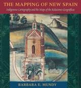
The Mapping of New Spain
Indigenous Cartography and the Maps of the Relaciones GeograficasBarbara E. Mundy
University of Chicago Press, 1996
"Its contribution to its specific field is both significant and original. . . . It is a pure pleasure to read." —Sabine MacCormack, Isis
"Mundy has done a fine job of balancing the artistic interpretation of the maps with the larger historical context within which they were drawn. . . . This is an important work." —John F. Schwaller, Sixteenth Century Journal
"This beautiful book opens a Pandora's box in the most positive sense, for it provokes the reconsideration of several long-held opinions about Spanish colonialism and its effects on Native American culture." —Susan Schroeder, American Historical Review
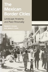
The Mexican Border Cities
Landscape Anatomy and Place PersonalityDaniel D. Arreola and James R. Curtis
University of Arizona Press, 1993
The Mexican Border Cities draws on extensive field research to examine eighteen settlements along the 2,000-mile border, ranging from towns of less than 10,000 people to dynamic metropolises of nearly a million. The authors chronicle the cities' growth and compare their urban structure, analyzing them in terms of tourist districts, commercial landscapes, residential areas, and industrial and transportation quarters.
Arreola and Curtis contend that, despite their proximity to the United States, the border cities are fundamentally Mexican places, as distinguished by their cultural landscapes, including town plan, land-use pattern, and building fabric. Their study, richly illustrated with over 75 maps and photographs, offers a provocative and insightful interpretation of the geographic anatomy and personality of these fascinating—and rapidly changing—communities.
The Middle Path
Avoiding Environmental CatastropheEric Lambin
University of Chicago Press, 2007
In The Middle Path, noted geographer Eric Lambin provides a concise, readable summary of the present state of the environment and considers what must be done if environmental catastrophe is to be avoided. Finding merit in the arguments of both optimists and pessimists, Lambin argues that it is not too late to exploit the inherent tendency toward equilibrium of large-scale systems such as the earth’s environment. By relying upon a combination of remedies as global as international cap-and-trade emission treaties and as local as municipal programs promoting the use of bicycles rather than cars, it may yet be possible to rescue humanity from a potentially fatal crisis of its own making.
Based on rigorous scientific analysis, and strikingly free of ideological prejudice, The Middle Path presents a fresh view of our troubled future, brilliantly balancing tough-minded realism with humanitarian ideals of cooperation and ingenuity.
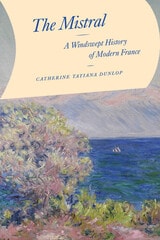
The Mistral
A Windswept History of Modern FranceCatherine Tatiana Dunlop
University of Chicago Press, 2024
Every year, the chilly mistral wind blows through the Rhône valley of southern France, across the Camargue wetlands, and into the Mediterranean Sea. Most forceful when winter turns to spring, the wind knocks over trees, sweeps trains off their tracks, and destroys crops. Yet the mistral turns the sky clear and blue, as it often appears in depictions of Provence. The legendary wind is central to the area’s regional identity and has inspired artists and writers near and far for centuries.
This force of nature is the focus of Catherine Dunlop’s The Mistral, a wonderfully written examination of the power of the mistral wind, and in particular, the ways it challenged central tenets of nineteenth-century European society: order, mastery, and predictability. As Dunlop shows, while the modernizing state sought liberation from environmental realities through scientific advances, land modification, and other technological solutions, the wind blew on, literally crushing attempts at control, and becoming increasingly integral to regional feelings of place and community.
The Monumental Andes
Geology, Geography, and Ancient Cultures in the Peruvian AndesRoseanne Chambers
University of Utah Press, 2024
At once approachable and informative, The Monumental Andes tells the history of the lofty mountains and civilizations that characterize the Central Andes. The book explores many interconnected aspects of ancient Andean life, including climate, topography, agricultural methods, natural hazards, the construction of monumental structures, the creation of sophisticated art objects, and the plant-based hallucinogens and narcotics used in religious rituals. From earthquake-resistant structures to shrines on the tops of active volcanoes, ancient Andeans left behind relics that amaze and inspire today.
The Mountain
A Political History from the Enlightenment to the PresentBernard Debarbieux and Gilles Rudaz
University of Chicago Press, 2015
In The Mountain, geographers Bernard Debarbieux and Gilles Rudaz trace the origins of the very concept of a mountain, showing how it is not a mere geographic feature but ultimately an idea, one that has evolved over time, influenced by changes in political climates and cultural attitudes. To truly understand mountains, they argue, we must view them not only as material realities but as social constructs, ones that can mean radically different things to different people in different settings.
From the Enlightenment to the present day, and using a variety of case studies from all the continents, the authors show us how our ideas of and about mountains have changed with the times and how a wide range of policies, from border delineation to forestry as well as nature protection and social programs, have been shaped according to them. A rich hybrid analysis of geography, history, culture, and politics, the book promises to forever change the way we look at mountains.
The Mysteries of the Marco Polo Maps
Benjamin B. Olshin
University of Chicago Press, 2014
In The Mysteries of the Marco Polo Maps, historian of cartography Benjamin B. Olshin offers the first credible book-length analysis of these artifacts, charting their course from obscure origins in the private collection of Italian-American immigrant Marcian Rossi in the 1930s; to investigations of their authenticity by the Library of Congress, J. Edgar Hoover, and the FBI; to the work of the late cartographic scholar Leo Bagrow; to Olshin’s own efforts to track down and study the Rossi maps, all but one of which are in the possession of Rossi’s great-grandson Jeffrey Pendergraft. Are the maps forgeries, facsimiles, or modernized copies? Did Marco Polo’s daughters—whose names appear on several of the artifacts—preserve in them geographic information about Asia first recorded by their father? Or did they inherit maps created by him? Did Marco Polo entrust the maps to Admiral Ruggero Sanseverino, who has links to Rossi’s family line? Or, if the maps have no connection to Marco Polo, who made them, when, and why?
Regardless of the maps’ provenance, Olshin’s tale—stretching from the remote reaches of the northern Pacific to early Chinese legends—takes readers on a journey confounding yet fascinating, offering insights into Italian history, the age of exploration, and the wonders of cartography.
The Nature of Space
Milton Santos
Duke University Press, 2021
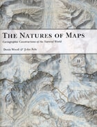
The Natures of Maps
Cartographic Constructions of the Natural WorldDenis Wood and John Fels
University of Chicago Press, 2008
To answer that question, the authors turn to a category of maps with a particularly strong reputation for objectivity: maps of nature. From depictions of species habitats and bird migrations to portrayals of the wilds of the Grand Canyon and the reaches of the Milky Way, such maps are usually presumed—even by users who should know better—to be strictly scientific. Yet by drawing our attention to every aspect of these maps’ self-presentation, from place names to titles and legends, the authors reveal the way that each piece of information collaborates in a disguised effort to mount an argument about reality. Without our realizing it, those arguments can then come to define our very relationship to the natural world—determining whether we see ourselves as humble hikers or rampaging despoilers, participants or observers, consumers or stewards.
Richly illustrated, and crafted in vivid and witty prose, The Natures of Maps will enlighten and entertain map aficionados, scholars, and armchair navigators alike. You’ll never be able to look at Google Maps quite the same way again.
The Old Barn Book
A Field Guide to North American Barns & Other Farm StructuresNoble, Allen G
Rutgers University Press, 1996
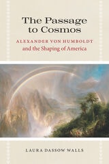
The Passage to Cosmos
Alexander von Humboldt and the Shaping of AmericaLaura Dassow Walls
University of Chicago Press, 2009
Explorer, scientist, writer, and humanist, Alexander von Humboldt was the most famous intellectual of the age that began with Napoleon and ended with Darwin. With Cosmos, the book that crowned his career, Humboldt offered to the world his vision of humans and nature as integrated halves of a single whole. In it, Humboldt espoused the idea that, while the universe of nature exists apart from human purpose, its beauty and order, the very idea of the whole it composes, are human achievements: cosmos comes into being in the dance of world and mind, subject and object, science and poetry.
Humboldt’s science laid the foundations for ecology and inspired the theories of his most important scientific disciple, Charles Darwin. In the United States, his ideas shaped the work of Emerson, Thoreau, Poe, and Whitman. They helped spark the American environmental movement through followers like John Muir and George Perkins Marsh. And they even bolstered efforts to free the slaves and honor the rights of Indians.
Laura Dassow Walls here traces Humboldt’s ideas for Cosmos to his 1799 journey to the Americas, where he first experienced the diversity of nature and of the world’s peoples—and envisioned a new cosmopolitanism that would link ideas, disciplines, and nations into a global web of knowledge and cultures. In reclaiming Humboldt’s transcultural and transdisciplinary project, Walls situates America in a lively and contested field of ideas, actions, and interests, and reaches beyond to a new worldview that integrates the natural and social sciences, the arts, and the humanities.
To the end of his life, Humboldt called himself “half an American,” but ironically his legacy has largely faded in the United States. The Passage to Cosmos will reintroduce this seminal thinker to a new audience and return America to its rightful place in the story of his life, work, and enduring legacy.
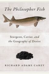
The Philosopher Fish
Sturgeon, Caviar, and the Geography of DesireRichard Adams Carey
Brandeis University Press, 2024
From the acclaimed eco-journalist Rick Carey comes a fascinating chronicle of a fast-disappearing fish—and of the people whose lives and livelihoods depend on it. Since the days of the Persian Empire, caviar has trumpeted status, wealth, prestige, and sex appeal. In this remarkable journey to caviar’s source, Carey immerses himself in the world of the sturgeon, the fish that lays these golden eggs. The sturgeon has a fascinating biological past—and a very uncertain future. Sturgeon populations worldwide have declined seventy percent in the last twenty years. Meanwhile, the beluga sturgeon, producer of the most coveted caviar, has climbed to number four on the World Wildlife Fund’s most-endangered species list. A high-stakes cocktail of business, crime, diplomacy, technology, and the dilemmas of conservation, The Philosopher Fish is the epic story of a 250-million-year-old fish struggling to survive.
This new edition includes new chapters bringing up to date the story of this elusive and mysterious fish, and the people involved with both preserving and exploiting it.