Results by title
228 books match the query 'Guidebooks' and 39 start with t

The AIA Guide to Columbus
Jeffrey T. Darbee
Ohio University Press, 2008
Columbus, the largest city in Ohio, has, since its founding in 1812, been home to many impressive architectural landmarks. The AIA Guide to Columbus, produced by the Columbus Architecture Foundation, highlights the significant buildings and neighborhoods in the Columbus metropolitan area. Skillfully blending architectural interest with historic significance, The AIA Guide to Columbus documents approximately 160 buildings and building groups and is organized geographically. Each chapter provides an opportunity to explore a special area of Columbus' built environment.
The Columbus Architecture Foundation has been affiliated with the American Institute of Architects (AIA), Columbus Chapter, for more than thirty years. Its first book project was Architecture Columbus, published in 1976. This new companion volume updates coverage of the buildings and provides a portable, accessible guide to the city's architectural history.
The AIA Guide to Columbus identifies buildings designated as historic and those that have won awards, and includes information on architectural styles, excellent photographs, maps, a glossary, and an index. The focus is on easy touring, whether the reader is walking or driving. Students, visitors, and residents with a penchant for knowing more about their city will enjoy discovering the rich heritage of Columbus' downtown, special districts, and neighborhoods.
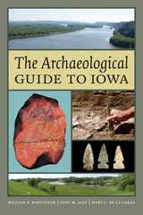
The Archaeological Guide to Iowa
William E. Whittaker, Lynn M. Alex, Mary De La Garza
University of Iowa Press, 2015
Fortunately, there are many sites open to the public where the remnants of the past are visible, either in their original location or in nearby museum exhibits. Few things are more inspiring than walking among the Malchow Mounds, packed so tightly it is hard to tell where one ends and the other begins. Strolling around downtown Des Moines is a lot more interesting when you are aware of the mounds, Indian villages, and the fort that once stood there. And, although you can’t visit the Wanampito site, you can see the splendid seventeenth-century artifacts excavated from it at Heery Woods State Park.
For people who want to experience Iowa’s archaeological heritage first hand, this one-of-a-kind guidebook shows the way to sixty-eight important sites. Many are open to visitors or can be seen from a public location; others, on private land or no longer visible on the landscape, live on through artifact displays. The guide also includes a few important sites that are not open to visitors because these places have unique stories to tell. Sites of every type, from every time period, and in every corner of the state are featured. Whether you have a few hours to indulge your curiosity or are planning a road trip across the state, this guide will take you to places where Iowa’s deep history comes to life.
The Big Thicket Guidebook
Exploring the Backroads and History of Southeast TexasLorraine G. Bonney
University of North Texas Press, 2011
The Bronx
The Ultimate Guide to New York City's Beautiful BoroughUltan, Lloyd
Rutgers University Press, 2015
The Brooklyn Experience
The Ultimate Guide to Neighborhoods & Noshes, Culture & the Cutting EdgeFreudenheim, Ellen
Rutgers University Press, 2016
Targeting the independent, curious traveler, The Brooklyn Experience includes a dozen “do-it-yourself” tours, including a visit to Woody Allen’s childhood neighborhood, and amazing Revolutionary and Civil War sites.
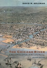
The Chicago River
An Illustrated History and Guide to the River and Its Waterways, Second EditionDavid M. Solzman
University of Chicago Press, 2006
The river is indeed the soul of the city—it runs through the heart of downtown, and it is a vehicle for both pleasure and the industry that keeps Chicago humming. With The Chicago River, Solzman has succeeded in writing an encyclopedic work—at once guidebook and history—that explores the river’s physical character and natural history. Examining the river’s past, contemplating its present, and forecasting its future, Solzman draws on his unparalleled knowledge to point out places of scientific and historic interest—involving everything from infamous murder cases to invasive zebra mussels. The book’s 200 photographs and maps perfectly complement Solzman’s vivid prose, leading readers on a visual journey as sinuous as the river it celebrates—a journey interspersed with plenty of river lore, facts, and literary quotations.
Solzman, a veteran Chicago River tour guide, has also compiled a diverse collection of easy and enjoyable tours for anyone who wants to experience the river by foot, boat, canoe, or car. And he provides an appendix that lists river-related organizations, museums, tours, and riverfront restaurants and clubs.
With practical tips, evocative language, and an astonishing array of anecdotes, TheChicago River is the most comprehensive guide to the river and its waterways, the perfect companion for everyone from the active river enthusiast to the armchair traveler.
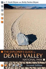
The Explorer's Guide to Death Valley National Park, Second Edition
T. Scott Bryan
University Press of Colorado, 2009

The Good Beer Guide to New England
Andy Crouch
University Press of New England, 2006
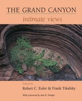
The Grand Canyon
Intimate ViewsEdited by Robert C. Euler and Frank Tikalsky; Foreword by Ann H. Zwinger
University of Arizona Press, 1992
Contents
Foreword, by Ann H. Zwinger
1. The Geologic Record, by Stanley S. Beus
2. The Living Canyon, by Steven W. Carothers
3. Grand Canyon Indians, by Robert C. Euler
4. Historical Explorations, by Robert C. Euler
5. The Canyon by River, by Kim Crumbo
6. Hiking the Canyon, by Frank Tikalsky
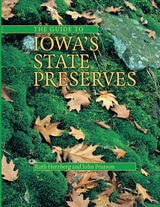
The Guide to Iowa's State Preserves
Herzberg, Ruth & John A. Pearson
University of Iowa Press, 2001
The Iowa state preserves system was created in 1965; a decade later, thirty preserves had been dedicated, including “six native prairies, a native White Pine stand, the state's only Sphagnum bog, a Balsam Fir stand, some of the oldest exposed rock outcrops in the world, an ancient fort, a fen, several Indian mound groups and a historical cemetery.” This new guide to all ninety Iowa state preserves—biological, geological, archaeological, historical, and scenic—describes the state's most treasured prairies and forests, quartzite outcrops and ice caves, and Indian mounds and wetlands as well as such historic sites as Fort Atkinson and Montauk.
Each entry includes two-color, progressively scaled maps giving the location of the preserve within the state, within its county, relative to a nearby town (with a recommended driving route), and on the local landscape (using USGS 7.5-minute topo maps). Also included are written directions (using 911 street names and signs); a description of the preserve's size, features, and history; a list of nearby or similar preserves, parks, natural areas, and other attractions; recommended readings; and contact information. (There are a few exceptions for privately owned or fragile preserves.) For travelers, a map in the introduction numbers all the preserves both geographically and alphabetically by name.
Although the preserves system emphasizes preservation rather than recreation, some preserves do have formal trails; some allow hunting, horseback riding, and canoeing; a few have museums or nature centers. This comprehensive guide allows visitors to plan active and informative visits to sites that highlight Iowa's natural and cultural heritage.
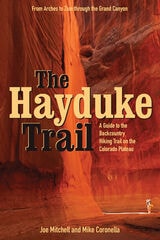
The Hayduke Trail
A Guide to the Backcountry Hiking Trail on the Colorado PlateauJoe Mitchell
University of Utah Press, 2005
Joe Mitchell and Mike Coronella pioneered Hayduke after concluding that a long trail—such as the Appalachian or Pacific Crest— was possible on the Plateau, thus introducing more people to these unique and threatened public lands. The Hayduke Trail includes detailed maps of the entire route, suggested cache points, and a wealth of description and tips for tackling this intense undertaking.
Hiking the entire route requires at least three months, though like other long trails it can be broken into smaller segments. The guide, featured in the March 2005 issue of National Geographic Adventure Magazine, is designed for experienced desert trekkers seeking a thorough-hiking experience on a well-tested route.

The Literary Guide and Companion to Southern England
Revised EditionRobert M. Cooper
Ohio University Press, 1998
In a series of intriguing routes through the English countryside, Professor Robert Cooper notes those attractions that the casual tourist might unknowingly pass by, such as the house where Dickens wrote A Tale of Two Cities, or the windswept quay where John Fowles’s French Lieutenant’s woman walked. Maps and information about restaurants and accommodations give the traveler the opportunity of having pints of “half and half” where Jane Austen dined or visiting the pub where Blake’s scuffle led to his trial for treason.
This newly revised and updated edition of Robert Cooper’s acclaimed handbook combines the utility of current travel information with the appeal of literary history, biography, and anecdote in a leisurely and flavorful guide to the broad sweep of southern England outside of London. A rich and reliable guide to the landscape that fostered one of our most cherished cultures, The Literary Guide and Companion to Southern England is an indispensable resource for those who wish to experience literature firsthand.
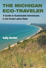
The Michigan Eco-Traveler
A Guide to Sustainable Adventures in the Great Lakes StateSally Barber
University of Michigan Press, 2014
Whether you’re a weekend traveler, extreme adventurer, or family on vacation, The Michigan Eco-Travelerlights the way to a greener getaway. Naturalists, conservationists, and hospitality experts will find the book equally helpful in responding to the ever rising demand for sustainable recreation.
The Michigan Roadside Naturalist
J. Alan Holman and Margaret B. Holman
University of Michigan Press, 2003
Did you know . . . ?
- Michigan is seventeenth in oil production in the United States.
- The Great Lakes are said to be the only glacially produced structures that can be seen from the moon.
- Michigan was once part of a coral reef.
- The wood frog is one of the commonest true frogs of moist woodland floors in Michigan today and is able to freeze solid during the winter without harmful effects.
These and many more amazing facts await the curious traveler in The Michigan Roadside Naturalist, J. Alan and Margaret B. Holman's captivating guide to the natural treasures of Michigan. A perfect accompaniment to the classic Michigan Trees and The Forests of Michigan, this user-friendly guide offers a Who's Who of the geology, biology, and archaeology of the Great Lakes State, as well as highway adventures along the state's major routes.
The book begins with an educational yet accessible tour of important points in Michigan's natural and archaeological history, followed by seven road trips based on commonly traveled state routes, moving from south to north in the Lower Peninsula and east to west in the Upper Peninsula. Readers can proceed directly to the road trips or familiarize themselves with the state's treasure trove of fascinating features before embarking. Either way, an informative and fun odyssey awaits the passionate naturalist, amateur or otherwise.
J. Alan Holman is Curator Emeritus of Vertebrate Paleontology at the Michigan State University Museum and Emeritus Professor of Geology and Zoology at Michigan State University. Margaret B. Holman is Research Associate at Michigan State University Museum and Department of Anthropology, Michigan State University.

The New Hiking the Monadnock Region
44 Nature Walks and Day-Hikes in the Heart of New EnglandJoe Adamowicz
University Press of New England, 2007
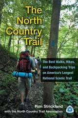
The North Country Trail
The Best Walks, Hikes, and Backpacking Trips on America’s Longest National Scenic TrailRon Strickland with the North Country Trail Association
University of Michigan Press, 2013
The North Country Trail is the longest of America’s eleven congressionally designated National Scenic Trails. Winding through seven states—New York, Pennsylvania, Ohio, Michigan, Wisconsin, Minnesota, and North Dakota—the NCT’s 4,600 miles attract more than one million visitors annually. These hikers are treated to a smorgasbord of Upper Midwest hiking featuring everything from urban strolls to backcountry adventure through mountains, rivers, prairies, and shoreline. This book is the definitive guide for NCT hikers—whether first-timers, seasoned backpackers, or any level in between—who wish to maximize their experience on this splendid trail.
In addition to a full overview of the trail’s tread in each state, the guide describes in detail forty of the NCT’s premier segments, with helpful information including easy-to-read trail descriptions, physical and navigation difficulties, trail highlights, hiking tips, and precise maps incorporating the latest GPS technology.

The Poconos
An Illustrated Natural History GuideHalma, Robert
Rutgers University Press, 1988
The Poconos, a rich plateau nestled in northeastern Pennsylvania between the Delaware River and the Moosic Mountains, encompass a variety of alluring features. The perfect reference for amateur naturalists, outdoor enthusiasts, tourists, and others who wish to explore the area, this classic guide clearly explains the unique geographic characteristics, animal habits and habitats, climate, geology, and vegetation of the area.
The authors trace the region from its beginnings millions of years ago as part of a shallow sea, through the reshaping forces of great glaciers, to today’s roadways and turnpikes. This revised and expanded edition also includes brief profiles of individuals who played significant roles in the preservation or understanding of the area’s ecology. Chapters provide a general survey of the area, including its history and places to be explored and observed, information on forest types, wildlife, and aquatic habitats, updated facts and figures on animal populations, as well as new details on invasive species.
Throughout the book, numerous boxes direct readers to observatory points for specific birds, ecosystems, vegetation types, and geological features, while maps, tables, original pen-and-ink illustrations, and a select list of field guides and other references enhance the book’s appeal. An indispensable companion for visitors as well as residents, The Poconos is a must-read for everyone who wants to discover or better understand the beauty and natural history of this unique region.
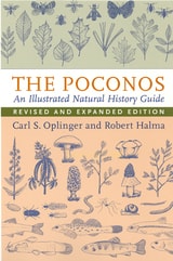
The Poconos
An Illustrated Natural History GuideCarl S. Oplinger and Robert Halma
Rutgers University Press, 2006
The Poconos, a rich plateau nestled in northeastern Pennsylvania between the Delaware River and the Moosic Mountains, encompass a variety of alluring features. The perfect reference for amateur naturalists, outdoor enthusiasts, tourists, and others who wish to explore the area, this classic guide clearly explains the unique geographic characteristics, animal habits and habitats, climate, geology, and vegetation of the area.
The authors trace the region from its beginnings millions of years ago as part of a shallow sea, through the reshaping forces of great glaciers, to today’s roadways and turnpikes. This revised and expanded edition also includes brief profiles of individuals who played significant roles in the preservation or understanding of the area’s ecology. Chapters provide a general survey of the area, including its history and places to be explored and observed, information on forest types, wildlife, and aquatic habitats, updated facts and figures on animal populations, as well as new details on invasive species.
Throughout the book, numerous boxes direct readers to observatory points for specific birds, ecosystems, vegetation types, and geological features, while maps, tables, original pen-and-ink illustrations, and a select list of field guides and other references enhance the book’s appeal. An indispensable companion for visitors as well as residents, The Poconos is a must-read for everyone who wants to discover or better understand the beauty and natural history of this unique region.
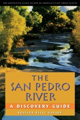
The San Pedro River
A Discovery GuideRoseann Beggy Hanson
University of Arizona Press, 2001
Roseann Hanson has spent much of her life exploring the San Pedro and its environs and has written a book that is both a personal celebration of and a definitive guide to this, the last undammed and unchanneled river in the Southwest. Taking you from the San Pedro's entry into the U.S. at the Mexican border to its confluence with the Gila River about a hundred miles north, she devotes a separate chapter to each of seven sections of river. Each chapter contains an eloquent essay on natural and cultural history, laced with Hanson's own experiences, plus an exploration guide brimming with useful information: how to get to the river, finding hiking trails, camping and other accommodations, birdwatching tips, access to biking and horseback riding, and nearby historic sites. Maps are included for each stretch of river, and the text is illustrated throughout with drawings from Roseann's copious field notebooks. Along the 40 miles of the San Pedro Riparian National Conservation Area, a sanctuary protected by the Bureau of Land Management since 1988, Hanson shows how the elimination of cattle and off-road vehicles has restored the river corridor to a more natural condition. She tells of the impact of humans on the San Pedro, from Clovis hunters to American settlers to Washington bureaucrats, and shows how, as the river winds its way north, it is increasingly threatened by groundwater pumping and urbanization.
In addition to the "discovery" sections of each chapter, Hanson has included species checklists for habitats and plants, birds, mammals, and reptiles and amphibians to make this a perfect companion for anyone exploring the area, whether as occasional tourist or frequent visitor. The book's blending of graceful prose and practical information shows that a river is the sum of many parts. Roseann Hanson will give you a special understanding—and perhaps a sense of stewardship—of this wild place.
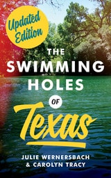
The Swimming Holes of Texas
By Julie Wernersbach and Carolyn Tracy; photography by Carolyn Tracy
University of Texas Press, 2020
Nothing beats a natural swimming hole for cooling off on a scorching summer day in Texas. Cold, clear spring water, big old shade trees, and a quiet stretch of beach or lawn offer the perfect excuse to pack a cooler and head out with family and friends to the nearest natural oasis. Whether you’re looking for a quick getaway or an unforgettable summer vacation, let The Swimming Holes of Texas be your guide.
Julie Wernersbach and Carolyn Tracy highlight one hundred natural swimming spots across the entire state. The book is organized by geographic regions, so you can quickly find local places to swim—or plan a trip to a more distant spot you’d like to explore. Each swimming hole is illustrated with an inviting color photo and a description of what it’s like to swim there, as well as the site’s history, ecology, and conservation. The authors include all the pertinent info about admission fees and hours, parking, and on-site amenities such as showers and restrooms. They also offer tips for planning your trips and lists of the swimming holes that are most welcoming to families and pets.
So when the temperature tops 100 and there’s nothing but traffic in sight, take a detour down the backroads and swim, sunbathe, revel, and relax in the swimming holes of Texas.
The Swimming Holes of Texas
By Julie Wernersbach and Carolyn Tracy; photography by Carolyn Tracy
University of Texas Press, 2017

The Swindle of Innovative Educational Finance
Kenneth J. Saltman
University of Minnesota Press, 2018
How “innovative” finance schemes skim public wealth while hijacking public governance
Charter school expansion. Vouchers. Scholarship tax credit programs. The Swindle of Innovative Educational Finance offers a new social theory to explain why these and other privatization policies and programs win support despite being unsupported by empirical evidence. Kenneth J. Saltman details how, under the guise of innovation, cost savings, and corporate social responsibility, new and massive neoliberal educational privatization schemes have been widely adopted in the United States. From a trillion-dollar charter school bubble to the Chan Zuckerberg Initiative to celebrities branding private schools, Saltman ultimately connects such schemes to the country’s current crisis of truth and offers advice for resistance.
Forerunners is a thought-in-process series of breakthrough digital works. Written between fresh ideas and finished books, Forerunners draws on scholarly work initiated in notable blogs, social media, conference plenaries, journal articles, and the synergy of academic exchange. This is gray literature publishing: where intense thinking, change, and speculation take place in scholarship.
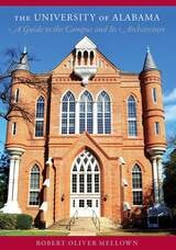
The University of Alabama
A Guide to the Campus and Its ArchitectureRobert Oliver Mellown
University of Alabama Press, 2013
In 1988 the University of Alabama Press published Robert Oliver Mellown’s The University of Alabama: A Guide to the Campus, a culmination of a decade’s worth of research into both the facts and the legends surrounding the architecture, history, and traditions of the Capstone.
Over twenty years later, this new guide brings to light the numerous additions, expansions, and renovations the university has undergone on its spacious grounds in Tuscaloosa. In addition to updated sections devoted to the university’s historic landmarks—such as Foster Auditorium, where “the stand in the schoolhouse door” occurred; Denny Chimes,where the handprints and footprints of famous Tide athletes are memorialized in concrete; and the Gorgas House, which with stood the destruction of Union troops at the end of the Civil War—new sections account for the acquisition of Bryce Hospital’s campus, the expansions at Bryant-Denny Stadium to accommodate the growing Crimson Tide fan base, and the burgeoning student recreation facilities, playing fields, and residential communities.
Chapters are arranged into various campus tours for walking or driving—Antebellum, Victorian, Early Twentieth-Century, East Quad, West Quad, Science and Engineering Corridor, Student Life, Bryce, Medical, Southeast, Athletics, and Off Campus. Alumni, prospective students and their parents, new faculty, out-of-state visitors, and foreign dignitaries will all welcome this useful, compact, and colorful guide to one of the most beautiful campuses in the country.

The WPA Guide to 1930s Alabama
Harvey H. Jackson, III
University of Alabama Press, 2000
A fascinating time capsule, this classic guide captures Alabama at a critical moment in its history between the Great Depression and World War II and its aftermath.
The WPA guide to Alabama provides a unique snapshot of 1930s Alabama life and culture. Like the other state guides in the WPA's American Guide Series, it features essays on history, economy, people, folkways, education, and other characteristics of the state, as well as general information about the towns and cities. Fifteen suggested automobile tours encourage visitors and residents to explore every corner of the state, from the Gulf Coast to the Black Belt and the Tennessee Valley, from bayous to farmlands to mountain gorges.
When it was first published in 1941, the guide went far to dispel the myth of an Alabama consisting only of cotton fields, magnolias, and plantation houses by highlighting the vibrant university life in Tuscaloosa, the modern industrial activity in Birmingham, the informality of politics in Montgomery, the cultural diversity in Alabama's port city, Mobile, and the small town life in Huntsville before it became home to the space industry. The book includes a calendar of annual events, census data, and a wealth of information useful to the traveling public of the time and enlightening to readers today. The guide lists radio stations, buses, railroads, and highways as they existed before the advent of television, interstates, and malls.
Harvey Jackson's fascinating introduction assesses the guide as a historical document and recounts the involved and sometimes controversial process by which it was researched and written. Project directors struggled to make the guide palatable to its public while still addressing such issues as poverty and race relations and recognizing the state's diversity and its rich folk culture. The result makes for compelling reading for general readers and historians alike.

The WPA Guide to 1930s Iowa
Joseph Frazier Federal Writers Project
University of Iowa Press, 1938
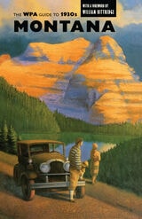
The WPA Guide to 1930s Montana
Work Projects Work Projects Administration
University of Arizona Press, 1994
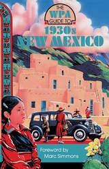
The WPA Guide to 1930s New Mexico
Works Projects Work Projects Administration
University of Arizona Press, 1989
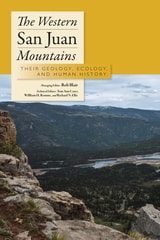
The Western San Juan Mountains
Their Geology, Ecology, and Human HistoryRob Blair
University Press of Colorado, 1996
The most complete work published on the natural history of southwest Colorado's majestic mountain system, The Western San Juan Mountains: Their Geology, Ecology, and Human History is designed to be used while exploring the scenic 235-mile paved San Juan Skyway, which passes through Durango, Silverton, Ouray, Telluride, Dolores, and Cortez.
The Western San Juan Mountains covers the physical environment, the biological communities, the human history, and points of interest represented on milepost signs along the highway. Some of the many topics covered include: how the San Juan Mountains were formed; why the landscape is so rugged and picturesque; why the vegetation changes from the lowlands to the alpine heights; energy and mineral resources of the area; why these mountains intrigued early explorers; factors that influence the unpredictable weather; and the first-known inhabitants.
The contributions to this guide include Fort Lewis College geologists, biologists, archaeologists, historians, and other specialists. Together they have amassed more than one hundred years of study based not only on previous work but on their own research.
This generously illustrated guidebook is aimed at all those who wish to understand this intricate mountain system in much greater detail than provided by most picture books.

The Wildlife of New England
A Viewer's GuideJohn S. Burk
University of New Hampshire Press, 2011
With practical guidance, helpful tips, and informative overviews of each location, The Wildlife of New England invites you to discover more than 80 wildlife-viewing areas around New England.
• Where are you most likely to spot a moose, black bear, or otter in the wild?
• On what hilltop can you see thousands of migrating hawks in a single day?
• Where might you see a basking shark, seal, or sea star?
Experienced nature writer and photographer John S. Burk answers these questions and more in this unique guidebook. Organized by state, each viewing location is discussed in detail, including its natural habitats and their unique features, characteristic species to watch for and when to see them, and recommended trails, auto roads, and driving directions. The Wildlife of New England also offers informative introductions to 60 of the region's iconic animals organized by their natural habitats and shown in stunning photographs, many in color.
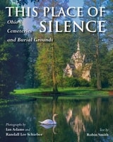
This Place of Silence
Ohio's Cemeteries and Burial GroundsIan Adams; Randall Lee Schieber; Robin L. Smith
Ohio University Press, 2024
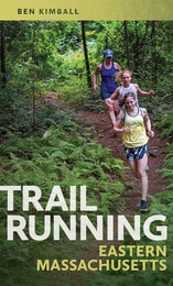
Trail Running Eastern Massachusetts
Ben Kimball
University of Massachusetts Press, 2022
Eastern Massachusetts offers incredible trail-running opportunities, ranging from popular long-distance routes like the Bay Circuit Trail to lesser-known loops that run through the mountains and forests of the Quabbin watershed and Merrimack Valley region, and trails that pass alongside the shores of Cape Cod. All over the Bay State, there are trails suitable for runners of all levels waiting to be discovered and explored.
Avid trail runner Ben Kimball offers a selection of fifty-one of eastern Massachusetts’s most spectacular trail sites, including detailed trail descriptions, topographic maps, directions, parking information, safety tips, and much more. Both experienced and novice trail runners will find Trail Running Eastern Massachusetts to be an invaluable resource for exploring nature and getting a good workout, in the Boston area and beyond.
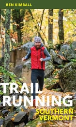
Trail Running Southern Vermont
Ben Kimball
University of Massachusetts Press, 2024
The wild and rural landscape of southern Vermont offers a true bounty of great trail-running opportunities, from out-and-back (or pointtopoint) runs on popular long-distance routes, such as segments of the Long Trail or Appalachian Trail, to quiet, little-known loops hidden away in the woods. This helpful guide is just the resource needed for trip planning or for a spontaneous run in a beautiful place.
Local expert trail runner Ben Kimball offers a range of suggested route options, sometimes even several at the same site, for runners of all skill levels. He also provides important practical information, such as the full distance of the suggested route; a difficulty rating; the trail style and type; the total ascent; and directions, along with a detailed description of the trail itself. There are also scannable codes for downloading trail maps to your smartphone. The trails included vary in difficulty and terrain type, and range from low elevations in the Connecticut River Valley to as high as 4,000 feet at Killington Peak in the Green Mountains. This indispensable book is the perfect companion for adventurous runners and hikers interested in exploring southern Vermont.
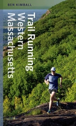
Trail Running Western Massachusetts
Ben Kimball
University Press of New England, 2015
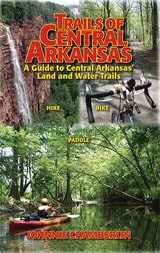
Trails of Central Arkansas
A Guide to Central Arkansas' Land and Water TrailsJohnnie Chamberlin
Parkhurst Brothers, Inc., 2012
Trails of Central Arkansas delivers:
* Sixty trails in 36 parks or locations from Benton and Bryant to Cabot, from Wrightsville to Conway
* Color maps of every trail
* GPS coordinates for every trailhead
* Color-coded distinctions between paved and unpaved trails
* Level of difficulty ratings
* Scenery Scores
* Top-ten lists: Most Scenic, Trails for Kids, and Trails for Solitude
Trails of Little Rock
Hiking, Biking, and Kayaking Trails in Little RockJohnnie Chamberlin
Parkhurst Brothers, Inc., 2009
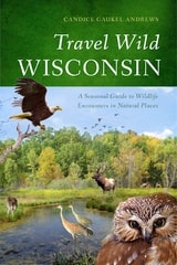
Travel Wild Wisconsin
A Seasonal Guide to Wildlife Encounters in Natural PlacesCandice Gaukel Andrews
University of Wisconsin Press, 2013
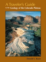
Travelers Guide
To The Geology Of Colorado PlateauDonald L Baars
University of Utah Press, 2002
Driving across I-70 in southern Utah one can’t help but wonder about the magnificent upturned rocks of the San Rafael Reef. With A Travelers Guide to the Geology of the Colorado Plateau in hand, you’ll soon discover that you were driving through Page and Navajo Sandstone formations, sharply folded into a monocline along one of the "Basin and Range" fault lines. Nearing Flagstaff, Arizona, on Highway 89, you will learn that Mt. Humphry of the San Francisco Peaks, a Navajo Sacred Mountain, was once an active volcano. Keep reading and you’ll find many things worth a slight detour.
A Traveler's Guide to the Geology of the Colorado Plateau will enrich and enliven all of your trips through the varied landscapes of the Colorado Plateau as you learn about the geological forces that have shaped its natural features. The mile-by-mile road logs will take you from Vernal, Utah, in the north to the southernmost reaches of the Plateau in Sedona, Arizona; from the red rocks of Cedar Breaks National Monument near Cedar City, Utah, to the edges of the soaring peaks of the San Juan Mountains near Durango, Colorado. The most comprehensive geological guide to the Colorado Plateau
Traveling Through Time
A Guide to Michigan's Historical MarkersLaura Rose Ashlee, Editor
University of Michigan Press, 2005
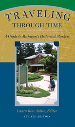
Since 1955 the state of Michigan has erected historical markers throughout the state. In this revised edition of Traveling Through Time, Laura Rose Ashlee collects the histories that appear on these markers together into one handy guidebook---a great desk reference for researchers and armchair historians alike.
Some of the book's special features include:
o Location and full text of each marker
o Arranged alphabetically within county chapters
o More than 85 historic and color photographs
o Special section on Michigan historical markers placed outside Michigan
Turning Down the Sound
Travel Escapes in Washington's Small TownsFoster Church
Oregon State University Press, 2014
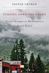
As in his previous book, Discovering Main Street: Travel Adventures in Small Towns of the Northwest, Church employs the finesse of his Pulitzer-Prize-winning journalism. He also shares his passion for encouraging tourists down less traveled paths—paths that curve beside valleys and wheat fields, travel along orchards and straits, and abut mountains and rivers.
Once inside these small towns, local flavors abound. Church reveals how each community’s unique character informs its hospitality and culture: In Morton, the abandoned Roxy movie theater was re-opened to host lectures and live performances. In the town of Palouse, a once-lonesome farming community in the Washington wheat country is now home to antiques shops and art galleries, and in Pomeroy, a pioneering legacy is celebrated in a lively annual festival.
With maps, photographs, and recommendations for more than thirty-five towns in all corners of the state, Turning Down the Sound vastly expands the resources available for readers and travelers keen on encountering what Church calls American tourism’s last frontier: its small towns.