Results by title
375 books match the query 'Excavations (Archaeology)' and 90 start with t
The Last Civilized Place
Sijilmasa and Its Saharan DestinyBy Ronald A. Messier and James A. Miller
University of Texas Press, 2015
Set along the Sahara’s edge, Sijilmasa was an African El Dorado, a legendary city of gold. But unlike El Dorado, Sijilmasa was a real city, the pivot in the gold trade between ancient Ghana and the Mediterranean world. Following its emergence as an independent city-state controlling a monopoly on gold during its first 250 years, Sijilmasa was incorporated into empire—Almoravid, Almohad, and onward—leading to the “last civilized place” becoming the cradle of today’s Moroccan dynasty, the Alaouites. Sijilmasa’s millennium of greatness ebbed with periods of war, renewal, and abandonment. Today, its ruins lie adjacent to and under the modern town of Rissani, bypassed by time.
The Moroccan-American Project at Sijilmasa draws on archaeology, historical texts, field reconnaissance, oral tradition, and legend to weave the story of how this fabled city mastered its fate. The authors’ deep local knowledge and interpretation of the written and ecological record allow them to describe how people and place molded four distinct periods in the city’s history. Messier and Miller compare models of Islamic cities to what they found on the ground to understand how Sijilmasa functioned as a city. Continuities and discontinuities between Sijilmasa and the contemporary landscape sharpen questions regarding the nature of human life on the rim of the desert. What, they ask, allows places like Sijilmasa to rise to greatness? What causes them to fall away and disappear into the desert sands?
The Last House at Bridge River
The Archaeology of an Aboriginal Household in British Columbia during the Fur Trade PeriodAnna M. Prentiss
University of Utah Press, 2017
The Last House at Bridge River offers a comprehensive archaeological study of a single-house floor and roof deposit dated to approximately 1835–1858 C.E. Although the Fur Trade period of the nineteenth century was a time of significant change for aboriginal peoples in the Pacific Northwest, it is a period that is poorly understood. These studies of Housepit 54 at the Bridge River site offer new insights, revealing that ancestors of today’s St’át’imc people were actively engaged in maintaining traditional lifestyles and making the best of new opportunities for trade and intergroup interaction.
Among its major contributions, the book includes a first-ever historical ecology of the Middle Fraser Canyon that places aboriginal and Euro-Canadian history in ecological context. It demonstrates that an integrated multidisciplinary approach to archaeological research can achieve insights well beyond what is known from the ethnographic and historical records. Because the project derives from a long-term partnership between the University of Montana and the Bridge River Indian Band, it illustrates the value of collaborations between archaeologists and First Nations. Together, contributors present a Fur Trade period aboriginal society at a level of intimacy unparalleled elsewhere.
The Late Archaic across the Borderlands
From Foraging to FarmingEdited by Bradley J. Vierra
University of Texas Press, 2005
Why and when human societies shifted from nomadic hunting and gathering to settled agriculture engages the interest of scholars around the world. One of the most fruitful areas in which to study this issue is the North American Southwest, where Late Archaic inhabitants of the Sonoran and Chihuahuan Deserts of Mexico, Arizona, and New Mexico turned to farming while their counterparts in Trans-Pecos and South Texas continued to forage. By investigating the environmental, biological, and cultural factors that led to these differing patterns of development, we can identify some of the necessary conditions for the rise of agriculture and the corresponding evolution of village life.
The twelve papers in this volume synthesize previous and ongoing research and offer new theoretical models to provide the most up-to-date picture of life during the Late Archaic (from 3,000 to 1,500 years ago) across the entire North American Borderlands. Some of the papers focus on specific research topics such as stone tool technology and mobility patterns. Others study the development of agriculture across whole regions within the Borderlands. The two concluding papers trace pan-regional patterns in the adoption of farming and also link them to the growth of agriculture in other parts of the world.
The Legacy of Fort William Henry
Resurrecting the PastDavid R. Starbuck
University Press of New England, 2014
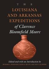
The Louisiana and Arkansas Expeditions of Clarence Bloomfield Moore
Clarence Bloomfield Moore
University of Alabama Press, 2004
A Dan Josselyn Memorial Publication
The ninth and final volume in the C.B. Moore reprint series that covers archaeological discoveries along North American Waterways.
Clarence B. Moore (1852-1936), a wealthy Philadelphia socialite, paper company heir, and photographer, made the archaeology of the Southeast his passion. Beginning in the 1870s, Moore systematically explored prehistoric sites along the major waterways of the region, from the Ohio River south to Florida and as far west as Texas, publishing his findings, at his own expense, with the Academy of Natural Sciences of Philadelphia.
This volume, the final in a series of nine, includes Moore’s investigations along waterways of Arkansas and Louisiana—the Ouachita, Red, Saline, Black, Tensas, and Atchafalaya Rivers—in three complete field sessions ending in 1909, 1912, and 1913. He located and mapped more than 185 mounds and cemeteries. Artifacts recovered in this territory, such as ceramic effigy pots, earthenware pipes, arrowheads, celts, and projectile points, include some of the most important ones discovered by Moore in his 47 years of excavating. Included in this volume is a CD containing the 69 color illustrations from all the original expedition volumes.
The elaborate earthwork of Poverty Point, located in West Carroll Parish, Louisiana, is perhaps the most remarkable archaeological site presented in the volume. In some cases, Moore documented sites along the tributaries that have since been destroyed by river action or looters. In other cases, the National Register of Historic Sites and concerned landowners in Arkansas and Louisiana have preserved the record of aboriginal peoples and their life ways that was first illuminated by Moore's sophisticated study.
The Medieval and Ottoman Hajj Route in Jordan
An Archaeological and Historical StudyA. Petersen
Council for British Research in the Levant, 2012
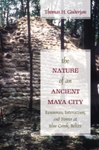
The Nature of an Ancient Maya City
Resources, Interaction, and Power at Blue Creek, BelizeThomas H. Guderjan
University of Alabama Press, 2007
For two millennia, the site now known as Blue Creek in northwestern Belize was a Maya community that became an economic and political center that included some 15,000-20,000 people at its height. Fairly well protected from human destruction, the site offers the full range of city components including monumental ceremonial structures, elite and non-elite residences, ditched agricultural fields, and residential clusters just outside the core. Since 1992, a multi-disciplinary, multi-national research team has intensively investigated Blue Creek in an integrated study of the dynamic structure and functional inter-relationships among the parts of a single Maya city. Documented in coverage by National Geographic, Archaeology magazine, and a documentary film aired on the Discovery Channel, Blue Creek is recognized as a unique site offering the full range of undisturbed architectural construction to reveal the mosaic that was the ancient city. Moving beyond the debate of what constitutes a city, Guderjan’s long-term research reveals what daily Maya life was like.
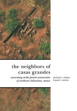
The Neighbors of Casas Grandes
Medio Period Communities of Northwestern ChihuahuaMichael E. Whalen and Paul E. Minnis
University of Arizona Press, 2009
This volume provides a fascinating and detailed look into the culture of the Casas Grandes area, involving not just the research of the architecture and artifacts left behind but also the ecology of the area. The authors’ research reveals the complex relationship Casas Grandes had with its neighbors, varying from very direct contact with some communities to more indirect links with others. Important internal influences on the area’s development come to light and population sizes throughout the period demonstrate the absorption of the surrounding populations into Casas Grandes as it reached the peak of its power in the region.
New discoveries suggest the need to revise the previously held beliefs about the age of Casas Grandes and the dates of its rise to power. This ancient civilization may have developed as early as 1180 AD. Such breakthroughs provide fresh insight about not only Casas Grandes but the nearby settlements as well. The Neighbors of Casas Grandes is an important and vital piece of primary field research for all those interested in the Southwest’s archaelogy and history. Its contribution to the knowledge of the Casas Grandes region is monumental in helping us better understand the society that once flourished there.
The Northern Titicaca Basin Survey
Huancané-PutinaCharles Stanish, Cecilia Chávez Justo, Karl LaFavre, and Aimée Plourde
University of Michigan Press, 2014
The Northwest Florida Expeditions of Clarence Bloomfield Moore
Clarence Bloomfield Moore
University of Alabama Press, 1999
A Dan Josselyn Memorial Publication
This comprehensive compilation of Moore's archaeological reports on northwest Florida and southern Alabama and Georgia presents the earliest documented investigations of this region.
When Clarence Bloomfield Moore cruised the rivers of Florida in search of prehistoric artifacts a century ago, he laid the groundwork for archaeological investigations to follow. This volume reflects Moore's fieldwork along the northwest Florida coast, the most archaeologically rich area of the state, as well as Southern Alabama and Georgia.
Here readers will share Moore's first look at the area in 1901-1903 and additional observations made in 1918 during what was to be his last field season. Moore's works reveal ceramics, tools, skeletal remains, and exotic artifacts excavated from the earthen mounds and shell middens built by native peoples over the last two millennia.
In the introduction to this edition, David Brose and Nancy Marie White place Moore's investigations within the context of the science, natural history, and antiquarianism of his day. They document what happened to the sites he explored, tell how his findings fit into the body of his research, and explain how those findings should be interpreted in the context of Southeastern culture history and modern archaeological theory.
Moore was the most knowledgeable Southeastern archaeologist of his time; his writings are a benchmark for anyone studying those areas today.
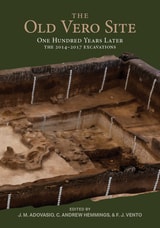
The Old Vero Site (8IR009)
One Hundred Years Later, The 2014 - 2017 ExcavationsJames M. Adovasio, C. Andrew Hemmings, and F. J. Vento
University of Utah Press, 2023
The Old Vero Site details the course of the recent re-excavations of the site while also summarizing the original excavations from a century ago. The volume lays out the sequence and results of the recent project, using new data to conclude that Sellards’s claims are not supported by the evidence. Adovasio, Hemmings, and Vento provide the data to settle the matter definitively: human remains at the site were intrusive from a later time horizon, as critics of the original work had vociferously argued.

The Paleolithic of Siberia
New Discoveries and InterpretationsEdited and Compiled by Anatoli P. Derev'anko: Demitri B. Shimkin and W. Roger Powers (American Editors). Translated by Inna P. Laricheva
University of Illinois Press, 1998
It traces the routes of human migration throughout Eurasia, shows Siberian lithic industries as they evolved from the Early through the Middle and Late Paleolithic, and correlates them with reports from Mongolia, China, Japan, and America.
The Petexbatun Regional Archaeological Project
A Multidisciplinary Study of the Maya CollapseArthur A. Demarest
Vanderbilt University Press, 2006
Then, based on the project's findings, Demarest presents interpretive reconstructions of the linked histories of the Pasion River kingdoms and correlates these interpretations with the variable evidence and culture-histories of other regions of the Classic Maya lowlands. He points out that only through linking such accurate regional culture-histories can we begin to understand the eighth- through tenth-century changes in Classic Maya civilization. The volume describes how the Petexbatun project addressed this challenge in its research design, structure, and large, multicentered zone of study. Building on the previous twenty years of Harvard research in adjacent zones, the Vanderbilt projects succeeded in reconstructing events and processes throughout the Pasion River Valley, the largest single inland trade route of the ancient Maya world.
In its conclusions, this first of the Petexbatun volumes of multidisciplinary studies, evidence, analyses, and interpretations, provides answers to some long-standing questions about the "Classic Maya collapse," as well as a new, preliminary culture-history of the abandonment, decline, or transformation of the Classic Maya kingdoms of the western Peten. It is an exciting preview and summary of a decade of evidence on the debate over the fate of the Classic Maya civilization, one of the great controversies in the history of Pre-Columbian archaeology. VIMA Series #1
The Pottery Hill Site
A Historic Period Shoshone Settlement in Grass Valley, NevadaHelen Fairman Wells and Evelyn Seelinger
University of Utah Press, 2023
This archaeological study of the interactions between Western Shoshone families and Euro-American ranchers in the late nineteenth century helps fill the gap between what is known regarding Late Prehistoric foragers of the American West and ethnohistoric understanding of Native American peoples of the Great Basin.
Pottery Hill, an archaeological site located in Grass Valley, Nevada, northeast of the historic mining town of Austin, represents a small settlement of Native Americans who lived there in the late 1800s. The Grass Valley Shoshone, whose environment and traditional lifeways were disrupted by the arrival of miners and settlers in the 1860s, found work on the ranches and farms in the valley.
Archaeological fieldwork conducted in the 1970s investigated house remains, hearths, and artifacts. A recent analysis of these data, enhanced by the use of archival documents and oral history, provides new insights into the dynamics of late nineteenth-century life in central Nevada. The Pottery Hill Site addresses a critical period in the history of the Grass Valley Shoshone, who adopted and modified Euro-American artifacts and materials while maintaining important aspects of their traditional culture. It gives readers a deeper understanding of the effects of Euro-American settlement on the Shoshone, the history of the western United States, and the reciprocal impacts of cultural contact.
The Prehispanic Ethnobotany of Paquimé and Its Neighbors
Paul E. Minnis and Michael E. Whalen
University of Arizona Press, 2020
This volume is the first large-scale investigation of the prehispanic ethnobotany of this important ancient site and its neighbors. The authors examine ethnobotanical relationships during Medio Period, AD 1200–1450, when Paquimé was at its most influential. Based on two decades of archaeological research, this book examines uses of plants for food, farming strategies, wood use, and anthropogenic ecology. The authors show that the relationships between plants and people are complex, interdependent, and reciprocal. This volume documents ethnobotanical relationships and shows their importance to the development of the Paquimé polity.
How ancient farmers made a living in an arid to semi-arid region and the effects their livelihood had on the local biota, their relations with plants, and their connection with other peoples is worthy of serious study. The story of the Casas Grandes tradition holds valuable lessons for humanity.
The Prehistory of Gold Butte
A Virgin River Hinterland, Clark County, NevadaKelly R McGuire
University of Utah Press, 2014
The Prehistory of Gold Butte uses a theoretical perspective rooted in human behavior ecology and other foraging models to present the results of one of the largest and most comprehensive archaeological investigations ever undertaken in southern Nevada, involving the systematic survey of more than 31,000 acres, the documentation of more than 377 sites, and the excavation of nine prehistoric sites. Gold Butte—at the crossroads of the Mojave Desert, the Great Basin, and the Colorado Plateau in southern Nevada—has a 12,000-year record of human occupation with archaeological elements that can be traced to all three culture zones.
The Prehistory of Morro Bay
Central California's Overlooked EstuaryEdited by Terry L. Jones, Deborah A. Jones, William R. Hildebrandt, Kacey Hadick, and Patricia Mikkelsen
University of Utah Press, 2019
The Quest for the Historical Israel
Debating Archaeology and the History of Early IsraelIsrael Finkelstein
SBL Press, 2007
The Ritual Landscape of Late Precontact Eastern Oklahoma
Archaeology from the WPA Era until Todayby Amanda L. Regnier, Scott W. Hammerstedt, and Sheila Bobalik Savage
University of Alabama Press, 2019
As part of Great Depression relief projects started in the 1930s, the Works Progress Administration (WPA) sponsored massive archaeological projects across Oklahoma. The WPA crews excavated eight mound sites and dozens of nonmound residential sites in the Arkansas River Valley that date between AD 1000 and 1450. These sites are considered the westernmost representations of Mississippian culture in the Southeast.
The results of these excavations were documented in field journals and photographs prepared by the field supervisors and submitted in a series of quarterly reports to WPA headquarters. These reports contain a wealth of unpublished information summarizing excavations at the mound sites and residential sites, including mound profiles, burial descriptions, house maps, artifact tables, and artifact sketches. Of the excavated mound sites, results from only one, Spiro, have been extensively studied and synthesized in academic literature. The seven additional WPA-excavated mound sites—Norman, Hughes, Brackett, Eufaula, Skidgel, Reed, and Lillie Creek—are known to archaeologists outside of Oklahoma only as unlabeled points on maps of mound sites in the Southeast.
The Ritual Landscape of Late Precontact Eastern Oklahoma curates and contextualizes the results of the WPA excavations, showing how they inform archaeological understanding of Mississippian occupation in the Arkansas Valley. Regnier, Hammerstedt, and Savage also relate the history and experiences of practicing archaeology in the 1930s, incorporating colorful excerpts from field journals of the young, inexperienced archaeologists. Finally, the authors update current knowledge of mound and nonmound sites in the region, providing an excellent example of historical archaeology.

The River and the Railroad
An Archaeological History of RenoMary Ringhoff
University of Nevada Press, 2011
The Safford Valley Grids
Prehistoric Cultivation in the Southern Arizona DesertWilliam E. Doolittle
University of Arizona Press, 2004
Between A.D. 750 and 1385, people gathered rocks from the tops of the terraces and rearranged them in grids of varying size and shape, averaging about 4 meters to 5 meters square. The grids captured rainfall and water accumulated under the rocks forming the grids. Agave was planted among the rocks, providing a dietary supplement to the maize and beans that were irrigated on the nearby bottom land, a survival crop when the staple crops failed, and possibly a trade commodity when yields were high. Stunning photographs by Adriel Heisey convey the vastness of the grids across the landscape.
The Sandy Ridge and Halstead Paleo-Indian Sites
Unifacial Tool Use and Gainey Phase Definition in South-Central OntarioLawrence J. Jackson with a foreword by Henry T. Wright and phytolith analysis by Anita Buehrle
University of Michigan Press, 1998
The Sangamo Frontier
History and Archaeology in the Shadow of LincolnRobert Mazrim
University of Chicago Press, 2006
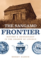
When Abraham Lincoln moved to Illinois’ Sangamo Country in 1831, he found a pioneer community transforming from a cluster of log houses along an ancient trail to a community of new towns and state roads. But two of the towns vanished in a matter of years, and many of the activities and lifestyles that shaped them were almost entirely forgotten. In The Sangamo Frontier, archaeologist Robert Mazrim unearths the buried history of this early American community, breathing new life into a region that still rests in Lincoln’s shadow.
Named after a shallow river that cuts through the prairies of central Illinois, the Sangamo Country—an area that now encompasses the capital city of Springfield and present-day Sangamon County—was first colonized after the War of 1812. For the past fifteen years, Mazrim has conducted dozens of excavations there, digging up pieces of pioneer life, from hand-forged iron and locally made crockery to pewter spoons and Staffordshire teacups. And here, in beautifully illustrated stories of each dig, he shows how each of these small artifacts can teach us something about the lifestyles of people who lived on the frontier nearly two hundred years ago. Allowing us to see past the changed modern landscape and the clichés of pioneer history, Mazrim deftly uses his findings to portray the homes, farms, taverns, and pottery shops where Lincoln’s neighbors once lived and worked.
Drawing readers into the thrill of discovery, The Sangamo Frontier inaugurates a new kind of archaeological history that both enhances and challenges our written history. It imbues today’s landscape with an authentic ghostliness that will reawaken the curiosity of anyone interested in the forgotten people and places that helped shape our nation.
The Search for Mabila
The Decisive Battle between Hernando de Soto and Chief TascalusaEdited by Vernon James Knight Jr.
University of Alabama Press, 2009
The Shock of Colonialism in New England
Fragments from a FrontierMeghan C. L. Howey
University of Alabama Press, 2025
Explores the untold impacts of colonialism in New England through diverse colonist lives, Indigenous encounters, and environmental legacies.
In The Shock of Colonialism in New England, archaeologist Meghan C. L. Howey uses excavations in the seventeenth-century colonial frontier of the Great Bay Estuary/P8bagok in today’s New Hampshire to trace the connection between European global colonialism and the planetary climate crises. Howey shows how this landscape holds forgotten stories of what it meant to live through the shock of colonialism.
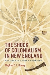
These stories reveal an unexpected diversity and dynamism among English colonists, multifaceted encounters with Indigenous peoples, and lasting environmental damage from labor-intensive industries. Early Euro-American maps and stunning archaeological finds, such as a broken pickaxe embedded in a hearth, and a historical marker for the Oyster River “Massacre” of 1694 complicate our limited views of a shared past.
The reality of English colonialism in the dispossession of Indigenous lands and its wake is not commemorated. Howey’s work is a powerful corrective that traces the rise of intergenerational colonial wealth made possible by land commodified as property, the increased labor required to work newly opened land, the importation of indentured Scots and enslaved Africans to provide that labor, and the resulting degradation of the natural environment. Through Howey’s insights into the stories they tell, these fragments from a frontier can help contemporary readers better understand the past as they seek a more just and sustainable future.
The Swift Creek Gift
Vessel Exchange on the Atlantic CoastNeill J. Wallis
University of Alabama Press, 2011
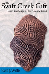
A unique dataset for studying past social interactions comes from Swift Creek Complicated Stamped pottery that linked sites throughout much of the Eastern Woodlands but that was primarily distributed over the lower Southeast. Although connections have been demonstrated, their significance has remained enigmatic. How and why were apparently utilitarian vessels, or the wooden tools used to make them, distributed widely across the landscape?
This book assesses Woodland Period interactions using technofunctional, mineralogical, and chemical data derived from Swift Creek Complicated Stamped sherds whose provenience is fully documented from both mortuary mounds and village middens along the Atlantic coast. Together, these data demonstrate formal and functional differences between mortuary and village assemblages along with the nearly exclusive occurrence of foreign-made cooking pots in mortuary contexts. The Swift Creek Gift provides insight into the unique workings of gift exchanges to transform seemingly mundane materials like cooking pots into powerful tools of commemoration, affiliation, and ownership.
The Teotihuacan Trinity
The Sociopolitical Structure of an Ancient Mesoamerican CityBy Annabeth Headrick
University of Texas Press, 2007
Northeast of modern-day Mexico City stand the remnants of one of the world's largest preindustrial cities, Teotihuacan. Monumental in scale, Teotihuacan is organized along a three-mile-long thoroughfare, the Avenue of the Dead, that leads up to the massive Pyramid of the Moon. Lining the avenue are numerous plazas and temples, which indicate that the city once housed a large population that engaged in complex rituals and ceremonies. Although scholars have studied Teotihuacan for over a century, the precise nature of its religious and political life has remained unclear, in part because no one has yet deciphered the glyphs that may explain much about the city's organization and belief systems.
In this groundbreaking book, Annabeth Headrick analyzes Teotihuacan's art and architecture, in the light of archaeological data and Mesoamerican ethnography, to propose a new model for the city's social and political organization. Challenging the view that Teotihuacan was a peaceful city in which disparate groups united in an ideology of solidarity, Headrick instead identifies three social groups that competed for political power—rulers, kin-based groups led by influential lineage heads, and military orders that each had their own animal insignia. Her findings provide the most complete evidence to date that Teotihuacan had powerful rulers who allied with the military to maintain their authority in the face of challenges by the lineage heads. Headrick's analysis also underscores the importance of warfare in Teotihuacan society and clarifies significant aspects of its ritual life, including shamanism and an annual tree-raising ceremony that commemorated the Mesoamerican creation story.
The Urban Questions
Interdisciplinary and Multiscalar Approaches to Investigating the Ancient Mesoamerican CityLisa Johnson and Arianna Campiani
University of Utah Press, 2025
This groundbreaking volume presents a fresh and comprehensive look at the urban development of Mesoamerican cities. Moving beyond traditional methods, The Urban Questions adopts a dynamic, multidisciplinary approach to understanding the complexity and diversity of ancient settlements. By examining urbanism at multiple scales—from individual events to households, neighborhoods, and entire regions—it offers a nuanced view of how these cities evolved over time.
Contributors explore key themes such as community identity, infrastructure management, and the intersection of social, political, and economic processes. Rich in both spatial and material analysis, the chapters provide insights into the lived experience of ancient Mesoamerican inhabitants and the gradual expansion of their cities. With innovative archaeological methodologies and theoretical frameworks, this volume is an essential resource for scholars of Mesoamerican studies, archaeology, and urban history, shedding new light on the dynamic nature of ancient cities.

The View from Madisonville
Protohistoric Western Fort Ancient Interaction PatternsPenelope Ballard Drooker
University of Michigan Press, 1997
Madisonville was one of the key settlements of the Ohio Valley Fort Ancient people and was the subject of James Griffin’s 1943 classic, The Fort Ancient Aspect. It is a site rich in burials and artifacts documenting the earliest European influences. Drooker re-explores a century of excavation to explain how Contact Period events affected Madisonville inhabitants and their links to eastern Fort Ancient, northern Ohio, Iroquoian, Oneota, and Mississipian groups.
The Vijayanagara Metropolitan Survey, Vol. 1
Carla M. Sinopoli, Kathleen D. Morrison
University of Michigan Press, 2007
The West and Central Florida Expeditions of Clarence Bloomfield Moore
Clarence Bloomfield Moore, edited and with an introduction by Jeffrey M. Mitchem
University of Alabama Press, 1999
This compilation of Moore's publications on western and central Florida provides all of his archaeological data on the region's mounds and prehistoric canals in a single volume.
The name Clarence B. Moore is familiar to every archaeologist interested in the southeastern United States. This amateur archaeologist's
numerous scientific expeditions to the region resulted in dozens of well-illustrated publications, the value of which increases daily as many of the sites he investigated continue to be destroyed by modern development.
Moore invested considerable time and effort exploring Florida's archaeological sites, devoting more pages of published reports and articles to Florida than to any other state. Because of the wealth of material on Florida, Moore's Florida expedition publications have been
collected in three separate volumes, all published within the Classics in Southeastern Archaeology series. The thirteen papers reproduced in this
volume present the results of Moore's research in West and Central Florida.
Moore's first and last expeditions were to Florida and spanned almost fifty years of archaeological investigations. Following the eastern river drainages to central and western Florida, in 1900 Moore concentrated his efforts along the Florida Gulf Coast, spurred by the exciting
discoveries of Frank Hamilton Cushing at Key Marco in 1896. Although this region is rich in mound sites, many sites located by Moore in the early
years of this century had already been destroyed by construction and lime processing. In addition to mound groupings—some containing masses of skeletal remains—Moore found a number of sites connected by a network of prehistoric canals. Several of the sites located by Moore contained European trade goods and have been used to trace the early wanderings of the conquistadores in the New World.
Moore's early work on the Florida Gulf Coast succeeded in preserving much of the archaeological record in this area. He is to be credited with remarkable insights concerning mound and earthwork construction, artifact trade networks, and chronology development.
The Wreck of the "America" in Southern Illinois
A Flatboat on the Ohio RiverMark J. Wagner
Southern Illinois University Press, 2015
Winner, Illinois State Historical Society Superior Achievement, 2016
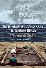
Flatboats were the most prolific type of vessel on the Ohio and Mississippi Rivers during the early 1800s. Thousands of these boats descended the two rivers each year, carrying not only valuable cargo to New Orleans but also western-bound emigrants to newly opened territories. By the late 1800s, flatboats had completely disappeared, and no intact examples were known to exist. Our knowledge of these historic vessels had been limited to illustrations, memoirs, and traveler accounts.
That changed in 2000 after local residents found a wreck on the Ohio River shoreline in Illinois. Archaeologist Mark J. Wagner and his colleagues from Southern Illinois University Carbondale investigated extensively and established that the wreck was a pre–Civil War flatboat, which they named America, after a nearby town.
In The Wreck of the America in Southern Illinois: A Flatboat on the Ohio River, Wagner provides a brief description and general history of flatboats and the various reasons they wrecked—such as poor workmanship and encounters with pirates, storms, rocks, and floating trees. Wagner describes the remains of the America, how it was constructed, the artifacts found nearby and inside—including pewter spoons, utensils with bone handles, metal buttons, and an iron felling axe—and the probable cause of its sinking. Wagner concludes with a history of the America since its discovery in 2000 and a plea that the boat be removed from the riverbank and preserved before the Ohio washes it away.
Thirty Years Into Yesterday
A History of Archaeology at Grasshopper PuebloJefferson Reid and Stephanie Whittlesey
University of Arizona Press, 2005
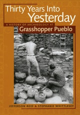
Like the enigmatic Mogollon culture it sought to explore and earlier University of Arizona field schools in the Forestdale Valley and at Point of Pines, Grasshopper research engendered decades of controversy that still lingers in the pages of professional journals. Jefferson Reid and Stephanie Whittlesey, players in the controversy who are intimately familiar with the field school that ended in 1992, offer a historical account of this major archaeological project and the intellectual debates it fostered.
Thirty Years Into Yesterday charts the development of the Grasshopper program under three directors and through three periods dominated by distinct archaeological paradigms: culture history, processual archaeology, and behavioral archaeology. It examines the contributions made each season, the concepts and methods each paradigm used, and the successes and failures of each. The book transcends interests of southwestern archaeologists in demonstrating how the three archaeological paradigms reinterpreted Grasshopper, illustrating larger shifts in American archaeology as a whole. Such an opportunity will not come again, as funding constraints, ethical concerns, and other issues no doubt will preclude repeating the Grasshopper experience in our lifetimes.
Ultimately, Thirty Years Into Yesterday continues the telling of the Grasshopper story that was begun in the authors’ previous books. In telling the story of the archaeologists who recovered the material residue of past Mogollon lives and the place of the Western Apache people in their interpretations, Thirty Years Into Yesterday brings the story full circle to a stunning conclusion.
Tibes
People, Power, and Ritual at the Center of the CosmosEdited by L. Antonio Curet and Lisa M. Stringer
University of Alabama Press, 2009
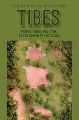
The prehistoric civic-ceremonial center of Tibes is located on the southern coast of Puerto Rico, just north of the modern coastal city of Ponce. Protected on two sides by a river, and on the other two sides by hills, this approximately 10.5-acre site remains as fertile and productive today as when first occupied over 2,000 years ago. Such a rich region would have been a choice location for native peoples because of the diversity in all resources, from land, air, and sea--and also symbolically crucial as a liminal space within the landscape. It may have been regarded as a space charged with numen or cosmic energy where different parts of the cosmos (natural vs. supernatural, or world of the living vs. world of the dead) overlap. Archaeological evidence reveals a long occupation, about 1,000 years, possibly followed by an extensive period of sporadic ceremonial use after the site itself was practically abandoned.
In this volume, nineteen Caribbeanists, across a wide academic spectrum, examine the geophysical, paleoethnobotanical, faunal, lithics, base rock, osteology, bone chemistry and nutrition, social landscape, and ceremonial constructs employed at Tibes. These scholars provide a concise, well-presented, comprehensive analysis of the evidence for local level changes in household economy, internal organization, accessibility to economic, religious, and symbolic resources related to the development and internal operation of socially stratified societies in the Caribbean.
Time's River
Archaeological Syntheses from the Lower Mississippi ValleyEdited by Janet Rafferty and Evan Peacock
University of Alabama Press, 2008
An archaeologically rich region, in advance of impending disturbance
This volume stands as a key general resource for archaeologists working in the region extending from Louisiana through Mississippi north to Missouri and Kentucky, and it represents an opportunity to influence for decades a large part of the archaeological work to take place in the Southeast.
The book responds to a need for a comprehensive archaeological overview of the Lower Mississippi Valley that forms a portion of an interstate corridor spanning nine states that will run from southern Michigan to the Texas-Mexico border. The culturally sensitive Mississippi Delta is one of the richest archaeological areas in North America, and it is crucial that research designs be comprehensive, coordinated, and meet current preservation and future research needs. The authors are well-respected researchers from both within and outside the region with expertise in the full range of topics that comprise American archaeology. They examine matters of method and theory, the application of materials science, geophysics, and other high-tech tools in archaeology that provide for optimum data-recovery.
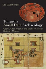
Toward a Small Data Archaeology
Otomí, Aztec Imperial, and Spanish Colonial Xaltocan, MexicoLisa Overholtzer
University Press of Colorado, 2025
Xaltocan served as the Otomí city-state capital before being conquered by the Tepanecs, subsequently incorporated into the Aztec Empire, and finally integrated into the vast Spanish colonial sphere. In reconstructing long-term household histories that bridge the pre-Hispanic and early Colonial periods, this book resists narratives that define Indigenous peoples solely through the lens of conquest and subordination. Instead, it presents richly detailed reconstructions of familial relationships and social networks, achieved through the rigorous analysis of artifacts, ecofacts, human remains, and ancient DNA. This meticulous and community-collaborative approach not only maximizes insights available from a limited archaeological record but also honors the ethical imperative to work with descendant communities.
Toward a Small Data Archaeology offers an innovative reexamination of the past by privileging the intricate, household-level narratives of Indigenous communities over the homogenizing tendencies of broad-scale "big data" approaches. By peopling the past, Overholtzer redefines methodological boundaries within archaeology, produces reconstructions and narratives that are more in line with Indigenous philosophies, and offers a compelling vision for a future in which historical narratives are reconstructed through a lens that is both deeply scientific and inherently humane.

Traces Behind the Esmeraldas Shore
Warren DeBoer
University of Alabama Press, 1996
Although long famous for its antiquities—notably intricate goldwork, elaborate pottery, and earthen mounds—the Santiago-Cayapas region of coastal Ecuador has been relatively neglected from the standpoint of scientific archaeology. Until recently, no sound chronology was available, and even the approximate age of the region's most impressive monument, the large and much-looted site of La Tolita, remained in doubt.
Building on evidence obtained during the last decade, this book documents an eventful prehistory for Santiago-Cayapas that spans three millennia. A highlight of this prehistory was the reign of La Tolita as a regional center from 200 B.C. to A.D. 350. Archaeological data from
La Tolita's hinterland indicate a complex and changing social landscape in which La Tolita's hegemony was never absolute nor uncontested.
Abundantly illustrated and written in a crisp, witty, and occasionally irreverent style, Traces Behind the Esmeraldas Shore will stimulate debate and rankle interpretive conventions about those social formations that archaeologists gloss as 'chiefdoms.'
Transitions
Archaic and Early Woodland Research in the Ohio CountryMartha P. Otto
Ohio University Press, 2008
The late archaic and early woodland peoples lived in the Ohio region between 5,000 and 2,000 years ago. This was a time of transition, when hunters and gatherers began to grow native seed crops, establish more permanent settlements, and develop complex forms of ritual and ceremonialism, sometimes involving burial mound construction.
The focused archaeological studies described in Transitions: Archaic and Early Woodland Research in the Ohio Country shed light on this important episode in human cultural development. The authors describe important archaeological sites such as the rich Late Archaic settlements of southwestern Ohio and the early Adena Dominion Land Company enclosure in Franklin County. They present detailed accounts of Native American behavior, such as the use of smoking pipes by Adena societies and a reconstruction of mound use and ritual.
Transitions is the result of a comprehensive, long-term study focusing on particular areas of Ohio with the most up-to-date and detailed treatment of Ohio’s native cultures during this important time of change. This book will be of great value to students and other readers who wish to go beyond the general and often dated treatments of Ohio archaeology currently available.
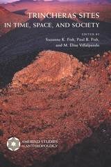
Trincheras Sites in Time, Space, and Society
Edited by Suzanne K. Fish, Paul R. Fish, and M. Elisa Villalpando
University of Arizona Press, 2008
This multi-author volume integrates a remarkable body of new data representing a textbook-like array of current research issues and methodologies in the archaeology of the region. Scholars from the United States and Mexico offer original research on trincheras sites in Chihuahua, Sonora, Arizona, and New Mexico. Scales of focus range from intensive intrasite sampling to the largest contiguous survey in the region. Authors incorporate spatial analyses, artifact studies, environmental and subsistence data, ethnographic analogs, ethnohistorical records, cross-cultural comparisons, archaeology, and archival resources.
The volume’s discussions contribute innovative approaches to worldwide interpretations of landscapes marked by hilltop sites. Contributors present meticulous research arguing that many trincheras sites were primarily used for habitation and ceremonial rites, in addition to previously predominant views of them as defensive refuges. Because trincheras occupations date from the late preceramic era to shortly before Spanish contact, authors relate them to early forms of agriculture, the emergence of village life, the appearance of differentiated settlement systems, and tendencies toward political and ritual centralization.
Detailed maps and figures illustrate the text, and close-up aerial photographs capture the visual essence of the sites, highlighted by a section that includes color photographs and an essay by renowned photographer Adriel Heisey.
Contributors:
Christian E. Downum
Paul R. Fish
Suzanne K. Fish
Robert J. Hard
Adriel Heisey
Stephen A. Kowalewski
Randall H. McGuire
Ben A. Nelson
John R. Roney
Judith Taylor
M. Elisa Villalpando
Joseph Vogel
Henry Wallace
David R. Wilcox
J. Scott Wood
Twelve Millennia
Archaeology of the Upper Mississippi River ValleyJames L Theler
University of Iowa Press, 2003
The people of Taquile Island on the Peruvian side of beautiful Lake Titicaca, the highest navigable lake in the Americas, are renowned for the hand-woven textiles that they both wear and sell to outsiders. One thousand seven hundred Quechua-speaking peasant farmers, who depend on potatoes and the fish from the lake, host the forty thousand tourists who visit their island each year. Yet only twenty-five years ago, few tourists had even heard of Taquile. In Weaving a Future: Tourism, Cloth, and Culture on an Andean Island, Elayne Zorn documents the remarkable transformation of the isolated rocky island into a community-controlled enterprise that now provides a model for indigenous communities worldwide.
Over the course of three decades and nearly two years living on Taquile Island, Zorn, who is trained in both the arts and anthropology, learned to weave from Taquilean women. She also learned how gender structures both the traditional lifestyles and the changes that tourism and transnationalism have brought. In her comprehensive and accessible study, she reveals how Taquileans used their isolation, landownership, and communal organizations to negotiate the pitfalls of globalization and modernization and even to benefit from tourism. This multi-sited ethnography set in Peru, Washington, D.C., and New York City shows why and how cloth remains central to Andean society and how the marketing of textiles provided the experience and money for Taquilean initiatives in controlling tourism.
The first book about tourism in South America that centers on traditional arts as well as community control, Weaving a Future will be of great interest to anthropologists and scholars and practitioners of tourism, grassroots development, and the fiber arts.