Results by title
54 books match the query 'Hiking' and 4 start with w

Walk of Ages
A Generational Journey from Mt. Whitney to Death ValleyWithanee Andersen
University of Nevada Press, 2024
Following in her father’s footsteps, Withanee Andersen begins the expedition of a lifetime when she and her comrades embark on a trek from Mt. Whitney to Death Valley, tracing the rugged path her father, Jim Andersen, traversed forty-three years earlier.
With hopes of being listed in the Guinness Book of World Records, Jim led the first documented walk from the highest to lowest point in the contiguous United States in 1974. He lived, albeit just barely, to tell the tale to his daughter, sparking a desire in Withanee to retrace his steps in his honor. In 2017, she took on the incredible task of recreating Jim’s legacy trek of 131 miles with the help of divine intervention, ice-cold beer, and her parents, who were following along as the support party.
Walk of Ages humorously relates the parallel journey of an epic adventure told from two perspectives—a daughter’s difficult quest, and a father who supports her through it while recalling his own experiences from four decades earlier. Throughout this momentous odyssey, readers will realize how a once-in-a-generation adventure leads to life-changing transformation, and that the bond between father and daughter knows no bounds.
[more]
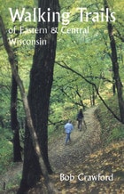
Walking Trails of Eastern and Central Wisconsin
Bob Crawford
University of Wisconsin Press, 1997
The sheer physical beauty and varied landscapes of eastern and central Wisconsin are best experienced on its walking trails. Walking Trails of Eastern and Central Wisconsin is a handy guide to trails that wind through the streets of old Milwaukee and the forests of the Kettle Moraine, across the Niagara Escarpment, along the shores of picturesque Door County, or up the sandstone mound at Lone Rock for a panoramic view of flatlands that once were the bed of glacial Lake Wisconsin.
A companion to the popular Walking Trails of Southern Wisconsin, this book describes more than 200 trails in 72 locations throughout five of the state's major regions. Bob Crawford provides maps and detailed instructions to make the trails easy to locate.
With each trail description you'll find:
* details about the route and terrain, as well as geographical, biological, or historical features of interest;
* regulations including open days and hours, and rules regarding dogs, trail bikes, cross-country skiing, and other activities;
* information about available restrooms, drinking water, nature centers, and other facilities at the site;
* a description assessing degree of difficulty—slope, width, maintenance, and other such factors—and a helpful rating of "walkability" on a scale from 1 to 5.
The only comprehensive guide to hiking locations in the eastern part of the state, this book also provides lists of trail locations that include playground equipment for kids and picnic facilities for those who want to make a day trip of their hiking outing. Appendices spotlight trails that boast historical significance, ice age features, picnic areas, and cross-country skiing opportunities.
[more]

Walking on the Wild Side
Long-Distance Hiking on the Appalachian TrailFondren, Kristi M
Rutgers University Press, 2015
Received the 2016 Theodore and Franklin Roosevelt Award for Excellence in Recreation and Park Research from the National Recreation and Park Association
The most famous long-distance hiking trail in North America, the 2,181-mile Appalachian Trail—the longest hiking-only footpath in the world—runs along the Appalachian mountain range from Georgia to Maine. Every year about 2,000 individuals attempt to “thru-hike” the entire trail, a feat equivalent to hiking Mount Everest sixteen times. In Walking on the Wild Side, sociologist Kristi M. Fondren traces the stories of forty-six men and women who, for their own personal reasons, set out to conquer America’s most well known, and arguably most social, long-distance hiking trail.
In this fascinating in-depth study, Fondren shows how, once out on the trail, this unique subculture of hikers lives mostly in isolation, with their own way of acting, talking, and thinking; their own vocabulary; their own activities and interests; and their own conception of what is significant in life. They tend to be self-disciplined, have an unwavering trust in complete strangers, embrace a life of poverty, and reject modern-day institutions. The volume illuminates the intense social intimacy and bonding that forms among long-distance hikers as they collectively construct a long-distance hiker identity. Fondren describes how long-distance hikers develop a trail persona, underscoring how important a sense of place can be to our identity, and to our sense of who we are. Indeed, the author adds a new dimension to our understanding of the nature of identity in general.
Anyone who has hiked—or has ever dreamed of hiking—the Appalachian Trail will find this volume fascinating. Walking on the Wild Side captures a community for whom the trail is a sacred place, a place to which they have become attached, socially, emotionally, and spiritually.
[more]

Wasatch Eleveners
A Hiking and Climbing Guide to the 11,000 foot Mountains of Utah's Wasatch RangeWinters, Randy
University of Utah Press, 2006
The Wasatch Mountains sit on the western edge of the Rockies. Stretching south through Utah from Bear River in the north to Mount Nebo in the central part of the state, their peaks dominate the skyline of Salt Lake City and nearby urban areas. Elevations range from 9,000 to almost 12,000 feet, with eighteen peaks above 11,000 feet. All of the 11ers can be summited as a day-hike, without the use of climbing gear.
This guide provides information on trailhead access, approaches, and routes for every 11,000-foot peak. It includes overview maps of major roads, topographical overview maps, and detailed route maps for each peak. There are also total roundtrip mileages, elevation-gain (or loss) figures, and alternate routes to help hikers plan their adventures.
Featured peaks include North Mount Nebo, South Mount Nebo, Middle Mount Nebo, Mount Timpanogos, 'South' Timpanogos, West American Fork Twin Peak, 'North' Timpanogos, 'South' American Fork Twin Peak, Unnamed 11,383, Unnamed 11,347, East Broads Fork Twin Peak, West Broads Fork Twin Peak, Pfeifferhorn, White Baldy, Sunrise Peak, Unnamed 11,288, Lone Peak, North Peak, Red Baldy, Red Top Mountain, South Thunder, North Thunder, Unnamed 11,137, Monte Cristo Peak, Dromedary Peak, Box Elder Peak, Mount Baldy, Provo Peak, Sugarloaf Mountain, 'East' Provo Peak, Mount Superior, and 'East' American Fork Twin Peak.
[more]