Results by title
577 books match the query 'Earth Sciences' and 44 start with a
A Book of Waves
Stefan Helmreich
Duke University Press, 2023
A Brain for All Seasons
Human Evolution and Abrupt Climate ChangeWilliam H. Calvin
University of Chicago Press, 2002
Our ancestors lived through hundreds of such abrupt episodes since the more gradual Ice Ages began two and a half million years ago—but abrupt cooling produced a population bottleneck each time, one that eliminated most of their relatives. We are the improbable descendants of those who survived—and later thrived.
William H. Calvin's marvelous A Brain for All Seasons argues that such cycles of cool, crash, and burn powered the pump for the enormous increase in brain size and complexity in human beings. Driven by the imperative to adapt within a generation to "whiplash" climate changes where only grass did well for a while, our ancestors learned to cooperate and innovate in hunting large grazing animals.
Calvin's book is structured as a travelogue that takes us around the globe and back in time. Beginning at Darwin's home in England, Calvin sits under an oak tree and muses on what controls the speed of evolutionary "progress." The Kalahari desert and the Sterkfontein caves in South Africa serve as the backdrop for a discussion of our ancestors' changing diets. A drought-shrunken lake in Kenya shows how grassy mudflats become great magnets for grazing animals. And in Copenhagen, we learn what ice cores have told us about abrupt jumps in past climates.
Perhaps the most dramatic discovery of all, though, awaits us as we fly with Calvin over the Gulf Stream and Greenland: global warming caused by human-made pollution could paradoxically trigger another sudden episode of global cooling. Because of the accumulation of greenhouse gases in the atmosphere, the oceanic "conveyor belt" that sends warmer waters into the North Atlantic could abruptly shut down. If that happens again, much of the Earth could be plunged into a deep chill within a few years. Europe would become as cold and dry as Siberia. Agriculture could not adapt quickly enough to avoid worldwide famines and wars over the dwindling food supplies—a crash from which it would take us many centuries to recover.
With this warning, Calvin connects us directly to evolution and the surprises it holds. Highly illustrated, conversational, and learned, A Brain for All Seasons is a fascinating view of where we came from, and where we're going.

A Deadly Wind
The 1962 Columbus Day StormJohn Dod
Oregon State University Press, 2018
The Columbus Day Storm of 1962 was a freak of nature, a weather outlier with deadly winds topping one hundred miles per hour. The storm killed dozens, injured hundreds, damaged more than fifty thousand homes, and leveled enough timber to build one million homes. To find an equally ferocious storm of its kind, fast-forward fifty years and cross the continent to Superstorm Sandy’s 2012 attack on the East Coast. While Superstorm Sandy was predicted days in advance, the Columbus Day Storm caught ill-equipped weather forecasters by surprise.
This unrivalled West Coast windstorm fueled the Asian log export market, helped give birth to the Oregon wine industry, and influenced the 1962 World Series. It remains a cautionary tale and the Pacific Northwest benchmark for severe windstorms in this era of climate change and weather uncertainty. From its genesis in the Marshall Islands to its final hours on Vancouver Island, British Columbia, the storm plowed an unparalleled path of destruction.
In A Deadly Wind, veteran journalist John Dodge tells a compelling story spiced with human drama, Cold War tension, and Pacific Northwest history. This is a must-read for the tens of thousands of storm survivors, for history buffs, and for anyone interested in the intersection of severe weather events and climate change.
A Field Guide to Snow
Matthew Sturm
University of Alaska Press, 2020
In A Field Guide to Snow, veteran snow scientist Matthew Sturm answers those questions and more. Drawing on decades of study, he explains in clear and simple ways how and why snow works the way it does. The perfect companion a ski trip or a hike in the snowy woods, A Field Guide to Snow will give you a new appreciation for the science behind snow’s beauty.
A Geography of New Jersey
The City in the GardenStansfield, Charles A.
Rutgers University Press, 1998
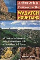
A Hiking Guide to the Geology of the Wasatch Mountains
Mill Creek and Neffs Canyons, Mount Olympus, Big and Little Cottonwood and Bells CanyonsWilliam T Parry
University of Utah Press, 2005
Northern Utah’s Wasatch Mountains are popular destinations for outdoor enthusiasts in every season. These mountains rise spectacularly from the relatively flat valley floor to thirteen peaks over 11,000 feet in elevation. An additional nineteen peaks rise more than 10,000 feet in elevation. Although many hiking guides exist for the Wasatch Mountains, there has been no guide book that focuses on the geologic features visible from the trails—until now.
Written by a recognized authority on the geology of the Wasatch Mountains, this guide is meant to enrich the experience of outdoor enthusiasts who want to understand the geological history and development of the Wasatch range. The first section of the book introduces the major geological time periods—the record of mountain building events from oldest to youngest, the effects of glaciation, and the development of the present topography. It then follows with a descriptive trail guide for each major trail system, including Mill Creek and Neffs Canyons, Mount Olympus, Little and Big Cottonwood Canyons, and Bells Canyon. Trail length, elevation gain, relative difficulty, and major geological features are outlined for each trail. Now you can hike these trails with the answers to all your geologic questions right at your fingertips.
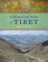
A Historical Atlas of Tibet
Karl E. Ryavec
University of Chicago Press, 2015
Cradled among the world’s highest mountains—and sheltering one of its most devout religious communities—Tibet is, for many of us, an ultimate destination, a place that touches the heavens, a place only barely in our world, at its very end. In recent decades Western fascination with Tibet has soared, from the rise of Tibetan studies in academia to the rock concerts aimed at supporting its independence to the simple fact that most of us—far from any base camp—know exactly what a sherpa is. And yet any sustained look into Tibet as a place, any attempt to find one’s way around its high plateaus and through its deep history, will yield this surprising fact: we have barely mapped it. With this atlas, Karl E. Ryavec rights that wrong, sweeping aside the image of Tibet as Shangri-La and putting in its place a comprehensive vision of the region as it really is, a civilization in its own right. And the results are absolutely stunning.
The product of twelve years of research and eight more of mapmaking, A Historical Atlas of Tibet documents cultural and religious sites across the Tibetan Plateau and its bordering regions from the Paleolithic and Neolithic times all the way up to today. It ranges through the five main periods in Tibetan history, offering introductory maps of each followed by details of western, central, and eastern regions. It beautifully visualizes the history of Tibetan Buddhism, tracing its spread throughout Asia, with thousands of temples mapped, both within Tibet and across North China and Mongolia, all the way to Beijing. There are maps of major polities and their territorial administrations, as well as of the kingdoms of Guge and Purang in western Tibet, and of Derge and Nangchen in Kham. There are town plans of Lhasa and maps that focus on history and language, on population, natural resources, and contemporary politics.
Extraordinarily comprehensive and absolutely gorgeous, this overdue volume will be a cornerstone in cartography, Asian studies, Buddhist studies, and in the libraries or on the coffee tables of anyone who has ever felt the draw of the landscapes, people, and cultures of the highest place on Earth.

A Jumble of Needs
Women’s Activism and Neoliberalism in the Colonias of the SouthwestRebecca Dolhinow
University of Minnesota Press, 2010
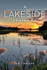
A Lakeside Companion
Ted J. Rulseh
University of Wisconsin Press, 2018
You'll discover the interconnected worlds of a lake: the water; the sand, gravel, rocks, and muck of the bottom; the surface of the lake; the air above; and the shoreline, a belt of land incredibly rich in flora and fauna. Explained, too, are the physical, biological, and chemical processes that determine how many and what kinds of fish live in the lake, which plants grow there, the color and clarity of the water, how ice forms in winter and melts in spring, and much more. Useful advice will help you look out for your lake and advocate for its protection.
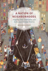
A Nation of Neighborhoods
Imagining Cities, Communities, and Democracy in Postwar AmericaBenjamin Looker
University of Chicago Press, 2015
Looker investigates the cultural, social, and political complexities of the idea of “neighborhood” in postwar America and how Americans grappled with vast changes in their urban spaces from World War II to the Reagan era. In the face of urban decline, competing visions of the city neighborhood’s significance and purpose became proxies for broader debates over the meaning and limits of American democracy. By studying the way these contests unfolded across a startling variety of genres—Broadway shows, radio plays, urban ethnographies, real estate documents, and even children’s programming—Looker shows that the neighborhood ideal has functioned as a central symbolic site for advancing and debating theories about American national identity and democratic practice.
A Natural History of Time
Pascal Richet
University of Chicago Press, 2007
The quest to pinpoint the age of the Earth is nearly as old as humanity itself. For most of history, people trusted mythology or religion to provide the answer, even though nature abounds with clues to the past of the Earth and the stars. In A Natural History of Time, geophysicist Pascal Richet tells the fascinating story of how scientists and philosophers examined those clues and from them built a chronological scale that has made it possible to reconstruct the history of nature itself.
Richet begins his story with mythological traditions, which were heavily influenced by the seasons and almost uniformly viewed time cyclically. The linear history promulgated by Judaism, with its story of creation, was an exception, and it was that tradition that drove early Christian attempts to date the Earth. For instance, in 169 CE, the bishop of Antioch, for instance declared that the world had been in existence for “5,698 years and the odd months and days.”
Until the mid-eighteenth century, such natural timescales derived from biblical chronologies prevailed, but, Richet demonstrates, with the Scientific Revolution geological and astronomical evidence for much longer timescales began to accumulate. Fossils and the developing science of geology provided compelling evidence for periods of millions and millions of years—a scale that even scientists had difficulty grasping. By the end of the twentieth century, new tools such as radiometric dating had demonstrated that the solar system is four and a half billion years old, and the universe itself about twice that, though controversial questions remain.
The quest for time is a story of ingenuity and determination, and like a geologist, Pascal Richet carefully peels back the strata of that history, giving us a chance to marvel at each layer and truly appreciate how far our knowledge—and our planet—have come.

A Neighborhood That Never Changes
Gentrification, Social Preservation, and the Search for AuthenticityJaponica Brown-Saracino
University of Chicago Press, 2009
Newcomers to older neighborhoods are usually perceived as destructive, tearing down everything that made the place special and attractive. But as A Neighborhood That Never Changes demonstrates, many gentrifiers seek to preserve the authentic local flavor of their new homes, rather than ruthlessly remake them. Drawing on ethnographic research in four distinct communities—the Chicago neighborhoods of Andersonville and Argyle and the New England towns of Provincetown and Dresden—Japonica Brown-Saracino paints a colorful portrait of how residents new and old, from wealthy gay homeowners to Portuguese fishermen, think about gentrification.
The new breed of gentrifiers, Brown-Saracino finds, exhibits an acute self-consciousness about their role in the process and works to minimize gentrification’s risks for certain longtime residents. In an era of rapid change, they cherish the unique and fragile, whether a dilapidated house, a two-hundred-year-old landscape, or the presence of people deeply rooted in the place they live. Contesting many long-standing assumptions about gentrification, Brown-Saracino’s absorbing study reveals the unexpected ways beliefs about authenticity, place, and change play out in the social, political, and economic lives of very different neighborhoods.
A New Map of Wonders
A Journey in Search of Modern MarvelsCaspar Henderson
University of Chicago Press, 2017
Henderson’s brilliant exploration borrows from the form of one of the oldest and most widely known sources of wonder: maps. Large, detailed mappae mundi invited people in medieval Europe to vividly imagine places and possibilities they had never seen before: manticores with the head of a man, the body of a lion, and the stinging tail of a scorpion; tribes of one-eyed men who fought griffins for diamonds; and fearsome Scythian warriors who drank the blood of their enemies from their skulls. As outlandish as these maps and the stories that went with them sound to us today, Henderson argues that our views of the world today are sometimes no less incomplete or misleading. Scientists are only beginning to map the human brain, for example, revealing it as vastly more complex than any computer we can conceive. Our current understanding of physical reality is woefully incomplete. A New Map of Wonders explores these and other realms of the wonderful, in different times and cultures and in the present day, taking readers from Aboriginal Australian landscapes to sacred sites in Great Britain, all the while keeping sight questions such as the cognitive basis of wonder and the relationship between wonder and science.
Beautifully illustrated and written with wit and moral complexity, this sequel to The Book of Barely Imagined Beings is a fascinating account of the power of wonder and an unforgettable meditation on its importance to our future.
A Resonant Ecology
Max Ritts
Duke University Press, 2024
A Scientific Peak
How Boulder Became a World Center for Space and Atmospheric ScienceJoseph P. Bassi
American Meteorological Society, 2015
A Scientific Peak chronicles Boulder’s meteoric rise to eventually become “America’s Smartest City” and a leader in space and atmospheric sciences. In just two decades following World War II, a tenacious group of researchers, supported by groups from local citizenry to the State of Colorado, managed to convince the US government and some of the world’s scientific pioneers to make Boulder a center of the new space age. Joseph P. Bassi introduces us to the characters, from citizens to scientists, and the mix of politics, passion, and sheer luck at the start of Boulder’s transformation from “Scientific Siberia” to the research mecca it is today.
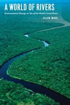
A World of Rivers
Environmental Change on Ten of the World's Great RiversEllen Wohl
University of Chicago Press, 2010
Far from being the serene, natural streams of yore, modern rivers have been diverted, dammed, dumped in, and dried up, all in efforts to harness their power for human needs. But these rivers have also undergone environmental change. The old adage says you can’t step in the same river twice, and Ellen Wohl would agree—natural and synthetic change are so rapid on the world’s great waterways that rivers are transforming and disappearing right before our eyes.
A World of Rivers explores the confluence of human and environmental change on ten of the great rivers of the world. Ranging from the Murray-Darling in Australia and the Yellow River in China to Central Europe’s Danube and the United States’ Mississippi, the book journeys down the most important rivers in all corners of the globe. Wohl shows us how pollution, such as in the Ganges and in the Ob of Siberia, has affected biodiversity in the water. But rivers are also resilient, and Wohl stresses the importance of conservation and restoration to help reverse the effects of human carelessness and hubris.
What all these diverse rivers share is a critical role in shaping surrounding landscapes and biological communities, and Wohl’s book ultimately makes a strong case for the need to steward positive change in the world’s great rivers.
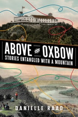
Above the Oxbow
Stories Entangled with a MountainDanielle R. Raad
West Virginia University Press, 2026
Above the Oxbow is a journey through the tangle of rich narratives surrounding Mount Holyoke, a locally cherished mountain in Western Massachusetts. It explores how visitors have forged connections with the mountain through various activities over the past two centuries. In an accessible blend of storytelling and scholarly analysis, Danielle Raad shows the significance of the landscape, historic sites, and material culture, revealing how cultural perspectives, community activism, collective memory, and personal experiences shape our understanding of a place. Situated at the intersection of public history and environmental history, this ethnography of place also discloses the curious stories of the Summit House, an erstwhile tramway, an airplane crash, and the local fight to conserve Mount Holyoke as a natural space and celebrates its myriad uses today.
Abundant Earth
Toward an Ecological CivilizationEileen Crist
University of Chicago Press, 2019
Crist argues that to do so would require a two-pronged approach. Scaling down calls upon us to lower the global human population while working within a human-rights framework, to deindustrialize food production, and to localize economies and contract global trade. Pulling back calls upon us to free, restore, reconnect, and rewild vast terrestrial and marine ecosystems. However, the pervasive worldview of human supremacy—the conviction that humans are superior to all other life-forms and entitled to use these life-forms and their habitats—normalizes and promotes humanity’s ongoing expansion, undermining our ability to enact these linked strategies and preempt the mounting suffering and dislocation of both humans and nonhumans.
Abundant Earth urges us to confront the reality that humanity will not advance by entrenching its domination over the biosphere. On the contrary, we will stagnate in the identity of nature-colonizer and decline into conflict as we vie for natural resources. Instead, we must chart another course, choosing to live in fellowship within the vibrant ecologies of our wild and domestic cohorts, and enfolding human inhabitation within the rich expanse of a biodiverse, living planet.
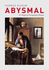
Abysmal
A Critique of Cartographic ReasonGunnar Olsson
University of Chicago Press, 2007
People rely on reason to think about and navigate the abstract world of human relations in much the same way they rely on maps to study and traverse the physical world. Starting from that simple observation, renowned geographer Gunnar Olsson offers in Abysmal an astonishingly erudite critique of the way human thought and action have become deeply immersed in the rhetoric of cartography and how this cartographic reasoning allows the powerful to map out other people’s lives.
A spectacular reading of Western philosophy, religion, and mythology that draws on early maps and atlases, Plato, Kant, and Wittgenstein, Thomas Pynchon, Gilgamesh, and Marcel Duchamp, Abysmal is itself a minimalist guide to the terrain of Western culture. Olsson roams widely but always returns to the problems inherent in reason, to question the outdated assumptions and fixed ideas that thinking cartographically entails. A work of ambition, scope, and sharp wit, Abysmal will appeal to an eclectic audience—to geographers and cartographers, but also to anyone interested in the history of ideas, culture, and art.
Acting with the World
Agency in the AnthropoceneAndrew Pickering
Duke University Press, 2025
Adaptive Governance and Climate Change
Ronald D. Brunner and Amanda H. Lynch
American Meteorological Society, 2010
While recent years have seen undeniable progress in international acknowledgement both of the dangers of climate change and the importance of working to mitigate it, little has actually been done. Emissions continue to rise, and even the ambitious targets set by international accords would fall far short of the drastic cuts that are needed to prevent catastrophe.
With Adaptive Governance and Climate Change, Ronald D. Brunner and Amanda H. Lynch argue that we need to take a new tack, moving away from reliance on centralized, top-down approaches—the treaties and accords that have proved disappointingly ineffective thus far—and towards a more flexible, multi-level approach. Based in the principles of adaptive governance—which are designed to produce programs that adapt quickly and easily to new information and experimental results—such an approach would encourage diversity and innovation in the search for solutions, while at the same time pointedly recasting the problem as one in which every culture and community around the world has an inherent interest.
Africa South
Harm J. de Blij
Northwestern University Press, 1962
After the Map
Cartography, Navigation, and the Transformation of Territory in the Twentieth CenturyWilliam Rankin
University of Chicago Press, 2016
In After the Map, William Rankin argues that although this shift did not render traditional maps obsolete, it did radically change our experience of geographic knowledge, from the God’s-eye view of the map to the embedded subjectivity of GPS. Likewise, older concerns with geographic truth and objectivity have been upstaged by a new emphasis on simplicity, reliability, and convenience. After the Map shows how this change in geographic perspective is ultimately a transformation of the nature of territory, both social and political.
Air Apparent
How Meteorologists Learned to Map, Predict, and Dramatize WeatherMark Monmonier
University of Chicago Press, 1999
"Clever title, rewarding book. Monmonier . . . offers here a basic course in meteorology, which he presents gracefully by means of a history of weather maps." —Scientific American
"Mark Monmonier is onto a winner with Air Apparent. . . . It is good, accessible science and excellent history. . . . Read it." —Fred Pearce, New Scientist
"[Air Apparent] is a superb first reading for any backyard novice of weather . . . but even the veteran forecaster or researcher will find it engaging and, in some cases, enlightening." —Joe Venuti, Bulletin of the American Meteorological Society
"Monmonier is solid enough in his discussion of geographic and meteorological information to satisfy the experienced weather watcher. But even if this information were not presented in such a lively and engaging manner, it would still hook most any reader who checks the weather map every morning or who sits happily entranced through a full cycle of forecasts on the Weather Channel."—Michael Kennedy, Boston Globe
American Boundaries
The Nation, the States, the Rectangular SurveyBill Hubbard Jr.
University of Chicago Press, 2009
American Capitals
A Historical GeographyChristian Montès
University of Chicago Press, 2014
American Imperial Pastoral
The Architecture of US Colonialism in the PhilippinesRebecca Tinio McKenna
University of Chicago Press, 2017
In American Imperial Pastoral, Rebecca Tinio McKenna examines the design, construction, and use of Baguio, making visible the physical shape, labor, and sustaining practices of the US’s new empire—especially the dispossessions that underwrote market expansion. In the process, she demonstrates how colonialists conducted market-making through state-building and vice-versa. Where much has been made of the racial dynamics of US colonialism in the region, McKenna emphasizes capitalist practices and design ideals—giving us a fresh and nuanced understanding of the American occupation of the Philippines.
An American Provence
Thomas P. Huber
University Press of Colorado, 2011
-From An American Provence
In this poetic personal narrative, Thomas P. Huber reflects on two seemingly unrelated places-the North Fork Valley in western Colorado and the Coulon River Valley in Provence, France-and finds a shared landscape and sense of place. What began as a simple comparison of two like places in distant locations turned into a more complex, interesting, and personal task. Much is similar-the light, the valleys, the climate, the agriculture. And much is less so-the history, the geology, the physical makeup of villages. Using a geographer's eye and passion for the land and people, Huber examines the regions' similarities and differences to explore the common emotional impact of each region. Part intimate travelogue and part case study of geography in the real world, An American Provence illuminates the importance sense of place plays in who we are.
An Ecology of Happiness
Eric Lambin
University of Chicago Press, 2012
In this clever and wide-ranging work, Lambin draws on new scientific evidence in the fields of geography, political ecology, environmental psychology, urban studies, and disease ecology, among others, to answer such questions as: To what extent do we need nature for our well-being? How does environmental degradation affect our happiness? What can be done to protect the environment and increase our well-being at the same time? Drawing on case studies from Asia, Africa, Europe, and North America, Lambin makes a persuasive case for the strong link between healthy ecosystems and happy humans.
Unique in its scope and evenhanded synthesis of research from many fields, An Ecology of Happiness offers a compelling human-centered argument that is impossible to overlook when we marvel at murmurations of starlings or seek out the most brilliant fall foliage: nature makes our steps a little lighter and our eyes a little brighter. What better reason to protect an ecosystem or save a species than for our own pleasure?
An Errant Eye
Poetry and Topography in Early Modern FranceTom Conley
University of Minnesota Press, 2010
This tension, Conley demonstrates, cuts through literature and graphic matter of various shapes and forms-hybrid genres that include the comic novel, the emblem-book, the eclogue, sonnets, and the personal essay. An Errant Eye differs from historical treatments of spatial invention through Conley's argument that the topographic sensibility is one in which the ocular faculty, vital to the description of locale, is endowed with tact and touch.
Detailed close readings of Apian, Rabelais, Montaigne, and others empower the reader with a lively sense of the topographical impulse, deriving from Conley's own "errant eye," which is singularly discerning in attentiveness to the ambiguities of charted territory, the contours of woodcut images, and the complex combinations of word and figure in French Renaissance poetry, emblem, and politics.
An Observer's Guide to Clouds and Weather
A Northeastern Primer on PredictionToby Carlson, Paul Knight, and Celia Wyckoff
American Meteorological Society, 2014
This informative and accessible guide walks readers through the basics of making weather predictions through understanding cloud types and sky formations. It explains, in nontechnical terms, the science behind the weather, connecting fundamental meteorological concepts with the processes that shape weather patterns. Readers will learn how to develop their powers of observation and hone their ability to make quick forecasts without complicated tools. Whether you're an amateur weather enthusiast or a beginning meteorology student, An Observer’s Guide to Clouds and Weather will help anyone who prefers looking up to looking it up.
Ancient Life of the Great Lakes Basin
Precambrian to PleistoceneJ. Alan Holman
University of Michigan Press, 1995
Ancient Mesoamerican Population History
Urbanism, Social Complexity, and ChangeAdrian S. Z. Chase, Arlen F. Chase, and Diane Z. Chase
University of Arizona Press, 2024
Establishing ancient population numbers and determining how they were distributed across a landscape over time constitute two of the most pressing problems in archaeology. Accurate population data is crucial for modeling, interpreting, and understanding the past. Now, advances in both archaeology and technology have changed the way that such approximations can be achieved.
Including research from both highland central Mexico and the tropical lowlands of the Maya and Olmec areas, this book reexamines the demography in ancient Mesoamerica. Contributors present methods for determining population estimates, field methods for settlement pattern studies to obtain demographic data, and new technologies such as LiDAR (light detecting and ranging) that have expanded views of the ground in forested areas. Contributions to this book provide a view of ancient landscape use and modification that was not possible in the twentieth century. This important new work provides new understandings of Mesoamerican urbanism, development, and changes over time.
Contributors
Traci Ardren
M. Charlotte Arnauld
Bárbara Arroyo
Luke Auld-Thomas
Marcello A. Canuto
Adrian S. Z. Chase
Arlen F. Chase
Diane Z. Chase
Elyse D. Z. Chase
Javier Estrada
Gary M. Feinman
L. J. Gorenflo
Julien Hiquet
Scott R. Hutson
Gerardo Jiménez Delgado
Eva Lemonnier
Rodrigo Liendo Stuardo
José Lobo
Javier López Mejía
Michael L. Loughlin
Deborah L. Nichols
Christopher A. Pool
Ian G. Robertson
Jeremy A. Sabloff
Travis W. Stanton
Ancient Perspectives
Maps and Their Place in Mesopotamia, Egypt, Greece, and RomeEdited by Richard J. A. Talbert
University of Chicago Press, 2012
Ancient Perspectives encompasses a vast arc of space and time—Western Asia to North Africa and Europe from the third millennium BCE to the fifth century CE—to explore mapmaking and worldviews in the ancient civilizations of Mesopotamia, Egypt, Greece, and Rome. In each society, maps served as critical economic, political, and personal tools, but there was little consistency in how and why they were made. Much like today, maps in antiquity meant very different things to different people.
Apun
The Arctic SnowMatthew Sturm
University of Alaska Press, 2009
There are some twenty-five words for “snow” in the Inupiaq language. Each word denotes a different kind of snow—fresh powder snow, hard pack, soft snow, very wet snow, or just snow. Such fine distinction is reasonable, for over the centuries, Natives of the Arctic have had to rely on their knowledge of the snow to survive. Now Matthew Sturm has prepared an educational children’s book designed to teach a new generation of Arctic residents the importance of Arctic snow cover. Fully illustrated to demonstrate the cycle of the snow cover, Apun covers each phase of the “snow year.” Geared towards grades 3–4, this is a must read for elementary science classes.
Apun
The Arctic Snow (A Teacher's Guide)Matthew Sturm
University of Alaska Press, 2009
There are some twenty-five words for “snow” in the Inupiaq language. Each word denotes a different kind of snow—fresh powder snow, hard pack, soft snow, very wet snow, or just snow. Such fine distinction is reasonable, for over the centuries, Natives of the Arctic have had to rely on their knowledge of the snow to survive. Now Matthew Sturm has prepared an educational children’s book designed to teach a new generation of Arctic residents the importance of Arctic snow cover. Fully illustrated to demonstrate the cycle of the snow cover, Apun covers each phase of the “snow year.” Geared towards grades 3–4, this is a must read for elementary science classes.
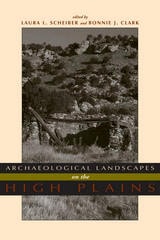
Archaeological Landscapes on the High Plains
Laura L. Scheiber
University Press of Colorado, 2008
Focusing on long-term change, this book considers ethnographic literature, archaeological evidence, and environmental data spanning thousands of years of human presence to understand human perception and construction of landscape. The contributors offer cohesive and synthetic studies emphasizing hunter-gatherers and subsistence farmers.
Using landscape as both reality and metaphor, Archaeological Landscapes on the High Plains explores the different and changing ways that people interacted with place in this transitional zone between the Rocky Mountains and the eastern prairies.
The contemporary archaeologists working in this small area have chosen diverse approaches to understand the past and its relationship to the present. Through these ten case studies, this variety is highlighted but leads to a common theme - that the High Plains contains important locales to which people, over generations or millennia, return. Providing both data and theory on a region that has not previously received much attention from archaeologists, especially compared with other regions in North America, this volume is a welcome addition to the literature. Contributors:
o Paul Burnett
o Oskar Burger
o Minette C. Church
o Philip Duke
o Kevin Gilmore
o Eileen Johnson
o Mark D. Mitchell
o Michael R. Peterson
o Lawrence Todd
Archeology and Volcanism in Central America
The Zapotitán Valley of El SalvadorEdited by Payson D. Sheets
University of Texas Press, 1983
Scientists have long speculated on the impact of extreme natural catastrophes on human societies. Archeology and Volcanism in Central America provides dramatic evidence of the effects of several volcanic disasters on a major civilization of the Western Hemisphere, that of the Maya.
During the past 2,000 years, four volcanic eruptions have taken place in the Zapotitán Valley of southern El Salvador. One, the devastating eruption of Ilopango around A.D. 300, forced a major migration, pushing the Mayan people north to the Yucatán Peninsula. Although later eruptions did not have long-range implications for cultural change, one of the subsequent eruptions preserved the Cerén site—a Mesoamerican Pompeii where the bodies of the villagers, the palm-thatched roofs of their houses, the pots of food in their pantries, even the corn plants in their fields were preserved with remarkable fidelity.
Throughout 1978, a multidisciplinary team of anthropologists, archeologists, geologists, biologists, and others sponsored by the University of Colorado's Protoclassic Project researched and excavated the results of volcanism in the Zapotitan Valley—a key Mesoamerican site that contemporary political strife has since rendered inaccessible.
The result is an outstanding contribution to our understanding of the impact of volcanic eruptions on early Mayan civilization. These investigations clearly demonstrate that the Maya inhabited this volcanically hazardous valley in order to reap the short-term benefits that the volcanic ash produced—fertile soil, fine clays, and obsidian deposits.
Aridland Springs in North America
Ecology and ConservationEdited by Lawrence E. Stevens and Vicky J. Meretsky; Foreword by Gary Paul Nabhan
University of Arizona Press, 2008
Aridland Springs in North America offers a much-needed comprehensive synthesis of aridland springs ecology. Stevens and Meretsky have assembled chapters from numerous and diverse experts from the fields of geology, hydrology, geomorphology, water quality, ecosystem dynamics, water law, and conservation biology. Through analyses and case studies, these contributors provide an in-depth overview of these topics and address issues critical for improving the knowledge and conservation of springs. This volume goes beyond examining the ecological importance of aridland springs to provide practical and productive ideas for their preservation. The authors facilitate future research by cultivating a language with which to collectively describe and study springs ecosystems, creating the beginnings of a comprehensive springs classification system. This book could not be more timely, as groundwater depletion throughout the continent is rapidly decimating these vital sources of life.
CONTENTS
Prologue
Gary P. Nabhan
1 Springs Ecosystem Ecology And Conservation
Lawrence E. Stevens And Vicky J. Meretsky
2 The Demise Of Desert Springs
Peter J. Unmack And W. L. Minckley*
3 The Hydrology Of Desert Springs In North America
David K. Kreamer And Abe Springer
4 A Comprehensive Springs Classification System: Integrating Geomorphic, Hydrogeochemical, And Ecological Criteria
Abraham E. Springer, Lawrence E. Stevens, Diana E. Anderson, Roderic A. Parnell1, David K. Kreamer, Lisa Levin, And Stephen P. Flora1
5 Quaternary Cauldron Springs As Paleoecological Archives
C. Vance Haynes Jr.
6 The Extreme Environment, Trophic Structure, And Ecosystem Dynamics Of A Large Fishless Desert Spring: Montezuma Well, Arizona
Dean W. Blinn
7 Combining Ecological Research And Conservation: A Case Study In Cuatro Ciénegas, Coahuila, México
Dean A. Hendrickson, Jane C. Marks, Angie Moline, Eric Dinger, Adam Cohen
8 The Desert Fan Palm Oasis
James W. Cornett
9 Spring-Supported Vegetation Along The Colorado River, Colorado Plateau: Floristics, Vegetation Structure And Environment
John R. Spence
10 Mechanisms Of Change In Seep/Spring Plant Communities On The Southern Colorado Plateau
Vicky J. Meretsky
11 Biodiversity And Productivity At An Undisturbed Spring In Comparison With Adjacent Grazed Riparian And Upland Habitats
Bianca S. Perla And Lawrence E. Stevens
12 Plant Diversity Influenced By Indigenous Management Of Freshwater Springs: Flora Of Quitovac, Sonora, Mexico
Gary Paul Nabhan
13 Historic And Prehistoric Ethnobiology Of Desert Springs
Amadeo M. Rea
14 Vegetation Dynamics Of Great Basin Springs: Potential Effects Of Groundwater Withdrawal
Duncan Patten, Leigh Rouse, Juliet Stromberg
15 The Knowles Canyon Hanging Garden, Glen Canyon National Recreation Area, Eight Years After Burning: Changes In Vegetation And Soil Biota
Tim B. Graham
16 Between The Cracks: Water Law And Spring Conservation In Arizona
Nancy Nelson
17 Ep

Armenia
A Historical AtlasRobert H. Hewsen
University of Chicago Press, 2001
Hewsen has divided the maps into five sections, each of which begins with a chronology of important dates and a historical introduction to the period. Specialized maps include Ptolemy's second-century map of Armenia, as well as maps of Roman, Cilician, Ottoman, tsarist, and Soviet Armenia. Other maps show the Persian khanate of Erevan, the Caucasian campaigns of World War I, the Armenian Genocide, the Armenian monuments in Turkey and Transcaucasia, the worldwide diaspora, ground plans of selected cities, and plans of the great monastery of Echmiadzin in 1660, 1890, and 1990. The atlas concludes with maps portraying the Karabagh war and the new Armenian Republic, and an extensive bibliography compiles references to the vast historical, ethnological, and travel literature on the region.
The first comprehensive and authoritative atlas of any of the former Soviet republics, this book does not treat Armenia in isolation, but instead sets it within the context of Caucasia as a whole, providing detailed information on neighboring regions such as Georgia and Azerbaijan. Armenia: A Historical Atlas will be an essential reference and an important teaching tool for generations to come.
Art and Cartography
Six Historical EssaysEdited by David Woodward
University of Chicago Press, 1987
Atlas of Iowa
Robert C. Shepard
University of Iowa Press, 2024
Atmospheric Things
On the Allure of Elemental EnvelopmentDerek P. McCormack
Duke University Press, 2018
Authors of the Storm
Meteorologists and the Culture of PredictionGary Alan Fine
University of Chicago Press, 2007
Whether it is used as an icebreaker in conversation or as the subject of serious inquiry, “the weather” is one of the few subjects that everyone talks about. And though we recognize the faces that bring us the weather on television, how government meteorologists and forecasters go about their jobs is rarely scrutinized. Given recent weather-related disasters, it’s time we find out more. In Authors of the Storm, Gary Alan Fine offers an inside look at how meteorologists and forecasters predict the weather.
Based on field observation and interviews at the Storm Prediction Center in Oklahoma, the National Weather Service in Washington, D.C., and a handful of midwestern outlets, Fine finds a supremely hard-working, insular clique of professionals who often refer to themselves as a “band of brothers.” In Fine’s skilled hands, we learn their lingo, how they “read” weather conditions, how forecasts are written, and, of course, how those messages are conveyed to the public. Weather forecasts, he shows, are often shaped as much by social and cultural factors inside local offices as they are by approaching cumulus clouds. By opening up this unique world to us, Authors of the Storm offers a valuable and fascinating glimpse of a crucial profession.