Results by title
375 books match the query 'Excavations (Archaeology)' and 42 start with a
A Canyon through Time
Archaeology, History, and Ecology of the Tecolote Canyon Area, Santa Barbara County, CaliforniaJon M Erlandson
University of Utah Press, 2008
Known by the Chumash Indians as Hel’apunitse (guitar fish), the canyon was a major nexus of Chumash village life from about 2000 to 500 years ago. After the arrival of Europeans, the canyon passed from Chumash hands through successive Spanish, Mexican, and American administrations.
In A Canyon through Time, the authors summarize the deep history of this beautiful canyon, which serves as a fascinating history in microcosm of the California coastal region. Using data from archaeology, ecology, geology, geography, and history, they weave an interdisciplinary tale of the natural and human prehistory and history of the Tecolote Canyon area.
A View From Black Mesa
The Changing Face of ArchaeologyGeorge J. Gumerman
University of Arizona Press, 1984
"In clear and nontechnical language it provides readers with a synopsis of Anasazi prehistory and cultural ecology. ...Gumerman's work is especially useful for anyone seeking an `on-site' introduction to some of the basic techniques and research orientations of modern American archaeology. Highly recommended for students and general readers." —Choice
"It should be read with thoughtful care by the `professional' archaeologist and ethnographer. And it will even more effectively serve the informed general reader, unconcerned with academic minutiae, through its fresh and direct exposition of the procedures, frustrations, and rewards of the calling." —The Kiva
"An outstanding success....a readable book that is suitable for professional archaeologists and the general public as well." —North American Archaeologist
"A readable book that is suitable for professional archaeologists and the general public." —North American Archaeologist
A World Engraved
Archaeology of the Swift Creek CultureEdited by Mark Williams and Daniel T. Elliott
University of Alabama Press, 1998
This major summary of the current state of archaeological research on the Swift Creek culture is the first comprehensive collection ever published concerning the Swift Creek people.
The Swift Creek people, centered in Georgia and surrounding states from A.D. 100 to 700, are best known from their pottery, which was decorated before firing with beautiful paddle-stamped designs--some of the most intricate and fascinating in the world.
Comprehensive in scope, this volume details the discovery of this culture, summarizes what is known about it at the present time, and shows how continued improvements in the collection and analysis of archaeological data are advancing our knowledge of this extinct society.
Although they know nothing of Swift Creek language and little about its society, archaeologists have collected valuable information about the
economic strategies of Swift Creek inhabitants. What archaeologists know best, however, is that the Swift Creek people were some of the best wood carvers the world has seen, and their pottery will stand as their lasting legacy for all time. This book presents and preserves their legacy.
Acorns and Bitter Roots
Starch Grain Research in the Prehistoric Eastern WoodlandsTimothy C. Messner
University of Alabama Press, 2011
Messner’s analysis is based on extensive reviews of the literature on early historic, prehistoric native plant use, and the collation of all available archaeobotanical data, a review of which also guided the author in selecting contemporary botanical specimens to identify and in interpreting starch residues recovered from ancient plant-processing technologies. The evidence presented here sheds light on many local ecological and cultural developments as ancient people shifted their subsistence focus from estuarine to riverine settings. These archaeobotanical datasets, Messner argues, illuminate both the conscious and unintentional translocal movement of ideas and ecologies throughout the Eastern Woodlands.
Advances in Titicaca Basin Archaeology–III
Edited by Alexei Vranich, Elizabeth A. Klarich and Charles Stanish
University of Michigan Press, 2012
Alliance and Landscape on Perry Mesa in the Fourteenth Century
David R. Abbott
University of Utah Press, 2014
Contributors to this volume examine the migration process under two explanatory frameworks: alliance and landscape. These frameworks are used to explore competing hypotheses, positing either a rapid colonization associated with an alliance organized for warfare at a regional scale, or a more protracted migration as this landscape became comparatively more attractive for migrating farmers in the late thirteenth century.
As the first major publication on the archaeology of Perry Mesa, this volume contributes to theoretical perspectives on migration and ethnogenesis, the study of warfare in the prehistoric Southwest, the study of intensive agricultural practices in a marginal environment, and the cultural history of a little studied and largely unknown portion of the ancient Southwest. It not only documents the migration but also the ensuing birth of a new ethnic identity that arose from the coalescence of diverse groups atop Perry Mesa.

American Beginnings
The Prehistory and Palaeoecology of BeringiaEdited by Frederick Hadleigh West
University of Chicago Press, 1996
"An invaluable resource. . . . It will no doubt remain the key reference book for Beringia for many years to come."—Steven Mithen, Journal of Human Evolution
"Extraordinary. The fifty-six contributors . . . represent the most prominent American and Russian researchers in the region."—Choice
"Publication of this well-illustrated compendium is a great service to early American and especially Siberian Upper Paleolithic archaeology."—Nicholas Saunders, New Scientist
"This is a great book . . . perhaps the greatest contribution to the archaeology of Beringia that has yet been published. . . . This is the kind of book to which archaeology should aspire."—Herbert D.G. Maschner, Antiquity
An Archaeological Survey of the Keban Reservoir Area of East-Central Turkey
Robert Whallon
University of Michigan Press, 1979
An Archaeologist's Guide to Organic Residues in Pottery
Eleanora A. Reber
University of Alabama Press, 2022
Unlock the chemical secrets of ancient pottery in this guide for mastering organic residue pottery analysis.
Pottery analysis is a crucial component of excavating an archaeological site. Organic residues in pottery are made up of chemicals that absorb into pots over their lifetime. These residues can reveal what people ate, whether different types of vessels were used for different cooking or foodstuffs preparation, and whether “elite” vessels were in use.
Organic residue analysis is a technical specialty that blends an unusual type of instrumental organic chemistry and archaeology. Because it is considered an obscure technique, archaeologists of all degrees of experience tend to struggle with how to apply the technology to archaeological questions and how to sample effectively in the field to answer these questions.
Eleanora A. Reber’s An Archaeologist’s Guide to Organic Residues in Pottery is a user-friendly resource for all archaeologists. Composed of case studies gleaned from Reber’s more than twenty years of archaeological research, this guide covers the range of residues encountered in the field and explains the methods and application of organic residue analysis.
Reber illustrates the useful aspects of residue analysis, such as compound-specific isotope analysis for the identification of traces of maize and marine resources, conifer resins, and the psychoactive alkaloid biomarkers caffeine and nicotine. Special attention is paid to sampling and construction of meaning as well as research questions to help field archaeologists integrate residue analysis seamlessly into their projects
Ancestral Landscapes of the Pueblo World
James E. Snead
University of Arizona Press, 2008
Ancient Communities in the Mimbres Valley
Continuity and Change from AD 750 to 1350Roger Anyon and Steven A. LeBlanc
University of Arizona Press, 2024
Expanding beyond studies that focus on a single pueblo, this volume represents the final report on the excavations of the Mimbres Foundation. It brings together data from a range of pithouse and pueblo sites of different sizes and histories in diverse locations—to refine the current understandings of Mimbres region archaeology in the context of the Greater Southwest.
From the end of the Late Pithouse period through the Black Mountain phase, the book provides excellent documentation of the artifacts and data recovered from the sites, addresses models of Mimbres community, and tracks change and continuity in the valley over centuries. In addition, the authors consider the nature of the relationship between the Classic Mimbres period population of the valley and the people of the succeeding Black Mountain phase, as well as relationships among the Black Mountain phase people and those of neighboring parts of the region, including the Casas Grandes world and the Jornada Mogollon area.
In Ancient Communities in the Mimbres Valley two leading archaeologists bring together a trove of unpublished investigations, expanding understandings and setting a course for the future.
Ancient Maya Commerce
Multidisciplinary Research at ChunchucmilScott R. Hutson
University Press of Colorado, 2017
Ancient Maya Commerce presents nearly two decades of multidisciplinary research at Chunchucmil, Yucatan, Mexico—a thriving Classic period Maya center organized around commercial exchange rather than agriculture. An urban center without a king and unable to sustain agrarian independence, Chunchucmil is a rare example of a Maya city in which economics, not political rituals, served as the engine of growth. Trade was the raison d’être of the city itself.
Using a variety of evidence—archaeological, botanical, geomorphological, and soil-based—contributors show how the city was a major center for both short- and long-distance trade, integrating the Guatemalan highlands, the Gulf of Mexico, and the interior of the northern Maya lowlands. By placing Chunchucmil into the broader context of emerging research at other Maya cities, the book reorients the understanding of ancient Maya economies. The book is accompanied by a highly detailed digital map that reveals the dense population of the city and the hundreds of streets its inhabitants constructed to make the city navigable, shifting the knowledge of urbanism among the ancient Maya.
Ancient Maya Commerce is a pioneering, thoroughly documented case study of a premodern market center and makes a strong case for the importance of early market economies in the Maya region. It will be a valuable addition to the literature for Mayanists, Mesoamericanists, economic anthropologists, and environmental archaeologists.
Contributors: Anthony P. Andrews, Traci Ardren, Sheryl Luzzadder-Beach, Timothy Beach, Chelsea Blackmore, Tara Bond-Freeman, Bruce H. Dahlin, Patrice Farrell, David Hixson, Socorro Jimenez, Justin Lowry, Aline Magnoni, Eugenia Mansell, Daniel E. Mazeau, Travis Stanton, Ryan V. Sweetwood, Richard E. Terry
Ancient Maya Life in the Far West Bajo
Social and Environmental Change in the Wetlands of BelizeJulie L. Kunen
University of Arizona Press, 2004
In this lively story of life in the wetlands on the outskirts of the major site of La Milpa, Julie Kunen documents a hitherto unrecognized form of intensive agriculture in the Maya lowlands—one that relied on the construction of terraces and berms to trap soil and moisture around the margins of low-lying depressions called bajos. She traces the intertwined histories of residential settlements on nearby hills and ridges and agricultural terraces and other farming-related features around the margins of the bajo as they developed from the Late Preclassic perios (400 BC-AD 250) until the area's abandonment in the Terminal Classic period (about AD 850).
Kunen examines the organization of three bajo communities with respect to the use and management of resources critical to agricultural production. She argues that differences in access to spatially variable natural resources resulted in highly patterned settlement remains and that community founders and their descendents who had acquired the best quality and most diverse set of resources maintained an elevated status in the society.
The thorough integration of three lines of evidence—the settlement system, the agricultural system, and the ancient environment—breaks new ground in landscape research and in the study of Maya non-elite domestic organization. Kunen reports on the history of settlement and farming in a small corner of the Maya world but demonstrates that for any study of human-environment interactions, landscape history consists equally of ecological and cultural strands of influence.
Ancient Nasca Settlement
Helaine Silverman
University of Iowa Press, 2002
Nasca society arose on the south coast of Peru two thousand years ago and evolved over the course of the next seven hundred years. Helaine Silverman's long-term, multistage work on the south coast of Peru has established her as one of the world's preeminent authorities on this brilliant and enigmatic civilization. Ancient Nasca Settlement and Society is the first extended treatment of the range of sites occupied by the people responsible for some of the most exquisite art, largest ground drawings, most intense hunting of human heads as trophies, and most ingenious hydraulic engineering of the pre-Columbian world.
Ancient Nasca Settlement and Society is based on Silverman's comprehensive survey of the Ingenio Valley, a water-rich tributary of the Río Grande de Nazca drainage; it also includes a critical synthesis of the settlement pattern data from the other river valleys of the system maps and tables, Silverman allows comparisons among the various phases of change in Nasca society. A companion CD-ROM provides a great deal of graphic material and allows users to manipulate the data in alternative scenarios.
Silverman situates the various classes of Nasca material culture within the spatial, social, economic, political, and ideological realities that can be adduced from the archaeological record. A work of archaeo-logical ethnography focused on a once-living society, this convincing and highly original book illuminates the ancient Nasca people's social construction of space and cultural meaning through their manipulation of their natural setting and their creation of particular kinds of built environments.
Anthropologies of Guayana
Cultural Spaces in Northeastern AmazoniaEdited by Neil L. Whitehead and Stephanie Alemán
University of Arizona Press, 2009
This is an important collection that brings together the work of scholars from North America, South America, and Europe to reveal the anthropological significance of Guayana, the ancient realm of El Dorado and still the scene of gold and diamond mining. Beginning with the earliest civilizations of the region, the chapters focus on the historical ecology of the rain forest and the archaeological record up to the sixteenth century, as well as ethnography, ethnology, and perceptions of space. The book features extensive discussions of the history of a range of indigenous groups, such as the Waiwai, Trio, Wajãpi, and Palikur. Contributions analyze the emergence of a postcolonial national society, the contrasts between the coastlands and upland regions, and the significance of race and violence in contemporary politics.
A noteworthy study of the prehistory and history of the region, the book also provides a useful survey of the current issues facing northeastern Amazonia. The chapters extend the anthropological agenda beyond the conventional focus on the “indigenous” even as contributors describe how Guayanese languages, mythologies, and social structures have remained resilient in the face of intense outside pressures.
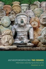
Anthropomorphizing the Cosmos
Middle Preclassic Lowland Maya Figurines, Ritual, and TimePrudence M. Rice
University Press of Colorado, 2019
Presenting original data, Anthropomorphizing the Cosmos offers insight into the synchronous appearance of fired-clay figurines with the emergence of societal complexity in and beyond Mesoamerica. Rice situates these Preclassic Maya figurines in the broader context of Mesoamerican human figural representation, identifies possible connections between anthropomorphic figurine heads and the origins of calendrics and other writing in Mesoamerica, and examines the role of anthropomorphic figurines and zoomorphic musical instruments in Preclassic Maya ritual. The volume shows how community rituals involving the figurines helped to mitigate the uncertainties of societal transitions, including the beginnings of settled agricultural life, the emergence of social differentiation and inequalities, and the centralization of political power and decision-making in the Petén lowlands.
Literature on Maya ritual, cosmology, and specialized artifacts has traditionally focused on the Classic period, with little research centering on the very beginnings of Maya sociopolitical organization and ideological beliefs in the Middle Preclassic. Anthropomorphizing the Cosmos is a welcome contribution to the understanding of the earliest Maya and will be significant to Mayanists and Mesoamericanists as well as nonspecialists with interest in these early figurines
Archaeological Investigations in a Northern Albanian Province
Results of the Projekti Arkeologjik i Shkodrës (PASH): Volume One: Survey and Excavation ResultsMichael L. Galaty and Lorenc Bejko, Editors
University of Michigan Press, 2023
Some of the earliest and largest hill forts and tumuli (burial mounds) in Albania, dating to the Bronze and Iron Age, are located in Shkodër. Shkodër (Rozafa) Castle became the capital of the so-called Illyrian Kingdom, which was conquered by Rome in the early 3rd century BC. This research report, focused on the province of Shkodër, is based on five years of field and laboratory work and is the first synthetic archaeological treatment of this region.
The results of the Projekti Arkeologjik i Shkodrës (or PASH) are presented here in two volumes. Volume 1 includes geological context, a literature review, historical background, and reports on the regional survey and test excavations at three settlements and three tumuli. In Volume 2, the authors describe the artifacts recovered through survey and excavation, including chipped stone, small finds, and pottery from the prehistoric, Classical, Roman, medieval, and post-medieval periods. They also present results of faunal, petrographic, chemical, carpological, and strontium isotope analyses of the artifacts. Extensive supporting data is available on the University of Michigan's Deep Blue data repository: https://doi.org/10.7302/xnpy-0e60
These two volumes place northern Albania—and the Shkodër Province in particular—at the forefront of archaeological research in the Balkans.
Archaeological Investigations in a Northern Albanian Province
Results of the Projekti Arkeologjik i Shkodrës (PASH): Volume Two: Artifacts and Artifact AnalysisMichael L. Galaty and Lorenc Bejko, Editors
University of Michigan Press, 2023
Some of the earliest and largest hill forts and tumuli (burial mounds) in Albania, dating to the Bronze and Iron Age, are located in Shkodër. Shkodër (Rozafa) Castle became the capital of the so-called Illyrian Kingdom, which was conquered by Rome in the early 3rd century BC. This research report, focused on the province of Shkodër, is based on five years of field and laboratory work and is the first synthetic archaeological treatment of this region.
The results of the Projekti Arkeologjik i Shkodrës (or PASH) are presented here in two volumes. Volume 1 includes geological context, a literature review, historical background, and reports on the regional survey and test excavations at three settlements and three tumuli. In Volume 2, the authors describe the artifacts recovered through survey and excavation, including chipped stone, small finds, and pottery from the prehistoric, Classical, Roman, medieval, and post-medieval periods. They also present results of faunal, petrographic, chemical, carpological, and strontium isotope analyses of the artifacts. Extensive supporting data is available on the University of Michigan's Deep Blue data repository: https://doi.org/10.7302/xnpy-0e60
These two volumes place northern Albania—and the Shkodër Province in particular—at the forefront of archaeological research in the Balkans.
Archaeological Landscapes on the High Plains
Laura L. Scheiber
University Press of Colorado, 2008
Focusing on long-term change, this book considers ethnographic literature, archaeological evidence, and environmental data spanning thousands of years of human presence to understand human perception and construction of landscape. The contributors offer cohesive and synthetic studies emphasizing hunter-gatherers and subsistence farmers.
Using landscape as both reality and metaphor, Archaeological Landscapes on the High Plains explores the different and changing ways that people interacted with place in this transitional zone between the Rocky Mountains and the eastern prairies.
The contemporary archaeologists working in this small area have chosen diverse approaches to understand the past and its relationship to the present. Through these ten case studies, this variety is highlighted but leads to a common theme - that the High Plains contains important locales to which people, over generations or millennia, return. Providing both data and theory on a region that has not previously received much attention from archaeologists, especially compared with other regions in North America, this volume is a welcome addition to the literature. Contributors:
o Paul Burnett
o Oskar Burger
o Minette C. Church
o Philip Duke
o Kevin Gilmore
o Eileen Johnson
o Mark D. Mitchell
o Michael R. Peterson
o Lawrence Todd
Archaeological Narratives of the North American Great Plains
From Ancient Pasts to Historic ResettlementSarah J. Trabert
University Press of Colorado, 2021
Archaeological Perspectives on Warfare on the Great Plains
Andrew Clark
University Press of Colorado, 2018
The Great Plains has been central to academic and popular visions of Native American warfare, largely because the region’s well-documented violence was so central to the expansion of Euroamerican settlement. However, social violence has deep roots on the Plains beyond this post-Contact perception, and these roots have not been systematically examined through archaeology before. War was part, and perhaps an important part, of the process of ethnogenesis that helped to define tribal societies in the region, and it affected many other aspects of human lives there. In Archaeological Perspectives on Warfare on the Great Plains, anthropologists who study sites across the Plains critically examine regional themes of warfare from pre-Contact and post-Contact periods and assess how war shaped human societies of the region.
Contributors to this volume offer a bird’s-eye view of warfare on the Great Plains, consider artistic evidence of the role of war in the lives of indigenous hunter-gatherers on the Plains prior to and during the period of Euroamerican expansion, provide archaeological discussions of fortification design and its implications, and offer archaeological and other information on the larger implications of war in human history. Bringing together research from across the region, this volume provides unprecedented evidence of the effects of war on tribal societies. Archaeological Perspectives on Warfare on the Great Plains is a valuable primer for regional warfare studies and the archaeology of the Great Plains as a whole.
Contributors: Peter Bleed, Richard R. Drass, David H. Dye, John Greer, Mavis Greer, Eric Hollinger, Ashley Kendell, James D. Keyser, Albert M. LeBeau III, Mark D. Mitchell, Stephen M. Perkins, Bryon Schroeder, Douglas Scott, Linea Sundstrom, Susan C. Vehik
Archaeological Remote Sensing in North America
Innovative Techniques for Anthropological ApplicationsEdited by Duncan P. McKinnon and Bryan S. Haley
University of Alabama Press, 2017
Updating the highly praised 2006 publication Remote Sensing in Archaeology, edited by Jay K. Johnson, Archaeological Remote Sensing in North America: Innovative Techniques for Anthropological Applications is a must-have volume for today’s archaeologist. Targeted to practitioners of archaeological remote sensing as well as students, this suite of current and exemplary applications adheres to high standards for methodology, processing, presentation, and interpretation.
The use of remote sensing technologies to address academic and applied archaeological and anthropological research problems is growing at a tremendous rate in North America. Fueling this growth are new research paradigms using innovative instrumentation technologies and broader-area data collection methods. Increasingly, investigators pursuing these new approaches are integrating remote sensing data collection with theory-based interpretations to address anthropological questions within larger research programs.
In this indispensable volume, case studies from around the country demonstrate the technically diverse and major remote sensing methods and their integration with relevant technologies, such as geographic information systems (GIS) and global positioning systems (GPS), and include various uses of the “big four”: magnetometry, resistivity, ground-penetrating radar (GPR), and electromagnetic induction.
The study explores four major anthropological themes: site structure and community organization; technological transformation and economic change; archaeological landscapes; and earthen mound construction and composition. Concluding commentary from renowned expert Kenneth L. Kvamme overviews the practices, advances, and trends of geophysics and remote sensing in the past decade.
Archaeological Salvage in the Walter F. George Basin of the Chattahoochee River in Alabama
David DeJarnette
University of Alabama Press, 2010
David L. DeJarnette, the founder of scientific archaeology in the state of Alabama, reports on archaeological surveys and excavations undertaken in the Chattahoochee River Valley between 1947 and 1962. The three contributors, Wesley R. Hurt, Edward B. Kurjack, and Fred Lamar Pearson Jr., each made signal contributions to the archaeology of the southeastern states. With their mentor, David L. DeJarnette, they worked out a viable cultural chronology of the region from the earliest Paleoindian and Archaic foragers to the period of early European-Indian contact. They excavated key sites, including the Woodland period Shorter Mound, the protohistoric Abercrombie village, and Spanish Fort Apalachicola, in addition to a number of important Creek Indian town sites of the eighteenth century. All are here, illustrated abundantly by site photographs, maps, and of course, the artifacts recovered from these remarkable investigations.
Copublication with the Historic Chattahoochee Commission
Archaeology and Desertification
The Wadi Faynan Landscape Survey, Southern JordanG. Barker
Council for British Research in the Levant, 2007
Archaeology and Geoinformatics
Case Studies from the CaribbeanEdited by Basil A. Reid
University of Alabama Press, 2008
Addressing the use of geoinformatics in Caribbean archaeology, this volume is based on case studies drawn from specific island territories, namely, Barbados, St. John, Puerto Rico, Jamaica, Nevis, St. Eustatius, and Trinidad and Tobago, as well as inter-island interaction and landscape conceptualization in the Caribbean region. Geoinformatics is especially critical within the Caribbean where site destruction is intense due to storm surges, hurricanes, ocean and riverine erosion, urbanization, industrialization, and agriculture, as well as commercial development along the very waterfronts that were home to many prehistoric peoples. By demonstrating that the region is fertile ground for the application of geoinformatics in archaeology, this volume places a well-needed scholarly spotlight on the Caribbean.
Archaeology at El Perú-Waka'
Ancient Maya Performances of Ritual, Memory, and PowerEdited by Olivia C. Navarro-Farr and Michelle Rich
University of Arizona Press, 2014
El Perú-Waka’ is an ancient Maya city located in present-day northwestern Petén, Guatemala. Rediscovered by petroleum exploration workers in the mid-1960s, it is the largest known archaeological site in the Laguna del Tigre National Park in Guatemala’s Maya Biosphere Reserve. The El Perú-Waka’ Regional Archaeological Project initiated scientific investigations in 2003, and through excavation and survey, researchers established that Waka’ was a key political and economic center well integrated into Classic-period lowland Maya civilization, and reconstructed many aspects of Maya life and ritual activity in this ancient community. The research detailed in this volume provides a wealth of new, substantive, and scientifically excavated data, which contributors approach with fresh theoretical insights. In the process, they lay out sound strategies for understanding the ritual manipulation of monuments, landscapes, buildings, objects, and memories, as well as related topics encompassing the performance and negotiation of power throughout the city’s extensive sociopolitical history.
Archaeology at Shiloh Indian Mounds, 1899-1999
Paul D. Welch
University of Alabama Press, 2006
The Shiloh Indian Mounds archaeological site, a National Historic Landmark, is a late prehistoric community within the boundaries of the Shiloh National Military Park on the banks of the Tennessee River, where one of the bloodiest battles of the Civil War was fought in April 1862. Dating between AD 1000 and 1450, the archaeological site includes at least eight mounds and more than 100 houses. It is unique in that the land has never been plowed, so visitors can walk around the area and find the collapsed remains of 800-year-old houses and the 900-meter-long palisade with bastions that protected the village in prehistoric times. Although its location within a National Park boundary has protected the area from the recent ravages of man, riverbank erosion began to undermine the site in the 1970s. In the mid-1990s, Paul Welch began a four-year investigation culminating in a comprehensive report to the National Park Service on the Shiloh Indian Mounds.
These published findings confirm that the Shiloh site was one of at least fourteen Mississippian mound sites located within a 50 km area and that Shiloh was abandoned in approximately AD 1450. It also establishes other parameters for the Shiloh archaeological phase. This current volume is intended to make information about the first 100 years of excavations at the Shiloh site available to the archaeological community.
Archaeology at the Site of the Museum of the American Revolution
A Tale of Two Taverns and the Growth of PhiladelphiaRebecca Yamin
Temple University Press, 2019
When the Museum of the American Revolution acquired the land at Third and Chestnut streets in Olde City, Philadelphia, it came with the condition that an archaeological investigation be conducted. The excavation that began in the summer of 2014 yielded treasures in the trash: unearthed privy pits provided remarkable finds from a mid-eighteenth-century tavern to relics from a button factory dating to the early twentieth century. These artifacts are described and analyzed by urban archaeologist Rebecca Yamin in Archaeology at the Site of the Museum of the American Revolution.
Yamin, lead archaeologist on the dig, catalogues items—including earthenware plates and jugs, wig curlers, clay pipes, and liquor bottles—to tell the stories of their owners and their roles in Philadelphia history. As she uncovers the history of the people as well as their houses, taverns, and buildings that were once on the site, she explains that by looking at these remains, we see the story of the growth of Philadelphia from its colonial beginnings to the Second World War.
Archaeology at the Site of the Museum of the American Revolution is a perfect keepsake for armchair archaeologists, introductory students, and history buffs.
Archaeology below the Cliff
Race, Class, and Redlegs in Barbadian Sugar SocietyMatthew C. Reilly
University of Alabama Press, 2019
Archaeology below the Cliff: Race, Class, and Redlegs in Barbadian Sugar Society is the first archaeological study of the poor whites of Barbados, the descendants of seventeenth-century European indentured servants and small farmers. “Redlegs” is a pejorative to describe the marginalized group who remained after the island transitioned to a sugar monoculture economy dependent on the labor of enslaved Africans. A sizable portion of the “white” minority, the Redlegs largely existed on the peripheries of the plantation landscape in an area called “Below Cliff,” which was deemed unsuitable for profitable agricultural production. Just as the land on which they resided was cast as marginal, so too have the poor whites historically and contemporarily been derided as peripheral and isolated as well as idle, alcoholic, degenerate, inbred, and irrelevant to a functional island society and economy.
Using archaeological, historical, and oral sources, Matthew C. Reilly shows how the precarious existence of the Barbadian Redlegs challenged elite hypercapitalistic notions of economics, race, and class as they were developing in colonial society. Experiencing pronounced economic hardship, similar to that of the enslaved, albeit under very different circumstances, Barbadian Redlegs developed strategies to live in a harsh environment. Reilly’s investigations reveal that what developed in Below Cliff was a moral economy, based on community needs rather than free-market prices.
Reilly extensively excavated households from the tenantry area on the boundaries of the Clifton Hall Plantation, which was abandoned in the 1960s, to explore the daily lives of poor white tenants and investigate their relationships with island economic processes and networks. Despite misconceptions of strict racial isolation, evidence also highlights the importance of poor white encounters and relationships with Afro-Barbadians. Historical data are also incorporated to address how an underrepresented demographic experienced the plantation landscape. Ultimately, Reilly’s narrative situates the Redlegs within island history, privileging inclusion and embeddedness over exclusion and isolation.
Archaeology of North Pacific Fisheries
Edited by Madonna L. Moss and Aubrey Cannon
University of Alaska Press, 2011
For thousands of years, fisheries were crucial to the sustenance of the First Peoples of the Pacific Coast. Yet human impact has left us with a woefully incomplete understanding of their histories prior to the industrial era. Covering Alaska, British Columbia, and Puget Sound, The Archaeology of North Pacific Fisheries illustrates how the archaeological record reveals new information about ancient ways of life and the histories of key species. Individual chapters cover salmon, as well as a number of lesser-known species abundant in archaeological sites, including pacific cod, herring, rockfish, eulachon, and hake. In turn, this ecological history informs suggestions for sustainable fishing in today’s rapidly changing environment.
Archaeology of Southern Urban Landscapes
Amy L Young
University of Alabama Press, 2000
Groundbreaking essays in urban archaeology highlight the impact of towns and cities on the southern landscape.
The rapid growth and development of urban areas in the South have resulted in an increase in the number of urban archaeology projects required by federal and state agencies. These projects provide opportunities not only to investigate marginal areas between the town and countryside but also to recover information long buried beneath the earliest urban structures. Such projects have also created a need for a one-volume update on archaeology as it is practiced in the urban areas of the southeastern United States.
Archaeology of Southern Urban Landscapes will assist practitioners and scholars in the burgeoning fields of urban and landscape archaeology by treating the South as a distinctive social, geographic, and material entity and by focusing on the urban South rather than the stereotypical South of rural plantations. The case studies in this volume span the entire southeastern United States, from Annapolis to New Orleans and from colonial times to the 19th century. The authors address questions involving the function of cities, interregional diversity, the evolution of the urban landscape, and the impact of the urban landscape on southern culture. By identifying the relationship between southern culture and the South's urban landscapes, this book will help us understand the built landscape of the past and predict future growth in the region.
Archaeology of the Lower Muskogee Creek Indians, 1715-1836
Howard Thomas Foster II
University of Alabama Press, 2006
The Muskogee Indians who lived along the lower Chattahoochee and Flint River watersheds had, and continue to have, a profound influence on the development of the southeastern United States, especially during the historic period (circa 1540–1836). Our knowledge of that culture is limited to what we can learn from their descendants and from archaeological and historical sources.
Combining historical documents and archaeological research on all known Lower Muskogee Creek sites, Thomas Foster has accurately pinpointed town locations discussed in the literature and reported in contemporary Creek oral histories. In so doing, this volume synthesizes the archaeological diversity and variation within the Lower Creek Indians between 1715 and 1836. The book is a study of archaeological methods because it analyzes the temporal and geographic variation within a single archaeological phase and the biases of that archaeological data. Foster’s research segregates the variation between Lower Creek Indian towns through a regional and direct historic approach. Consequently, he is able to discern the unique differences between individual Creek Indian towns.
Foster argues that the study of Creek Indian history should be at the level of towns instead of archaeological phases and that there is significant continuity between the culture of the Historic Period Indians and the Prehistoric and Protohistoric peoples.
Archaeology, History, and Predictive Modeling
Research at Fort Polk, 1972-2002David G. Anderson and Steven D. Smith
University of Alabama Press, 2003
Fort Polk Military Reservation encompasses approximately 139,000 acres in western Louisiana 40 miles southwest of Alexandria. As a result of federal mandates for cultural resource investigation, more archaeological work has been undertaken there, beginning in the 1970s, than has occurred at any other comparably sized area in Louisiana or at most other localities in the southeastern United States. The extensive program of survey, excavation, testing, and large-scale data and artifact recovery, as well as historic and archival research, has yielded a massive amount of information. While superbly curated by the U.S. Army, the material has been difficult to examine and comprehend in its totality.
With this volume, Anderson and Smith collate and synthesize all the information into a comprehensive whole. Included are previous investigations, an overview of local environmental conditions, base military history and architecture, and the prehistoric and historic cultural sequence. An analysis of location, environmental, and assemblage data employing a sample of more than 2,800 sites and isolated finds was used to develop a predictive model that identifies areas where significant cultural resources are likely to occur. Developed in 1995, this model has already proven to be highly accurate and easy to use.
Archaeology, History, and Predictive Modeling will allow scholars to more easily examine the record of human activity over the past 13,000 or more years in this part of western Louisiana and adjacent portions of east Texas. It will be useful to southeastern archaeologists and anthropologists, both professional and amateur.
Archaeometallurgy in Mesoamerica
Current Approaches and New PerspectivesAaron N. Shugar
University Press of Colorado, 2013
The chapters are organized following the cyclical nature of metals--beginning with extracting and mining ore, moving to smelting and casting of finished objects, and ending with recycling and deterioration back to the original state once the object is no longer in use. Data obtained from archaeological investigations, ethnohistoric sources, ethnographic studies, along with materials science analyses, are brought to bear on questions related to the integration of metallurgy into local and regional economies, the sacred connotations of copper objects, metallurgy as specialized crafting, and the nature of mining, alloy technology, and metal fabrication.
Archeology in the Adirondacks
The Last FrontierDavid R. Starbuck
University Press of New England, 2018
Archeology of the Funeral Mound
Ocmulgee National Monument, GeorgiaCharles H. Fairbanks, with a new introduction by Mark Williams
University of Alabama Press, 2003
The largest prehistoric mound site in Georgia is located in modern-day Macon and is known as Ocmulgee. It was first recorded in August 1739 by General James Oglethorpe’s rangers during an expedition to the territory of the Lower Creeks. The botanist William Bartram wrote extensively of the ecology of the area during his visit in 1773, but the 1873 volume by Charles C. Jones, Antiquities of the Southern Indians, Particularly of the Georgia Tribes, was the first to treat the archaeological significance of the site.
Professional excavations began at Ocmulgee in 1933 under the auspices of the Smithsonian Institution, using Civil Works Administration labor. Investigations continued under a variety of sponsorships until December 1936, when the locality was formally named a national monument. Excavation of the mounds, village sites, earth lodge, and funeral mound revealed an occupation of the Macon Plateau spanning more than 7,000 years. The funeral mound was found to contain log tombs, bundles of disarticulated bones, flexed burials, and cremations. Grave goods included uniquely patterned copper sun disks that were found at only one other site in the Southeast—the Bessemer site in Alabama—so the two ceremonial centers were established as contemporaries.
In this classic work of archaeological research and analysis, Charles Fairbanks has not only offered a full treatment of the cultural development and lifeways of the builders of Ocmulgee but has also related them effectively to other known cultures of the prehistoric Southeast.
Arkansas Archaeology
Essays in Honor of Dan and Phyllis MorseRobert C. Mainfort
University of Arkansas Press, 1999

Arretium (Arezzo)
Edited by Ingrid Edlund-Berry and Cristiana Zaccagnino
University of Texas Press, 2024
A comprehensive examination of the history and excavation of the Etruscan city of Arretium.
Beneath the Italian city of Arezzo lie the remains of Etruscan Arretium. This volume, the first comprehensive treatment of excavations at Arretium, gathers the most up-to-date scholarship on the city and delves into key archaeological discoveries and the stories they tell about life in the Etruscan world.
Chapters explore local history—including the city’s complex political exchanges with Rome—Etruscan religion, Arretium’s role as a center of the arts, and the challenges of excavation amid the bustle of European urban modernity. Editors Ingrid Edlund-Berry and Cristiana Zaccagnino have gathered chapters by expert contributors that detail Arretium’s material culture, including the city’s famed pottery, Arretine ware, which was known across the Mediterranean; terracotta pieces depicting gods and other supernatural beings; and exquisite bronze-work, most notably the piece now known as the Chimaera of Arezzo. One of the few Etruscan cities that continued flourishing after the Roman takeover, Arretium proves to be a trove of archaeological riches and of the historical insights they reveal.
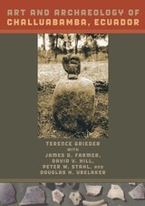
Art and Archaeology of Challuabamba, Ecuador
By Terence Grieder
University of Texas Press, 2009
Challuabamba (chī-wa-bamba)—now a developing suburb of Cuenca, the principal city in the southern highlands of Ecuador—has been known for a century as an ancient site that produced exceptionally fine pottery in great quantities. Suspecting that Challuabamban ceramics might provide a link between earlier, preceramic culture and later, highly developed Formative period art, Terence Grieder led an archaeological investigation of the site between 1995 and 2001. In this book, he and the team of art historians and archaeologists who excavated at Challuabamba present their findings, which establish the community's importance as a center in a network of trade and artistic influence that extended to the Amazon River basin and the Pacific Coast.
Art and Archaeology of Challuabamba, Ecuador presents an extensive analysis of ceramics dating to 2100-1100 BC, along with descriptions of stamps and seals, stone and shell artifacts, burials and their offerings, human remains, and zooarchaeology. Grieder and his coauthors demonstrate that the pottery of Challuabamba fills a gap between early and late Formative styles and also has a definite connection with later highland styles in Peru. They draw on all the material remains to reconstruct the first clear picture of Challuabamba's prehistory, including agriculture and health, interregional contacts and exchange, red-banded incised ware and ceramic production, and shamanism and cosmology.
Because southern Ecuador has received relatively little archaeological study, Art and Archaeology of Challuabamba, Ecuador offers important baseline data for what promises to be a key sector of the prehistoric Andean region.
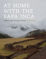
At Home with the Sapa Inca
Architecture, Space, and Legacy at ChincheroBy Stella Nair
University of Texas Press, 2015
By examining the stunning stone buildings and dynamic spaces of the royal estate of Chinchero, Nair brings to light the rich complexity of Inca architecture. This investigation ranges from the paradigms of Inca scholarship and a summary of Inca cultural practices to the key events of Topa Inca’s reign and the many individual elements of Chinchero’s extraordinary built environment.
What emerges are the subtle, often sophisticated ways in which the Inca manipulated space and architecture in order to impose their authority, identity, and agenda. The remains of grand buildings, as well as a series of deft architectural gestures in the landscape, reveal the unique places that were created within the royal estate and how one space deeply informed the other. These dynamic settings created private places for an aging ruler to spend time with a preferred wife and son, while also providing impressive spaces for imperial theatrics that reiterated the power of Topa Inca, the choice of his preferred heir, and the ruler’s close relationship with sacred forces.
This careful study of architectural details also exposes several false paradigms that have profoundly misguided how we understand Inca architecture, including the belief that it ended with the arrival of Spaniards in the Andes. Instead, Nair reveals how, amidst the entanglement and violence of the European encounter, an indigenous town emerged that was rooted in Inca ways of understanding space, place, and architecture and that paid homage to a landscape that defined home for Topa Inca.
Athapaskan Migrations
The Archaeology of Eagle Lake, British ColumbiaR. G. Matson and Martin P. R. Magne
University of Arizona Press, 2007
In Athapaskan Migrations, authors R. G. Matson and Martin P. R. Magne use a variety of methods to identify and describe the arrival of the Athapaskan-speaking Chilcotin Indians in west central British Columbia. By contrasting two similar geographic areas—using the parallel direct historical approach—the authors define this aspect of Athapaskan culture. They present a sophisticated model of Northern Athapaskan migrations based on extensive archaeological, ethnographic, and dendrochronological research.
A synthesis of 25 years of work, Athapaskan Migrations includes detailed accounts of field research in which the authors emphasize ethnic group identification, settlement patterns, lithic analysis, dendrochronology, and radiocarbon dating. Their theoretical approach will provide a blueprint for others wishing to establish the ethnic identity of archaeological materials. Chapter topics include basic methodology and project history; settlement patterns and investigation of both the Plateau Pithouse and British Columbia Athapaskan Traditions; regional surveys and settlement patterns; excavated Plateau Pithouse Tradition and Athapaskan sites and their dating; ethnic identification of recovered material; the Chilcotin migration in the context of the greater Pacific Athapaskan, Navajo, and Apache migrations; and summaries and results of the excavations. The text is abundantly illustrated with more than 70 figures and includes access to convenient online appendixes. This substantial work will be of special importance to archaeologists, anthropologists, linguists, and scholars in Athapaskan studies and Canadian First Nation studies.
Aztalan
Mysteries of an Ancient Indian TownRobert A. Birmingham and Lynne Goldstein
Wisconsin Historical Society Press, 2006
Birmingham and Goldstein attempt to unlock some of the mysteries, providing insights and information about the group of people who first settled here in 1100 AD. Filled with maps, drawings, and photographs of artifacts, this small volume examines a time before modern Native American people settled in this area.