Results by title
12 books match the query 'Point'

At the Point of a Cutlass
The Pirate Capture, Bold Escape, and Lonely Exile of Philip AshtonGregory N. Flemming
University Press of New England, 2015

Climate Change
The Point of No ReturnMojib Latif
Haus Publishing, 2009

Excavations at Nantack Village, Point of Pines, Arizona
David A. Breternitz
University of Arizona Press, 1959

From Point to Pixel
A Genealogy of Digital AestheticsMeredith Hoy
Dartmouth College Press, 2017

Point of Pines Pueblo
A Mountain Mogollon Aggregated CommunityTammy Stone
University of Utah Press, 2020
University of Utah Anthropological Papers No. 133
Point of Pines Pueblo has long been the center of theoretical debates in southwestern archaeology, yet detailed descriptions of the site have been lacking. Located on the San Carlos Apache Reservation in central Arizona, this large Mountain Mogollon village (about 800 rooms) dates from AD 1200 to 1400. For the first 100 years of occupation it was a multiethnic community and is often referenced in discussions of aggregation, community organization, migration, and ethnic interaction. In Point of Pines Pueblo Tammy Stone details the architectural structures and cultural materials at the site, providing a body of information never before published.
From 1947 to 1960, Point of Pines Pueblo was excavated by the University of Arizona field school under the direction of Emil Haury. Data from that work were housed at the Arizona State Museum Archives. Stone draws from those original excavation notes to present detailed descriptions of each architectural structure and extramural feature along with information on the associated artifacts, dated dendrochronology samples, and ethnobotanical samples unearthed at the site. A rich source of raw data, this book will serve as a valuable resource for years to come.
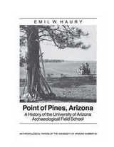
Point of Pines
A History of the University of Arizona Archaeological Field SchoolEmil W. Haury
University of Arizona Press, 1989

Point of Reckoning
The Fight for Racial Justice at Duke UniversityTheodore D. Segal
Duke University Press, 2021

Point of Sale
Analyzing Media RetailDaniel Herbert
Rutgers University Press, 2020

Point of View and the Emotional Arc of Stories
A handbook for writers and storytellersLoren Niemi & Nancy Donoval
Parkhurst Brothers, Inc., 2020

Point of View
Talks on EducationEdward H. Levi
University of Chicago Press, 2007

Surveying in Early America
The Point of Beginning, An Illustrated HistoryDan Patterson; Clinton Terry
Ohio University Press, 2020
Published by the University of Cincinnati Press
In Surveying in Early America: The Point of Beginning, An Illustrated History, award-winning photographer Dan Patterson and American historian Clinton Terry vividly examine the profession of surveying in the eighteenth century. Retracing the steps Washington and other surveyors took to map the Ohio River Valley, readers are immersed in historically accurate details of early surveying techniques and practices. Terry's narrative describes the practice of land and survey measurement—methods that did not substantially change until the invention of GPS technology 200 years later. Over 100 full color photographs exclusively shot for the book depict authentic and historically accurate reproductions of tools along with early American reenactors to provide an interpretive look at surveying as a primary means to building the American nation. Working with the Department of the Geographer, Patterson restages actual expeditions, brilliantly displaying the techniques and instruments Washington would have employed 260 years ago. Through the lens of Patterson's camera and Terry's accompanying narrative, readers see what Washington saw as he learned his trade, explored the vast American wilderness, and occasionally laid personal claim to great expanses of land along the way.
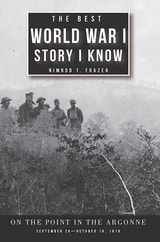
The Best World War I Story I Know
On the Point in the Argonne, September 26–October 16, 1918Nimrod T. Frazer
University of Alabama Press, 2018
The Best World War I Story I Know: On the Point in the Argonne is the breath-taking story of three US Army divisions tasked with capturing the Côte de Châtillon during the Meuse-Argonne offensive in autumn 1918. Readers will first follow in the footsteps of Missouri-Kansas Guard troops who were repulsed in the opening days of the battle; their courage in the face of heavy fire was not enough to overcome poor leadership.
They were replaced by the 1st Division, the “best of the Regular Army.” This fine unit became physically and mentally exhausted after suffering horrendous casualties. Unable to fight on, “The Big Red One” was exchanged at the base of Côte de Châtillon, with the 42nd, the Rainbow Division. It too struggled to gain ground on the heavily-contested hill until General Douglas MacArthur’s determined 84th Brigade of “Alabama cotton pickers and Iowa corn growers” forced their way past the Germans. The Côte was finally in American hands and the war all but over.