
 A SCHOLARLY BOOK REPOSITORY
11 start with L start with L

For centuries, France has long been the world’s greatest wine-producing country. Its wines are the global gold standard, prized by collectors, and its winemaking regions each offer unique tasting experiences, from the spice of Bordeaux to the berry notes of the Loire Valley. Although grape variety, climate, and the skill of the winemaker are essential in making good wine, the foundation of a wine’s character is the soil in which its grapes are grown. Who could better guide us through the relationship between the French land and the wine than a geologist, someone who deeply understands the science behind the soil? Enter scientist Charles Frankel.
In Land and Wine, Frankel takes readers on a tour of the French winemaking regions to illustrate how the soil, underlying bedrock, relief, and microclimate shape the personality of a wine. The book’s twelve chapters each focus in-depth on a different region, including the Loire Valley, Alsace, Burgundy, Champagne, Provence, the Rhône valley, and Bordeaux, to explore the full meaning of terroir. In this approachable guide, Frankel describes how Cabernet Franc takes on a completely different character depending on whether it is grown on gravel or limestone; how Sauvignon yields three different products in the hills of Sancerre when rooted in limestone, marl, or flint; how Pinot Noir will give radically different wines on a single hill in Burgundy as the vines progress upslope; and how the soil of each château in Bordeaux has a say in the blend ratios of Merlot and Cabernet-Sauvignon. Land and Wine provides a detailed understanding of the variety of French wine as well as a look at the geological history of France, complete with volcanic eruptions, a parade of dinosaurs, and a menagerie of evolution that has left its fossils flavoring the vineyards.
Both the uninitiated wine drinker and the confirmed oenophile will find much to savor in this fun guide that Frankel has spiked with anecdotes about winemakers and historic wine enthusiasts—revealing which kings, poets, and philosophers liked which wines best—while offering travel tips and itineraries for visiting the wineries today.
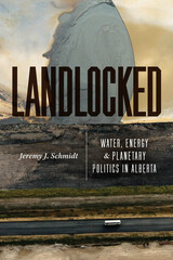
A study of oil-rich Alberta reveals the entwined relationships among geoscience, governance, and power.
The Canadian province of Alberta holds the world’s fourth-largest reserve of fossil fuels, with oil sands famous for bitumen, a viscous form of petroleum. A clearinghouse for international environmental ideas and energy policies, Alberta pioneered state-led efforts to understand, extract, and sell bitumen. Without natural access to ocean ports, Alberta is reliant on pipelines to global markets, which are often hampered by neighboring provinces and nations alike. But Alberta is also landlocked in another sense: it is caught in an extractive relationship with oil-rich earth.
In Landlocked, Jeremy J. Schmidt focuses on Alberta’s energy industry, particularly its use of water and oil, to argue for a new way to understand how political authority is forged and maintained through the environment. Schmidt details how water and oil were enrolled in early state-making projects, such as irrigation, before tracing the reverberating consequences, including a series of events in 2013 that released 4.2 million barrels of bitumen into underground environments. By uncovering the ways that geosciences supported activities—from land settlement to the dispossession of Indigenous peoples—that produced particular environmental policies and approaches to management and governance, he shows that geosciences aren’t merely instruments of state power, but central to Alberta’s political identity and legitimacy.
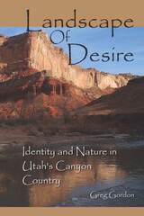
Landscape of Desire powerfully documents and celebrates a place and the evolutions that occur when human beings are intimately connected to their surroundings. Greg Gordon accomplishes this with a tapestry of writing that interweaves land use history, natural history, experiential education, and personal reflection. He tracks the geomorphology of southern Utah as well as the creatures and plants his student group encounters, the history lessons (planned and unplanned), the trials and joys of gathering so many individuals into a cohesive will, and his own personal epiphanies, restraints, insights, and disillusionments.
Landscape of Desire examines the plight of the western landscape. It discusses a wide range of issues, including mining, grazing, dams, recreation, wilderness, and land management. Since recreation has replaced extraction industries as the primary use of wilderness, especially in southern Utah, Gordon addresses its impactful qualities. He overviews the history of the conflict between preservation and development and places these issues in a cultural context. The text is presented in a narrative format, following the individuals of one field course Gordon lead that explored Muddy Creek and the Dirty Devil River from Interstate 70 to Lake Powell. Though each chapter focuses on the geologic formation the group is traveling through, the plants, animals, ecology, and human impacts are all tightly woven into the narrative. Not only does the land affect the members of the field course, but their attitudes and insights affect the land.
In Landscape of Desire Gordon achieves a vision of wholeness of this popular and contested region of Utah that centers around the implications of being human and also stewards of the wild.
Late Quaternary Environments of the United States was first published in 1983. Minnesota Archive Editions uses digital technology to make long-unavailable books once again accessible, and are published unaltered from the original University of Minnesota Press editions.
In the late 1970s American and Russian scientists met twice in conferences on Quaternary paleoclimates sponsored by the U.S.-U.S.S.R. Bilateral Agreement on the Environment. The conferees agreed to prepare volumes summarizing the current status of research in the two countries. Late-Quaternary Environments of the United States provides a two-volume overview of new and significant information on research of the last fifteen years, since the 1965 publication of Quaternary of the United States,edited by H E. Wright, Jr., and D. G. Frey. The volume on the late Quaternary in the Soviet Union will also be published by the University of Minnesota Press.
Volume 1 of Late-Quaternary Environments of the United States covers the Late Pleistocene, the interval between 25,000 and 10,000 years ago—a time of extreme environmental stress as the world passed from full-glacial conditions of the last ice age into the present interglacial age. The interval of geologic time since the last glacial period—termed the Holocene—is the subject of Volume 2. The complexity of the natural changes occurring in the late Quaternary, and their interrelationships, make it impossible for a single scientific discipline to encompass them. Thus the papers in both volumes come from authors in many research fields—geology, ecology, physical geography, archaeology, geochemistry, geophysics, limnology, soil science, paleontology, and climatology. Many of the hypotheses presented—especially on the dynamic Late Pleistocene environments—are still hotly debated and will require additional testing as scientists strive to reconstruct the changing world of the glacial and postglacial ages.
Living by the Rules of the Sea is a primer for people living along the nation's coastlines, those considering moving to the coast, or those who want a greater understanding of the risks and dangers posed by living at the seacoast. Published as part of Duke University Press's Living with the Shore series, but without a direct focus on the coastline of one particular state, this book is intended as an overall guide to coastal physical processes, risk assessment of potential property damage from coastal natural hazards, and property damage mitigation.
Over the past twenty years, the authors have mapped and studied most of the barrier islands in the United States and have experienced coastal processes such as storms and shoreline retreat at close range. They represent a coastal geology/oceanographic perspective that is decidedly in favor of preserving the natural protective capabilities of the native coastal environment. While strongly anti-engineering in outlook, Living by the Rules of the Sea does provide a review of coastal engineering techniques. It also examines methods of repairing damage to the natural environment that lessen the prospect of further property damage. Finally, it employs a more inclusive "coastal zone" approach rather than simply concentrating on a more narrowly defined shoreline. Barrier islands are viewed as part of a larger system in which changes in one part of the system—for example, the mining of sand dunes or dredging offshore for beach replenishment sand—can have profound effects on another part of the system, predictable effects even though they may not be visible for years or decades.
A comprehensive handbook with references to recent storms including hurricanes Andrew, Gilbert, Hugo, Emily, and Opal, Living by the Rules of the Sea is designed to help people make better and more informed choices about where or if to live at the coast.
Powerful storms have always played a major role in coastal processes in South Carolina, and the effects of Hurricane Hugo, the storm that ravaged the area in 1989, are thoroughly discussed. A series of Coastal Risk Maps are also included. These maps, graphically depicting areas of predictable erosion and storm damage potential, have been provided for every developed beach or barrier island in the state. Beyond the threat of hurricanes and coastal erosion, South Carolina, home of the Charleston Seismic Region, is also at risk for earthquakes. An entire chapter is devoted to earthquake-resistant construction, and the great Charleston earthquake of 1886 is examined in detail. Fires and floods are discussed. The Beachfront Management Act of 1990—the first state legislation of its kind that provides a system for dealing with migrating shorelines while preserving beaches for future generations—is also explained.
Covering everything from a history of the development of South Carolina's coast to recommendations on how to select an island homesite, this book will be a resource to professional coastal planners and managers, residents, prospective homeowners, and naturalists.
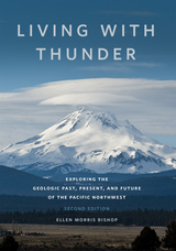
“In geology, the present is the key to the past. And the past is also a touchstone of the future. We would do well to heed the stories the stones have to tell.” —from the Introduction
Updated throughout, this second edition of Living with Thunder provides readers with a robust introduction to the geological history of the Pacific Northwest—a landscape born of thunderous volcanic eruptions, earthquakes, and island-continent collisions. By combining engaging science writing with stunning color photographs, Ellen Morris Bishop presents an up-to-date geologic survey of Washington, Oregon, Northern California, and western Idaho. Whether examining new findings about the Yellowstone hotspot's rampage across Oregon, an updated history of Cascadia earthquakes, Mount Hood's 1793-1795 eruptions, the arrival of Indigenous peoples at least 18,000 years ago, or how Pacific Northwest eruptions and tectonics influenced past climate changes, Bishop’s gift as a scientist and storyteller engages general readers, geological nonspecialists, and students of the Earth sciences, alike.
Highlighting the Northwest’s exceptional record of past climate changes and the implications for our future, the book outlines new understandings about the climatic consequences of major geologic events and their dramatic influences on ecosystems and ancient life. It also examines the confluence of scientific findings with Native American experience, stories, and traditional knowledge of earthquakes, eruptions, and more. With new illustrations, enhanced maps, the latest geologic timescale, and an extensive list of updated references and recommended readings, Living with Thunder offers a key to understanding the Northwest’s unique, long-term geologic heritage by giving voice to the rocks and their histories.
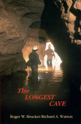
In 1925 the geological connection between Flint Ridge and Mammoth Cave was proved when dye placed in a Flint Ridge spring showed up in Echo River at Mammoth Cave.
That tantalizing swirl of dye confirmed speculations that wereto tempt more than 650cavers over half a century with the thrill of being the first to make human passage of the cave connection. Roger Brucker and Richard Watson tell not only of their own twenty-year effort to complete the link but the stories of many others who worked their way through mud-choked crawlways less than a foot high only to find impenetrable blockages.
Floyd Collins died a grisly death in nearby Sand Cave in1925, after being trapped there for 15 days. The wide press coverage of the rescue efforts stirred the imagination of the public and his body was on macabre display in a glass-topped coffin in Crystal Cave into the 1940s. Agents of a rival cave owner once even stole his corpse, which was recovered and still is in a coffin in the cave. Modern cavers still have a word with Floyd as they start their downward treks.
Brucker and Watson joined the parade of cavers who propelled themselves by wiggling kneecaps, elbows, and toes through quarter-mile long crawlways, clinging by fingertips and boot toes across mud-slick walls, over bottomless pits, into gurgling streams beneath stone ceilings that descend to water level, down crumbling crevices and up mountainous rockfalls, into wondrous domed halls, and straight ahead into a blackness intensified rather than dispelled by the carbide lamps on their helmets.
Over two decades they explored the passages with others who sought the final connection as vigorously as themselves. Pat Crowther, a young mother of two, joined them and because of her thinness became the member of the crew to go first into places no human had ever gone before. In that role, in July 1972, she wiggled her way through the Tight Spot and found the route that would link the Flint Ridge and Mammoth Cave systems into one cave extending 144.4 miles through the Kentucky limestone.
In a new afterword to this edition the authors summarize the subsequent explorations that have more than doubled the established length of the cave system. Based upon geological evidence, the authors predict that new discoveries will add another 200 miles to the length of the world’s longest cave, making it over 500 miles long.
"Anyone interested in geologic time, and that should include all geologists and a fair smattering of biologists, physicists and chemists, should make Burchfield's commendable and time-tested volume part of their personal library"—Brent Darymple, Quartely Review of Biology
READERS
Browse our collection.
PUBLISHERS
See BiblioVault's publisher services.
STUDENT SERVICES
Files for college accessibility offices.
RECENTLY PUBLISHED


")


UChicago Accessibility Resources
home | accessibility | search | about | contact us
BiblioVault ® 2001 - 2026
The University of Chicago Press